BlockBefore
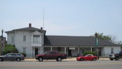
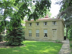
Photograph of Stone Manor
Photograph by User:Teemu08, CC BY-SA 3.0. Via Wikimedia Commons.

Stone Manor

Listed on the National Register of Historic Places in 1980.

From the record

One of 38 National Register listings published here for Will County · listed in 1980 · category: Building.

Sources: the case file at the National Archives · the National Register database, National Park Service · the Wikipedia article
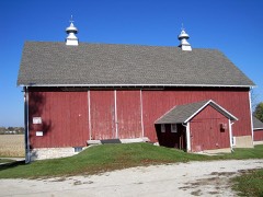
The listing

  • What is counted as historic. The nomination lists 2 buildingss as contributing to the listing.
  • Address. SE of Lockport, Lockport, 60491
  • When was it listed? November 1980
  • Category. building
  • Township. Homer township
  • Architectural style. Italianate architecture
  • National Register reference number. 80001420 - the number the National Park Service assigned this property when it was listed, and the key its nomination file is catalogued under at the National Archives.

Storms near this property

39 since 1996

Regional context, not property-specific evidence. The National Weather Service names Lockport, the town this property stands in, in 39 storm reports between 1996 and 2026: 18 thunderstorm wind, 17 hail, 1 flash flood, 1 lightning. No death or injury is recorded in these reports. Each account below is quoted exactly as the forecast office filed it, from the NOAA Storm Events Database, and each date opens the federal record of that event.

WhenEvent Place namedHarm What the report says
July 2007Thunderstorm WindLockport$50,000A microburst hit the Cedar Glen Subdivision in Homer Glen, east of Lockport. This is just northwest of the intersection of 159th Street and Cedar Road. There was scattered damage to trees throughout the neighborhood. Objects such as trampolines and lawn furniture were blown over as well. The most concentrated damage was in the east end of the subdivision along Cedar Glen Drive where several mature spruce trees were uprooted and some hardwood trees had large limbs or trunks snapped. A large portion of a roof of a house was torn off. Most of the damage was blown down from the northwest to southeast. In the west end of the neighborhood, some of the limbs were blown more to the south and southwest, in a downburst pattern. More than 30 trees were blown down at Old Oak Country Club.
July 2017Thunderstorm WindLockport$10,000A large part of a roof was blown off a building and an 8 inch diameter tree was blown down.
June 2007Thunderstorm WindLockport$10,000Seven utility poles blown down at 151st Street and Creme Road in Homer Township.
August 2025Thunderstorm WindLockport-Several large branches were broken in Lockport. The large trunk of a rotted tree also fell onto a house.
August 2025Thunderstorm WindSouth Lockport-Whole trees were snapped in the vicinity of the Lockport High School baseball fields.
February 2024HailLockport-An NWS employee observed 1 hail in Lockport.
May 2024Thunderstorm WindLockport-Tree limbs were blown down with one of the limbs 6 to 9 inches in diameter.
July 2024Thunderstorm WindLockport-A two foot diameter tree was snapped and fell onto a house and power lines.
July 2023Thunderstorm WindLockport-A power pole was reported down in Lockport. Time was estimated using radar.
July 2020Thunderstorm WindSouth Lockport-A large tree was blown down onto a utility pole and power lines near Division and Hamilton Streets. A transformer was also blown down.
August 2020Thunderstorm WindLockport-Tree limbs and power lines were blown down in Lockport.
September 2010Thunderstorm WindLockport-One large tree limb was blown down across a road.
September 2007Thunderstorm WindLockport-Five to six inch diameter tree limbs were blown down on 159th street. Half of a Willow tree was also blown down.
July 2006FloodLockport-Eight inches of water covering Route 171, south of Division.
July 2006Thunderstorm WindLockport-A one foot diameter tree was blown down near Farrell Street and Route 7. Tree limbs also blown down.
July 2006Funnel CloudLockport-A funnel cloud was reported near Archer and New Avenue.
May 2006Thunderstorm WindLockport-A six inch diameter, 30 foot long tree limb was blown down at 151st Street and Farrel Road.
June 2006Thunderstorm WindLockport-Trees and tree limbs were blown down.
October 2006HailLockport-Quarter size hail reported at New Avenue and Archer Avenue.
March 2005HailLockport-Nickel sized hail was reported near the intersection of Bruce Rd. and Lawrence Ave.
April 2004Flash FloodLockport-Near intersection of State Hwy 171 and New Ave. One half foot of standing water on road.
May 2004HailLockport-Reported at the intersection of 11th and Lincoln Streets.
March 2004LightningLockport-Lightning struck electric line from pole to house at Barry Circle
May 2004HailLockport-Reported at the intersection of 135th Street and County Line Road.
June 2004HailLockport-Reported at the intersection of Rt. 7 and Madison St.
March 2026HailLockport-no account filed
February 2024HailLockport-no account filed
June 2019HailLockport-no account filed
April 2015HailLockport-no account filed
June 2015HailSouth Lockport-no account filed
June 2015HailLockport-no account filed
June 2014Thunderstorm WindSouth Lockport-no account filed
June 2011HailLockport-no account filed
June 2004HailLockport-no account filed
August 2003HailLockport-no account filed
June 1999HailLockport-no account filed
January 1996Thunderstorm WindLockport-no account filed
May 1996HailLockport-no account filed

Every storm recorded in Will County

Map coverage status

No historic map-sheet match is published for this property yet. That does not mean no map exists. This record needs a coordinate-quality review before it can be joined to a sheet boundary. Browse the county's mapped places while that work is pending.

Listed places nearby

6 within 8 miles

Other National Register properties close enough to walk or drive between, ordered by distance from this one. Both positions come from the same geocoding pass that matched these properties to their map sheets.

Photograph PropertyDistance Listed
McGovney-Yunker Farmstead4.3 miles2006
Robert Milne House6.0 miles1979
Will County Historical Society Headquarters6.2 miles1972
Lockport Historic District6.4 miles1975
John Heck House6.4 miles1994
Illinois and Michigan Canal6.9 miles1966

Sources for this property

National Archives recordThe nomination case file for reference 80001420 in Record Group 79.
Wikipedia articleCommunity-written account of this property, licensed CC BY-SA.
Will CountyAll 38 listed properties in this county.

Provenance

  • Listing record. National Park Service National Register of Historic Places, listed-properties dataset, current to 2026-05-22.
  • Map join. Address geocoded through the United States Census geocoder, then tested against the published boundary of every sheet in the USGS Historical Topographic Map Collection.
  • How this page is made. Listing fields come from federal records; map-sheet coverage is a labelled coordinate-to-boundary calculation, not a source-field claim.
  • Storms. NOAA National Centers for Environmental Information, Storm Events Database https://www.ncei.noaa.gov/stormevents/ A work of the United States government, no copyright under 17 U.S.C. 105. Narratives are quoted verbatim from the National Weather Service report and are not edited or summarised.