 Block
Mackinaw, Illinois
14 topographic sheets cover this place, the earliest surveyed in 1928 and the latest in 1990. It stands in Mackinaw Township. It lies in ZIP code area 61755. The Survey maps it on the Mackinaw quadrangle. 1,879 people lived here at the 2020 count. It stands 682 feet above sea level.
On record in Mackinaw
Buildings and businesses the archive holds for this place. Each opens its own page, with the source record it came from.
On the National Register 1 record
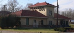 Illinois Traction System Mackinaw Depotlisted 1978
Population over time
3 figuresMackinaw grew from 1,452 to 1,879 between 2000 and 2020. These are the recorded population figures Wikidata holds for this place, reached through the Geographic Names Information System number this page is keyed on rather than by name, so they belong to this place and not to another of the same name. Most are census counts, but not all are: an early figure may be a founding or settlement estimate, and an estimate published within five years of a census is left out. The change column is computed, and is left blank where more than 20 years separate a figure from the one before it, because a gap that long is not a change between two counts.
| Year | People | Change |
|---|---|---|
| 2000 | 1,452 | |
| 2010 | 1,950 | +498 (+34%) |
| 2020 | 1,879 | -71 (-4%) |
Topographic sheets covering this place
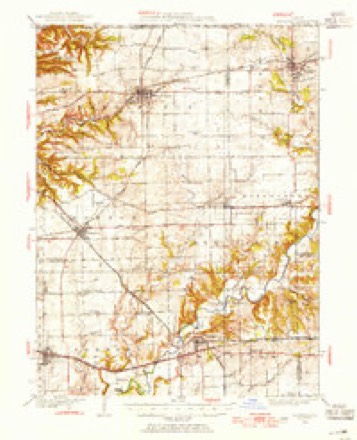
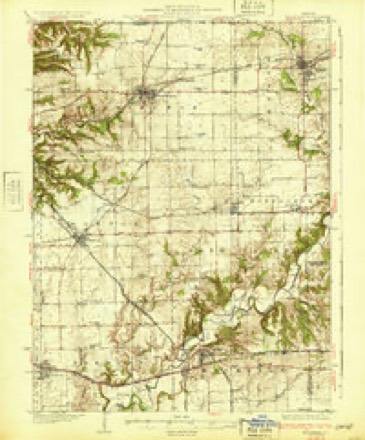
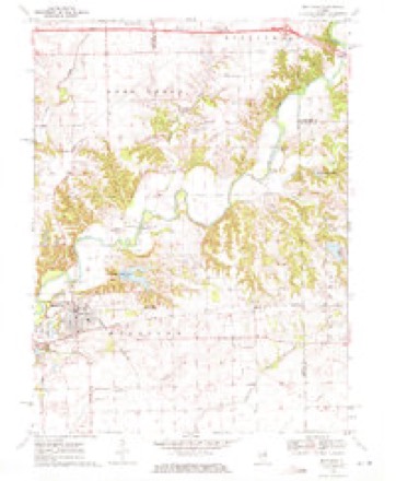
9 surveys from 14 printed sheetsMatched by testing this settlement's coordinate against the published boundary of every sheet in the United States Geological Survey's historical collection. Each opens the scanned sheet at the Survey.
- 1928 USGS Mackinaw quadrangle1:62500
- 1932 USGS Mackinaw quadrangle1:62500, 2 printings
- 1958 USGS Peoria quadrangle1:250000, 4 printings
- 1961 USGS Peoria quadrangle1:250000
- 1963 USGS Peoria quadrangle1:250000
- 1970 USGS Mackinaw quadrangle1:24000, 2 printings
- 1985 USGS Peoria quadrangle1:100000
- 1989 USGS Peoria quadrangle1:100000
- 1990 USGS Peoria quadrangle1:250000






In the county-history sources
7,686 words on this townshipHistory of Tazewell County, Illinois ; Together with Sketches of Its Cities, Villages and Townships, Educational, Religious, Civil, Military, and Political History; Portraits of Prominent Persons and Biographies of Representative Citizens. History of Illinois ... Digest of State Laws, published 1879 names this settlement in its chapter on Mackinaw Township. These are the passages that mention it, exactly as the scans read.
The early history of the villags of Mackinaw is very fully detailed in the second chapter of this History, we therefore deem it unnecessary to record it here. The present population of the town is about 800. It is on the line of the I., B. & W., and I. M. Railroads. The first post-office was established in 1827. Mordecai Mobley was the first postmaster ; the present postmaster is James E. Hill. There is one drug store, three grocery stores, one furniture store, one hardAvare store, and two of general merchandise, one hotel, one large agricultural implement house, three wagon shops, and a grist-mill. There is a Masonic lodge, which was organized over a half century ago, and is now in a flourishing condition. The Trustees of the town are as follows : Daniel Beckly, James H. Porter, J. L. Davis, Thomas Higgins, and J. H. Wilson.
Passage source: History of Tazewell County, Illinois ; Together with Sketches of Its Cities, Villages and Townships, Educational, Religious, Civil, Military, and Political History; Portraits of Prominent Persons and Biographies of Representative Citizens. History of Illinois ... Digest of State Laws, published 1879.
Christian Church. - From the earliest settlement of Mackinaw township, dating as for back as 1826, there were occasional religious meetings held at private houses and subsequently school-houses. Methodist, Cumberland Presbyterian, United Brethren, occasionally a Baptist, a New Light, or Old Christian preacher, living in other settlements, or traveling through, would stop with the friendly pioneers and preach to those who would gather in. These meetings were not without some good effect. In 183-t, Elder James A. Lindsey came from Kentucky and settled in the east part of the township. He was a minister of the Disciples or Christian Church, and was, perhaps, the first resident preacher of the township ; was a man of sterling worth and integrity, kind and genial in disposition, and ardently devotional. He began at once the proclamation of the Gospel as taught by this people. Having a large family, and realizing the importance of regular church influence, he soon made it a special feature of his work to establish the cause in his own neighborhood. He was successful in harmonizing some of other religious views, and baptizing others who had made no profession. These efforts resulted in a meeting for consolidation, which was held at his house in Sept., 1837, and on the 5th day of October, at what was known as Mt. Pleasant school-house, the first Christian Church of the township, and perhaps the first, that was strictly on that basis, in the county. The Methodist Conference had established a station at
Passage source: History of Tazewell County, Illinois ; Together with Sketches of Its Cities, Villages and Townships, Educational, Religious, Civil, Military, and Political History; Portraits of Prominent Persons and Biographies of Representative Citizens. History of Illinois ... Digest of State Laws, published 1879.
Mackinaw town, and had monthly preaching, and this has always been a point in their Conference. The Christian Church organized with 23 members and chose as Elders, George Hittle and Samuel Fleshen; Deacons, Michael Hittle and Nehemiah Hill; James E. Lindsey, Evangelist, and R. F. Houston, Clerk. From the first the congregation prospered and increased steadily, seldom failing to meet on the first day of every week. Her circle of influence and boundaries enlarged. The school-house and the private homes were soon too small to contain the anxious congregations. The groves, God's first temples, were the frequent resorts of the early worshippers. This book will foil into the hands of those who will remember with emotions of supreme delight many of those grove meetings, where was heard the clarion voices of a Davenport, a Palmer, or a Bowles, or the milder teaching of a Young, a Major, or a Lindsey, all of whom have gone to their rewards. They brought scores to the Cross and delighted the souls of 'the devoted throngs. When, in the year 1849, the congregation conceived the necessity of a house of worship, a majority of the members favored building in Mackinaw town. Accordingly, in that and the following years, they erected a large and comfortable house. For a period of over a quarter century they occupied it, and seldom failed on the first day of the week to hold their meeting in accordance with their faith. During these years they have enjoyed the pastoral and evangelizing services of many of the finest speakers of Central Illinois. In addition to those already named there were AVm. Ryan, James Robinson, the Johnsons, the Aliens, S. T. Jones, Howe, Mitchel, R. Williams, Chaplin, Poynter, Shick, Samuel Lowe, John Lindsey, ^\. Houston, and a host of others.
Passage source: History of Tazewell County, Illinois ; Together with Sketches of Its Cities, Villages and Townships, Educational, Religious, Civil, Military, and Political History; Portraits of Prominent Persons and Biographies of Representative Citizens. History of Illinois ... Digest of State Laws, published 1879.
Machine-read from a century-old scan, so expect the errors a machine makes: misspelled names, dropped words, stray characters.
Read the whole chapter on Mackinaw Township - it names this place 18 more 18 times.
Fires near this place
5 since 2011Regional context, not property-specific evidence. The federal wildfire occurrence database lists 5 fires within 5 miles of Mackinaw between 2011 and 2012, burning about 17 acres in total. None started naturally. None was recorded as arson. Distance is straight-line from the map coordinates, so a fire counted here may appear on a neighbouring settlement's page as well.
| Reported cause | Fires |
|---|---|
| Debris and open burning | 2 |
| Missing data/not specified/undetermined | 2 |
| Equipment and vehicle use | 1 |
The most recent of them, most recent first, with the day each was reported and the service that recorded it.
| Date | Cause | Size | Reported by | Name on the report |
|---|---|---|---|---|
| 17 July 2012 | Debris and open burning | under an acre | Illinois Division of Forestry Resources | WOODFORD |
| 2 April 2011 | Debris and open burning | 12 acres | Illinois Division of Forestry Resources | TAZ |
| 6 March 2012 | Missing data/not specified/undetermined | under an acre | Illinois Division of Forestry Resources | LEGION |
| 18 March 2012 | Equipment and vehicle use | 2.0 acres | Illinois Division of Forestry Resources | QUEEN |
| 11 March 2012 | Missing data/not specified/undetermined | 2.0 acres | Illinois Division of Forestry Resources | FRITZ |
Settlements close enough to share some of these fires:
Mines and quarries near this place
5 within 5 milesRegional context, not property-specific evidence. The federal mineral resources record lists 5 workings within 5 miles of Mackinaw: 3 past producers, 2 producers. 2 still produce. What was taken out: Sand and Gravel, Construction. Distance is straight-line from the map coordinates, so a quarry counted here may appear on a neighbouring settlement's page as well.
| Where | Site | Commodity | Status | Recorded |
|---|---|---|---|---|
| Lee Pit | Sand and Gravel, Construction | Past Producer | ||
| Mackinaw Plant & Sand Pit | Sand and Gravel, Construction | Past Producer | ||
| Percy Ragar Pit | Sand and Gravel, Construction | Producer | ||
| Rokey Acres Pit | Sand and Gravel, Construction | Producer | ||
| Rokey Acres Pit No. 2 | Sand and Gravel, Construction | Past Producer |
Storms near this place
35 since 2000Regional context, not property-specific evidence. The National Weather Service names Mackinaw in 35 storm reports between 2000 and 2026: 25 thunderstorm wind, 6 hail, 4 tornado. No death or injury is recorded in these reports. Each account below is quoted exactly as the forecast office filed it, from the NOAA Storm Events Database, and each date opens the federal record of that event.
| When | Event | Place named | Harm | What the report says |
|---|---|---|---|---|
| June 2010 | Thunderstorm Wind | Mackinaw | $90,000 | The roof of a house and several outbuildings were damaged. Numerous trees and power lines were blown down. |
| July 2016 | Thunderstorm Wind | Mackinaw | $30,000 | A 50-foot tall poplar tree approximately 12 to 15 feet in diameter was blown over onto Heritage Drive at Heritage Lake. Numerous trees were snapped around Mackinaw. |
| August 2015 | Tornado (EF0) | Mackinaw | $30,000 | A tornado touched down 1.7 miles east-southeast of Mackinaw at 6:09 PM CDT. The tornado tracked northeastward for 2 miles, damaging several pine trees, downing tree limbs onto 3 houses, and damaging crops in a path 50 to 75 yards wide. The tornado dissipated in a wooded area 2.7 miles east-northeast of Mackinaw at 6:11 PM CDT. |
| January 2008 | Tornado (EF1) | Mackinaw | $30,000 | A tornado touched down for a few minutes near Mackinaw and moved through a farmstead. The tornado destroyed a pole barn and damaged a house and a few other outbuildings. In addition, a chain link fence and a few tree limbs were blown down. |
| June 2010 | Thunderstorm Wind | Mackinaw | $26,000 | The roof of a barn was damaged and a large tree was blown down across Fast Avenue. In addition...a semi truck was tipped over. |
| August 2009 | Thunderstorm Wind | Mackinaw | $12,000 | Several large tree limbs were blown down near Mackinaw and Heritage Lake. |
| August 2009 | Thunderstorm Wind | Mackinaw | $8,000 | Several 9-inch diameter tree limbs were blown down in Mackinaw. |
| July 2009 | Thunderstorm Wind | Mackinaw | $5,000 | A tree was blown down onto a Jon boat docked at the Heritage Lake fishing pier. The boat later sunk. |
| January 2026 | Thunderstorm Wind | Mackinaw | - | A power pole was blown down. |
| March 2026 | Thunderstorm Wind | Mackinaw | - | A large tree branch was blown down. |
| March 2025 | Thunderstorm Wind | Mackinaw | - | A large oak tree was snapped by thunderstorm winds. |
| April 2025 | Thunderstorm Wind | Mackinaw | - | A 70-foot section of a barn's wall was blown out and several 6-inch diameter tree branches were knocked down. |
| May 2024 | Thunderstorm Wind | Mackinaw | - | A trained spotter measured a wind gust of 62mph at the intersection of IL-9 and North Hoffman Avenue on the southwest side of Mackinaw. |
| June 2024 | Thunderstorm Wind | Mackinaw | - | The siding and shingles of a house were damaged. |
| May 2023 | Thunderstorm Wind | Mackinaw | - | A tree was blown across the road at the intersection of South Tazewell Street and West Madison Street. |
| May 2023 | Thunderstorm Wind | Mackinaw | - | A powerline was blown down on 2nd Street. |
| May 2020 | Thunderstorm Wind | Mackinaw | - | An 8-inch diameter tree branch was blown down. |
| July 2020 | Thunderstorm Wind | Mackinaw | - | Strong thunderstorm winds flattened crops south of Mackinaw. |
| June 2017 | Thunderstorm Wind | Mackinaw | - | Two 6-inch diameter tree limbs were blown down. |
| October 2010 | Thunderstorm Wind | Mackinaw | - | A tree limb was blown onto powerlines, resulting in a power outage to much of Mackinaw and Heritage Lake. |
| June 2008 | Tornado (EF0) | Mackinaw | - | A tornado touched down in open fields. No damage was reported. |
| March 2006 | Thunderstorm Wind | Mackinaw | - | Windows blown in on house. |
| April 2006 | Thunderstorm Wind | Mackinaw | - | Roof damage to a small building. |
| June 2006 | Thunderstorm Wind | Mackinaw | - | A circus tent was partially blown down. |
| July 2005 | Thunderstorm Wind | Mackinaw | - | Several one foot diameter trees blown down. |
| May 2003 | Tornado (F0) | Mackinaw | - | A tornado briefly touched down in a field. No damage or injuries were reported. |
| April 2002 | Thunderstorm Wind | Mackinaw | - | Numerous trees were blown down in Mackinaw River State Fish and Wildlife Area. |
| August 2000 | Thunderstorm Wind | Mackinaw | - | A fifteen inch diameter tree was blown down. |
| June 2024 | Hail | Mackinaw | - | no account filed |
| April 2023 | Hail | Mackinaw | - | no account filed |
| May 2019 | Hail | Mackinaw | - | no account filed |
| April 2009 | Hail | Mackinaw | - | no account filed |
| May 2005 | Thunderstorm Wind | Mackinaw | - | no account filed |
| July 2003 | Hail | Mackinaw | - | no account filed |
| July 2002 | Hail | Mackinaw | - | no account filed |
Nearest settlements
The eight closest, with where each one stands in the county. Distances are straight-line, computed from the Geographic Names Information System coordinates.
| Map | Place | Distance | Sheets |
|---|---|---|---|
| Heritage Lake | 1.8 miles | 14 | |
| Allentown | 2.5 miles | 15 | |
| New Castle (historical) | 2.9 miles | 14 | |
| Walnut | 3.7 miles | 13 | |
| Lilly | 3.8 miles | 14 | |
| Tazewell | 3.9 miles | 13 | |
| Mayfair | 6.0 miles | 15 | |
| Fravert | 6.1 miles | 13 |
Elsewhere
Matched on this settlement's Geographic Names Information System number rather than its name, so it cannot be a different place of the same name in another state.
| Wikipedia article on Mackinaw | An encyclopaedic summary. Its text is share-alike, so it is linked here rather than copied. |
| Wikidata item Q2672222 | The structured record the population and elevation above come from. Public domain (CC0). |
Provenance
This settlement is recorded in the Geographic Names Information System as feature 412805. The sheet list is computed by point-in-boundary test against the United States Geological Survey's historical topographic inventory. Both are works of the United States government and carry no copyright under 17 U.S.C. 105.
Wildfire. Short, Karen C. 2022. Spatial wildfire occurrence data for the United States, 1992-2020 [FPA_FOD_20221014]. 6th Edition. Fort Collins, CO: Forest Service Research Data Archive. https://doi.org/10.2737/RDS-2013-0009.6 Collected with United States Government funding and usable without additional permissions or fees.
Mines and quarries. USGS Mineral Resources Data System (MRDS) https://mrdata.usgs.gov/mrds/ A work of the United States government, no copyright under 17 U.S.C. 105.
Storms. NOAA National Centers for Environmental Information, Storm Events Database https://www.ncei.noaa.gov/stormevents/ A work of the United States government, no copyright under 17 U.S.C. 105. Narratives are quoted verbatim from the National Weather Service report and are not edited or summarised.