 Block
Tazewell, Illinois
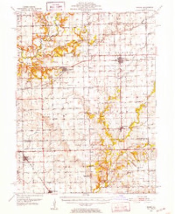
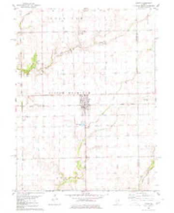
13 topographic sheets cover this place, the earliest surveyed in 1951 and the latest in 1990. It stands in Little Mackinaw Township. It lies in ZIP code area 61755. It stands on Whitten Branch. The Survey maps it on the Minier quadrangle.
Topographic sheets covering this place
8 surveys from 13 printed sheetsMatched by testing this settlement's coordinate against the published boundary of every sheet in the United States Geological Survey's historical collection. Each opens the scanned sheet at the Survey.
- 1951 USGS Minier quadrangle1:62500, 3 printings
- 1958 USGS Peoria quadrangle1:250000, 4 printings
- 1961 USGS Peoria quadrangle1:250000
- 1963 USGS Peoria quadrangle1:250000
- 1980 USGS Minier quadrangle1:24000
- 1985 USGS Lincoln quadrangle1:100000
- 1989 USGS Lincoln quadrangle1:100000
- 1990 USGS Peoria quadrangle1:250000




In the county-history sources
5,139 words on this townshipHistory of Tazewell County, Illinois ; Together with Sketches of Its Cities, Villages and Townships, Educational, Religious, Civil, Military, and Political History; Portraits of Prominent Persons and Biographies of Representative Citizens. History of Illinois ... Digest of State Laws, published 1879 names this settlement in its chapter on Little Mackinaw Township. These are the passages that mention it, exactly as the scans read.
In point of agriculture, of the class and kind of improvements, and of the wealth and high standing of her people. Little Mackinaw is second to no township in Tazewell county. It is mostly prairie land, undulating, and well drained by the Little Mackinaw, Whitten branch and Sugar creeks. The Kansas City branch of the C, A. & St. L. Railroad passes through it on a direct east and west line. The village of Minier is located on sec. 22, on the line of this road, and also on the Illinois Midland Railroad. This town was laid out in 1867, Oct. 18th, by Geo. W. Minier, Chas. E. Boyer, and others. It is now a thriving place, and considerable business is done here. We speak more fully of the business men further on in this article. The township is inhabited by a cultured, refined and a religious people. Good churches, neat school-houses, and the fine commodious residences on every hand, are unmistakable evidences of the verity of this statement.
Passage source: History of Tazewell County, Illinois ; Together with Sketches of Its Cities, Villages and Townships, Educational, Religious, Civil, Military, and Political History; Portraits of Prominent Persons and Biographies of Representative Citizens. History of Illinois ... Digest of State Laws, published 1879.
Jesse F. Beal, farmer, was born in Washington township, Tazewell Co., Aug. 20, 1842, and received such education as was afforded by attendance upon the common schools. His parents, Moses H. and Anna A. Beal, were natives of Ohio. July 25, 1861, he enlisted in Co. D, 7th 111. Infantry, the first regiment raised in the State, and served three years, doing battle for his country. In 1868, Oct. 15, he was united in marriage with Jane Etzler. She died Oct. 23, 1869. He was married again Nov. 18, 1873, to Sarah Jelly. He casts his ballot and influence on the side of Republicanism. Postoffice, Minier.
Passage source: History of Tazewell County, Illinois ; Together with Sketches of Its Cities, Villages and Townships, Educational, Religious, Civil, Military, and Political History; Portraits of Prominent Persons and Biographies of Representative Citizens. History of Illinois ... Digest of State Laws, published 1879.
William Bennett, farmer, section 19; was born in Elm Grove township, Tazewell Co., 111., May 5, 1829, which certainly places him in the list with " old settlers." His father, Nathaniel Bennett, was from Kentucky; his mother, Elizabeth Bennett, was from the Buckeye State. William only enjoyed such educational advantages as the' common schools of this county afforded in pioneer times. He has held most of the township offices at different times and served as Justice of the Peace for nine years. Sept. 3, 1854, he was joined in holy matrimony with Angelina Kimler. They have had twelve children - four boys and eight girls - seven of w^hom are now living. P. O., Minier,
Passage source: History of Tazewell County, Illinois ; Together with Sketches of Its Cities, Villages and Townships, Educational, Religious, Civil, Military, and Political History; Portraits of Prominent Persons and Biographies of Representative Citizens. History of Illinois ... Digest of State Laws, published 1879.
Machine-read from a century-old scan, so expect the errors a machine makes: misspelled names, dropped words, stray characters.
Read the whole chapter on Little Mackinaw Township - it names this place 10 more 10 times.
Fires near this place
2 since 2011Regional context, not property-specific evidence. The federal wildfire occurrence database lists 2 fires within 5 miles of Tazewell between 2011 and 2012, burning about 12 acres in total. None started naturally. None was recorded as arson. Distance is straight-line from the map coordinates, so a fire counted here may appear on a neighbouring settlement's page as well.
| Reported cause | Fires |
|---|---|
| Debris and open burning | 2 |
The most recent of them, most recent first, with the day each was reported and the service that recorded it.
| Date | Cause | Size | Reported by | Name on the report |
|---|---|---|---|---|
| 17 July 2012 | Debris and open burning | under an acre | Illinois Division of Forestry Resources | WOODFORD |
| 2 April 2011 | Debris and open burning | 12 acres | Illinois Division of Forestry Resources | TAZ |
Settlements close enough to share some of these fires:
Mines and quarries near this place
1 within 5 milesRegional context, not property-specific evidence. The federal mineral resources record lists 1 working within 5 miles of Tazewell: 1 past producer. None of them still produces. What was taken out: Sand and Gravel, Construction. Distance is straight-line from the map coordinates, so a quarry counted here may appear on a neighbouring settlement's page as well.
| Where | Site | Commodity | Status | Recorded |
|---|---|---|---|---|
| Lee Pit | Sand and Gravel, Construction | Past Producer |
Nearest settlements
The eight closest, with where each one stands in the county. Distances are straight-line, computed from the Geographic Names Information System coordinates.
Provenance
This settlement is recorded in the Geographic Names Information System as feature 423234. The sheet list is computed by point-in-boundary test against the United States Geological Survey's historical topographic inventory. Both are works of the United States government and carry no copyright under 17 U.S.C. 105.
Wildfire. Short, Karen C. 2022. Spatial wildfire occurrence data for the United States, 1992-2020 [FPA_FOD_20221014]. 6th Edition. Fort Collins, CO: Forest Service Research Data Archive. https://doi.org/10.2737/RDS-2013-0009.6 Collected with United States Government funding and usable without additional permissions or fees.
Mines and quarries. USGS Mineral Resources Data System (MRDS) https://mrdata.usgs.gov/mrds/ A work of the United States government, no copyright under 17 U.S.C. 105.