 Block
Mattoon, Illinois
14 topographic sheets cover this place, the earliest surveyed in 1934 and the latest in 1998. It stands in Mattoon Township. It lies in ZIP code area 61938. The Survey maps it on the Mattoon East quadrangle. 16,870 people lived here at the 2020 count. It stands 732 feet above sea level.
On record in Mattoon
Buildings and businesses the archive holds for this place. Each opens its own page, with the source record it came from.
On the National Register 9 records
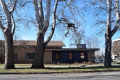 Burgess-Osborne Memorial Auditoriumlisted 2018
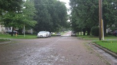 Fifteenth Street and Oklahoma Avenue Brick Streetlisted 1999
 Illinois Central Railroad Depotlisted 2002
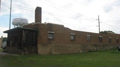 Railway Express Agency Buildinglisted 1994
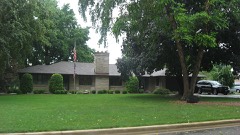 Richard Roytek Houselisted 2011
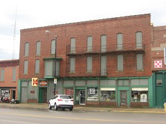 Starr Hotellisted 1994
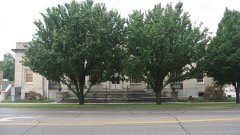 U. S. Post Officelisted 1979
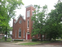 Unity Churchlisted 1982
- Lumpkin Heights and Elm Ridge Subdivision Historic Districtlisted 2017
Population over time
2 figuresMattoon fell from 18,555 to 16,870 between 2010 and 2020. These are the recorded population figures Wikidata holds for this place, reached through the Geographic Names Information System number this page is keyed on rather than by name, so they belong to this place and not to another of the same name. Most are census counts, but not all are: an early figure may be a founding or settlement estimate, and an estimate published within five years of a census is left out. The change column is computed, and is left blank where more than 20 years separate a figure from the one before it, because a gap that long is not a change between two counts.
| Year | People | Change |
|---|---|---|
| 2010 | 18,555 | |
| 2020 | 16,870 | -1,685 (-9%) |
Topographic sheets covering this place
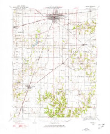
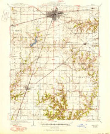
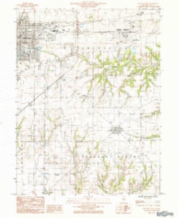
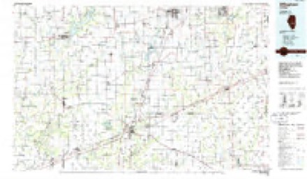
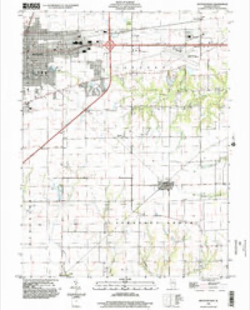
7 surveys from 14 printed sheetsMatched by testing this settlement's coordinate against the published boundary of every sheet in the United States Geological Survey's historical collection. Each opens the scanned sheet at the Survey.
- 1934 USGS Mattoon quadrangle1:62500, 2 printings
- 1937 USGS Mattoon quadrangle1:62500, 3 printings
- 1958 USGS Decatur quadrangle1:250000, 3 printings
- 1961 USGS Decatur quadrangle1:250000, 2 printings
- 1984 USGS Mattoon East quadrangle1:24000
- 1986 USGS Effingham quadrangle1:100000, 2 printings
- 1998 USGS Mattoon East quadrangle1:24000


In the county-history sources
44,148 words on this townshipThe History of Coles County, Illinois ... Map of Coles County; History of Illinois ... History of Northwest ... Constitution of the United States, Miscellaneous Matters, &c., &c, published 1879 names this settlement in its chapter on Mattoon Township. These are the passages that mention it, exactly as the scans read.
The prairies are now the chief producing part of the township. They easily admit of good drainage and, though to some extent rather level, are exceedingly productive. Corn is the principal cereal grown. The others do w^ell, but throughout this part of Central Illinois are not the staple article of agriculture. Cattle and hogs are raised quite extensively. Mr. Elisha Linder and a few others have been for many years prominently engaged in this business. The railroads at Mattoon give a direct outlet to all the chief markets of the world and should maintain a constant sale for farm produce.
Passage source: The History of Coles County, Illinois ... Map of Coles County; History of Illinois ... History of Northwest ... Constitution of the United States, Miscellaneous Matters, &c., &c, published 1879.
A curious phenomenon exists on the farm of W. M. Champion, in the southwest part of this township. When digging for a well in March, 1871, after attaining a depth of thirty-one feet, a drill was used which was sunk a few feet farther, and a vein of carbonate gas struck. It was observed that Avhen the drill was withdrawn the water gurgled up at irregular intervals, and as a vein Avas supposed to be found preparations were made to wall the well. No smell was attached to the gas, and no thoughts of it being then entertained. From the peculiar motion of the water it was feared by one of the men that there might be poisonous gases in the well, and"bne of them went after a wisp of hay and another for some shavings. The latter returned first, and, lighting his bunch, was hallooed to by the other to " Throw it down." /. e., on the ground. Thinking he meant throw it in the well he did, and a frightful report and sheet of flame burst forth. Mr. Tremble and one or two others who were near were severely scorched about the face, and all were tremendously amazed. The gas soon burned out, but would soon accumulate. Various experiments were made with it. An iron tube was inserted and the gas allowed to escape in a small stream. When lighted it burned with a brilliant light. The well soon became notorious and was visited by scores of people from all sections of the West. Finally, Mr. Champion bethought himself to utilize the gas, and, conducting it by pipes to his house, soon had it in use in his kitchen to cook by, and in other stoves it was used as fuel. It made an excellent light, and he has all the appliances of a city in that regard. He walled the well, and now water stands in it, all seasons, so that from one well he gets light, fuel and water, all without any tax or license.
Passage source: The History of Coles County, Illinois ... Map of Coles County; History of Illinois ... History of Northwest ... Constitution of the United States, Miscellaneous Matters, &c., &c, published 1879.
In the summer of 1826, Mr. Charles Sawyer, a resident of Kentucky, came to this part of Illinois looking for a home. He remained a short time with the Trues, in what is now La Fayette Township, and examined the country to the south and west of them. Selecting a location at the north side of the timber, on the Little Wabash, he returned to the True settlement, and hired a man named Bates, for $10, to build him a cabin, while he should return to Kentucky for his family. Mr. Bates hired Levi Doty, a young man living in the neighborhood, to build the cabin, and, by winter, a very comfortable home was ready for " Uncle Charley " when he should return. This cabin was the first habitation for a white man known to have been built in the bounds of either Mattoon or Paradise Township. It stood near the site of Mr. John Sawyer's house in Section 28, and until a few other pioneers could erect similar habitations, was the home of the emigrant while he was selecting and preparing his own fireside.
Passage source: The History of Coles County, Illinois ... Map of Coles County; History of Illinois ... History of Northwest ... Constitution of the United States, Miscellaneous Matters, &c., &c, published 1879.
Machine-read from a century-old scan, so expect the errors a machine makes: misspelled names, dropped words, stray characters.
Read the whole chapter on Mattoon Township - it names this place 152 more 152 times.
Mines and quarries near this place
1 within 5 milesRegional context, not property-specific evidence. The federal mineral resources record lists 1 working within 5 miles of Mattoon: 1 past producer. None of them still produces. What was taken out: Stone, Crushed/Broken. Distance is straight-line from the map coordinates, so a quarry counted here may appear on a neighbouring settlement's page as well.
| Where | Site | Commodity | Status | Recorded |
|---|---|---|---|---|
| Mattoon City Eng | Stone, Crushed/Broken | Past Producer |
Storms near this place
60 of 126 shownRegional context, not property-specific evidence. The National Weather Service names Mattoon in 126 storm reports between 1993 and 2026: 72 thunderstorm wind, 34 hail, 13 flash flood, 4 tornado. The reports record 7 injuries. Each account below is quoted exactly as the forecast office filed it, from the NOAA Storm Events Database, and each date opens the federal record of that event.
| When | Event | Place named | Harm | What the report says |
|---|---|---|---|---|
| March 1998 | Tornado (F2) | Mattoon | 3 hurt, $3,000,000 | A tornado touched down 1 mile southwest of Mattoon and travelled to the northeast. It damaged 4 homes in the initial touchdown area and then crossed a set of railroad tracks turning over 4 empty 30-ton coal cars. After crossing the railroad tracks, the tornado hit a self-storage facility, where six of the ten buildings in the complex were destroyed. The tin and steel girder buildings were not bolted down to the cement slabs, so they were lifted up, "wadded up" into a big pile, and deposited downstream about 200 yards. Further to the northeast, it damaged or destroyed numerous homes and businesses before lifting. It remained aloft for several blocks, then touched down again, tearing off treetops and damaging several roofs in the area. It lifted again and touched down a final time about a block away. Damage in this area was to tree tops and roofs. Overall, the tornado was on the ground for 1.5 miles and it either damaged or destroyed 120 homes and businesses. Damage is estimated between $2.5 and $3 million. Two people sustained minor injuries and one 9 year old child was seriously injured when a picture frame blew off the wall, hit her in the back, and cut her, causing her left lung to partially collapse. |
| August 2012 | Thunderstorm Wind | Mattoon | 2 hurt, $40,000 | Numerous trees were blown down and a few power poles were snapped along Route 16 west of Mattoon. Two people were injured when they were hit by falling tree branches as they were trying to take shelter from the storm. A semi and trailer were blown over on Route 16 2 miles west of Mattoon. Many corn fields sustained wind damage as well. |
| September 2003 | Tornado (F1) | Mattoon | 1 hurt, $10,000,000 | A tornado touched down 4 miles north northeast of Mattoon near a printing plant. It then traveled east damaging several buildings at the plant. Almost 500,000 square feet of the roof was damaged or destroyed. Contents in the buildings including electronic equipment and over 5 million pounds of paper were damaged. With over 400 employees in the plant at the time of the tornado, only one person suffered minor injuries but didn't need immediate medical attention. After hitting the plant, the tornado damaged some outbuildings at a nearby farm before lifting and dissipating. Damage to the plant was estimated around $10 million. |
| July 2009 | Lightning | Mattoon | 1 hurt | An employee at WMCI radio in Mattoon was injured when lightning struck the radio station tower. The employee was indoors, working on radio transmission equipment. |
| April 2018 | Flash Flood | Mattoon | $2,000,000 | A steady, but moderate to heavy rain, moved into the southern parts of Coles County shortly after 7 am CDT. Thunderstorms caused the rain to intensify between 9:00 and 10:00 am CDT, when nearly 2.00 inches of rain was measured. Total rainfall ranged from 4.00 to 6.00 inches in about a nine hour period. Flash flooding rapidly developed in Mattoon, Charleston and other surrounding areas, where numerous streets were flooded and had to be closed. Illinois Route 16 was closed in several spots as well as parts of I-57 between milepost 184 and 192. Five houses in Mattoon were flooded, resulting in the evacuation of 11 people, where the water was 3 to 5 feet deep, mainly due to the flooding of Kickapoo Creek. Numerous water rescues were also conducted by local officials for people trapped in vehicles. Lakeland College just south of Mattoon cancelled classes due to all of the road closures from the flooding. |
| June 2008 | Thunderstorm Wind | Mattoon | $250,000 | Widespread tree and power line damage occurred in and around Mattoon. In addition, several buildings in town sustained roof damage, a cinder block wall partly collapsed at a tire dealership, and numerous vehicles were damaged at a car dealership by flying debris. |
| May 2013 | Thunderstorm Wind | Mattoon | $125,000 | Numerous trees, tree branches, and power poles were blown down throughout Mattoon. |
| June 2016 | Thunderstorm Wind | Mattoon | $75,000 | Empty semi trailers were pushed over and numerous trees and power lines were blown down. |
| August 2012 | Thunderstorm Wind | Mattoon | $65,000 | Numerous trees and power poles were blown down across Mattoon. Electricity was knocked out to many residents for about 2 hours. Power lines were blown down and blocked Lake Mattoon Road. |
| July 2016 | Thunderstorm Wind | Mattoon | $60,000 | A tree was blown onto a garage on 22nd Street and several trees and tree branches were blown down along Western Avenue. |
| June 2009 | Thunderstorm Wind | Mattoon | $50,000 | A substation was damaged by strong winds. |
| July 2016 | Thunderstorm Wind | Mattoon | $40,000 | Numerous trees were blown onto power lines near East County Road 1000N and Dole Road. |
| June 2016 | Thunderstorm Wind | Mattoon | $32,000 | Several power lines were blown down just west of Mattoon. |
| July 2016 | Thunderstorm Wind | Mattoon | $25,000 | Several large tree branches were blown down in Mattoon. |
| September 2015 | Thunderstorm Wind | Mattoon | $25,000 | Several tree branches were blown down around Mattoon. One tree fell onto a house. |
| July 2013 | Thunderstorm Wind | Mattoon | $25,000 | Numerous tree branches and power lines were blown down on the west side of Mattoon. |
| June 2011 | Thunderstorm Wind | Mattoon | $25,000 | Several tree limbs were blown down in Mattoon. |
| July 2008 | Thunderstorm Wind | Mattoon | $25,000 | The roof was damaged at Central Illinois Transmission in Mattoon. There were also several trees and power lines blown down in the area. |
| August 2007 | Thunderstorm Wind | Mattoon | $20,000 | Numerous trees, large tree limbs, and power lines were blown down across Mattoon.| |
| August 1999 | Thunderstorm Wind | Mattoon | $20,000 | Numerous tree limbs and power lines blown down. |
| August 2009 | Thunderstorm Wind | Mattoon | $17,000 | A tree was blown down near Mattoon High School. In addition, wind damage occurred to the Mattoon Dispatch Center. |
| August 2009 | Thunderstorm Wind | Mattoon | $16,000 | A couple of semi trailer tankers were damaged at 21st and Marshall in Mattoon. |
| August 2019 | Thunderstorm Wind | Mattoon | $15,000 | A tree was blown onto a house, tearing a hole in its roof. A large oak tree was knocked down near the golf course. Numerous power lines were blown down around town. |
| December 2008 | Thunderstorm Wind | Mattoon | $12,000 | Trees and power lines were blown down in the town of Coles. |
| June 2017 | Thunderstorm Wind | Mattoon | $10,000 | A porch roof was flipped onto a house. |
| July 2014 | Thunderstorm Wind | Mattoon | $8,000 | Several large tree branches were blown down. |
| October 2007 | Thunderstorm Wind | Mattoon | $8,000 | Numerous tree branches were blown down.| |
| May 2018 | Thunderstorm Wind | Mattoon | $3,000 | An uprooted tree fell and hit a power line. |
| July 2010 | Thunderstorm Wind | Mattoon | $3,000 | A 1.5-foot diameter healthy tree was snapped. |
| May 2015 | Thunderstorm Wind | Mattoon | $2,000 | A tree was blown down. |
| October 2014 | Thunderstorm Wind | Mattoon | $1,500 | A large tree was blown down across Lafayette Street. |
| September 2014 | Thunderstorm Wind | Mattoon | $1,500 | A tree was blown down across a road. |
| June 2011 | Thunderstorm Wind | Mattoon | $1,500 | A large glass window was blown out in the phone company office building at 17th and Charleston in Mattoon. |
| August 2009 | Thunderstorm Wind | Mattoon | $1,000 | Two 4-inch diameter tree branches were blown down in Mattoon. |
| March 2026 | Thunderstorm Wind | Mattoon | - | Multiple small trees were snapped, a pine tree was blown over, and a fence was damaged. |
| March 2026 | Thunderstorm Wind | Mattoon | - | Air conditioner units were ripped off a building. |
| March 2026 | Thunderstorm Wind | Mattoon | - | The sign and roof of a shopping center were damaged and traffic lights were snapped at 18th Street and Rudy Avenue. |
| March 2026 | Thunderstorm Wind | Mattoon | - | A shed was flipped upside down in the middle of the road near the intersection of 18th Street and Olive Avenue. |
| June 2025 | Thunderstorm Wind | Mattoon | - | A large tree was uprooted, and other trees had branches blown down. |
| June 2025 | Thunderstorm Wind | Mattoon | - | Trees were blown down onto power lines. |
| July 2025 | Thunderstorm Wind | Mattoon | - | A tree was blown onto a home. |
| July 2024 | Thunderstorm Wind | Mattoon | - | A tree was blown down across Western Avenue between 25th Street and 26th Street. |
| July 2024 | Thunderstorm Wind | Mattoon | - | A large tree was blown down onto two cars near the intersection of Marshall Avenue and 36th Street on the southwest side of Mattoon. |
| July 2024 | Thunderstorm Wind | Mattoon | - | Large tree branches were blown down. |
| June 2023 | Thunderstorm Wind | Mattoon | - | A large tree limb was blown down. |
| August 2022 | Flash Flood | Mattoon | - | There was flowing water four to five inches deep on Charleston Avenue near 21st Street. |
| August 2022 | Flash Flood | Mattoon | - | Water was flowing across numerous streets in Mattoon...including Western Avenue and Charleston Avenue. Vehicles were stalled in high water on Charleston Avenue between 14th Street and 15th Street and on Charleston Avenue near 26th Street. |
| July 2022 | Flash Flood | Mattoon | - | Water over the intersection of 28th St and Commercial Avenue in Mattoon. |
| June 2021 | Thunderstorm Wind | Mattoon | - | A tree was blown down. |
| June 2021 | Flood | Mattoon | - | Portions of IL-16 east of downtown Mattoon were closed due to flooding. IL-316 and US-45 on the north side of town were also closed. Some vehicles were stranded in high water. |
| December 2021 | Thunderstorm Wind | Mattoon | - | A semi was blown over near the Rural King Distribution Center. |
| June 2019 | Thunderstorm Wind | Mattoon | - | Numerous trees and power lines were blown down. |
| August 2019 | Thunderstorm Wind | Mattoon | - | Numerous large tree branches were blown down. |
| April 2018 | Flood | Mattoon | - | A steady, but moderate to heavy rain, moved into the southern parts of Coles County shortly after 7 am CDT. Thunderstorms caused the rain to intensify between 9:00 and 10:00 am CDT, when nearly 2.00 inches of rain was measured. Total rainfall ranged from 4.00 to 6.00 inches in about a nine hour period. Flash flooding rapidly developed in Mattoon, Charleston and other surrounding areas, where numerous streets were flooded and had to be closed. Illinois Route 16 was closed in several spots as well as parts of I-57 between milepost 184 and 192. Five houses in Mattoon were flooded, resulting in the evacuation of 11 people, where the water was 3 to 5 feet deep, mainly due to the flooding of Kickapoo Creek. Numerous water rescues were also conducted by local officials for people trapped in vehicles. Lakeland College just south of Mattoon cancelled classes due to all of the road closures from the flooding. Additional periods of rainfall during the late morning and afternoon of April 3rd kept many areas from Mattoon to Charleston flooded the remained of the day. The flooding subsided during the very early morning hours of April 4th. |
| May 2018 | Thunderstorm Wind | Mattoon | - | Several large tree limbs were blown down. |
| February 2008 | Flash Flood | Mattoon | - | Flooding closed 9th Street in Mattoon between Stinson Avenue and Old State Road. One vehicle stalled in the high water. |
| March 2008 | Hail | Mattoon | - | Spotters reported penny to quarter sized hail on the west and north sides of Mattoon. |
| July 2007 | Flash Flood | Mattoon | - | Several streets in Mattoon closed due to flooding. |
| April 2006 | Thunderstorm Wind | Mattoon | - | Numerous trees and power poles blown down. Roof and siding damage to several homes. Machine shed destroyed and grain bins damaged 1 mile north of Mattoon. |
| June 2006 | Thunderstorm Wind | Mattoon | - | No damage was reported. |
Nearest settlements
The eight closest, with where each one stands in the county. Distances are straight-line, computed from the Geographic Names Information System coordinates.
| Map | Place | Distance | Sheets |
|---|---|---|---|
| Lane Acres | 1.8 miles | 14 | |
| Rolling Green | 2.4 miles | 14 | |
| Lipsey | 2.5 miles | 14 | |
| Country Club Estates | 2.5 miles | 14 | |
| Jones | 2.9 miles | 14 | |
| Magnet | 3.3 miles | 14 | |
| Wabash Point | 3.8 miles | 14 | |
| Newby | 4.1 miles | 14 |
Elsewhere
Matched on this settlement's Geographic Names Information System number rather than its name, so it cannot be a different place of the same name in another state.
| Wikipedia article on Mattoon | An encyclopaedic summary. Its text is share-alike, so it is linked here rather than copied. |
| Wikidata item Q575271 | The structured record the population and elevation above come from. Public domain (CC0). |
Provenance
This settlement is recorded in the Geographic Names Information System as feature 413131. The sheet list is computed by point-in-boundary test against the United States Geological Survey's historical topographic inventory. Both are works of the United States government and carry no copyright under 17 U.S.C. 105.
Mines and quarries. USGS Mineral Resources Data System (MRDS) https://mrdata.usgs.gov/mrds/ A work of the United States government, no copyright under 17 U.S.C. 105.
Storms. NOAA National Centers for Environmental Information, Storm Events Database https://www.ncei.noaa.gov/stormevents/ A work of the United States government, no copyright under 17 U.S.C. 105. Narratives are quoted verbatim from the National Weather Service report and are not edited or summarised.