 Block
Jones, Illinois
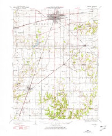
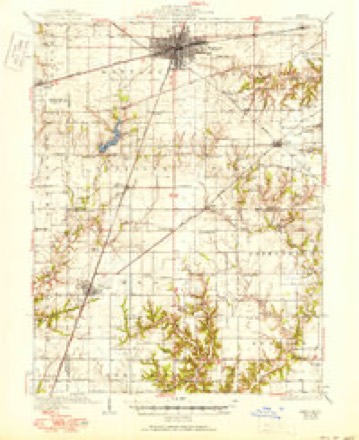
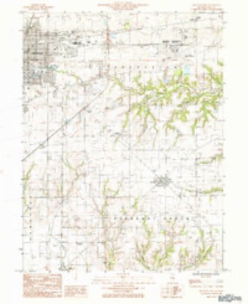
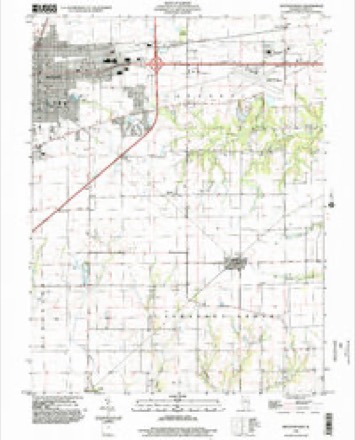
14 topographic sheets cover this place, the earliest surveyed in 1934 and the latest in 1998. It stands in Lafayette Township. It lies in ZIP code area 61938. The Survey maps it on the Mattoon East quadrangle. It stands 738 feet above sea level.
Topographic sheets covering this place
7 surveys from 14 printed sheetsMatched by testing this settlement's coordinate against the published boundary of every sheet in the United States Geological Survey's historical collection. Each opens the scanned sheet at the Survey.
- 1934 USGS Mattoon quadrangle1:62500, 2 printings
- 1937 USGS Mattoon quadrangle1:62500, 3 printings
- 1958 USGS Decatur quadrangle1:250000, 3 printings
- 1961 USGS Decatur quadrangle1:250000, 2 printings
- 1984 USGS Mattoon East quadrangle1:24000
- 1986 USGS Effingham quadrangle1:100000, 2 printings
- 1998 USGS Mattoon East quadrangle1:24000


In the county-history sources
7,878 words on this townshipThe History of Coles County, Illinois ... Map of Coles County; History of Illinois ... History of Northwest ... Constitution of the United States, Miscellaneous Matters, &c., &c, published 1879 names this settlement in its chapter on Lafayette Township. These are the passages that mention it, exactly as the scans read.
During the summer of 1825, several persons were in this part of Illinois, prospecting, hunting and seeking homes. Among them were Samuel Henry and John Robinson, of Crawford County. They spent some time on the Kickapoo, hunting and examining the different sections of country adjacent. Finding an excellent soil, plenty of timber and water enough for all practical purposes, they determined to make this their home. Robinson soon brought his wife to this place, and set about building a camp. Henry, on his return to Crawford County, hired John Veach to bring him, his family and their effects to the new home. Then there were but very few settlers in the present limits of Coles County, and, what few there were, were pioneers in the truest sense of the word. Mr, Veach, not caring for the journey, sent his son Jesse, then eighteen years of age, and an expert hunter and frontiersman. On the 18th of December, he loaded the Henry family into the old Virginia wagon, hitched his ox and horse teams to it, and prepared for the journey. That night they went to the cabin of S. H. Bates, father of John Bates, now well known in Coles County, and remained with them till morning. Mr. Bates was also ready to come with them, having heard of the richness of the soil here, and the promise of a competence in after-life. That night, the two families got to where Isaac Lewis lived, not far from where the present town of Robinson is situated, where they remained overnight. They found, on their arrival here, that Ben Parker, an early settler in Coles, which, it must be recollected, did not then exist in name, was here to take Mr. Lewis back with him. It will be observed that neither Mr. Henry nor Mr. Lewis had teams of their own. They were too poor to own any, and were, therefore, dependent on their neighbors for such accommodations as they could get. The three families made the journey in four days. The first day out, they got as far as Eaton's mill, on the north fork of the Embarrass. The second day, to Long Point, where they camped, there being no habitation near. The third day, they got to a camp, where George Parker now lives, where they got some corn for their teams. The evening of the fourth day, they arrived at the unfinished cabin of Mr. Bates, which they completed, so they could find shelter therein, and remained there for the night. The cabin was inclosed and covered, but no doors made nor any chimney built. The next day, Mr. Veach started for the Kickapoo timber with Mr. Henry's family. He got to the camp made by Robinson about the middle of the afternoon, unloaded his wagon, and returned to the Bates cabin to remain overnight. The next day he started home, reaching it in a few days time.
Passage source: The History of Coles County, Illinois ... Map of Coles County; History of Illinois ... History of Northwest ... Constitution of the United States, Miscellaneous Matters, &c., &c, published 1879.
Mr. Henry and his family reached their new home on the afternoon of December 25, 1825. They were alone in this part of the country - no one west of them for many miles. A few settlers were in the eastern part of the county, but none nearer than the cabin of Mr. Bates, whom they left that morning. On their way up from Crawford County, they met Robinson and his wife with their ox-team going back to the settlement, where they expected to remain during the winter. They informed them an unfinished camp was awaiting them, and told them how they had left, expecting to return in the spring. Mr. Henry and his wife set about, immediately on their arrival, making themselves as comfortable as they could, and, as the winter was rather mild, experienced but little hardship. They found wild honey and game abundant, and suffered none for provisions. They had brought corn enough to supply themselves with corn- bread, and with that and the abundant wild food fared well while alone in the woods. Early in the spring, Robinson and his wife returned with their ox-team, bringing with them the news of the day and the cheering information that others were preparing to follow. During their return visit, Mrs. Robinson had become a mother, and brought back the first baby to the settlement. Both families used the cabin, built the autumn before, until Henry could complete his own, into which he at once moved, and the second home in the township was established. When the season opened, these two men prepared ground, sowed wheat, planted corn, started a small garden for each, and prepared to erect permanent cabins as soon as the crops could be " laid away." Before this was done, however, they were joined by John Wilkinson, from Edgar County, who, hearing of the rich soil and natural advantages to be found here, left that county and located in the northeast part of what is now La Fayette Township, forming the beginning of a settlement there. He remained only one year, however, when he sold to Isaac Parker and went to Texas, where he afterward became a noted man. This same spring of which we are speaking (1826), Samuel Woods came up from Crawford County, selected his claim, planted a crop, with the assistance of a few neighbors raised a cabin, and, in the fall, went back and brought up his family. He settled near the east side of the township, not far from the present Methodist Church, He remained here until his death. Thomas Robnet came the same spring, and located near where H. Nabb now lives. Not liking the location, he moved, soon after, to the farm now owned by Levi Doty, where he lived till 1833, when he sold that claim and went to the Lone-Star State. Whether any other families than these mentioned came this summer, is now very difficult to determine. Mr. Jesse Veach says he knows there were none when he brought Henry's family, in the fall of 1825, and he has not been informed of any more than those named. He went back to Crawford County, the next year went to New Orleans on a flatboat, and, on his return, married and settled in the neighborhood where he had lived. He did not become a citizen of Coles County till 1831. He was up here, however, he says, several times in the interim, and knew pretty well what was being done. As it impossible, at this date, to accurately note the date of each one's settlement before the Black Hawk war, we will give each one as far as we have been able to gather them. Some wilU undoubtedly, be omitted, as no record was kept and no one lives now who can tell to a certainty who came. Among those coming next after those mentioned ,was James James, who came from Edgar County in 1826 or 1827 - probably the latter year. He married, for his second wife, a daughter of Mr. Bates, whose coming has already been mentioned. Levi and James Doty, both young men, came about the same time. They are yet living. James Burns settled near where William R. Jones now lives, but remained only a few years. James Ashmore, from Tennessee, came in this period. It will be remembered that at his house the first election in the county was held. It was rather a central point, and also one well known. He and the entire family of Ashmores became prominently known all over Coles County. On the day of the election, plenty of whisky was furnished by the opposing candidates, as was the custom then, and, as this beverage excited men to unlawful and wicked deeds then, as now, about a dozen fights occurred. It was a " big thing " then to be the " boss fighter," or able to whip any man in the country. It seemed to be a measure of prowess then, as on the frontier now. Mr. John Phipps states that he was at that election, and remembers (he was twelve years old at the time) there were about a dozen fights before the day was over. One champion and his friends would challenge another of equally renowned prowess, and the point must be settled.
Passage source: The History of Coles County, Illinois ... Map of Coles County; History of Illinois ... History of Northwest ... Constitution of the United States, Miscellaneous Matters, &c., &c, published 1879.
Another settler of this period was William Parker, who settled where William Jones now lives. Another was John Veach, who hearing the stories of the fertile land in this part of the country, came here in 1828, and remained. John Phipps came that same year, from Wabash County. He had four or five children, one of whom, John, Jr., narrates the coming of the family, their settlement here, and their own and neighbors' struggles for a start. He says they moved into an old, unfinished cabin they found in the woods not far from where he is now living, and which they occupied some time. It had no floor, was very imperfectly daubed, and was, withal, a poor lodging-place. It was, though, the best they could do, and like many another pioneer family, they did what they could, not what they wanted to. They were consoled in a measure by the fact that some of their neighbors had no better lodging-place, some, even, had none. They, and all others similarly situated, did the best they could in these primitive dwellings till they could get their crops gathered, when they erected closer and better cabins, which they used until circumstances allowed them to build frame dwellings. Mr. Phipps shows now with no little pride, an old wind-mill, sixty-seven years old, his father brought with him when he came to this part of the State. He remembers, in addition to the families named, those of Elijah Gibbs, who came here from Crawford County, and who remained until his death occurred ; William Ewing, from Kentucky; William Williams, who came in 1829, from Kentucky, and who lived here all his life. "Capt." R. E. Y. Williams, a boy then, is now living on the old place. Samuel Williams came with the others, but did not remain long, returning to Kentucky. Others, he remembers, were old Mr. Scott, William R. Jones, Rev. Daniel Barham, a noted Baptist minister, and one of the early settlers in Pleasant Grove, John Gordon, another pioneer, who moved there in 1829, Rev. Threlkeld, and a few others.
Passage source: The History of Coles County, Illinois ... Map of Coles County; History of Illinois ... History of Northwest ... Constitution of the United States, Miscellaneous Matters, &c., &c, published 1879.
Machine-read from a century-old scan, so expect the errors a machine makes: misspelled names, dropped words, stray characters.
Read the whole chapter on Lafayette Township - it names this place 7 more 7 times.
Fires near this place
1 since 2015Regional context, not property-specific evidence. The federal wildfire occurrence database lists 1 fire within 5 miles of Jones in 2015, burning under an acre in total. None started naturally. None was recorded as arson. Distance is straight-line from the map coordinates, so a fire counted here may appear on a neighbouring settlement's page as well.
| Reported cause | Fires |
|---|---|
| Debris and open burning | 1 |
The most recent of them, most recent first, with the day each was reported and the service that recorded it.
| Date | Cause | Size | Reported by | Name on the report |
|---|---|---|---|---|
| 24 March 2015 | Debris and open burning | under an acre | Illinois Division of Forestry Resources | 1303241 |
Settlements close enough to share some of these fires:
Mines and quarries near this place
1 within 5 milesRegional context, not property-specific evidence. The federal mineral resources record lists 1 working within 5 miles of Jones: 1 past producer. None of them still produces. What was taken out: Stone, Crushed/Broken. Distance is straight-line from the map coordinates, so a quarry counted here may appear on a neighbouring settlement's page as well.
| Where | Site | Commodity | Status | Recorded |
|---|---|---|---|---|
| Mattoon City Eng | Stone, Crushed/Broken | Past Producer |
Storms near this place
2 since 2017Regional context, not property-specific evidence. The National Weather Service names Jones in 2 storm reports between 2017 and 2018: 1 thunderstorm wind, 1 hail. No death or injury is recorded in these reports. Each account below is quoted exactly as the forecast office filed it, from the NOAA Storm Events Database, and each date opens the federal record of that event.
| When | Event | Place named | Harm | What the report says |
|---|---|---|---|---|
| March 2017 | Thunderstorm Wind | Jones | $15,000 | A semi was blown over at mile marker 187 on I-57. |
| May 2018 | Hail | Jones | - | One inch hail was reported at the Mattoon Country Club. |
Nearest settlements
The eight closest, with where each one stands in the county. Distances are straight-line, computed from the Geographic Names Information System coordinates.
| Map | Place | Distance | Sheets |
|---|---|---|---|
| Rolling Green | 0.7 miles | 14 | |
| Country Club Estates | 1.2 miles | 14 | |
| Newby | 1.2 miles | 14 | |
| Mattoon | 2.9 miles | 14 | |
| Magnet | 3.4 miles | 14 | |
| Lerna | 3.4 miles | 14 | |
| Lane Acres | 4.3 miles | 14 | |
| Wabash Point | 4.6 miles | 14 |
Elsewhere
Matched on this settlement's Geographic Names Information System number rather than its name, so it cannot be a different place of the same name in another state.
| Wikidata item Q6275079 | The structured record the population and elevation above come from. Public domain (CC0). |
Provenance
This settlement is recorded in the Geographic Names Information System as feature 422851. The sheet list is computed by point-in-boundary test against the United States Geological Survey's historical topographic inventory. Both are works of the United States government and carry no copyright under 17 U.S.C. 105.
Wildfire. Short, Karen C. 2022. Spatial wildfire occurrence data for the United States, 1992-2020 [FPA_FOD_20221014]. 6th Edition. Fort Collins, CO: Forest Service Research Data Archive. https://doi.org/10.2737/RDS-2013-0009.6 Collected with United States Government funding and usable without additional permissions or fees.
Mines and quarries. USGS Mineral Resources Data System (MRDS) https://mrdata.usgs.gov/mrds/ A work of the United States government, no copyright under 17 U.S.C. 105.
Storms. NOAA National Centers for Environmental Information, Storm Events Database https://www.ncei.noaa.gov/stormevents/ A work of the United States government, no copyright under 17 U.S.C. 105. Narratives are quoted verbatim from the National Weather Service report and are not edited or summarised.