 Block
Moline, Illinois
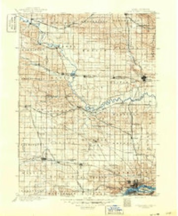
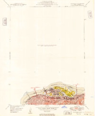
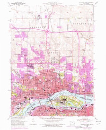
20 topographic sheets cover this place, the earliest surveyed in 1891 and the latest in 1993. It stands in Moline Township. It lies in ZIP code area 61265. It lies near Sylvan Island. The Survey maps it on the Davenport East quadrangle. 42,985 people lived here at the 2020 count. It stands 630 feet above sea level.
Research this city
On record in Moline
Buildings and businesses the archive holds for this place. Each opens its own page, with the source record it came from.
On the National Register 6 records
 John Deere Houselisted 2003
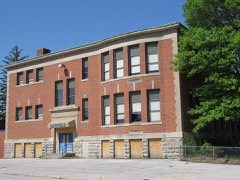 Garfield Elementary Schoollisted 2017
 LeClaire Hotellisted 1994
 Moline Downtown Commercial Historic Districtlisted 2007
 Rock Island National Cemeterylisted 1997
- Skelly Service Stationlisted 2024
Population over time
2 figuresMoline fell from 43,483 to 42,985 between 2010 and 2020. These are the recorded population figures Wikidata holds for this place, reached through the Geographic Names Information System number this page is keyed on rather than by name, so they belong to this place and not to another of the same name. Most are census counts, but not all are: an early figure may be a founding or settlement estimate, and an estimate published within five years of a census is left out. The change column is computed, and is left blank where more than 20 years separate a figure from the one before it, because a gap that long is not a change between two counts.
| Year | People | Change |
|---|---|---|
| 2010 | 43,483 | |
| 2020 | 42,985 | -498 (-1%) |
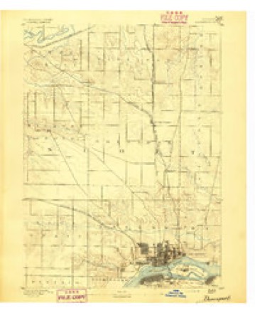
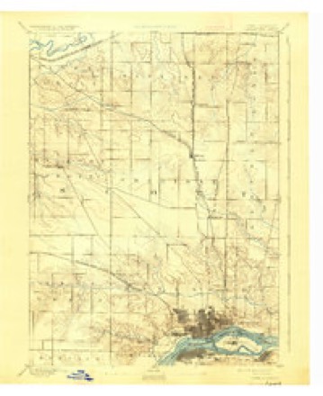
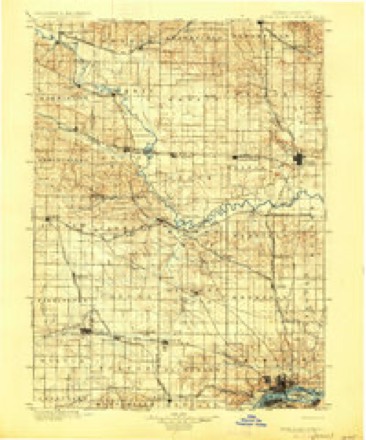
Topographic sheets covering this place
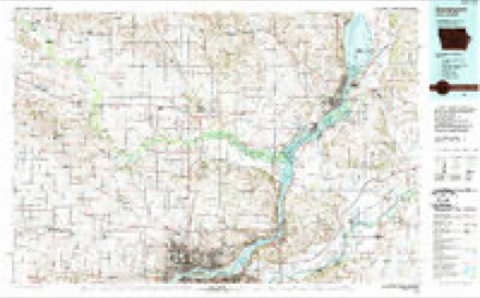
12 surveys from 20 printed sheetsMatched by testing this settlement's coordinate against the published boundary of every sheet in the United States Geological Survey's historical collection. Each opens the scanned sheet at the Survey.
- 1891 USGS Davenport quadrangle1:62500
- 1894 USGS Davenport quadrangle1:62500, 4 printings
- 1901 USGS Rock Island quadrangle1:125000, 2 printings
- 1910 USGS Rock Island quadrangle1:125000
- 1949 USGS Davenport quadrangle1:24000
- 1953 USGS Davenport East quadrangle1:24000, 3 printings
- 1958 USGS Davenport quadrangle1:250000, 2 printings
- 1961 USGS Davenport quadrangle1:250000
- 1962 USGS Davenport quadrangle1:250000
- 1984 USGS Davenport quadrangle1:100000, 2 printings
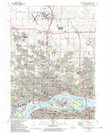
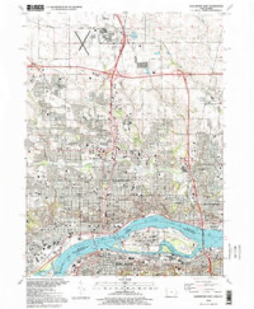
- 1991 USGS Davenport East quadrangle1:24000
- 1993 USGS Davenport East quadrangle1:24000



What happened here
An account from the chapter on Moline township. The inset identifies its exact source book and publication year.
William A Meese
in covered boats, and while distracting the attention of the Indians, ojK'ned fire on them from the water, at the same time that his Menominee allies attacked their village from the banks in the rear. Those who snrvived the slaughter removed to the Mississippi River. On arriving there they foimd that country inhabited liy the Sauteaux, a branch of the ("hippewa tribe.
In the county-history sources
45,071 words on this townshipHistoric Rock Island County;, published 1908 names this settlement in its chapter on Moline Township. These are the passages that mention it, exactly as the scans read.
After proceeding about six miles the wind increased to a hurricane. Campbell's boat being still heavily loaded, he says: "I was afraid of her dashing to pieces on the rocks, and ordered her to be put shore, which in doing from the severe gale of wind which was blowing, and the roughness of the water, dashed her so hard on shore it was imjiossible to get her off while the storm lasted." The boat was driven on the north .sliorc of an island lying about six miles east of Moline and which since that day has been known as Campbell's Island. It lies near the eastern shore in Rock Island County and hclouss to the State of Illinois.
Passage source: Historic Rock Island County;, published 1908.
Charles, who settled on what is now known as the Case place on Rock River; Rinah Wells and his four sons, Rinah, Jr., Lucius, John and Samuel, who also settled on Rock River; Joel Wells, Jr., who settled near Hampton; Joel Wells, Sr., Levi and Huntington Wells, who settled at Moline; Joseph Danforth a mile above Moline; Michael Bartlctt where Deere i^c Mansur's factory, Moline, now is; George Goble and his son, Benjamin, about two miles above Moline; William Brashar, who settled south of the present city of Rock Island; Joshua A'andrruff and his sons, who settled on \'andruff's Island; Charles H. Case and Benjamin F. Pike.
Passage source: Historic Rock Island County;, published 1908.
At this time in the southern part of the the state negroes were held in bondage, under what was known and recognized as the indentured or registered servant's act. . This was contrary to the ordinance of 1787 which governed the admission of Illinois into the union as a state, but our Legislature enacted laws which our courts upheld, by which slavery existed in Illinois. In May, 1829, a man named Stejihens from St. Louis settled on the Mississippi where Walker Station now is, two miles east of Moline, bringing with him twenty black slaves, and built two cabins". There were but few settlers in this locality, but this new departure was not in accord with their ideas, and in October Joseph Danforth traveled to the nearest justice of the peace, who resided at Galena, and seciu'ed from him a warrant for Stei)hens' arrest for holding slaves. George Goble, the father of J^enjamin Goble, knowing Danforth's intention, warned Stephens, who immediately started south with his slaves. Stephens' two cabins were afterwards taken by two brothers named Smith, who floored the cabins with planks taken from the hull of Major ("ampbell's keel boat, which had burned only to the water's edge, and which had lain imbedded in the sand on Campbell's Island where it stranded on that ill fated July 19, 1814. No one after this ever tried to own slaves in this county, although some of the officers at Fort Armstrong had negro servants, some of whom were held as indentured blacks, a few as slaves. One of the latter afterwards gained national prominence.
Passage source: Historic Rock Island County;, published 1908.
Machine-read from a century-old scan, so expect the errors a machine makes: misspelled names, dropped words, stray characters.
Read the whole chapter on Moline Township - it names this place 68 more 68 times.
Fires near this place
17 since 2006Regional context, not property-specific evidence. The federal wildfire occurrence database lists 17 fires within 5 miles of Moline between 2006 and 2011, burning about 13 acres in total. None started naturally. None was recorded as arson. Distance is straight-line from the map coordinates, so a fire counted here may appear on a neighbouring settlement's page as well.
| Reported cause | Fires |
|---|---|
| Missing data/not specified/undetermined | 9 |
| Debris and open burning | 4 |
| Smoking | 3 |
| Power generation/transmission/distribution | 1 |
The most recent of them, most recent first, with the day each was reported and the service that recorded it.
| Date | Cause | Size | Reported by | Name on the report |
|---|---|---|---|---|
| 23 September 2009 | Smoking | under an acre | Illinois Division of Forestry Resources | IDNR2 |
| 11 September 2009 | Debris and open burning | under an acre | Illinois Division of Forestry Resources | IDNR |
| 16 August 2008 | Missing data/not specified/undetermined | 2.0 acres | Illinois Division of Forestry Resources | MM15 |
| 3 July 2010 | Missing data/not specified/undetermined | under an acre | Illinois Division of Forestry Resources | 528 |
| 24 July 2010 | Power generation/transmission/distribution | under an acre | Illinois Division of Forestry Resources | MID AMERICA |
| 22 July 2008 | Missing data/not specified/undetermined | under an acre | Illinois Division of Forestry Resources | POLE |
| 3 April 2011 | Missing data/not specified/undetermined | 10 acres | Iowa Department of Natural Resources | H AVE AND E 49, IA |
| 15 April 2010 | Missing data/not specified/undetermined | under an acre | Illinois Division of Forestry Resources | LOWER |
Settlements close enough to share some of these fires:
Mines and quarries near this place
6 within 5 milesRegional context, not property-specific evidence. The federal mineral resources record lists 6 workings within 5 miles of Moline: 4 past producers, 1 plant, 1 producer. 2 still produce. What was taken out: Stone, Crushed/Broken, Sand and Gravel, Construction. Distance is straight-line from the map coordinates, so a quarry counted here may appear on a neighbouring settlement's page as well.
| Where | Site | Commodity | Status | Recorded |
|---|---|---|---|---|
| Builders Sand and Gravel Co. Dredge | Sand and Gravel, Construction | Producer | ||
| Allied Stone Plant #30 | Stone, Crushed/Broken | Plant | ||
| Bettendorf Stone Co. Quarry | Stone, Crushed/Broken | Past Producer | ||
| Rock Island City Eng. | Stone, Crushed/Broken | Past Producer | ||
| U. S. Army Engineers | Stone, Crushed/Broken | Past Producer | ||
| Unknown | Stone, Crushed/Broken | Past Producer |
Storms near this place
60 of 82 shownRegional context, not property-specific evidence. The National Weather Service names Moline in 82 storm reports between 1994 and 2025: 36 thunderstorm wind, 22 hail, 14 flash flood, 4 flood. No death or injury is recorded in these reports. Each account below is quoted exactly as the forecast office filed it, from the NOAA Storm Events Database, and each date opens the federal record of that event.
| When | Event | Place named | Harm | What the report says |
|---|---|---|---|---|
| March 2006 | Flash Flood | Moline | $50,000 | Thunderstorms trained across the Quad City Metro area and produced rainfall rates exceeding 1 inch per 30 minutes. Spotters, amateur radio, and the media reported numerous roads flooded out or cars floating. By 2015 CST KWQC-TV was reporting cars floating in parts of Rock Island. AT 2030 CST two reports indicated 11th Street and 14th Avenue in Rock Island was under water with 11th Street flooded in other spots.KMLI ASOS reported 1.78 inches of rain for 12 March 2006 of which 1.66 inches fell during the 1800-2400 CST time period. At the same time, the KDVN ASOS reported 1.05 inches of rain for 12 March 2006. The heaviest rain occurred during the 1900-2300 CST time period in a narrow band in between the two ASOS sites. The highest know rainfall amount occurred in central Davenport where 3.50 inches of rain fell. The closeness of the heavy rainband to the KDVN 88D resulted in a severe underestimation of the rainfall. Rainfall estimates from the distant KILX and KLOT 88D sites indicate 3-4 inches of rain fell. |
| June 2009 | Flash Flood | Moline | $25,000 | Heavy rains resulted in flash flooding of some streets in Moline, IL during the early evening of June 19. |
| June 2008 | Thunderstorm Wind | Moline | $25,000 | Wind gusts estimated to be 65 mph blew down several trees and power lines in Moline, IL at 7:47 pm June 12. |
| July 2007 | Flash Flood | Moline | $25,000 | Three to six inches of rain fell in a short amount of time during the early morning hours of July 4th in Moline, IL resulting in flash flooding. About 20 to 30 people were rescued from stalled vehicles around 4:30 AM. A police car was also caught in flood waters at South Park Mall. In addition, street flooding forced the closure of the access road to the Cloverleaf Mobile Home Park off of 38th Street. |
| March 2006 | Thunderstorm Wind | Moline | $10,000 | Many trees were downed across the city. Trinity Medical Center on 7th Street lost all electrical power for several hours. Limited power was available for the facility through emergency generators. |
| June 2006 | Lightning | Moline | $10,000 | Lightning strike at 2728 13th Avenue; discovered an hour later. |
| July 2015 | Thunderstorm Wind | Moline | $3,000 | Damage was reported to a roof and some siding was blown off of the FEDEX and KINKOS building near the South Park Mall and John Deere Road. |
| March 1998 | Thunderstorm Wind | East Moline | $3,000 | Police car and another vehicle were damaged when a large sign was blown onto the vehicles. |
| July 2006 | Thunderstorm Wind | Moline | $2,000 | large limbs down. |
| July 2006 | Thunderstorm Wind | East Moline | $2,000 | trees down |
| July 2003 | Heavy Rain | Moline | $2,000 | in 20 minutes; street flooding |
| July 2003 | Heavy Rain | Moline | $2,000 | Street flooding |
| July 2015 | Thunderstorm Wind | Moline | $1,000 | A few car windows were blown out at the South Park Mall parking lot. |
| June 2004 | Lightning | Moline | $1,000 | Lightning struck and downed a 50 foot walnut tree which blocked 52nd street between 8th and 9th Avenues. |
| June 1999 | Lightning | Moline | $1,000 | A lightning strike damaged the attic area of a residence. |
| May 2025 | Thunderstorm Wind | East Moline | - | A public report of a 2 inch tree limb knocked down by thunderstorm wind. The time of the event was estimated using radar. |
| August 2025 | Thunderstorm Wind | Moline | - | Photos were received on social media of a large tree downed on a powerline in Moline. Time estimated by radar. |
| July 2025 | Flash Flood | Moline | - | A trained spotter reported 2 to 3 feet of water over the intersection of 18th avenue and 12th in Moline. Cars are stalled in the water. |
| July 2024 | Thunderstorm Wind | Moline | - | A measured thunderstorm wind gust of 63 knots by the RQCI4 in the Quad Cities. |
| July 2024 | Thunderstorm Wind | Moline | - | A public report via social media of a large tree and powerlines downed by thunderstorm winds. |
| June 2024 | Thunderstorm Wind | Moline | - | Tree limbs broken by thunderstorm winds, reported through mping. |
| July 2024 | Tornado (EF1) | East Moline | - | Nearly continuous damage was surveyed consistent with a tornado producing 85-100 mph winds. In Davenport, Iowa, damage occurred to dozens of large trees, including several large healthy snapped trees. Some trees fell on homes and at least one on a car. A large section of an apartment roof was also torn off. Damage in Scott County Iowa was rated EF1 with maximum winds around 100 mph. The tornado crossed the Mississippi River and moved into Rock Island County Illinois along River Drive in East Moline, around 18:28 CST. The tornado snapped some tree trunks before dissipating around 18:32 CST. The tornado was also rated EF-1 in Rock Island County, with maximum winds around 90 mph. |
| March 2023 | Hail | Moline | - | Report from Mping. |
| April 2023 | Thunderstorm Wind | Moline | - | A trained spotter reported power poles down and sign damage at Applebees in Moline. Winds were estimated as over 80 MPH. |
| February 2022 | Hail | Moline | - | Dime size hail was reported through MPING. |
| July 2022 | Thunderstorm Wind | Moline | - | A member of the public reported a 1 inch tree limb down. |
| March 2020 | Flash Flood | Moline | - | A trained spotter reported that the intersection of 12 Street and 19th Avenue was closed due to flooding. They also reported that two cars were stranded in the flood waters. |
| July 2020 | Thunderstorm Wind | Moline | - | Several large tree branches blown down near 18th Ave and 11th St in Moline. |
| July 2020 | Thunderstorm Wind | Moline | - | A citizen reported multiple trees and power lines blown down. |
| March 2019 | Flood | East Moline | - | Heavy rain and snow melting across the region caused the Mississippi River to rise above its major flood stage on March 23rd and remain above the major flood stage through the end of the month. An initial crest of 18.50 feet occurred late in the day on the 24th. |
| June 2019 | Thunderstorm Wind | East Moline | - | A public report via social media of a large tree branches down. The time of the event was estimated using radar. |
| August 2019 | Thunderstorm Wind | Moline | - | A large tree limb was reported blown down at 12th Street and 25th Avenue in Moline. |
| May 2019 | Flash Flood | Moline | - | Local broadcast media reported significant street flooding on 41st Street in front of the Genesis Health complex. |
| May 2019 | Hail | Moline | - | The hail lasted 3 minutes. |
| May 2019 | Flash Flood | Moline | - | Six inches of flowing water over 16th street, between 13th and 14th in Moline. |
| May 2019 | Flash Flood | Moline | - | A live video confirmed by Facebook Live, of flash flooding along River Drive in the vicinity of the TaxSlayer Center/Quad City Convention Center. Water was deep enough to cause vehicles to stall and float slightly. |
| May 2019 | Flood | East Moline | - | The Mississippi River at Rock Island Lock and Dam 15 began the month above its major flood stage of 18 feet. The river stage at the beginning of the month was 21.10 feet. The river would rise to a crest of 22.70 feet at 450 PM CST on May 3rd. This crest is a new all time highest crest for the Mississippi River at Rock Island. This broke the old record of 22.63 feet that had previously occurred on July 9, 1993. The river fell below major flood stage around noon on May 12th. |
| April 2019 | Flash Flood | Moline | - | Broadcast media reported that cars drove into flood water along River Drive in Moline. This was caused by heavy rainfall of 1.00 to 1.50 inches in a half hour and the inability of water to run off into the Mississippi River. |
| May 2018 | Thunderstorm Wind | Moline | - | Local broadcast media reported a large tree branch was blown down. This tree branch took down a power line which started a fire to a house. |
| June 2017 | Thunderstorm Wind | Moline | - | Nine to 12 inch diameter tree limbs were reported blown down. |
| June 2017 | Thunderstorm Wind | Moline | - | Large tree branches were blown down, which was relayed through local TV social media. |
| July 2017 | Thunderstorm Wind | Moline | - | A public report was received of 2 to 4 inch in diameter tree limbs down. |
| August 2016 | Thunderstorm Wind | Moline | - | The public reported a 2 to 4 inch tree limb down. The time of the event was estimated using radar. |
| August 2015 | Thunderstorm Wind | Moline | - | A trained spotter reported an estimated wind gust of 60 MPH. The gust blew down some 2 inch diameter branches on the west side of Moline. The time of the event was estimated using radar. |
| May 2013 | Flash Flood | Moline | - | Broadcast media reported 7th Street and 19th Avenue in Moline was flooded with water flowing over the sidewalks. |
| May 2013 | Flash Flood | Moline | - | A trained spotter reported water over 38th Street from 19th Avenue to the Avenue of the Cities in Moline. |
| May 2013 | Flash Flood | Moline | - | Broadcast media reported water rapidly flowing over a road with a stalled vehicle at Morgan Park in Moline. |
| June 2013 | Flash Flood | Moline | - | Broadcast Media reported that South Park Mall was closed in Moline due to rising water in parking lot due to heavy rain. Rainfall amounts from around Moline ranged from 3 to a little over 4 inches. The ASOS at the Moline/Quad Cities Airport reported 4.19 inches of rain through 10 AM CDT. |
| June 2013 | Thunderstorm Wind | Moline | - | The ASOS at the Quad City International Airport measured a wind gusts of 68 mph. |
| June 2013 | Hail | Moline | - | In addition to the hail, trees were blown down along Avenue of the Cities in Moline. Also there were power outages in the same area. |
| June 2013 | Thunderstorm Wind | Moline | - | Several large trees, about a foot in diameter, were reported down near 19th Avenue and 26th Avenue. Time of the event was estimated using radar. |
| June 2013 | Thunderstorm Wind | Moline | - | Several large tree branches were blown down. |
| June 2011 | Thunderstorm Wind | Moline | - | Wind gusts estimated to be 60 to 70 mph were observed near the Rock Island Arsenal bridge in Moline, IL at 520 am CDT June 9. |
| June 2011 | Thunderstorm Wind | Moline | - | Wind gusts estimated to be 65 mph blew down some huge tree limbs in Moline, IL at 526 am CDT June 9. |
| June 2011 | Thunderstorm Wind | Moline | - | Wind gusts estimated to be 75 mph were observed in Moline, IL at 526 am CDT June 9. |
| June 2010 | Thunderstorm Wind | Moline | - | Wind gusts measured to be 60 mph were observed in Moline, IL at 738 pm June 18. |
| June 2009 | Thunderstorm Wind | Moline | - | Wind gusts estimated to be 65 mph blew down several tree branches in Moline, IL around 600 pm June 19. |
| July 2008 | Thunderstorm Wind | Moline | - | Wind gusts estimated to be 60 mph blew down a large tree branch in Moline, IL at 611 am July 21. A power outage was also observed. |
| August 2007 | Flood | Moline | - | The Rock River level at Moline was in flood during this period. It crested at 14.48 feet on the morning of the 29th. |
| June 2001 | Thunderstorm Wind | Moline | - | 60 mph thunderstorm wind gust reported by trained spotter. |
Nearest settlements
The eight closest, with where each one stands in the county. Distances are straight-line, computed from the Geographic Names Information System coordinates.
| Map | Place | Distance | Sheets |
|---|---|---|---|
| Bridgeway Addition | 2.4 miles | 23 | |
| Fruitland | 2.4 miles | 23 | |
| Rock Island | 3.4 miles | 20 | |
| East Moline | 3.8 miles | 21 | |
| Poplar Grove | 4.6 miles | 14 | |
| Milan | 4.8 miles | 23 | |
| Silvis | 5.3 miles | 21 | |
| Glendale (historical) | 5.5 miles | 14 |
Elsewhere
Matched on this settlement's Geographic Names Information System number rather than its name, so it cannot be a different place of the same name in another state.
| Wikipedia article on Moline | An encyclopaedic summary. Its text is share-alike, so it is linked here rather than copied. |
| Wikidata item Q579736 | The structured record the population and elevation above come from. Public domain (CC0). |
Provenance
This settlement is recorded in the Geographic Names Information System as feature 413710. The sheet list is computed by point-in-boundary test against the United States Geological Survey's historical topographic inventory. Both are works of the United States government and carry no copyright under 17 U.S.C. 105.
Wildfire. Short, Karen C. 2022. Spatial wildfire occurrence data for the United States, 1992-2020 [FPA_FOD_20221014]. 6th Edition. Fort Collins, CO: Forest Service Research Data Archive. https://doi.org/10.2737/RDS-2013-0009.6 Collected with United States Government funding and usable without additional permissions or fees.
Mines and quarries. USGS Mineral Resources Data System (MRDS) https://mrdata.usgs.gov/mrds/ A work of the United States government, no copyright under 17 U.S.C. 105.
Storms. NOAA National Centers for Environmental Information, Storm Events Database https://www.ncei.noaa.gov/stormevents/ A work of the United States government, no copyright under 17 U.S.C. 105. Narratives are quoted verbatim from the National Weather Service report and are not edited or summarised.