 Block
Monticello, Illinois
14 topographic sheets cover this place, the earliest surveyed in 1937 and the latest in 1990. It stands in Monticello Township. It lies in ZIP code area 61856. It stands on Camp Creek. The Survey maps it on the Monticello quadrangle. 5,941 people lived here at the 2020 count. It stands 659 feet above sea level.
Research this city
On record in Monticello
Buildings and businesses the archive holds for this place. Each opens its own page, with the source record it came from.
On the National Register 4 records
 Robert Allerton Estatelisted 2007
 Monticello Courthouse Square Historic Districtlisted 2009
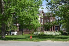 North State Street Historic Districtlisted 1998
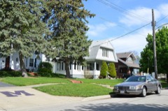 South Charter Street Historic Districtlisted 2002
Population over time
2 figuresMonticello grew from 5,548 to 5,941 between 2010 and 2020. These are the recorded population figures Wikidata holds for this place, reached through the Geographic Names Information System number this page is keyed on rather than by name, so they belong to this place and not to another of the same name. Most are census counts, but not all are: an early figure may be a founding or settlement estimate, and an estimate published within five years of a census is left out. The change column is computed, and is left blank where more than 20 years separate a figure from the one before it, because a gap that long is not a change between two counts.
| Year | People | Change |
|---|---|---|
| 2010 | 5,548 | |
| 2020 | 5,941 | +393 (+7%) |
Topographic sheets covering this place
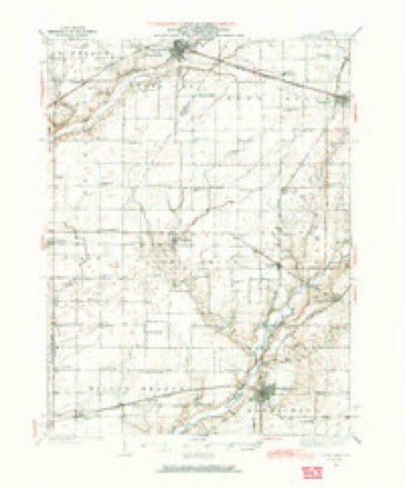
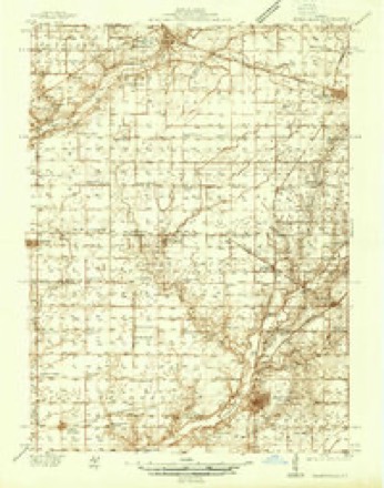
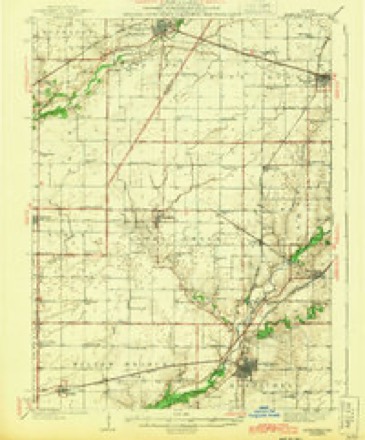
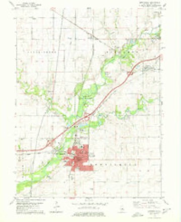
9 surveys from 14 printed sheetsMatched by testing this settlement's coordinate against the published boundary of every sheet in the United States Geological Survey's historical collection. Each opens the scanned sheet at the Survey.
- 1937 USGS Monticello quadrangle1:62500
- 1937 USGS Monticello quadrangle1:48000
- 1943 USGS Monticello quadrangle1:62500, 2 printings
- 1958 USGS Peoria quadrangle1:250000, 4 printings
- 1961 USGS Peoria quadrangle1:250000
- 1963 USGS Peoria quadrangle1:250000
- 1979 USGS Monticello quadrangle1:24000
- 1985 USGS Champaign quadrangle1:100000, 2 printings
- 1990 USGS Peoria quadrangle1:250000




In the county-history sources
4,606 words on this townshipPast and Present of Piatt County, Illinois : Together with Biographical Sketches of Many Prominent and Influential Citizens, published 1903 names this settlement in its chapter on Monticello Township. These are the passages that mention it, exactly as the scans read.
The location of Monticello is almost an ideal place for a town. The country is rolling and affords excellent drainage; it is near the river and is in the center of a very fine farming and stock country. It is the oldest town in the county, having been laid out in
Passage source: Past and Present of Piatt County, Illinois : Together with Biographical Sketches of Many Prominent and Influential Citizens, published 1903.
The original plat of Monticello did not include the Heyworth house, erected on what is now the Lodge place. The first house in the limits of the city was a small store house which stood on the northwest corner of the square, where the First National Bank is now located. It was built in 1837 by Mr. Cass, the first merchant in the town. The first dwelling house was built in 1839 by Mr. Nicholas Devore. The house was several years in building and went by the name of "Old Fort" for a number of years. The second dwelling house in the town was built by John Tenbrooke. It was a log house and served for a hotel. The third house was erected by James Outten just opposite the jail. The fourth house was a little blacksmith shop near the Honselman House, one block south of the square. In 1839 this was the extent of Monticello.
Passage source: Past and Present of Piatt County, Illinois : Together with Biographical Sketches of Many Prominent and Influential Citizens, published 1903.
In 1841 Daniel Stickel opened the first regular store in the town on the south side of the present square. J. C. Johnson opened the first drug store and was the first regular postmaster. The first physician who settled in Monticello was Dr. King. The first preaching in the town was at the home of Mr. Outten, where a circuit rider of the M. E. church stopped once a month. In 1843 and 1844 Rev. Peter Cartwright held meetings in the old court house. He was quite a noted character in his day.
Passage source: Past and Present of Piatt County, Illinois : Together with Biographical Sketches of Many Prominent and Influential Citizens, published 1903.
Machine-read from a century-old scan, so expect the errors a machine makes: misspelled names, dropped words, stray characters.
Read the whole chapter on Monticello Township - it names this place 15 more 15 times.
Mines and quarries near this place
4 within 5 milesRegional context, not property-specific evidence. The federal mineral resources record lists 4 workings within 5 miles of Monticello: 2 producers, 2 past producers. 2 still produce. What was taken out: Sand and Gravel, Construction, Stone, Crushed/Broken. Distance is straight-line from the map coordinates, so a quarry counted here may appear on a neighbouring settlement's page as well.
| Where | Site | Commodity | Status | Recorded |
|---|---|---|---|---|
| Monticello City Pit | Stone, Crushed/Broken | Past Producer | ||
| Monticello Quality Sand Pit | Sand and Gravel, Construction | Producer | ||
| Piatt County Highway Department | Stone, Crushed/Broken | Past Producer | ||
| Shady Rest Pit ??? | Sand and Gravel, Construction | Producer |
Storms near this place
46 since 1993Regional context, not property-specific evidence. The National Weather Service names Monticello in 46 storm reports between 1993 and 2025: 21 thunderstorm wind, 17 hail, 6 tornado, 1 flash flood. The reports record 1 injury. Each account below is quoted exactly as the forecast office filed it, from the NOAA Storm Events Database, and each date opens the federal record of that event.
| When | Event | Place named | Harm | What the report says |
|---|---|---|---|---|
| April 1996 | Tornado (F1) | Monticello | 1 hurt, $1,000,000 | no account filed |
| October 2001 | Tornado (F2) | Monticello | $2,200,000 | An eyewitness reported that the tornado touched down on the southwest side of Monticello and traveled to the north northeast across town. It blew down numerous trees near the golf course then destroyed a storage building. In this area the tornado intensified to F2 Intensity (wind speeds of 120 to 130 mph) taking the roof of a church completely off and blew it into the roof of a nearby 2 story apartment building. The apartment building suffered severe damage and has been deemed uninhabitable. A farm implement building/business, which was close to 200 feet in length, had roughly three quarters of the building destroyed. Damage for this building was estimated at nearly $2 million, as several combines inside were severely damaged or destroyed. Debris from the building was thrown into a nearby power substation, causing a complete power outage to the town of 5,000 residents as well as neighboring communities. The tornado appeared to have lifted off the ground and stayed at tree top level for the remainder of its life through the town producing F0 damage. Numerous trees had the tops broken off and several large trees were uprooted. Once outside of town it did touch down briefly once more, damaging the roof of one home and destroying several outbuildings and a garage of another homestead about a mile north northeast of town. In this location, several 2 inch by 6 inch pieces of lumber from one of the machine sheds had shot through patio doors into the home. No injuries were reported due to the tornado. Damage is estimated around $2.2 million. |
| May 2009 | Hail | Monticello | $255,000 | Large hail damaged siding, gutters, roofs, and windows to numerous homes in the Long Grove subdivision west of Monticello. Hail up to 2.75 inches in diameter was also reported on the east side of Monticello, where several cars were damaged. |
| May 2009 | Lightning | Monticello | $60,000 | Lightning struck a power pole on the east side of Monticello. The lightning strike caused damage to electrical systems and appliances in several homes. There were no injuries. |
| May 2009 | Thunderstorm Wind | Monticello | $35,000 | Several large trees were blown down and roof damage occurred to 3 homes in Monticello. |
| August 2009 | Thunderstorm Wind | Monticello | $25,000 | A large tree was blown onto a home on the east side of Monticello. A nearby barn had its doors ripped off and part of its roof damaged. |
| June 2014 | Thunderstorm Wind | Monticello | $20,000 | Several trees were blown down. |
| May 2018 | Thunderstorm Wind | Monticello | $10,000 | A cinder block pool house was destroyed. |
| August 2009 | Thunderstorm Wind | Monticello | $10,000 | Numerous 3-inch diameter tree limbs were blown down in Monticello. |
| May 2018 | Thunderstorm Wind | Monticello | $5,000 | A machine shed door was blown off, knocking down some small trees nearby. |
| August 2000 | Thunderstorm Wind | Monticello | $5,000 | Numerous trees were blown down, as well as, large areas of corn and soybean crops extending from Monticello south to the county line along US 36. In Bement, a large tree limb fell onto a house breaking a window and tearing down some guttering. Also, some homes suffered siding damage. |
| May 2007 | Thunderstorm Wind | Monticello | $3,000 | Numerous large tree limbs were blown down. One limb tore a porch roof off a house.| |
| May 2013 | Thunderstorm Wind | Monticello | $2,000 | A large tree was blown down in Monticello. |
| May 2013 | Thunderstorm Wind | Monticello | $1,500 | A cable line was blown down in Monticello. |
| August 2025 | Thunderstorm Wind | Monticello | - | Two trees were blown down. |
| June 2023 | Thunderstorm Wind | Monticello | - | Numerous large tree branches were blown down. |
| October 2021 | Thunderstorm Wind | Monticello | - | A tree was blown onto a house. |
| April 2020 | Thunderstorm Wind | Monticello | - | Several trees were blown down. |
| June 2017 | Thunderstorm Wind | Monticello | - | A large tree branch was blown down. |
| February 2008 | Flash Flood | Monticello | - | Allerton Road was impassible near the Sangamon River. |
| July 2006 | Tornado (F0) | Monticello | - | A tornado briefly touched down in a field and caused crop damage. |
| July 2005 | Thunderstorm Wind | Monticello | - | Several trees and large branches blown down. |
| May 2003 | Tornado (F0) | Monticello | - | A tornado briefly touched down in a field. No damage or injuries were reported. |
| May 2003 | Thunderstorm Wind | Monticello | - | Three large trees were blown down. |
| June 1999 | Thunderstorm Wind | Monticello | - | Numerous trees, tree limbs, and power lines were blown down in Monticello and Pierson Station. Some trees fell onto US Route 36 near Pierson Station. |
| April 1997 | Tornado (F0) | Monticello | - | A tornado briefly touched down in an open field, near the intersection of I-72 and Route 10. No damage or injuries were reported. |
| April 1997 | Thunderstorm Wind | Monticello | - | Thunderstorm winds blew off the doors of a shed and a barn 5 miles northwest of Monticello. No injuries were reported and no damage estimate was available. |
| June 1995 | Thunderstorm Wind | Monticello | - | One tree was blown down. |
| August 1993 | Tornado (F0) | Monticello | - | A tornado briefly touched down near old Highway 47, 3 miles west of Monticello. No damage was reported. |
| June 2023 | Hail | Monticello | - | no account filed |
| March 2016 | Hail | Monticello | - | no account filed |
| May 2016 | Hail | Monticello | - | no account filed |
| May 2016 | Hail | Monticello | - | no account filed |
| April 2015 | Hail | Monticello | - | no account filed |
| November 2011 | Hail | Monticello | - | no account filed |
| May 2010 | Hail | Monticello | - | no account filed |
| May 2009 | Hail | Monticello | - | no account filed |
| May 2009 | Hail | Monticello | - | no account filed |
| May 2009 | Hail | Monticello | - | no account filed |
| April 2006 | Hail | Monticello | - | no account filed |
| March 2003 | Hail | Monticello | - | no account filed |
| August 2001 | Hail | Monticello | - | no account filed |
| May 2000 | Hail | Monticello | - | no account filed |
| April 1999 | Hail | Monticello | - | no account filed |
| May 1998 | Hail | Monticello | - | no account filed |
| October 1996 | Thunderstorm Wind | Monticello | - | no account filed |
Nearest settlements
The eight closest, with where each one stands in the county. Distances are straight-line, computed from the Geographic Names Information System coordinates.
| Map | Place | Distance | Sheets |
|---|---|---|---|
| Amenia | 4.9 miles | 14 | |
| White Heath | 5.1 miles | 14 | |
| Lodge | 5.5 miles | 14 | |
| Combs | 6.6 miles | 14 | |
| Piatt | 7.1 miles | 12 | |
| Bement | 7.3 miles | 12 | |
| De Land | 7.6 miles | 14 | |
| Centerville | 7.8 miles | 18 |
Elsewhere
Matched on this settlement's Geographic Names Information System number rather than its name, so it cannot be a different place of the same name in another state.
| Wikipedia article on Monticello | An encyclopaedic summary. Its text is share-alike, so it is linked here rather than copied. |
| Wikidata item Q578373 | The structured record the population and elevation above come from. Public domain (CC0). |
Provenance
This settlement is recorded in the Geographic Names Information System as feature 413750. The sheet list is computed by point-in-boundary test against the United States Geological Survey's historical topographic inventory. Both are works of the United States government and carry no copyright under 17 U.S.C. 105.
Mines and quarries. USGS Mineral Resources Data System (MRDS) https://mrdata.usgs.gov/mrds/ A work of the United States government, no copyright under 17 U.S.C. 105.
Storms. NOAA National Centers for Environmental Information, Storm Events Database https://www.ncei.noaa.gov/stormevents/ A work of the United States government, no copyright under 17 U.S.C. 105. Narratives are quoted verbatim from the National Weather Service report and are not edited or summarised.