 Block
Bement, Illinois
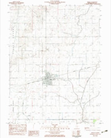
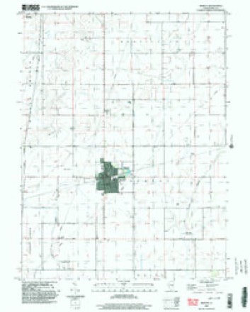
12 topographic sheets cover this place, the earliest surveyed in 1955 and the latest in 1998. It stands in Bement Township. It lies in ZIP code area 61813. The Survey maps it on the Bement quadrangle. 1,484 people lived here at the 2020 count. It stands 686 feet above sea level.
On record in Bement
Buildings and businesses the archive holds for this place. Each opens its own page, with the source record it came from.
On the National Register 2 records
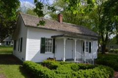 Francis E. Bryant Houselisted 2017
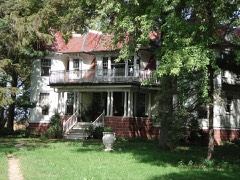 Voorhies Castlelisted 1979
Population over time
2 figuresBement fell from 1,730 to 1,484 between 2010 and 2020. These are the recorded population figures Wikidata holds for this place, reached through the Geographic Names Information System number this page is keyed on rather than by name, so they belong to this place and not to another of the same name. Most are census counts, but not all are: an early figure may be a founding or settlement estimate, and an estimate published within five years of a census is left out. The change column is computed, and is left blank where more than 20 years separate a figure from the one before it, because a gap that long is not a change between two counts.
| Year | People | Change |
|---|---|---|
| 2010 | 1,730 | |
| 2020 | 1,484 | -246 (-14%) |
Topographic sheets covering this place
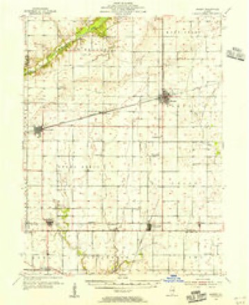
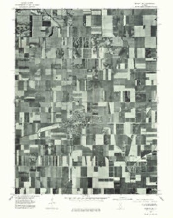
7 surveys from 12 printed sheetsMatched by testing this settlement's coordinate against the published boundary of every sheet in the United States Geological Survey's historical collection. Each opens the scanned sheet at the Survey.
- 1955 USGS Bement quadrangle1:62500, 2 printings
- 1958 USGS Decatur quadrangle1:250000, 3 printings
- 1961 USGS Decatur quadrangle1:250000, 2 printings
- 1975 USGS Bement NE quadrangle1:24000
- 1983 USGS Bement quadrangle1:24000
- 1985 USGS Decatur quadrangle1:100000, 2 printings
- 1998 USGS Bement quadrangle1:24000



In the county-history sources
7,637 words on this townshipHistory of Piatt County; Together with a Brief History of Illinois from the Discovery of the Upper Mississippi to the Present Time, published 1883 names this settlement in its chapter on Bement Township. These are the passages that mention it, exactly as the scans read.
The extreme northwestern portion of the township drains toward the Sangamon, while all the rest of the township is drained by the Lake Fork of the Okaw, which comes into the township in its north- eastern section, runs southwest and then southeast, leaving the township about the middle of its southern boundary line. The fall in the stream is very slight. After the rainy season the banks are soon overrun, and then for days and weeks the stream, through miles of its course, has the appearance of a lake or swamp ; and because of this slowness in discharging its waters, we suppose, the stream has been called Late Fork. The land traversed by the Lake Fork is very rich indeed, and when the channel of the stream is once deepened so that the surplus water can be turned from off the farming land, we anticipate that the finest crops in the country can be raised on what is now untillable land.
Passage source: History of Piatt County; Together with a Brief History of Illinois from the Discovery of the Upper Mississippi to the Present Time, published 1883.
Two railroads pass through this township. The Wabash road strikes the eastern boundary line about one mile from the northern boundary line, runs southwest through the township, crossing the western boundary line about three and one-half miles from the northwestern corner of the township. This road was the first one built in the county, and it has assisted greatly in the growth of the same. A road formerly known as the Chicago & Paducah railroad crosses the township nearly two miles from and runs parallel with the western boundary line of the township. This road now belongs to the great Wabash system. These roads cross at Bement.
Passage source: History of Piatt County; Together with a Brief History of Illinois from the Discovery of the Upper Mississippi to the Present Time, published 1883.
Early settlements. - From all accounts we consider that the first settlement in Bement township was made by "William Bailey, not long previous to 1854, in section 5. Another early settler was John Hughes, who lived near the head of Lake Fork timber. The first election in the township was held in his log house. There were not more than six voters in the entire township, and Jos. Moore was one of the judges. Mr. Smith Quick bought out Jno. Hughes, and Mr. Joseph Moore bought land of Mr. Bailey. Both Mr. Moore and Mr. Quick are yet living in the township.
Passage source: History of Piatt County; Together with a Brief History of Illinois from the Discovery of the Upper Mississippi to the Present Time, published 1883.
Machine-read from a century-old scan, so expect the errors a machine makes: misspelled names, dropped words, stray characters.
Read the whole chapter on Bement Township - it names this place 35 more 35 times.
Fires near this place
2 since 2009Regional context, not property-specific evidence. The federal wildfire occurrence database lists 2 fires within 5 miles of Bement in 2009, burning about 30 acres in total. None started naturally. None was recorded as arson. Distance is straight-line from the map coordinates, so a fire counted here may appear on a neighbouring settlement's page as well.
| Reported cause | Fires |
|---|---|
| Missing data/not specified/undetermined | 2 |
The most recent of them, most recent first, with the day each was reported and the service that recorded it.
| Date | Cause | Size | Reported by | Name on the report |
|---|---|---|---|---|
| 6 February 2009 | Missing data/not specified/undetermined | 30 acres | Illinois Division of Forestry Resources | LOOS |
| 17 January 2009 | Missing data/not specified/undetermined | under an acre | Illinois Division of Forestry Resources | DEMMINK |
Settlements close enough to share some of these fires:
Storms near this place
21 since 1998Regional context, not property-specific evidence. The National Weather Service names Bement in 21 storm reports between 1998 and 2024: 14 thunderstorm wind, 5 hail, 1 tornado, 1 flood. No death or injury is recorded in these reports. Each account below is quoted exactly as the forecast office filed it, from the NOAA Storm Events Database, and each date opens the federal record of that event.
| When | Event | Place named | Harm | What the report says |
|---|---|---|---|---|
| April 2020 | Thunderstorm Wind | Bement | $150,000 | Numerous power poles were blown down along Route 105 between Bement and Monticello. |
| April 2020 | Thunderstorm Wind | Bement | $100,000 | Numerous power lines and trees were blown down. |
| April 2020 | Thunderstorm Wind | Bement | $30,000 | Several trees and power lines were blown down southwest of Bement. |
| May 2017 | Thunderstorm Wind | Bement | $15,000 | Large tree branches were blown down in Bement. |
| May 1998 | Thunderstorm Wind | Bement | $4,000 | As a severe thunderstorm moved southeast across southern Piatt county, it blew down numerous power lines, trees, and tree limbs. Also, the winds damaged several storage sheds and barns. No injuries were reported. |
| May 2013 | Thunderstorm Wind | Bement | $2,000 | A tree was blown down across a road in Bement. |
| May 2024 | Thunderstorm Wind | Bement | - | Medium sized tree branches were blown down. |
| May 2024 | Flood | Bement | - | Farm fields were filled with standing water. |
| July 2024 | Thunderstorm Wind | Bement | - | Several tree limbs were blown down. |
| June 2023 | Thunderstorm Wind | Bement | - | Several large trees and tree limbs were blown down. |
| August 2022 | Thunderstorm Wind | Bement | - | Trees were blown down in Bement. |
| August 2019 | Thunderstorm Wind | Bement | - | A tree was blown onto a power line in Bement. |
| April 2006 | Thunderstorm Wind | Bement | - | Ten power poles and numerous tree limbs blown down. Large outbuilding destroyed three miles west of town. |
| May 2006 | Tornado (F0) | Bement | - | The tornado briefly touched down in a field. No damage or injuries were reported. |
| June 2002 | Thunderstorm Wind | Bement | - | Several trees were blown down north of Bement. |
| August 2001 | Thunderstorm Wind | Bement | - | Power lines and trees were reported down. |
| August 2000 | Hail | Bement | - | A supercell developed over northern Piatt County and moved to the south southeast . In Bement, one inch hail fell. As the storm approached the Milmine area, the hail grew in size. Four inch hail was reported in this area. Several vehicles in this area received hail damage. No injuries were reported. |
| April 2022 | Hail | Bement | - | no account filed |
| May 2014 | Hail | Bement | - | no account filed |
| June 2006 | Hail | Bement | - | no account filed |
| August 2000 | Hail | Bement | - | no account filed |
Nearest settlements
The eight closest, with where each one stands in the county. Distances are straight-line, computed from the Geographic Names Information System coordinates.
| Map | Place | Distance | Sheets |
|---|---|---|---|
| Bodmann | 2.7 miles | 12 | |
| Piatt | 2.8 miles | 12 | |
| Voorhies | 3.8 miles | 12 | |
| Milmine | 4.3 miles | 11 | |
| Monticello | 7.3 miles | 14 | |
| Amenia | 8.5 miles | 14 | |
| Cerro Gordo | 8.6 miles | 11 | |
| Hammond | 8.7 miles | 12 |
Elsewhere
Matched on this settlement's Geographic Names Information System number rather than its name, so it cannot be a different place of the same name in another state.
| Wikipedia article on Bement | An encyclopaedic summary. Its text is share-alike, so it is linked here rather than copied. |
| Wikidata item Q2671736 | The structured record the population and elevation above come from. Public domain (CC0). |
Provenance
This settlement is recorded in the Geographic Names Information System as feature 404159. The sheet list is computed by point-in-boundary test against the United States Geological Survey's historical topographic inventory. Both are works of the United States government and carry no copyright under 17 U.S.C. 105.
Wildfire. Short, Karen C. 2022. Spatial wildfire occurrence data for the United States, 1992-2020 [FPA_FOD_20221014]. 6th Edition. Fort Collins, CO: Forest Service Research Data Archive. https://doi.org/10.2737/RDS-2013-0009.6 Collected with United States Government funding and usable without additional permissions or fees.
Storms. NOAA National Centers for Environmental Information, Storm Events Database https://www.ncei.noaa.gov/stormevents/ A work of the United States government, no copyright under 17 U.S.C. 105. Narratives are quoted verbatim from the National Weather Service report and are not edited or summarised.