 Block
Nekoma, Illinois
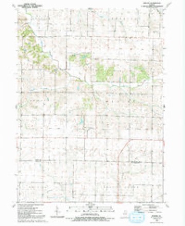
14 topographic sheets cover this place, the earliest surveyed in 1931 and the latest in 1992. It stands in Weller Township. It lies in ZIP code area 61490. The Survey maps it on the Nekoma quadrangle. 23 people lived here at the 2020 count. It stands 810 feet above sea level.
Topographic sheets covering this place
10 surveys from 14 printed sheetsMatched by testing this settlement's coordinate against the published boundary of every sheet in the United States Geological Survey's historical collection. Each opens the scanned sheet at the Survey.
- 1931 USGS Galva quadrangle1:48000
- 1940 USGS Galva quadrangle1:62500, 2 printings
- 1944 USGS Galva quadrangle1:62500, 2 printings
- 1953 USGS Nekoma quadrangle1:24000, 2 printings
- 1958 USGS Davenport quadrangle1:250000, 2 printings
- 1961 USGS Davenport quadrangle1:250000
- 1962 USGS Davenport quadrangle1:250000
- 1984 USGS Aledo quadrangle1:100000
- 1989 USGS Aledo quadrangle1:100000
- 1992 USGS Nekoma quadrangle1:24000





In the county-history sources
11,807 words on this townshipHistory of Henry County, Illinois : It's Taxpayers and Voters; Containing Also, a Biographical Directory, a Condensed History of the State; Map of the County; a Business Directory...etc, published 1877 names this settlement in its chapter on Weller Township. These are the passages that mention it, exactly as the scans read.
BROWN JEREMIAH J. Farmer and Stock Raiser, Sec. 36, P.O. Galva: was born in New Hampshire, in May, 1829, came to this Co. 1858; Ind; L'b; owns 160 acres, valued at sS.ooo; became to this state, Sept. 25, 1845; to this Co. 1858; has held office of School Director, School Trustee, and Supervisor; he married Catharine Protsman in 1852; she was born in Holland; they have nine children; four sons and five daughters : Francis E., Hattie J., Augusta A., Fred B., T. S., Clara E., Jennie A., Edward W., Jos. H. BRYANT O. S. Nekoma; druggist; Rep; Lib; born Long Island, N.Y. BURG A. Sec. 17, P.O. Bishop Hill; farmer; Rep; Luth; born Sweden; 41 acres. BUSHI\TELL LEONARD, Sec. 36, P.O. Galva; farmer; Ind; Lib; born Vt.
Passage source: History of Henry County, Illinois : It's Taxpayers and Voters; Containing Also, a Biographical Directory, a Condensed History of the State; Map of the County; a Business Directory...etc, published 1877.
ERICSON I-iARS, Farmer, Sec. 15; P. O. Bishop Hill; bom in Sweden; February, 1842; Rep; Lib; owns 109 acres, value $4.360; he came to this country with his parents in 1847. and settled at Bishop Hill; he enlisted in the 57th III. Inft. and served four years; married Elizabeth Jones, 1865; she was born in this county; has three children, named John E., Elmer, and Laura A.
Passage source: History of Henry County, Illinois : It's Taxpayers and Voters; Containing Also, a Biographical Directory, a Condensed History of the State; Map of the County; a Business Directory...etc, published 1877.
HURLBUT CHAS. Sec. I; P.O. Galva; Rep; Lib; born in Northampton March :o, 1840; owns 225 acres land, value $12,000; came to Rochester, Peoria county, and removed to Knox county, and lived there about 20 years, and came to Henry county in 1863, and has lived here 13 years. Married Miss Eli/.a A. Lang. Feb, 24, 1864; she was from Knox county, and born April 15. 1845; they have four children; Cora E., born April 4, 1865; Clarence E.t born Nov. 30, 1866; Clarion E., born Nov. 18, 1868; Carrie A., born Aug. 4, 1873; lost a little boy.
Passage source: History of Henry County, Illinois : It's Taxpayers and Voters; Containing Also, a Biographical Directory, a Condensed History of the State; Map of the County; a Business Directory...etc, published 1877.
Machine-read from a century-old scan, so expect the errors a machine makes: misspelled names, dropped words, stray characters.
Read the whole chapter on Weller Township - it names this place 25 more 25 times.
Storms near this place
9 since 2006Regional context, not property-specific evidence. The National Weather Service names Nekoma in 9 storm reports between 2006 and 2025: 7 thunderstorm wind, 1 flash flood, 1 tornado. No death or injury is recorded in these reports. Each account below is quoted exactly as the forecast office filed it, from the NOAA Storm Events Database, and each date opens the federal record of that event.
| When | Event | Place named | Harm | What the report says |
|---|---|---|---|---|
| August 2006 | Thunderstorm Wind | Nekoma | $2,000 | A few shingles were removed from a house with tables overturned and a shed door blown off. |
| July 2006 | Thunderstorm Wind | Nekoma | $1,000 | 4 to 5 inch diameter limbs down. |
| April 2025 | Tornado (EF0) | Nekoma | - | The tornado touched down about 1.5 miles northeast of Altona in Knox County (NWS central Illinois) traveling northward and proceeded north into Henry County where it destroyed two large grain bins and tossed the debris for nearly a mile to the northeast. The tornado snapped a power pole and a large tree along US Highway 34 before dissipating along N 300 Ave where it damaged an outbuilding. |
| March 2024 | Thunderstorm Wind | Nekoma | - | Tree limbs between four to five inches in diameter snapped by thunderstorm winds, with dime sized hail. |
| March 2023 | Thunderstorm Wind | Nekoma | - | The Emergency Manager reported that 4 power poles were broken. The time of the event was estimated using radar. |
| August 2021 | Thunderstorm Wind | Nekoma | - | Estimated wind gust just north of Nakoma. |
| May 2019 | Thunderstorm Wind | Nekoma | - | Numerous large trees topped off about half way up. |
| July 2016 | Thunderstorm Wind | Nekoma | - | A few large trees were reported down. The time was estimated based upon radar. |
| July 2009 | Flash Flood | Nekoma | - | Heavy rains resulted in flash flooding of the intersection of Highway 82 and Highway 17 about 9 miles south of Cambridge, IL during the late evening hours of July 24. The roadways were flooded and ditches were full. |
Nearest settlements
The eight closest, with where each one stands in the county. Distances are straight-line, computed from the Geographic Names Information System coordinates.
| Map | Place | Distance | Sheets |
|---|---|---|---|
| Bishop Hill | 4.2 miles | 14 | |
| Woodhull | 6.8 miles | 11 | |
| Ulah | 7.0 miles | 11 | |
| Galva | 7.8 miles | 14 | |
| Cambridge | 9.0 miles | 11 | |
| Andover | 10.0 miles | 11 | |
| Alpha | 10.2 miles | 11 | |
| German Corner | 11.8 miles | 11 |
Elsewhere
Matched on this settlement's Geographic Names Information System number rather than its name, so it cannot be a different place of the same name in another state.
| Wikipedia article on Nekoma | An encyclopaedic summary. Its text is share-alike, so it is linked here rather than copied. |
| Wikidata item Q14687941 | The structured record the population and elevation above come from. Public domain (CC0). |
Provenance
This settlement is recorded in the Geographic Names Information System as feature 414345. The sheet list is computed by point-in-boundary test against the United States Geological Survey's historical topographic inventory. Both are works of the United States government and carry no copyright under 17 U.S.C. 105.
Storms. NOAA National Centers for Environmental Information, Storm Events Database https://www.ncei.noaa.gov/stormevents/ A work of the United States government, no copyright under 17 U.S.C. 105. Narratives are quoted verbatim from the National Weather Service report and are not edited or summarised.