 Block
Nora, Illinois
14 topographic sheets cover this place, the earliest surveyed in 1937 and the latest in 1981. It stands in Nora Township. It lies in ZIP code area 61059. The Survey maps it on the Warren quadrangle. 107 people lived here at the 2020 count. It stands 1,014 feet above sea level.
Population over time
2 figuresNora fell from 121 to 107 between 2010 and 2020. These are the recorded population figures Wikidata holds for this place, reached through the Geographic Names Information System number this page is keyed on rather than by name, so they belong to this place and not to another of the same name. Most are census counts, but not all are: an early figure may be a founding or settlement estimate, and an estimate published within five years of a census is left out. The change column is computed, and is left blank where more than 20 years separate a figure from the one before it, because a gap that long is not a change between two counts.
| Year | People | Change |
|---|---|---|
| 2010 | 121 | |
| 2020 | 107 | -14 (-12%) |
Topographic sheets covering this place
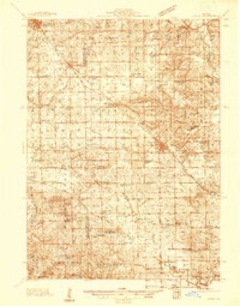
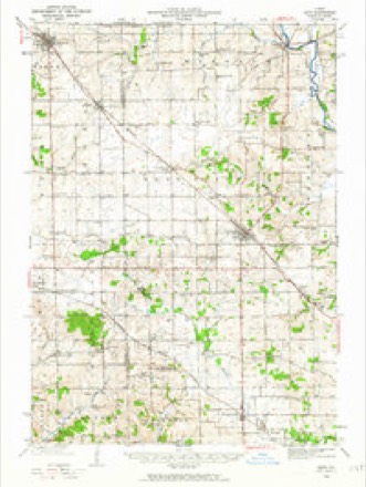
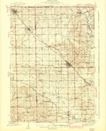
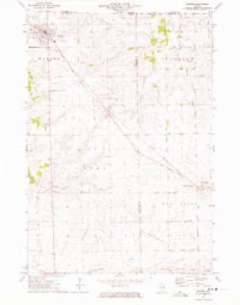
9 surveys from 14 printed sheetsMatched by testing this settlement's coordinate against the published boundary of every sheet in the United States Geological Survey's historical collection. Each opens the scanned sheet at the Survey.
- 1937 USGS Lena quadrangle1:48000
- 1942 USGS Lena quadrangle1:62500
- 1943 USGS Lena quadrangle1:62500, 2 printings
- 1954 USGS Rockford quadrangle1:250000
- 1955 USGS Rockford quadrangle1:250000
- 1958 USGS Rockford quadrangle1:250000, 4 printings
- 1963 USGS Rockford quadrangle1:250000
- 1971 USGS Warren quadrangle1:24000
- 1981 USGS Rockford quadrangle1:100000, 2 printings





In the county-history sources
12,305 words on this townshipThe History of Jo Daviess County, Illinois, Containing a History of the County, Its Cities, Towns, Etc., a Biographical Directory of Its Citizens, War Record of Its Volunteers in the Late Rebellion ... History of the Northwest, History of Illinois ... Constitution of the United States, published 1878 names this settlement in its chapter on Nora Township. These are the passages that mention it, exactly as the scans read.
The first settler was Garrett Garner, who'located a claim on section seven, which is now included in the farms owned by Samuel and Tilman H. Dobler. The following year Garner sold his claim to Asher Miner, and removed to Wisconsin, where he died a few years ago. To Asher Miner, the second permanent settler, belongs a large meed of credit for many of the undertakings of the township and the high character it has always sustained. He was a man of sterling worth, and highly esteemed by his neighbors and acquaintances for his clear sense of honor. In early life he was a resident of Ontario County, New York, but subsequently removed to Alleghany County in that state, and after a few years' residence there, emigrated to Jo Daviess county and settled in this township. He died in the village of Nora, October i), 1867.
Passage source: The History of Jo Daviess County, Illinois, Containing a History of the County, Its Cities, Towns, Etc., a Biographical Directory of Its Citizens, War Record of Its Volunteers in the Late Rebellion ... History of the Northwest, History of Illinois ... Constitution of the United States, published 1878.
From 1845 to 1849, immigration was heavy, and however willingly we would give the names of each successive settler, we find it impossible to do so, hence we mention only a few - not because there are none others equally as worthy of public mention, but because we have not the requisite space. There were Austin Warner, father of George and Goodwin Warner, and Cyrus Puckett, father of most of the Puckett families of the township. Captain George B. Stanchfield, was also among the early settlers, and was the founder of the Village of Nora. Not only has Captain Stanchfield been a warm supporter of the public enterprises of the village, but has always taken an active part in all matters pertaining to the advancement of the township of his home. His, to guide, and other kindred spirits to co-operate, has made Nora one of the best townships in the county. Although Mr. Stanchfield has retired from active participation in public affairs, his many good deeds and valuable services are not forgotten.
Passage source: The History of Jo Daviess County, Illinois, Containing a History of the County, Its Cities, Towns, Etc., a Biographical Directory of Its Citizens, War Record of Its Volunteers in the Late Rebellion ... History of the Northwest, History of Illinois ... Constitution of the United States, published 1878.
Among the active political and educational workers, may be mentioned the names T. Clarkson, Puckett, S. K. Miner, Robert M. Wilson and Alfonso E. Ricker. The acknowledged excellence of the high school and .the public schools in general, and the brilliant success of the Nora Lecture course, is attributed to the energy, intelligence and enterprise of these gentlemen. Mr. Forest Turner, anothef citizen, has also had the honor to represent this people in the lower branch of the State Legislature, having been elected in 1874.
Passage source: The History of Jo Daviess County, Illinois, Containing a History of the County, Its Cities, Towns, Etc., a Biographical Directory of Its Citizens, War Record of Its Volunteers in the Late Rebellion ... History of the Northwest, History of Illinois ... Constitution of the United States, published 1878.
Machine-read from a century-old scan, so expect the errors a machine makes: misspelled names, dropped words, stray characters.
Read the whole chapter on Nora Township - it names this place 66 more 66 times.
Fires near this place
8 since 2004Regional context, not property-specific evidence. The federal wildfire occurrence database lists 8 fires within 5 miles of Nora between 2004 and 2019, burning about 26 acres in total. None started naturally. None was recorded as arson. Distance is straight-line from the map coordinates, so a fire counted here may appear on a neighbouring settlement's page as well.
| Reported cause | Fires |
|---|---|
| Missing data/not specified/undetermined | 6 |
| Recreation and ceremony | 1 |
| Equipment and vehicle use | 1 |
The most recent of them, most recent first, with the day each was reported and the service that recorded it.
| Date | Cause | Size | Reported by | Name on the report |
|---|---|---|---|---|
| 21 June 2019 | Missing data/not specified/undetermined | 1.0 acres | Wisconsin Department of Natural Resources | 2019041 |
| 24 May 2008 | Missing data/not specified/undetermined | 10 acres | Illinois Division of Forestry Resources | WAND |
| 7 April 2009 | Missing data/not specified/undetermined | under an acre | Illinois Division of Forestry Resources | STAGECOACH |
| 30 April 2008 | Missing data/not specified/undetermined | under an acre | Illinois Division of Forestry Resources | 8011 |
| 11 April 2009 | Missing data/not specified/undetermined | 2.0 acres | Illinois Division of Forestry Resources | GERLACH |
| 1 April 2004 | Recreation and ceremony | 10 acres | Illinois State Fire Marshal's Office | not named |
| 22 March 2009 | Missing data/not specified/undetermined | 1.0 acres | Illinois Division of Forestry Resources | NIEMANN |
| 13 November 2009 | Equipment and vehicle use | 1.0 acres | Illinois Division of Forestry Resources | WULFEKUHLE |
Settlements close enough to share some of these fires:
Mines and quarries near this place
5 within 5 milesRegional context, not property-specific evidence. The federal mineral resources record lists 5 workings within 5 miles of Nora: 4 past producers, 1 plant. 1 still produces. What was taken out: Stone, Crushed/Broken. Distance is straight-line from the map coordinates, so a quarry counted here may appear on a neighbouring settlement's page as well.
| Where | Site | Commodity | Status | Recorded |
|---|---|---|---|---|
| Mark Quarry | Stone, Crushed/Broken | Past Producer | ||
| R. Crain Quarry | Stone, Crushed/Broken | Past Producer | ||
| Russell Quarry | Stone, Crushed/Broken | Past Producer | ||
| Unnamed Limestone Quarry | Stone, Crushed/Broken | Past Producer | ||
| Yungbluth Quarry & Mill | Stone, Crushed/Broken | Plant |
Storms near this place
21 since 2006Regional context, not property-specific evidence. The National Weather Service names Nora in 21 storm reports between 2006 and 2026: 12 thunderstorm wind, 8 hail, 1 funnel cloud. No death or injury is recorded in these reports. Each account below is quoted exactly as the forecast office filed it, from the NOAA Storm Events Database, and each date opens the federal record of that event.
| When | Event | Place named | Harm | What the report says |
|---|---|---|---|---|
| April 2026 | Funnel Cloud | Nora | - | A trained spotter reported a funnel cloud. |
| April 2026 | Hail | Nora | - | The time was estimated from radar data. |
| July 2025 | Thunderstorm Wind | Nora | - | A trained spotter reported large trees down. |
| May 2024 | Thunderstorm Wind | Nora | - | Many branches down. Estimated wind gust. |
| May 2024 | Thunderstorm Wind | Nora | - | Many large trees were blown down, or snapped by wind. Damage also to power poles and lines, between Nora and Warren, Illinois.Time estimated from radar data. |
| April 2023 | Hail | Nora | - | A trained spotter reported that hail was covering the deck with the largest stones about 1 inch in diameter. |
| July 2020 | Thunderstorm Wind | Nora | - | Two to three inch diameter branches were blown down. |
| July 2018 | Thunderstorm Wind | Nora | - | A trained spotter reported corn was flattened and a 10 inch diameter tree was split. |
| July 2017 | Thunderstorm Wind | Nora | - | A trained spotter reported a 1 foot in diameter silver maple tree branch was downed by the storm. |
| July 2016 | Thunderstorm Wind | Nora | - | A trained spotter reported a tree branch 4 inches in diameter was down. |
| May 2014 | Hail | Nora | - | The hail lasted for 10 minutes. |
| July 2011 | Thunderstorm Wind | Nora | - | Wind gusts estimated to be 70 mph blew down a large tree 1 miles east southeast of Nora, IL at 635 am CDT July 11. |
| July 2011 | Thunderstorm Wind | Nora | - | Wind gusts estimated to be 70 mph were observed 1 mile east southeast of Nora, IL at 635 am CDT July 11. Electric poles reported knocked over along the Stagecoach Trail east and southeast of Nora. |
| September 2010 | Thunderstorm Wind | Nora | - | Wind gusts estimated to be 50 to 60 mph were observed about 1 mile east southeast of Nora, IL around 330 pm CDT September 21. |
| June 2008 | Thunderstorm Wind | Nora | - | Winds estimated to be 65 mph blew a two and a half foot diameter tree down in Nora, IL at 8:06 pm June 8. A heavy wooden table was also blown over. |
| April 2008 | Hail | Nora | - | A trained spotter measured dime to penny size hail near Nora. |
| June 2008 | Thunderstorm Wind | Nora | - | Wind gusts estimated to be 65 mph blew down a tree over a road about 3 miles southwest of Nora, Illinois around 4:35 am June 6. Time and location estimated. |
| August 2006 | Hail | Nora | - | Penny size hail was reported on the Jo Daviess/Stephenson line. |
| April 2026 | Hail | Nora | - | no account filed |
| April 2023 | Hail | Nora | - | no account filed |
| July 2013 | Hail | Nora | - | no account filed |
Nearest settlements
The eight closest, with where each one stands in the county. Distances are straight-line, computed from the Geographic Names Information System coordinates.
| Map | Place | Distance | Sheets |
|---|---|---|---|
| Warren | 3.6 miles | 14 | |
| Sweet Home (historical) | 5.4 miles | 14 | |
| Millville | 5.6 miles | 14 | |
| Pitcherville (historical) | 7.0 miles | 14 | |
| Stockton | 8.0 miles | 14 | |
| East Stockton (historical) | 8.1 miles | 14 | |
| Apple River | 8.8 miles | 12 | |
| Morseville | 10.5 miles | 14 |
Elsewhere
Matched on this settlement's Geographic Names Information System number rather than its name, so it cannot be a different place of the same name in another state.
| Wikipedia article on Nora | An encyclopaedic summary. Its text is share-alike, so it is linked here rather than copied. |
| Wikidata item Q2026250 | The structured record the population and elevation above come from. Public domain (CC0). |
Provenance
This settlement is recorded in the Geographic Names Information System as feature 414546. The sheet list is computed by point-in-boundary test against the United States Geological Survey's historical topographic inventory. Both are works of the United States government and carry no copyright under 17 U.S.C. 105.
Wildfire. Short, Karen C. 2022. Spatial wildfire occurrence data for the United States, 1992-2020 [FPA_FOD_20221014]. 6th Edition. Fort Collins, CO: Forest Service Research Data Archive. https://doi.org/10.2737/RDS-2013-0009.6 Collected with United States Government funding and usable without additional permissions or fees.
Mines and quarries. USGS Mineral Resources Data System (MRDS) https://mrdata.usgs.gov/mrds/ A work of the United States government, no copyright under 17 U.S.C. 105.
Storms. NOAA National Centers for Environmental Information, Storm Events Database https://www.ncei.noaa.gov/stormevents/ A work of the United States government, no copyright under 17 U.S.C. 105. Narratives are quoted verbatim from the National Weather Service report and are not edited or summarised.