 Block
Warren, Illinois
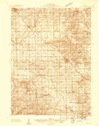
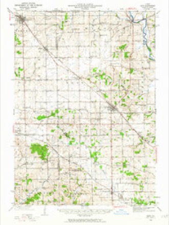
14 topographic sheets cover this place, the earliest surveyed in 1937 and the latest in 1981. It stands in Warren Township. It lies in ZIP code area 61087. The Survey maps it on the Warren quadrangle.
On record in Warren
Buildings and businesses the archive holds for this place. Each opens its own page, with the source record it came from.
On the National Register 2 records
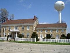 Old Stone Hotellisted 1975
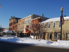 Warren Commercial Historic Districtlisted 1995
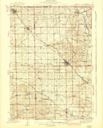
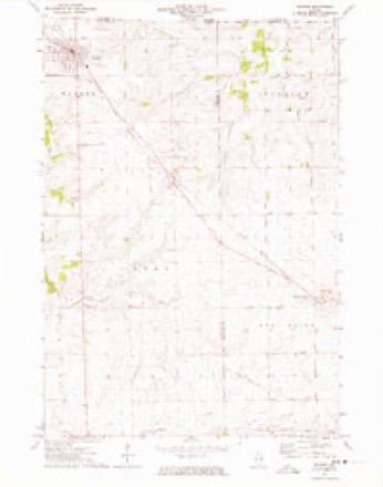
Topographic sheets covering this place
9 surveys from 14 printed sheetsMatched by testing this settlement's coordinate against the published boundary of every sheet in the United States Geological Survey's historical collection. Each opens the scanned sheet at the Survey.
- 1937 USGS Lena quadrangle1:48000
- 1942 USGS Lena quadrangle1:62500
- 1943 USGS Lena quadrangle1:62500, 2 printings
- 1954 USGS Rockford quadrangle1:250000
- 1955 USGS Rockford quadrangle1:250000
- 1958 USGS Rockford quadrangle1:250000, 4 printings
- 1963 USGS Rockford quadrangle1:250000
- 1971 USGS Warren quadrangle1:24000
- 1981 USGS Rockford quadrangle1:100000, 2 printings





In the county-history sources
69,799 words on this townshipThe History of Jo Daviess County, Illinois, Containing a History of the County, Its Cities, Towns, Etc., a Biographical Directory of Its Citizens, War Record of Its Volunteers in the Late Rebellion ... History of the Northwest, History of Illinois ... Constitution of the United States, published 1878 names this settlement in its chapter on Warren Township. These are the passages that mention it, exactly as the scans read.
Although Black Hawk's movement across the Mississippi, on the 6th of April, was at once construed into a hostile demonstration, and Davenport skillfully cultivated the idea, he was accompanied by his old men, women and children. !N"o Indian warriors ever went on the war path encumbered in that way. More than this, it does not appear, from the sixth <lay of April until Stillman's drunken soldiers fired on his flag of truce, on the 12th of May, that a single settler was murdered, or sufiered any material injury at the hands of Black Hawk or his band. In truth, Hon. H. S. Townsend, of Warren, states that in one instance, at least, where they took corn from a settler, they paid him for it. Capt. W. B. Green writes: " 1 never heard of Black Hawk's band, while passing up Rock River, committing any depredation whatever, not even petty theft." Frederick Stahl, Esq., of Galena, states that he was informed by the veteran John Dixon, that " when Black Hawk's band passed his post, before the arrival of the troops, they were at his house. Ne-o-Pope had the young braves well in hand, and informed him that they intended to commit no depredations, and should not fight unless they were attacked."
Passage source: The History of Jo Daviess County, Illinois, Containing a History of the County, Its Cities, Towns, Etc., a Biographical Directory of Its Citizens, War Record of Its Volunteers in the Late Rebellion ... History of the Northwest, History of Illinois ... Constitution of the United States, published 1878.
John S. Miller's house* was known as " Miller's tavern," and was situated on or near the corner of what is Branch and Dodge Streets, in that part of the city called " Old Town." On the same day the above order was entered, the following named citizens and voters were selected to serve as petit jurors : James Craig, John Chandler, Thomas Gray, Francis Kirkpatrick, John Barrel], James Smith, Thomas Drum, Joseph Hardy, John Kay, William Henry, James Langworthy, Samuel Whitesides, Martin Warren, Moses Eastman, James Cherry, James Kindall, Adam Hymer, Thomas Hymer, Peter Carr, George Ferguson, William H. Smith, James Brady, Enoch Wethers and William Brazier.
Passage source: The History of Jo Daviess County, Illinois, Containing a History of the County, Its Cities, Towns, Etc., a Biographical Directory of Its Citizens, War Record of Its Volunteers in the Late Rebellion ... History of the Northwest, History of Illinois ... Constitution of the United States, published 1878.
The first indictment returned was on the second day of the term against Michael Dee, for assault and battery, with intent to murder. Dee was arrested at once, brought into court, arraigned, and pleaded not guilty. A jury, consisting of William Tate, Alexis Phelps, William Erasure, John Barrel, Peter Carr, James Langworthy, James Smith, Dawson Parish, H. H. Gear, James Kindall, John Ray and William Henry, were " elected, tried and sworn." The defendant, by his attorney, " moved to exclude the testimony of Daniel Harrison and Warren Spears, and that they be sworn to answer whether they believed in a future state of rewards and punishments. The witnesses said they knew nothing about it, and they would not swear to any thing which they did not know." This answer was evidently satisfactory to the court, as the witnesses were sworn. The case was tried, and the jury brought in a verdict of " guilty."
Passage source: The History of Jo Daviess County, Illinois, Containing a History of the County, Its Cities, Towns, Etc., a Biographical Directory of Its Citizens, War Record of Its Volunteers in the Late Rebellion ... History of the Northwest, History of Illinois ... Constitution of the United States, published 1878.
Machine-read from a century-old scan, so expect the errors a machine makes: misspelled names, dropped words, stray characters.
Read the whole chapter on Warren Township - it names this place 35 more 35 times.
Fires near this place
10 since 2004Regional context, not property-specific evidence. The federal wildfire occurrence database lists 10 fires within 5 miles of Warren between 2004 and 2019, burning about 27 acres in total. None started naturally. None was recorded as arson. Distance is straight-line from the map coordinates, so a fire counted here may appear on a neighbouring settlement's page as well.
| Reported cause | Fires |
|---|---|
| Missing data/not specified/undetermined | 7 |
| Recreation and ceremony | 1 |
| Equipment and vehicle use | 1 |
| Debris and open burning | 1 |
The most recent of them, most recent first, with the day each was reported and the service that recorded it.
| Date | Cause | Size | Reported by | Name on the report |
|---|---|---|---|---|
| 21 June 2019 | Missing data/not specified/undetermined | 1.0 acres | Wisconsin Department of Natural Resources | 2019041 |
| 24 May 2008 | Missing data/not specified/undetermined | 10 acres | Illinois Division of Forestry Resources | WAND |
| 7 April 2009 | Missing data/not specified/undetermined | 1.0 acres | Illinois Division of Forestry Resources | CNR |
| 7 April 2009 | Missing data/not specified/undetermined | under an acre | Illinois Division of Forestry Resources | STAGECOACH |
| 30 April 2008 | Missing data/not specified/undetermined | under an acre | Illinois Division of Forestry Resources | 8011 |
| 24 April 2019 | Debris and open burning | under an acre | Wisconsin Department of Natural Resources | 2019010 |
| 11 April 2009 | Missing data/not specified/undetermined | 2.0 acres | Illinois Division of Forestry Resources | GERLACH |
| 1 April 2004 | Recreation and ceremony | 10 acres | Illinois State Fire Marshal's Office | not named |
Settlements close enough to share some of these fires:
Mines and quarries near this place
4 within 5 milesRegional context, not property-specific evidence. The federal mineral resources record lists 4 workings within 5 miles of Warren: 3 past producers, 1 producer. 1 still produces. What was taken out: Stone, Crushed/Broken. Distance is straight-line from the map coordinates, so a quarry counted here may appear on a neighbouring settlement's page as well.
| Where | Site | Commodity | Status | Recorded |
|---|---|---|---|---|
| Oppie Quarry | Stone, Crushed/Broken | Past Producer | ||
| R. Crain Quarry | Stone, Crushed/Broken | Past Producer | ||
| Russell Quarry | Stone, Crushed/Broken | Past Producer | ||
| Sweet Home Quarry | Stone, Crushed/Broken | Producer |
Storms near this place
30 since 2000Regional context, not property-specific evidence. The National Weather Service names Warren in 30 storm reports between 2000 and 2026: 17 thunderstorm wind, 9 hail, 1 heavy rain, 1 flash flood. The reports record 1 injury. Each account below is quoted exactly as the forecast office filed it, from the NOAA Storm Events Database, and each date opens the federal record of that event.
| When | Event | Place named | Harm | What the report says |
|---|---|---|---|---|
| July 2007 | Thunderstorm Wind | Warren | 1 hurt, $25,000 | Winds estimated to be 70 mph blew down trees and power lines. Several trees fell onto some houses. One person was transported to a hospital with a minor injury and later released. Power and phone service was knocked out to about half of the town. |
| August 2005 | Thunderstorm Wind | Warren | $7,000 | Several large oak trees were downed in the town of Warren with one tree down on a house. |
| June 2005 | Thunderstorm Wind | Warren | $5,000 | Large trees down; 1 on a house and another on railroad tracks |
| June 2006 | Thunderstorm Wind | Warren | $2,000 | trees and power lines down |
| May 2000 | Thunderstorm Wind | Warren | $1,000 | no account filed |
| March 2026 | Hail | Warren | - | A trained spotter reported lots of nickel size hail. |
| April 2026 | Thunderstorm Wind | Warren | - | Winds were out of the west. |
| May 2024 | Thunderstorm Wind | Warren | - | Numerous large trees down. |
| July 2024 | Thunderstorm Wind | Warren | - | A public report of a tree uprooted by thunderstorm winds. |
| July 2022 | Funnel Cloud | Warren | - | A law enforcement officer reported a brief funnel cloud. |
| June 2022 | Thunderstorm Wind | Warren | - | A large tree branch was blown down. |
| May 2020 | Tornado (EFU) | Warren | - | A trained spotter observed a brief tornado in an open field near Warren. The tornado is designated as an EF-U (unknown), as no damage was observed to assign an EF-scale rating. |
| June 2020 | Thunderstorm Wind | Warren | - | Trained spotter reported that a large, partially rotted tree was down. They estimated the wind speeds of 55 to 60 MPH. |
| September 2019 | Thunderstorm Wind | Warren | - | A trained spotter reported small tree branches down. |
| February 2017 | Hail | Warren | - | A spotter reported quarter size hail. |
| May 2017 | Thunderstorm Wind | Warren | - | A trained spotter estimated wind gusts of 50 to 60 mph. |
| June 2017 | Thunderstorm Wind | Warren | - | A large tree limb was blown down. |
| November 2015 | Thunderstorm Wind | Warren | - | Local law enforcement reports of lots of trees and power lines down in the Warren area. |
| April 2014 | Hail | Warren | - | A trained spotter reported hail that was the size of a nickel or slight larger and covering the ground. The hail lasted about 2 minutes. |
| May 2014 | Hail | Warren | - | Dime to quarter sized hail fell in Warren, IL at 528 pm CDT May 20. |
| September 2013 | Thunderstorm Wind | Warren | - | The Fire Department reported that trees and power lines were down throughout the town. |
| July 2012 | Thunderstorm Wind | Warren | - | A trained spotter reported several 12 inch tree limbs down along with power poles down near Warren. |
| June 2008 | Thunderstorm Wind | Warren | - | Wind gusts estimated to be 65 mph blew down some trees across Stagecoach Road between Warren, IL and Apple River, IL at 3:54 pm June 7. |
| July 2007 | Flash Flood | Warren | - | Flood waters covered Winslow Rd just southeast of Warren, IL. |
| June 2004 | Heavy Rain | Warren | - | Water 5 inches deep on Highway 78; U.S. 20 east of Stockton 1-2 inches of water on it. |
| October 2001 | Hail | Warren | - | 1.75 inch hail reported by law enforcement. |
| February 2024 | Hail | Warren | - | no account filed |
| May 2014 | Hail | Warren | - | no account filed |
| May 2004 | Hail | Warren | - | no account filed |
| May 2000 | Hail | Warren | - | no account filed |
Nearest settlements
The eight closest, with where each one stands in the county. Distances are straight-line, computed from the Geographic Names Information System coordinates.
| Map | Place | Distance | Sheets |
|---|---|---|---|
| Sweet Home (historical) | 3.6 miles | 14 | |
| Nora | 3.6 miles | 14 | |
| Millville | 4.6 miles | 14 | |
| Apple River | 5.8 miles | 12 | |
| Pitcherville (historical) | 9.1 miles | 14 | |
| Stockton | 10.2 miles | 14 | |
| Apple Canyon Lake | 10.3 miles | 15 | |
| East Stockton (historical) | 10.6 miles | 14 |
Provenance
This settlement is recorded in the Geographic Names Information System as feature 420531. The sheet list is computed by point-in-boundary test against the United States Geological Survey's historical topographic inventory. Both are works of the United States government and carry no copyright under 17 U.S.C. 105.
Wildfire. Short, Karen C. 2022. Spatial wildfire occurrence data for the United States, 1992-2020 [FPA_FOD_20221014]. 6th Edition. Fort Collins, CO: Forest Service Research Data Archive. https://doi.org/10.2737/RDS-2013-0009.6 Collected with United States Government funding and usable without additional permissions or fees.
Mines and quarries. USGS Mineral Resources Data System (MRDS) https://mrdata.usgs.gov/mrds/ A work of the United States government, no copyright under 17 U.S.C. 105.
Storms. NOAA National Centers for Environmental Information, Storm Events Database https://www.ncei.noaa.gov/stormevents/ A work of the United States government, no copyright under 17 U.S.C. 105. Narratives are quoted verbatim from the National Weather Service report and are not edited or summarised.