 Block
Seneca, Illinois
16 topographic sheets cover this place, the earliest surveyed in 1892 and the latest in 1991. It stands in Manlius Township. It lies in ZIP code area 61360. It stands on Crotty Creek. The Survey maps it on the Seneca quadrangle. 2,353 people lived here at the 2020 count. It stands 503 feet above sea level.
On record in Seneca
Buildings and businesses the archive holds for this place. Each opens its own page, with the source record it came from.
On the National Register 1 record
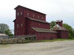 Armour's Warehouselisted 1997
Population over time
2 figuresSeneca fell from 2,371 to 2,353 between 2010 and 2020. These are the recorded population figures Wikidata holds for this place, reached through the Geographic Names Information System number this page is keyed on rather than by name, so they belong to this place and not to another of the same name. Most are census counts, but not all are: an early figure may be a founding or settlement estimate, and an estimate published within five years of a census is left out. The change column is computed, and is left blank where more than 20 years separate a figure from the one before it, because a gap that long is not a change between two counts.
| Year | People | Change |
|---|---|---|
| 2010 | 2,371 | |
| 2020 | 2,353 | -18 (-1%) |
Topographic sheets covering this place
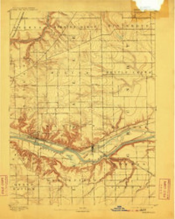
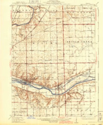
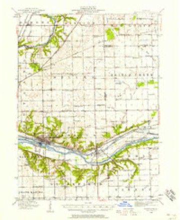
8 surveys from 16 printed sheetsMatched by testing this settlement's coordinate against the published boundary of every sheet in the United States Geological Survey's historical collection. Each opens the scanned sheet at the Survey.
- 1892 USGS Marseilles quadrangle1:62500, 3 printings
- 1916 USGS Marseilles quadrangle1:62500, 4 printings
- 1940 USGS Marseilles quadrangle1:62500
- 1958 USGS Aurora quadrangle1:250000, 3 printings
- 1961 USGS Aurora quadrangle1:250000
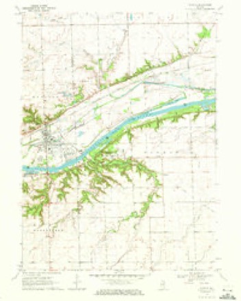
- 1970 USGS Seneca quadrangle1:24000, 2 printings
- 1985 USGS Ottawa quadrangle1:100000
- 1991 USGS Ottawa quadrangle1:100000


In the county-history sources
2,539 words on this townshipHistory of LaSalle County, Illinois : Its Topography, Geology, Botany, Natural History, History of the Mound Builders, Indian Tribes, French Explorations, and a Sketch of the Pioneer Settlers of Each Town to 1840, with an Appendix, Giving the Present Status of the County, Its Population, Resources, Manufactures and Institutions, published 1877 names this settlement in its chapter on Manlius Township. These are the passages that mention it, exactly as the scans read.
Wm. Richey was born in Pennsylvania, emigrated to Huron County, Ohio, where he heard the cannonading at the time of Perry's victory on Lake Erie. Lest his first wife and marricd Dolly Wilson, a Kentucky woman, near Indianapolis, in 1828, Moved to Wisconsin, and engaged in lead mining. Tn October, 1829, came to La Salle County, and made 'a claim on 8. 17, T. 33, R. 4, where William Moore now lives. He was accompanied by his son William W., the only child of his first wife that came West. 'The son stayed on the claim while the father went to the Blne Mounds for the family. They came by the way of Dixon, in a 'prairie schooner,"' with @ span of horses, and an ox and cow yoked together; arrived on the claim in January, 1830, The Only neighbor was James Galloway. In February, 1820, Mrs. Galloway died. Mr. Richey and son cut down a black walnut tree the Indians had girdled, and split ont some puncheon boards and made a coffin, in which Mrs. Galloway was buried. In the 'spring of 1830 Mr. Richey sold his claim to Abraham Trumbo. They then made a claim near Galloway's, but sold to Galloway soon after and made a claim on the S. E.3S. 18, I. 33, R. 6, and in the winter of 1831 built a cabin in the ravine near the Dr. Ward place, the first cabin built in Marseilles, and where James Richey was born, the first birth in what is now Marseilles, William W. sowed a email patch of wheat where the sod had been killed by Indian cultivation ; he got some what, but, what was more valuable, unwittingly got # pre-emption, and as he and his father were on the same quarter section, they were each entitled to a float on eighty acreselsewhere. They sold their floats to John Green, for which he entered their quarter section; they thus secured their quarter section without money and without price. After the massacre at Indian Creek, in 1832, William W. went to Seneca to notify Abel Sprague, who had a claim there, and then moved the family to Ottawa, The father was a teamster for the army, and the son enlisted as a soldier, They were discharged on the banks of the Wisconsin river. In the fall they helped Ephraim Sprague, Charles Brown, and Richard Hogaboom build a dam and dig a race fora eaw-mill at Marseilles. William Richey died about 1842; his wife died in 1839. William W narried Widow Green, and lives in the town of Brookfield.
Abdolonymus Stebbins, brother of Abner, and wile, Julia Webber, came from New York in 183, and settled on 8. 8, T. 33, R. 5. Had ten children. Bromback says he was not 20 good a worker but a better talker than Abner; that he was a staunch Whig, in favor of internal improvements, of developing manufactures, arts and sciences, and delighted in talking on these subjects by the hour; that there have been bigger fools in the United States Senate than Abdolonymus; that the good seed sown by him is still bearing frait; but that his Democratic held himand his political heresies in utter contempt, His children were; Henry, married Mary Ann Pope, his second wife was Miss Bignal, is now in Iowa; Lonana, married Jacob Reser, of Pontise ; Lorinda, married Volney Wood, both are deceased; Mary, died single; Louisa, married Gale Waterman, of Seneca; Emery, married Laura Lammy, of Iowa; Edgar, is in Missouri; Austin, mar. tied Miss Wiley, now in Florida. There are two
Abel Sprague made a claim near where Seneca now is, on the Crotty place, sold the claim to two young men by the name of Stocking, and they sold to one Carter, who afterwards abandoned it. In 1841, when work was resumed on the canal, Jeremiah Crotty occupied it.
Machine-read from a century-old scan, so expect the errors a machine makes: misspelled names, dropped words, stray characters.
Fires near this place
18 since 2018Regional context, not property-specific evidence. The federal wildfire occurrence database lists 18 fires within 5 miles of Seneca between 2018 and 2020, burning about 30 acres in total. None started naturally. None was recorded as arson. Distance is straight-line from the map coordinates, so a fire counted here may appear on a neighbouring settlement's page as well.
| Reported cause | Fires |
|---|---|
| Debris and open burning | 12 |
| Missing data/not specified/undetermined | 3 |
| Smoking | 2 |
| Fireworks | 1 |
The most recent of them, most recent first, with the day each was reported and the service that recorded it.
| Date | Cause | Size | Reported by | Name on the report |
|---|---|---|---|---|
| 26 July 2018 | Debris and open burning | under an acre | Illinois Division of Forestry Resources | 18-000370 |
| 25 July 2019 | Fireworks | 1.0 acres | Illinois Division of Forestry Resources | 19-000322 |
| 4 May 2020 | Missing data/not specified/undetermined | 2.0 acres | Illinois Division of Forestry Resources | 20-000143 |
| 27 May 2020 | Missing data/not specified/undetermined | 4.0 acres | Illinois Division of Forestry Resources | 20-166 |
| 2 May 2018 | Debris and open burning | 2.5 acres | Illinois Division of Forestry Resources | 18-000227 |
| 7 April 2018 | Debris and open burning | under an acre | Illinois Division of Forestry Resources | 18-000177 |
| 30 April 2018 | Debris and open burning | 3.0 acres | Illinois Division of Forestry Resources | 18-000219 |
| 23 April 2019 | Debris and open burning | 2.0 acres | Illinois Division of Forestry Resources | 19-165 |
Settlements close enough to share some of these fires:
Mines and quarries near this place
7 within 5 milesRegional context, not property-specific evidence. The federal mineral resources record lists 7 workings within 5 miles of Seneca: 5 past producers, 2 producers. 2 still produce. What was taken out: Sand and Gravel, Construction, Stone, Crushed/Broken. Distance is straight-line from the map coordinates, so a quarry counted here may appear on a neighbouring settlement's page as well.
| Where | Site | Commodity | Status | Recorded |
|---|---|---|---|---|
| Thompson Pit | Stone, Crushed/Broken | Past Producer | ||
| Holderman Pit | Sand and Gravel, Construction | Past Producer | ||
| Lucy Pit & Mill / Portable #1 | Sand and Gravel, Construction | Producer | ||
| Lucy Pit 1-A | Sand and Gravel, Construction | Past Producer | ||
| M. H. Spicer Pit | Sand and Gravel, Construction | Producer | ||
| Penoyer Pit | Sand and Gravel, Construction | Past Producer | ||
| Spicer Pit | Sand and Gravel, Construction | Past Producer |
Storms near this place
12 since 1999Regional context, not property-specific evidence. The National Weather Service names Seneca in 12 storm reports between 1999 and 2022: 5 thunderstorm wind, 4 flood, 2 flash flood, 1 hail. No death or injury is recorded in these reports. Each account below is quoted exactly as the forecast office filed it, from the NOAA Storm Events Database, and each date opens the federal record of that event.
| When | Event | Place named | Harm | What the report says |
|---|---|---|---|---|
| September 2008 | Flood | Seneca | $5,000,000 | The Illinois River reached a record crest of 33.79 feet at LaSalle on the 16th. Major flooding occurred along the river in LaSalle County. In Marseilles, flood waters inundated Illini State Park and nearby areas. Flood waters inundated the Peru power plant. Brunner and Water Streets were closed due to flooding. Navigation on the river was halted as most lock facilities were submerged. The Interstate 39 bridge was the only one open as State Highways 251, 351, and 178 were closed. Homes and businesses in Utica were flooded. In Ottawa, 89 residents of a nursing home were evacuated. Dee Bennett Road between Ottawa and Utica was closed. Central Elementary School in Ottawa was surrounded by water and the auditorium was flooded with 8 inches of water. |
| July 2021 | Flash Flood | Seneca | $1,200,000 | A slow moving thunderstorm produced torrential rain and flash flooding across portions of eastern La Salle County including in Seneca. Vegetation was flattened near many creeks and channels due to the fast moving flood waters. Along Hog Run, vegetation was flattened near North 21st Road with debris near the road. Along North 2350th Road near Armstrong Run, flood waters flowed over the roadway with debris in the channel. North La Salle Road was flooded, just south of Dupont Road with debris piled on the side of the road along with erosion in the channel. There was substantial deposition of sediment from a nearby sand and gravel facility across Dupont Road near Deadly Run. A substantial stretch of Dupont Road was flooded with extensive mud marking on pavement, east of Route 170 near a marina. Just west of Route 170, the east abutment to the River Road bridge over a small creek was washed out. A local highway department staff member was driving over this area when the washout occurred. His truck became stuck on remaining pavement on either side of the washout. The driver needed to be rescued and refused medical treatment. Scouring occurred on both sides of the creek with vegetation collapsed or partially collapsed. Homes on Timmons Lane were flooded with one home suffering a basement wall collapse. Further west near River Road and Lake Street, flooding of several houses occurred as Spring Brook Creek overflowed with water flowing over fields and into the houses. Significant damage occurred to vegetation where Spring Brook Creek crossed River Road. Rainfall of 4.24 inches was reported during a 3 hour period, one mile east of Seneca. The damage amount was estimated in consultation with local emergency management officials. |
| August 2022 | Thunderstorm Wind | Seneca | - | Tree limbs were blown down which damaged a fence. |
| July 2021 | Flood | Seneca | - | Flooding continued across portions of eastern LaSalle County during the morning of July 13th after flash flooding during the evening of July 12th. |
| May 2020 | Flood | Seneca | - | Major flooding occurred along portions of the Illinois River. The river crested at 33.14 feet near La Salle on May 18th, which is the third highest crest on record near La Salle. Flood stage near La Salle is 20 feet and major stage is 31 feet. The river crested at 472.64 feet at Ottawa on May 18th, which is the second highest crest on record at Ottawa. Flood stage at Ottawa is 463 feet and major stage is 471 feet. |
| September 2019 | Flash Flood | Seneca | - | Video showed swiftly moving water with debris near Route 6 and Main Street in Seneca. |
| February 2018 | Flood | Seneca | - | Major flooding occurred along the Illinois River. The river crested at 471.49 feet at Ottawa on February 22nd, which was the 3rd highest stage recorded. Flood stage at Ottawa is 463 feet and major stage is 469 feet. Moderate flooding occurred on the Illinois River near La Salle with a crest of 30.61 feet on February 23rd. Flood stage is 20 feet and major stage is 31 feet. The city of Marseilles issued a mandatory evacuation for residents south of the Illinois and Michigan Canal and east of Main Street. A nursing home near the Illinois River evacuated its 47 residents. |
| March 2005 | Hail | Seneca | - | Nickel sized hail was reported covering the ground. |
| June 1999 | Thunderstorm Wind | Seneca | - | Tree limbs were blown down. |
| August 2003 | Thunderstorm Wind | Seneca | - | no account filed |
| May 2000 | Thunderstorm Wind | Seneca | - | no account filed |
| September 2000 | Thunderstorm Wind | Seneca | - | no account filed |
Nearest settlements
The eight closest, with where each one stands in the county. Distances are straight-line, computed from the Geographic Names Information System coordinates.
| Map | Place | Distance | Sheets |
|---|---|---|---|
| Marseilles | 5.4 miles | 18 | |
| Stavanger | 6.0 miles | 15 | |
| Danway | 9.4 miles | 16 | |
| Ransom | 10.9 miles | 8 | |
| Dayton | 11.0 miles | 26 | |
| Norway | 11.0 miles | 16 | |
| Sulphur Springs | 11.5 miles | 26 | |
| Woodland Addition | 11.9 miles | 27 |
Elsewhere
Matched on this settlement's Geographic Names Information System number rather than its name, so it cannot be a different place of the same name in another state.
| Wikipedia article on Seneca | An encyclopaedic summary. Its text is share-alike, so it is linked here rather than copied. |
| Wikidata item Q2669015 | The structured record the population and elevation above come from. Public domain (CC0). |
Provenance
This settlement is recorded in the Geographic Names Information System as feature 418209. The sheet list is computed by point-in-boundary test against the United States Geological Survey's historical topographic inventory. Both are works of the United States government and carry no copyright under 17 U.S.C. 105.
Wildfire. Short, Karen C. 2022. Spatial wildfire occurrence data for the United States, 1992-2020 [FPA_FOD_20221014]. 6th Edition. Fort Collins, CO: Forest Service Research Data Archive. https://doi.org/10.2737/RDS-2013-0009.6 Collected with United States Government funding and usable without additional permissions or fees.
Mines and quarries. USGS Mineral Resources Data System (MRDS) https://mrdata.usgs.gov/mrds/ A work of the United States government, no copyright under 17 U.S.C. 105.
Storms. NOAA National Centers for Environmental Information, Storm Events Database https://www.ncei.noaa.gov/stormevents/ A work of the United States government, no copyright under 17 U.S.C. 105. Narratives are quoted verbatim from the National Weather Service report and are not edited or summarised.