 Block
Thebes, Illinois
22 topographic sheets cover this place, the earliest surveyed in 1934 and the latest in 1996. It stands in Thebes precinct. It lies in ZIP code area 62990. It stands on Sammons Creek. The Survey maps it on the Thebes quadrangle. 208 people lived here at the 2020 count. It stands 341 feet above sea level.
Research this city
On record in Thebes
Buildings and businesses the archive holds for this place. Each opens its own page, with the source record it came from.
On the National Register 1 record
- Thebes Courthouselisted 1972
Population over time
2 figuresThebes fell from 436 to 208 between 2010 and 2020. These are the recorded population figures Wikidata holds for this place, reached through the Geographic Names Information System number this page is keyed on rather than by name, so they belong to this place and not to another of the same name. Most are census counts, but not all are: an early figure may be a founding or settlement estimate, and an estimate published within five years of a census is left out. The change column is computed, and is left blank where more than 20 years separate a figure from the one before it, because a gap that long is not a change between two counts.
| Year | People | Change |
|---|---|---|
| 2010 | 436 | |
| 2020 | 208 | -228 (-52%) |
Topographic sheets covering this place
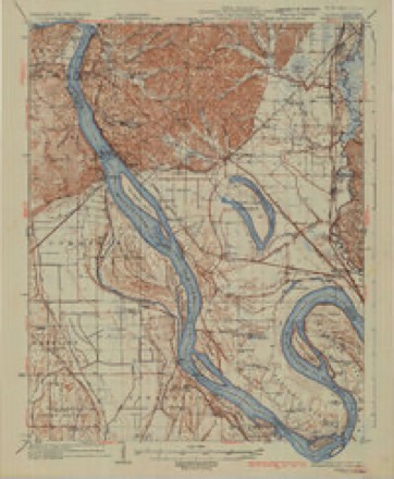
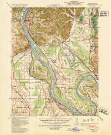
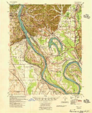
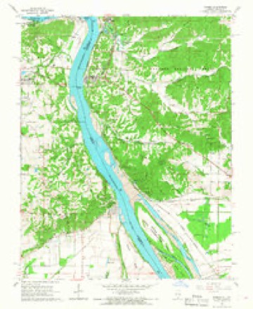
14 surveys from 22 printed sheetsMatched by testing this settlement's coordinate against the published boundary of every sheet in the United States Geological Survey's historical collection. Each opens the scanned sheet at the Survey.
- 1934 USGS Thebes quadrangle1:62500, 4 printings
- 1939 USGS Thebes quadrangle1:62500
- 1949 USGS Paducah quadrangle1:250000, 2 printings
- 1950 USGS Paducah quadrangle1:250000
- 1954 USGS Paducah quadrangle1:250000, 2 printings
- 1955 USGS Thebes quadrangle1:62500
- 1961 USGS Paducah quadrangle1:250000, 2 printings
- 1964 USGS Paducah quadrangle1:250000, 2 printings
- 1966 USGS Thebes quadrangle1:24000, 2 printings
- 1984 USGS Cape Girardeau quadrangle1:100000
- 1986 USGS Cape Girardeau quadrangle1:100000
- 1987 USGS Paducah quadrangle1:250000
- 1993 USGS Thebes quadrangle1:24000
- 1996 USGS Thebes quadrangle1:24000






Fires near this place
27 since 1997Regional context, not property-specific evidence. The federal wildfire occurrence database lists 27 fires within 5 miles of Thebes between 1997 and 2020, burning about 261 acres in total. None started naturally. 5 were recorded as arson. Distance is straight-line from the map coordinates, so a fire counted here may appear on a neighbouring settlement's page as well.
| Reported cause | Fires |
|---|---|
| Missing data/not specified/undetermined | 9 |
| Debris and open burning | 8 |
| Arson/incendiarism | 5 |
| Power generation/transmission/distribution | 2 |
| Recreation and ceremony | 2 |
| Railroad operations and maintenance | 1 |
The most recent of them, most recent first, with the day each was reported and the service that recorded it.
| Date | Cause | Size | Reported by | Name on the report |
|---|---|---|---|---|
| 6 September 2006 | Debris and open burning | 2.5 acres | Shawnee National Forest | MUD PUPPY |
| 9 August 2018 | Recreation and ceremony | under an acre | Shawnee National Forest | BEAN RIDGE |
| 29 August 2017 | Debris and open burning | under an acre | Shawnee National Forest | SEXTON CREEK |
| 8 May 2018 | Arson/incendiarism | 90 acres | Shawnee National Forest | REIMAN |
| 5 April 2007 | Railroad operations and maintenance | under an acre | Shawnee National Forest | GALE FIRE |
| 3 April 2011 | Power generation/transmission/distribution | 5.0 acres | Illinois Division of Forestry Resources | BEAN |
| 25 April 2014 | Power generation/transmission/distribution | under an acre | Shawnee National Forest | GALE |
| 19 April 2005 | Missing data/not specified/undetermined | 47 acres | Shawnee National Forest | REIMANN ROAD |
Settlements close enough to share some of these fires:
Mines and quarries near this place
10 of 14 shownRegional context, not property-specific evidence. The federal mineral resources record lists 14 workings within 5 miles of Thebes: 5 past producers, 4 prospects, 2 producers, 2 occurrences. 2 still produce. What was taken out: Stone, Crushed/Broken, Clay, Sand and Gravel, Construction, Diatomite. Distance is straight-line from the map coordinates, so a quarry counted here may appear on a neighbouring settlement's page as well.
| Where | Site | Commodity | Status | Recorded |
|---|---|---|---|---|
| Shawnee Special Use Silica Deposit 3 | Silica | Occurrence | ||
| Birk No. 3 Mine | Diatomite | Prospect | ||
| Birk No.3 Mine | Diatomite | Prospect | ||
| Ellis Porperty | Sand and Gravel, Construction | Past Producer | ||
| Marquette Clay Pit | Clay | Producer | ||
| Miss.River Shale Exposure | Clay | Prospect | ||
| Unk | Sand and Gravel, Construction | Past Producer | ||
| Grays Point Quarry #2 & Mill | Stone, Crushed/Broken | Producer | ||
| Limestone Prospect | Stone, Crushed/Broken | Occurrence | ||
| Thebes Sandstone Deposit | Stone, Crushed/Broken | Prospect |
Storms near this place
60 of 61 shownRegional context, not property-specific evidence. The National Weather Service names Thebes in 61 storm reports between 1999 and 2024: 53 flood, 4 thunderstorm wind, 3 hail, 1 tornado. No death or injury is recorded in these reports. Each account below is quoted exactly as the forecast office filed it, from the NOAA Storm Events Database, and each date opens the federal record of that event.
| When | Event | Place named | Harm | What the report says |
|---|---|---|---|---|
| June 2019 | Flood | Thebes | $2,000,000 | Major flooding continued on the Mississippi River through the month of June. After rising above flood stage in mid March, the Mississippi River remained above flood stage through the spring and into early summer. At the Thebes river gage, the river crested at 43.66 feet on June 10. This is considered a major flood. Major flooding starts at 42 feet. The East Cape Girardeau area was particularly hard hit, with some residences flooded for weeks. The Route 146 bridge connecting Illinois and Missouri at Cape Girardeau was closed due to flooding on the Illinois side of Route 146. Illinois Route 3 was flooded and closed for an extended period of time from Thebes north to East Cape Girardeau. A break in the Len Small Levee that occurred during the record flood of 2016 was not adequately repaired. This prolonged major flood enlarged the break in the levee, causing large parts of the Miller City area to flood. Several evacuated families were unable to reach their homes due to the flooding and road washouts. In the Miller City area, large sections of roads were washed away. The county highway engineer estimated damage to roads was well over one million dollars. A sewage plant at Thebes was inundated with floodwater and shut down, causing the community to be without sewer services. The Thebes Landing area of town was flooded. There was widespread flooding of low-lying farmland and woods across the county. Since some crop planting was not possible due to prolonged spring flooding, direct crop losses were reduced. The extended duration of the flooding caused levees to become unstable, and seepage became a problem. The governor of Illinois issued a disaster proclamation for the affected counties along the river. |
| January 1999 | Tornado (F2) | Thebes | $150,000 | no account filed |
| May 2017 | Flood | Thebes | $100,000 | Major flooding occurred along the Mississippi River early in the month. At the Thebes river gage, the river crested at 43.18 feet on the 6th. Flood stage is 33 feet. The river remained above flood stage for the entire month. There was extensive flooding of low-lying agricultural land, riverside parks, and river access roads. Residents of small communities such as Thebes and Gale were forced to evacuate or use boats to access their homes. Most roads leading to riverfront property were cut off by floodwaters. Some basements were flooded. The U.S. Coast Guard closed the Mississippi River to all vessel traffic to protect the integrity of levees, especially the Len Small Levee. This levee was broken during the record 2016 flood. Backwater flooding along tributary creeks affected many areas, including the inland community of McClure. Flooded streets in McClure impacted several families, who needed a boat to safely reach their homes. |
| June 2011 | Flood | Thebes | $100,000 | The Mississippi River remained above flood stage through the month of June. At the Thebes river gage, there were two separate crests. The river crested at 37.53 feet on the 1st and at 37.43 feet on the 23rd. Both of these crests represented moderate flooding. Though the flooding in June was considerably less severe than the preceding two months, a small number of homes and businesses remained underwater from East Cape Girardeau to the Miller City area, including McClure. Illinois Route 3 was on the verge of being closed, as was Illinois Route 146 near the Cape Girardeau bridge. Businesses near the intersection of Highways 3 and 146 remained flooded. Other buildings remained sandbagged, and at least one house's foundation was compromised. The Mississippi River remained too high to raise any of the locks and gates along the levees. As a result, the water from recent heavy rains as well as lingering floodwater from May remained trapped inland. |
| May 2019 | Flood | Thebes | $50,000 | After rising above flood stage in mid-March, the Mississippi River remained above flood stage through the remainder of the spring. At the Thebes river gage, the river crested at 41.83 feet on May 8. However, the river started rising again late in the month. The May crest fell just a little shy of the major flooding category, which starts at 42 feet. A sewage plant at Thebes was inundated with flood water and was shut down, causing the community to be without sewage services. The Thebes Landing area of town was flooded. There was considerable flooding of low-lying farmland and woods. Some county roads were inundated. Since crop planting was not possible in areas that had been flooded all spring, direct crop losses were not high. Due to the extended duration of the flooding, levees began to show signs of stress. There was concern about the stability of the levees, and seepage became a problem. Some roads nearest the levees began to buckle. |
| April 2011 | Flood | Thebes | $50,000 | Major flooding was in progress on the Mississippi River by the end of the month. The river continued rising into early May. There were voluntary evacuations of communities outside of levee protection systems, such as Olive Branch. The communities of Tamms, Olive Branch, and Miller City were isolated by floodwaters. Many homes in those communities were sandbagged, but most of the homes ended up being flooded. Lower portions of the community of Thebes were inundated. The National Guard was requested to assist with sandbagging residences. A water main break caused interruptions in the drinking water supply. |
| June 2013 | Flood | Thebes | $40,000 | Major flooding occurred along the Mississippi River near Thebes. There was extensive flooding of low-lying agricultural land, riverside parks, and river access roads. Many farmers had not yet planted due to the prolonged spring flooding, so crop losses were minimal. The river crested at 43.62 feet on the Thebes river gage on the 7th. Flood stage there is 33 feet. |
| April 2019 | Flood | Thebes | $20,000 | no account filed |
| May 2013 | Flood | Thebes | $10,000 | Continuing from April into May, moderate flooding occurred on the Mississippi River. At the Thebes river gage, the river crested at 39.6 feet early on the morning of the 6th. This was almost 7 feet above flood stage. There was considerable flooding of low-lying fields and woodlands near the river, including riverside parks and access roads. |
| March 2006 | Thunderstorm Wind | Thebes | $8,000 | Trees and power lines were downed. |
| October 2021 | Thunderstorm Wind | Thebes | $4,000 | Trees were down along Highway 3. |
| April 2013 | Flood | Thebes | $2,000 | Moderate flooding occurred along the Mississippi River near Thebes, affecting low-lying fields, woods, and riverside parks. Boat ramps and river access roads were flooded. The river continued rising into early May. |
| April 2011 | Thunderstorm Wind | Thebes | $2,000 | Small tree limbs were blown down, and a swing was blown over. |
| August 2007 | Thunderstorm Wind | Thebes | $2,000 | Trees were down on Old Route 3. |
| May 2024 | Flood | Thebes | - | Brief minor flooding occurred along the Mississippi River at Thebes early in the month. |
| May 2024 | Flood | Thebes | - | Minor flooding occurred on the Mississippi River at Thebes in low-lying areas. |
| July 2024 | Flood | Thebes | - | Torrential rainfall in portions of Southwestern Illinois resulted in a secondary surge of water levels on the Mississippi River, briefly returning gage levels at Thebes to minor flood. |
| July 2024 | Flood | Thebes | - | Minor flooding began near Thebes in early July and continued through mid July with impacts mainly limited to low-lying agricultural areas. |
| May 2022 | Flood | Thebes | - | Minor flooding occurred on the Mississippi River. Some low-lying fields near the river were flooded. |
| March 2021 | Flood | Thebes | - | Minor flooding occurred on the Mississippi River. Low-lying flood plain was underwater, which mostly consists of farmland. |
| March 2020 | Flood | Thebes | - | Minor flooding occurred on the Mississippi River. Bottomland woods and fields were inundated. The flooding continued into April. |
| April 2020 | Flood | Thebes | - | Minor flooding occurred on the Mississippi River. Some low-lying farmland and fields were inundated. The river continued rising into May. |
| January 2020 | Flood | Thebes | - | Minor flooding occurred along the Mississippi River. Low-lying woods and fields near the river were inundated. |
| February 2019 | Flood | Thebes | - | Minor flooding began on the Mississippi River as the month was ending. Low-lying woods and fields not protected by levees were underwater. |
| March 2019 | Flood | Thebes | - | The Mississippi River rose above flood stage around mid-month and then continued rising into April. Moderate flooding was in progress by the end of March. There was considerable flooding of low-lying fields and woods and rural county roads. The river crest and its impacts will be contained in the April report. |
| March 2019 | Flood | Thebes | - | Minor flooding continued from February into early March on the Mississippi River. Low-lying woods and fields not protected by levees were underwater. The Mississippi River rose above flood stage in response to snowmelt and rain in the northern parts of the river basin. |
| October 2019 | Flood | Thebes | - | Minor flooding of the Mississippi River inundated some low-lying fields and woodlands, as well as riverfront public recreation facilities. |
| October 2018 | Flood | Thebes | - | Minor flooding occurred along the Mississippi River. Some low-lying fields and woodlands near the river were inundated. |
| April 2017 | Flood | Thebes | - | Minor flooding occurred along the Mississippi River. Low-lying fields and woods near the river were under water. |
| June 2017 | Flood | Thebes | - | The Mississippi River continued to slowly fall after cresting in early May. Minor flooding of the Mississippi River in early June inundated low-lying fields. |
| April 2017 | Flood | Thebes | - | The Mississippi River rose above flood stage at the end of the month. Through the end of April, the flooding was mostly minor to moderate. However, this was the start of major flooding along the river. The river continued rising past the end of the month. |
| December 2015 | Flood | Thebes | - | The Mississippi River began its rise toward record-setting levels late in the month. The record crest did not occur until early January. In December, there was widespread flooding of low-lying areas not protected by levee systems. |
| July 2014 | Flood | Thebes | - | Minor flooding occurred along the Mississippi River near Thebes. Some low-lying fields and woodlands near the river were inundated. |
| July 2011 | Flood | Thebes | - | The Mississippi River finally fell below flood stage for the first time since April 21. At the Thebes river gage, the highest level (or crest) in July was 37.77 feet on the 6th. This crest represented moderate flooding. Though the flooding in July was considerably less severe than the preceding three months, a small number of homes and businesses remained underwater early in July. The Mississippi River remained too high to raise any of the locks and gates along the levees. As a result, the water from recent heavy rains as well as lingering floodwater from May remained trapped inland. |
| May 2010 | Flood | Thebes | - | Minor flooding occurred along the Mississippi River around Thebes. Agricultural bottomlands and some woodlands were flooded. |
| April 2010 | Flood | Thebes | - | Minor flooding occurred on the Mississippi River near Thebes. Some low-lying fields and river access points were under water. |
| April 2010 | Flood | Thebes | - | Minor flooding of the Mississippi River inundated some low-lying fields and river access points around Thebes. |
| August 2010 | Flood | Thebes | - | Minor flooding of the Mississippi River persisted from July into early August. Some fields in low-lying bottomlands were submerged. |
| March 2010 | Flood | Thebes | - | Moderate flooding of the Mississippi River occurred at Thebes. At the Thebes river gage, where flood stage is 33 feet, the river crested at 38.09 feet on the 31st. Flooding of low-lying fields and woodlands near the river was considerable. Some flooding of river access roads occurred in and around Gale and Thebes. |
| May 2010 | Flood | Thebes | - | Moderate flooding occurred along the Mississippi River around Thebes. The communities of Thebes and Gale experienced some flooding of low-lying areas. The flooding mostly affected agricultural bottomlands and woodlands. |
| June 2010 | Flood | Thebes | - | Moderate flooding occurred along the Mississippi River near Thebes and Gale. Considerable flooding of cropland and low-lying woods occurred. |
| July 2010 | Flood | Thebes | - | Moderate flooding occurred along the Mississippi River. Fields, boat ramps, and recreational facilities along the river were inundated. |
| June 2009 | Flood | Thebes | - | Minor flooding of the Mississippi River occurred, affecting mostly bottomland fields. On the river gage at Thebes, the river crested at 33.64 feet on the 22nd. This was less than a foot above the flood stage of 33 feet. |
| May 2009 | Flood | Thebes | - | Minor to moderate flooding of the Mississippi River occurred for nearly the entire month of May. At the Thebes gage, where flood stage is 33 feet, the river crested at 38.35 feet on the 23rd. Moderate flooding begins around 37 feet. Moderate flooding began around the communities of Thebes and Gale. Agricultural bottomland and low-lying areas were flooded. |
| October 2009 | Flood | Thebes | - | Flooding began on the Mississippi River on the 31th. At the Thebes river gage, the river did not crest until after the end of the month. Water began to flood low-lying fields near the river. |
| November 2009 | Flood | Thebes | - | Flooding began on the Mississippi River on the 31st of October. At the Thebes river gage, the river crested at 37.61 feet on the 4th of November. Flood stage there is 33 feet. This resulted in moderate flooding of lowland near the river. Flooding began in the villages of Thebes and Gale. Woods and fields near the river were inundated. No structures were known to have been flooded. |
| May 2008 | Flood | Thebes | - | Minor flooding of the Mississippi River occurred. At Thebes, the river crested at 36.63 feet on the 16th. Flood stage there is 33 feet. Minor flooding of low-lying areas around Thebes and Gale occurred. |
| April 2008 | Flood | Thebes | - | Moderate flooding of the Mississippi River occurred. At Thebes, the river remained above flood stage for the entire month of April. The crest in April was 38.94 feet on the 15th. Flood stage at Thebes is 33 feet. Many low-lying areas were flooded, primarily farm fields and woodlands. Low-lying parts of Thebes and Gale were flooded. Mobile homes were relocated out of flooded areas. |
| March 2008 | Flood | Thebes | - | Moderate flooding of the Mississippi River occurred. At the Thebes gage, the river crested at 40.37 feet on March 24. Flood stage there is 33 feet, and moderate flooding begins at 37 feet. Flooding occurred in the town of Thebes, prompting some evacuations that are fairly routine. Large areas of agricultural land were flooded. Spring planting was not yet underway, so crop losses were negligible. |
| July 2008 | Flood | Thebes | - | Moderate flooding of the Mississippi River occurred. At Thebes, the river crested at 40.95 feet on the 3rd. Flood stage there is 33 feet. Extensive flooding of lowland fields occurred. |
| August 2008 | Flood | Thebes | - | Minor flooding of the Mississippi River occurred at Thebes. The river crested at 33.88 feet on the 4th. Flood stage there is 33 feet. Low-lying fields and woodlands near the river were flooded. |
| June 2008 | Flood | Thebes | - | Moderate flooding of the Mississippi River occurred. At Thebes, the river crested at 40.12 feet on the 25th. Flood stage there is 33 feet. Extensive flooding of lowland fields occurred. The river began to climb again before the end of the month, reaching a higher crest in July. |
| February 2007 | Hail | Thebes | - | A swath of golf-ball size hail crossed central Alexander County. |
| May 2020 | Flood | Thebes | - | no account filed |
| May 2020 | Flood | Thebes | - | no account filed |
| April 2020 | Flood | Thebes | - | no account filed |
| June 2020 | Flood | Thebes | - | no account filed |
| January 2019 | Flood | Thebes | - | no account filed |
| July 2015 | Hail | Thebes | - | no account filed |
| March 2011 | Flood | Thebes | - | no account filed |
Nearest settlements
The eight closest, with where each one stands in the county. Distances are straight-line, computed from the Geographic Names Information System coordinates.
| Map | Place | Distance | Sheets |
|---|---|---|---|
| Gale | 2.1 miles | 22 | |
| Fayville | 4.3 miles | 22 | |
| East Cape Girardeau | 5.5 miles | 25 | |
| Olive Branch | 6.8 miles | 22 | |
| McClure | 6.9 miles | 25 | |
| Shasta (historical) | 7.1 miles | 22 | |
| Diswood | 7.4 miles | 22 | |
| Clank | 7.5 miles | 22 |
Elsewhere
Matched on this settlement's Geographic Names Information System number rather than its name, so it cannot be a different place of the same name in another state.
| Wikipedia article on Thebes | An encyclopaedic summary. Its text is share-alike, so it is linked here rather than copied. |
| Wikidata item Q11045962 | The structured record the population and elevation above come from. Public domain (CC0). |
Provenance
This settlement is recorded in the Geographic Names Information System as feature 424100. The sheet list is computed by point-in-boundary test against the United States Geological Survey's historical topographic inventory. Both are works of the United States government and carry no copyright under 17 U.S.C. 105.
Wildfire. Short, Karen C. 2022. Spatial wildfire occurrence data for the United States, 1992-2020 [FPA_FOD_20221014]. 6th Edition. Fort Collins, CO: Forest Service Research Data Archive. https://doi.org/10.2737/RDS-2013-0009.6 Collected with United States Government funding and usable without additional permissions or fees.
Mines and quarries. USGS Mineral Resources Data System (MRDS) https://mrdata.usgs.gov/mrds/ A work of the United States government, no copyright under 17 U.S.C. 105.
Storms. NOAA National Centers for Environmental Information, Storm Events Database https://www.ncei.noaa.gov/stormevents/ A work of the United States government, no copyright under 17 U.S.C. 105. Narratives are quoted verbatim from the National Weather Service report and are not edited or summarised.