 Block
From the record
7 National Register listings published here.
Sources: the National Register database, National Park Service
62 topographic sheets cover 28 settlements here, and 7 properties are on the National Register of Historic Places.
7 National Register listings published here.
Sources: the National Register database, National Park Service
Every property in this county listed on the National Register of Historic Places, with the year it was listed and the federal nomination document.
| Photograph | Property | Type | Listed | Reference |
|---|---|---|---|---|
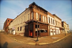 | Cairo Historic District | district | 1979 | 79000815 |
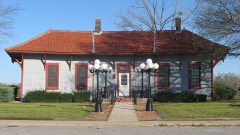 | Chicago and Eastern Illinois Railroad Depot | building | 1986 | 86003168 |
 | Magnolia Manor | building | 1969 | 69000053 |
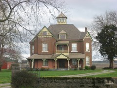 | Thomas J. and Caroline McClure House | building | 1996 | 96001341 |
| Old Customhouse | building | 1973 | 73000689 | |
| Thebes Courthouse | building | 1972 | 72000447 | |
| Ward Chapel AME Church | building | 2024 | 100010699 |
Every wildfire the federal occurrence database records inside this county: 70 of them, burning about 1,204 acres. 2 started naturally and 15 were recorded as arson. Each settlement page carries the fires within five miles of it.
| Reported cause | Fires |
|---|---|
| Debris and open burning | 28 |
| Arson/incendiarism | 15 |
| Missing data/not specified/undetermined | 14 |
| Power generation/transmission/distribution | 4 |
| Recreation and ceremony | 4 |
| Railroad operations and maintenance | 2 |
| Natural | 2 |
| Smoking | 1 |
The five largest, by the area the report gives. Four of them were set deliberately.
| Date | Cause | Size | Reported by | Name on the report |
|---|---|---|---|---|
| 24 March 1995 | Arson/incendiarism | 245 acres | Shawnee National Forest | STAT # 1 |
| 26 October 2000 | Arson/incendiarism | 106 acres | Shawnee National Forest | DISWOOD |
| 8 May 2018 | Arson/incendiarism | 90 acres | Shawnee National Forest | REIMAN |
| 15 March 2000 | Debris and open burning | 90 acres | Shawnee National Forest | HONEY |
| 27 January 2014 | Debris and open burning | 60 acres | Shawnee National Forest | COLD |
| 9 April 2001 | Debris and open burning | 60 acres | Shawnee National Forest | DOWN UNDER |
| 15 March 2000 | Arson/incendiarism | 50 acres | Shawnee National Forest | OLIVE BRANCH |
| 19 April 2005 | Missing data/not specified/undetermined | 47 acres | Shawnee National Forest | REIMANN ROAD |
Every settlement page carries the fires within five miles of it - see the settlement index below.
The NOAA Storm Events Database holds 338 reports for this county, causing no deaths, 13 injuries and about $18,396,810 in recorded property damage. Each settlement page carries the reports that name it.
| Kind of event | Reports |
|---|---|
| Flood | 152 |
| Thunderstorm Wind | 80 |
| Hail | 52 |
| Flash Flood | 21 |
| Tornado | 17 |
| Heavy Rain | 10 |
| Funnel Cloud | 5 |
| Lightning | 1 |
The most serious of them, by death, then injury, then recorded damage. The accounts are quoted exactly as the forecast office filed them.
| When | Event | Place named | Harm | What the report says |
|---|---|---|---|---|
| April 1957 | Tornado (F2) | not stated | 5 hurt, $250,000 | no account filed |
| April 1960 | Tornado (F1) | not stated | 4 hurt, $25,000 | no account filed |
| May 2003 | Tornado (F2) | Willard | 1 hurt, $300,000 | The tornado formed northwest of Cairo near the Mississippi River. Three tractor-trailer rigs were overturned on the Interstate 57 bridge over the Mississippi River. The tornado tracked through Cairo, damaging dozens of homes and several businesses. One single-family home was destroyed, injuring a child who was cut by flying debris. Of the damaged homes, about four sustained major damage, and the rest had mainly minor damage. |
| May 1999 | Thunderstorm Wind | Willard | 1 hurt, $75,000 | A wood-frame house sustained major damage to its roof and an attached garage. The garage was totally destroyed. A large section of the house's roof was blown off. A woman, who was standing in front of the window when the storm hit, received cuts to an artery in her neck. She was hospitalized overnight. Heavy rain coming through the damaged roof caused extensive water damage. About half a dozen trees were uprooted or snapped. Near the community of Willard, a garage was severely damaged by high winds. The walls of the garage were bowed outward, and the door was caved in. |
| April 1972 | Tornado (F2) | not stated | 1 hurt, $25,000 | no account filed |
| July 1970 | Tornado (F1) | not stated | 1 hurt, $25,000 | no account filed |
| January 2016 | Flood | East Cape Girardeau | $4,500,000 | Mississippi River levels continued their climb from December, and record flooding occurred early in the month. At the Thebes river gage, the river crested at a new record of 47.74 feet before dawn on the 2nd. The old record was 45.91 feet, which was set in May of 1995. Records at Thebes go back to at least 1844. The 2016 crest would have been higher if a major levee break had not occurred in Alexander County. Flood stage at Thebes is 33 feet. The primary flood-related impact was a large levee break (about one-quarter mile wide) in the Len Small Levee near Miller City, between Thebes and Cairo. This levee break contributed to major flooding in and near the communities of Olive Branch and Miller City. Several dozen residences were flooded, some of them by water up to seven feet deep. Voluntary evacuations were requested as floodwaters inundated these communities and cut off access roads. Many homes and businesses in these communities were sandbagged, but many of them ended up being flooded. A Red Cross shelter was opened at Cape Girardeau. The National Guard was requested to assist with sandbagging operations and levee repairs. A couple of relatively small levee breaches were reported between Miller City and Cairo. The levee protecting East Cape Girardeau was in danger of failing, and residents of that community were advised to evacuate. Schools were closed in much of the county due to widespread evacuations. The impact of all of this flooding would have been much greater during the growing season, when crop losses would have been extreme. Because of the high water, barge traffic was restricted on the Mississippi River. |
| July 2019 | Flood | East Cape Girardeau | $3,000,000 | The Mississippi River finally fell below flood stage at the Thebes river gage after spending about four and one-half months above flood stage. While the crest was among the ten highest on record, the extended duration of the flood played an even greater role on the impact. The combination of seepage and relief wells along the levees permitted large amounts of water to seep into normally dry areas. The biggest impacts in Alexander County were weeks after the river crested. Portions of Illinois Routes 3 and 146 were flooded and closed from the East Cape Girardeau area down to Thebes. A number of residences were flooded in McClure and East Cape Girardeau. Further south, the breach in the Len Small levee continued to permit large amounts of water into the Miller City area. A U.S. Geological Survey measurement determined that at least 20 percent of the total Mississippi River flow was exiting through the break in the Len Small levee. County roads and swaths of cropland were damaged extensively by fast-flowing water around the levee break. Six barges passed through the levee break and became stuck on Miller City Road. The loose barges damaged irrigation pivots and farm equipment. The river fell below flood stage late in the month, permitting more accurate damage assessments to take place. |
| June 2019 | Flood | Thebes | $2,000,000 | Major flooding continued on the Mississippi River through the month of June. After rising above flood stage in mid March, the Mississippi River remained above flood stage through the spring and into early summer. At the Thebes river gage, the river crested at 43.66 feet on June 10. This is considered a major flood. Major flooding starts at 42 feet. The East Cape Girardeau area was particularly hard hit, with some residences flooded for weeks. The Route 146 bridge connecting Illinois and Missouri at Cape Girardeau was closed due to flooding on the Illinois side of Route 146. Illinois Route 3 was flooded and closed for an extended period of time from Thebes north to East Cape Girardeau. A break in the Len Small Levee that occurred during the record flood of 2016 was not adequately repaired. This prolonged major flood enlarged the break in the levee, causing large parts of the Miller City area to flood. Several evacuated families were unable to reach their homes due to the flooding and road washouts. In the Miller City area, large sections of roads were washed away. The county highway engineer estimated damage to roads was well over one million dollars. A sewage plant at Thebes was inundated with floodwater and shut down, causing the community to be without sewer services. The Thebes Landing area of town was flooded. There was widespread flooding of low-lying farmland and woods across the county. Since some crop planting was not possible due to prolonged spring flooding, direct crop losses were reduced. The extended duration of the flooding caused levees to become unstable, and seepage became a problem. The governor of Illinois issued a disaster proclamation for the affected counties along the river. |
| May 2011 | Flood | Cache | $1,500,000 | Major flooding continued on the Mississippi River from April. At the Thebes river gage, the flood crest of 45.52 feet on the night of May 2 was the second highest crest on record. The record crest was 45.91 feet in May of 1995. A major levee break at Fayville resulted in flash flooding in central and northern parts of the county. Communities outside of levee protection systems, such as Olive Branch, Miller City, and Tamms, were evacuated as floodwaters inundated entire communities and cut off access roads. Many homes and businesses in those communities were sandbagged, but most of them ended up being flooded. Lower portions of the community of Thebes were inundated. The National Guard was requested to assist with sandbagging residences. A water main break caused interruptions in the drinking water supply. |
| May 2011 | Flood | Cairo | $1,000,000 | Record flooding occurred on the Ohio River. At the Cairo river gage, the flood crest of 61.72 feet on the evening of May 2 broke the previous record of 59.50 feet set in 1937. The activation of the New Madrid Floodway by the U.S. Army Corps of Engineers spared Cairo (population 2,800) from an even higher crest that could have easily overtopped the city's levees. With the detonation of the Mississippi River levee at Birds Point, Missouri, the Ohio River dropped suddenly at Cairo. The entire city of Cairo was placed under a mandatory evacuation order as the Ohio River approached the top of the levees protecting the city. Only about 40 people remained behind after the evacuation. Due to heavy rain and backed-up sewers, several blocks within the city experienced basement flooding despite being protected by levees. Some streets in the city were undermined by seepwater. Most routes into and out of the city were blocked by flooding, including Route 3 to the north and both bridges to the south (over the Mississippi and Ohio Rivers). A main rail line that runs through Cairo was shut down due to a large landslide. |
| March 2008 | Flood | Mc Clure | $800,000 | Numerous road closures were reported, though all major roads were reopened within 24 hours. U.S. Highway 51 was closed at the northern entrance to Cairo. Several homes were flooded, mainly in the Olive Branch and Gale areas. Basement flooding occurred in Cairo, especially north parts of the city. Ten people were rescued with three boats used by the Department of Natural Resources. |
| April 2011 | Tornado (EF2) | Cairo Arpt | $700,000 | At the Cairo Regional Airport, a twenty-foot tall hangar was completely destroyed, along with two light aircraft and a camper. The debris was blown onto airport runways. The airport manager was an eyewitness to the tornado and noted an anemometer reading of 118 mph. One mobile home was destroyed on Route 3. Several trees were snapped or uprooted, along with minor to moderate roof damage on two homes. In Urbandale, large trees damaged two trailers and one house. Peak winds were measured near 120 mph at the airport. The average path width was 150 yards. |
| February 2000 | Thunderstorm Wind | Cairo | $500,000 | A short-lived but very intense thunderstorm microburst caused about a half million dollars damage in the center of Cairo. The affected area, which was 5 city blocks wide and about a mile long, was primarily residential. A total of 52 buildings were damaged or destroyed. Of these 52, eight were businesses, seven were outbuildings or garages, and the rest were houses. Five of the residences were moved off their foundation and considered total losses. In another 25 buildings, windows were blown out and roofs were damaged. For the remaining structures, the damage was relatively minor, consisting of porch damage or gutters blown off. Initial reports indicated there were some minor injuries, however, later investigation revealed no injuries. |
| January 2016 | Flood | Urbandale | $400,000 | Major flooding of the Ohio River continued into January. At the Cairo river gage, the river crested at 56.14 feet on the 4th. This flood was very similar to the flood of March, 1997, when the crest was 56.2 feet. Flood stage there is 40 feet. The bridge connecting Cairo with Wickliffe, KY was closed due to floodwater over the bridge approach on the Kentucky side. The bridge, which carries U.S. Highway 51/60/62 over the Ohio River, was closed for about one week. Most of the flood gates were installed at Cairo. Areas not protected by the levee and floodwall system were inundated. Since the crop season was not underway, agricultural losses were insignificant. |
| March 1997 | Flash Flood | Cairo | $400,000 | no account filed |
| March 2018 | Flood | Cairo | $350,000 | Major flooding continued on the Ohio River from late February. At the Cairo river gage, the river crested at 54.8 feet on March 3. This was the 10th highest crest on record at Cairo, and it was 1.3 feet below the flood crest of January, 2016. Flood stage there is 40 feet. The bridge connecting Cairo with Wickliffe, KY was closed due to floodwater over the bridge approach on the Kentucky side. The bridge, which carries U.S. Highway 51/60/62 over the Ohio River, was closed for about one week. Most of the flood gates were installed at Cairo. Areas not protected by the levee and floodwall system were inundated. Since the crop season was not underway, agricultural losses were quite small. |
| May 2002 | Flash Flood | Countywide | $300,000 | no account filed |
| July 2023 | Flash Flood | Cairo | $150,000 | no account filed |
| January 1999 | Tornado (F2) | Thebes | $150,000 | no account filed |
| March 2019 | Flood | Cairo | $100,000 | Major flooding continued on the Ohio River from February into March. At the Cairo river gage, the river crested at 56.51 feet on the 1st. This was just a few inches above the crest of 56.2 feet in the flood of March, 1997. This flood crest was tied with the flood of April, 1975 for the second highest crest since the Flood of 1937. The flood of Spring, 2011 remains the highest crest since 1937. Flood stage at Cairo is 40 feet. U.S. Highway 60/62 was closed at the Ohio River bridge to Kentucky. This road serves as a primary link between Kentucky and Illinois. A detour of about 80 miles was required for commuters in the area. The governor of Illinois surveyed the flooded part of the county. There was extensive flooding of low-lying woods, fields, and parks. The impacts were very similar to the March, 1997 flood. Most of the flood gates were installed at Cairo. Areas not protected by the levee and floodwall system were inundated. The U.S. Army Corps of Engineers installed a high-capacity pump near Urbandale to remove water from heavy rainfall on the protected side of the levee. Since the crop season was not underway, agricultural losses were insignificant. |
| May 2017 | Flood | Thebes | $100,000 | Major flooding occurred along the Mississippi River early in the month. At the Thebes river gage, the river crested at 43.18 feet on the 6th. Flood stage is 33 feet. The river remained above flood stage for the entire month. There was extensive flooding of low-lying agricultural land, riverside parks, and river access roads. Residents of small communities such as Thebes and Gale were forced to evacuate or use boats to access their homes. Most roads leading to riverfront property were cut off by floodwaters. Some basements were flooded. The U.S. Coast Guard closed the Mississippi River to all vessel traffic to protect the integrity of levees, especially the Len Small Levee. This levee was broken during the record 2016 flood. Backwater flooding along tributary creeks affected many areas, including the inland community of McClure. Flooded streets in McClure impacted several families, who needed a boat to safely reach their homes. |
| October 2013 | Tornado (EF0) | Gale | $100,000 | The tornado passed through East Cape Girardeau with estimated peak winds near 80 mph. Numerous trees and tree branches were blown down. There was shingle and other minor damage to several houses. A church steeple was blown off a church. Some damage occurred to fencing and small sheds. The average path width was 175 yards. |
| June 2011 | Flood | Thebes | $100,000 | The Mississippi River remained above flood stage through the month of June. At the Thebes river gage, there were two separate crests. The river crested at 37.53 feet on the 1st and at 37.43 feet on the 23rd. Both of these crests represented moderate flooding. Though the flooding in June was considerably less severe than the preceding two months, a small number of homes and businesses remained underwater from East Cape Girardeau to the Miller City area, including McClure. Illinois Route 3 was on the verge of being closed, as was Illinois Route 146 near the Cape Girardeau bridge. Businesses near the intersection of Highways 3 and 146 remained flooded. Other buildings remained sandbagged, and at least one house's foundation was compromised. The Mississippi River remained too high to raise any of the locks and gates along the levees. As a result, the water from recent heavy rains as well as lingering floodwater from May remained trapped inland. |
| March 2006 | Thunderstorm Wind | Olive Branch | $100,000 | A survey of the damage indicated a microburst with peak winds to 85 MPH occurred. On the south side of town, 20 to 30 trees and power lines were down. Several homes received major roof damage. A tree fell on a mobile home, and a garage was blown off its foundation. A front porch was damaged. A roof was partially blown off a metal building. One small storage shed was destroyed, and another shed was blown off its foundation. The damage path was divergent from west to east. The damage path was about 750 yards wide and 600 yards long. |
| March 2011 | Flood | Cairo | $100,000 | no account filed |
| March 2017 | Thunderstorm Wind | East Cape Girardeau | $90,000 | A microburst containing estimated winds near 85 mph moved across the Mississippi River into East Cape Girardeau. The damage was almost entirely on the south side of Route 146. Shingles and siding were blown off several homes. The roof decking was damaged on a couple of homes. Dozens of trees or tree limbs were blown down. |
| April 2009 | Thunderstorm Wind | Miller City | $80,000 | A recently built shop was destroyed. Windows were blown out of a house. A camper was blown into a field. An irrigation rig was turned over and destroyed. |
| June 1995 | Thunderstorm Wind | Northern | $75,000 | Numerous trees and limbs were blown down. A few houses and mobile homes were damaged by falling trees in Thebes. In McClure, a grain silo was lifted off its foundation, and shed roofs were blown off. A tree landed on a house in Elco. The community of Thebes was without power for more than 24 hours. |
| February 2019 | Flood | Cairo | $50,000 | Major flooding occurred on the Ohio River. U.S. Highway 60/62 was closed at the Ohio River bridge to Kentucky. This road serves as a primary link between Kentucky and Illinois. A detour of about 80 miles was required for commuters in the area. The governor of Illinois surveyed the flooded part of the county. There was extensive flooding of low-lying woods, fields, and parks. Through February, the impacts were very similar to the March, 1997 flood. Most of the flood gates were installed at Cairo. Areas not protected by the levee and floodwall system were inundated. The U.S. Army Corps of Engineers installed a high-capacity pump near Urbandale to remove water from heavy rainfall on the protected side of the levee. Since the crop season was not underway, agricultural losses were insignificant. The Ohio River did not crest until March at the Cairo river gage. |
| June 2019 | Flood | Cairo | $50,000 | The Ohio River remained above flood stage since February 8 and through the month of June. This was the most prolonged flood on the Ohio River since records began at Cairo in the late 1800's. The highest recorded stage in the month of June (2019) was 51.54 feet, which corresponds to the moderate flood category. At this stage, the flooding has a significant impact on farming operations in the flood plain, causing some farmers to lose crops. However, farmers never were able to plant crops because this flood began in the winter. Riverside parks and recreational facilities remained underwater. Some side roads near the river were flooded. Due to the extended duration of the flooding, levees along the river were very stressed from saturation of the soil. Seepage was a concern, and relief wells caused water to rise on the land side of the levees. Moderate flooding continued into the month of July. |
| May 2019 | Flood | Cairo | $50,000 | The Ohio River rose above flood stage at Cairo on February 8 and remained above flood stage through the remainder of the spring. This was the most prolonged flood on the Ohio River at Cairo, IL since records began in the late 1800's. The highest recorded stage in the month of May (2019) was 50.53 feet, which corresponds to the moderate flood category. At this stage, the flooding has a major impact on farming operations in the flood plain, causing some farmers to lose crops. In this prolonged flood, farmers never really had the chance to plant in the flood plain. Flooding of riverside parks and recreational facilities occurred. A few side roads near the river were flooded. Due to the extended duration of the flooding, levees began to show signs of stress. There was concern about the stability of the levees, and seepage became a problem. Some roads nearest the levees began to buckle. |
| May 2019 | Flood | Thebes | $50,000 | After rising above flood stage in mid-March, the Mississippi River remained above flood stage through the remainder of the spring. At the Thebes river gage, the river crested at 41.83 feet on May 8. However, the river started rising again late in the month. The May crest fell just a little shy of the major flooding category, which starts at 42 feet. A sewage plant at Thebes was inundated with flood water and was shut down, causing the community to be without sewage services. The Thebes Landing area of town was flooded. There was considerable flooding of low-lying farmland and woods. Some county roads were inundated. Since crop planting was not possible in areas that had been flooded all spring, direct crop losses were not high. Due to the extended duration of the flooding, levees began to show signs of stress. There was concern about the stability of the levees, and seepage became a problem. Some roads nearest the levees began to buckle. |
| May 2011 | Flash Flood | Fayville | $50,000 | A major breach occurred in the Fayville levee. Despite widespread sandbagging, there was flash flooding across parts of central Alexander County. The communities of Miller City, Olive Branch, and Willard were impacted. Floodwaters covered sections of Illinois Route 3. Many homes and businesses were flooded. Olive Branch was inaccessible, and portions of Illinois Routes 3 and 37 were closed. |
| April 2011 | Thunderstorm Wind | Olive Branch | $50,000 | Numerous trees and power lines were down. |
| April 2011 | Flood | Thebes | $50,000 | Major flooding was in progress on the Mississippi River by the end of the month. The river continued rising into early May. There were voluntary evacuations of communities outside of levee protection systems, such as Olive Branch. The communities of Tamms, Olive Branch, and Miller City were isolated by floodwaters. Many homes in those communities were sandbagged, but most of the homes ended up being flooded. Lower portions of the community of Thebes were inundated. The National Guard was requested to assist with sandbagging residences. A water main break caused interruptions in the drinking water supply. |
| January 1999 | Thunderstorm Wind | Miller City | $50,000 | A carport and shed were demolished, and a one third of the roof was blown off a house. |
| April 2019 | Flood | Cairo | $50,000 | no account filed |
| July 2019 | Flood | Cairo | $40,000 | The Ohio River finally fell below flood stage at Cairo after spending five months above flood stage, which is the longest duration on record. Much of this time, the river was above flood stage at Cairo due to backwater from the swollen Mississippi River. When it came to the impacts of the flooding, the extended duration of the flooding was at least as significant as its severity. The levee system along the Ohio River was saturated by the extended presence of floodwaters, raising concerns about the stability and integrity of some levees. Repairs were made in certain locations where slippage was observed. Although crops were never planted in many parts of the flood plain, the agricultural impacts were still significant. At the Cairo river gage, the river crested in late June and fell below flood stage in mid July. |
| June 2013 | Flood | Thebes | $40,000 | Major flooding occurred along the Mississippi River near Thebes. There was extensive flooding of low-lying agricultural land, riverside parks, and river access roads. Many farmers had not yet planted due to the prolonged spring flooding, so crop losses were minimal. The river crested at 43.62 feet on the Thebes river gage on the 7th. Flood stage there is 33 feet. |
| April 2011 | Flood | Cairo | $40,000 | The entire city of Cairo was placed under a mandatory evacuation order as the Ohio River approached the top of the levees protecting the city. Only about 40 people remained behind after the evacuation. Due to heavy rain and backed-up sewers, several blocks within the city experienced basement flooding despite being protected by levees. Most routes into and out of the city were blocked by flooding, including Route 3 to the north and both bridges to the south (over the Mississippi and Ohio Rivers). |
| May 2013 | Thunderstorm Wind | Cairo | $30,000 | Half of the roof of the Alexander County courthouse was blown off. There was no other damage nearby. |
| May 2011 | Flood | Cache | $30,000 | no account filed |
| January 1999 | Flash Flood | Countywide | $30,000 | no account filed |
| March 2025 | Tornado (EF1) | Fayville | $25,000 | An EF-1 tornado began near the Mississippi River a mile northwest of Fayville, and moved east northeast. The tornado uprooted or snapped the trunks of dozens of trees and toppled an irrigation pivot. It moved into Pulaski County just northeast of Sandusky. The estimated peak wind was 105 mph. The total path length of the tornado was around 18 miles. A large area of 70-90 mph straight line winds swept just south of the tornado and eventually overtook it as it moved east of Interstate 57 in Pulaski County. |
| August 2023 | Flash Flood | Fayville | $25,000 | In the Rock Springs Hollow Road area, a roadway culvert was washed out. |
| October 2001 | Thunderstorm Wind | Tamms | $25,000 | In Miller City, sheds were blown down, and there was minor damage to roofs. In Tamms, there were some trees and wires down. A tree fell on a house in Urbandale. |
| July 2015 | Flood | Thebes Jct | $20,000 | Flooding on the Mississippi River continued from June into July and increased to major levels. At the Thebes river gage, the river crested at 42.02 feet on the 3rd. Flood stage is 33 feet. Extensive flooding of lowland fields occurred, including many acres of cropland. Residents of small communities such as Thebes and Gale were forced to evacuate or use boats to access their homes. Most roads leading to riverfront property were cut off by floodwaters. Some basements were flooded. Backwater flooding along tributary creeks affected many areas, including the inland community of McClure. Flooded streets in McClure impacted several families, who needed a boat to safely reach their homes. |
| May 2013 | Flood | Cairo | $20,000 | Continuing from April into May, moderate flooding of the Ohio River occurred. At the Cairo river gage, the river crested at 49.96 feet on the evening of the 10th. This is about 10 feet over the flood stage of 40 feet. There was considerable flooding of low-lying fields and woodlands near the river. A state park and some river access roads were under water. |
| April 2011 | Thunderstorm Wind | Thebes Jct | $20,000 | Trees and power lines were down on Illinois Route 3 near Thebes. Trees and power lines were down in the Horseshoe Lake area. |
| August 2009 | Thunderstorm Wind | Tamms | $20,000 | Trees were blown down countywide, primarily in the communities of Tamms, Olive Branch, and Miller City. |
| January 2008 | Thunderstorm Wind | Olive Branch | $20,000 | Trees were blown down. A tree was down on a trailer. Road signs were down on Illinois Route 3 at Olive Branch. |
| April 2019 | Flood | Thebes | $20,000 | no account filed |
| March 2025 | Thunderstorm Wind | Sandusky | $10,000 | Straight line winds toppled an irrigation pivot on Sandusky Road just west of Sandy Creek Road. This damage was just south of a tornado track. |
| March 2020 | Flood | Cairo | $10,000 | Moderate flooding occurred on the Ohio River through most of March at Cairo. The river crested at 52.64 feet at Cairo on the 31st. This is just shy of the major flood category, which starts at 53 feet. There was considerable flooding of low-lying areas near the river, including parks and farmland. Most main roads remained open, although water approached Illinois Route 3 north of Cairo. |
| May 2017 | Flood | Cairo | $10,000 | An extended period of moderate flooding occurred on the Ohio River. The river was above flood stage for the entire month. At the Cairo river gage, the river crested at 52.15 feet on May 8. Major flooding starts at 53 feet. There was considerable flooding of low-lying areas near the river, including parks and farmland. Most main roads remained open, although water approached Illinois Route 3. |
| May 2013 | Flood | Thebes | $10,000 | Continuing from April into May, moderate flooding occurred on the Mississippi River. At the Thebes river gage, the river crested at 39.6 feet early on the morning of the 6th. This was almost 7 feet above flood stage. There was considerable flooding of low-lying fields and woodlands near the river, including riverside parks and access roads. |
| October 2013 | Tornado (EF1) | Tamms | $10,000 | The tornado produced only tree damage along its path through this forested area. Hardwood tree trunks were snapped. Peak winds were estimated near 100 mph as the tornado approached the Pulaski County line. The tornado continued into northwest Pulaski County. |
| January 2010 | Lightning | Cairo | $10,000 | Lightning struck a housing development building, producing a large hole in the roof. |
| May 1995 | Thunderstorm Wind | Countywide | $10,000 | Numerous trees were downed. Hardest hit was the area along the Union County line, where trees fell across roads and damaged utility lines. |
The Survey's mineral resources record lists 29 workings inside this county. 7 still produce and 22 are closed or unrecorded. Each settlement page carries the workings within five miles of it.
| Commodity | Workings |
|---|---|
| Diatomite | 14 |
| Silica | 5 |
| Stone, Crushed/Broken | 3 |
| Sand and Gravel, Construction | 3 |
| Clay | 2 |
| Fire Clay (Refractory) | 1 |
| Stone | 1 |
The least common of them first, because a county's hundredth gravel pit says nothing its first ten did not.
| Where | Site | Commodity | Status | Recorded |
|---|---|---|---|---|
| Burk Mine Tammsco Inc. | Stone | Past Producer | ||
| Shawnee Low Interest Refractory Clay Deposit | Fire Clay (Refractory) | Occurrence | Sedimentary | |
| Miss.River Shale Exposure | Clay | Prospect | ||
| Spring Clay Pit | Clay | Past Producer | ||
| Jordan Creek Pit | Sand and Gravel, Construction | Past Producer | ||
| Jordan R&S Quarry Markgraf Matls | Sand and Gravel, Construction | Producer | ||
| Jordan Trucking Sand & Gravel Pit | Sand and Gravel, Construction | Past Producer | ||
| Limestone Prospect | Stone, Crushed/Broken | Occurrence | ||
| Moad Mines | Stone, Crushed/Broken | Producer | ||
| Thebes Sandstone Deposit | Stone, Crushed/Broken | Prospect | ||
| Illinois Minerals Co Mine No. 16 | Silica | Past Producer | ||
| Shawnee Special Use Silica Deposit 3 | Silica | Occurrence | ||
| Shawnee Special Use Silica Deposit 4 | Silica | Occurrence | ||
| Unimin Plant | Silica | Producer | ||
| Unimin Plant & Mill | Silica | Producer | ||
| Birk 2a Pit | Diatomite | Past Producer | ||
| Birk No. 2 Pit | Diatomite | Producer | ||
| Birk No. 2 Pit | Diatomite | Producer | ||
| Birk No. 2a Pit | Diatomite | Producer | ||
| Birk No. 2b Mine | Diatomite | Past Producer | ||
| Birk No. 2b Mine | Diatomite | Past Producer | ||
| Birk No. 3 Mine | Diatomite | Prospect | ||
| Birk No.3 Mine | Diatomite | Prospect | ||
| Illinois Minerals Co. No 24 Mine | Diatomite | Past Producer | ||
| Illinois Minerals Co. No. 24 Mine | Diatomite | Past Producer | ||
| Rhymer Mine | Diatomite | Past Producer | ||
| Rhymer Mine | Diatomite | Past Producer | ||
| Whitaker Mines | Diatomite | Past Producer | ||
| Whitaker Mines | Diatomite | Past Producer |
Named settlements recorded in the Geographic Names Information System, each with the topographic sheets covering it. Villages, hamlets and abandoned places alike. Each is shown with the nearest named watercourse or landform and the survey quadrangle it falls on.
McClure precinct · 62957 · Near Giboney Island · McClure quadrangle
25 sheets, 1920 to 1996
Thebes precinct · 62990 · Near Black Powder Hollow · Thebes quadrangle
22 sheets, 1934 to 1996
Cache precinct · 62914 · On Cottonwood Slough · Cairo quadrangle
27 sheets, 1931 to 1993
McClure precinct · 62957 · Near Picayune Island · McClure quadrangle
25 sheets, 1920 to 1996
Olive Branch precinct · 62969 · Near Coakley Hollow · Tamms quadrangle
22 sheets, 1934 to 1996
Olive Branch precinct · 62962 · Near Goose Island · Thebes quadrangle
22 sheets, 1934 to 1996
No longer a settlement
Tamms precinct · 62988 · Near Hogskin Bottoms · Mill Creek quadrangle
24 sheets, 1920 to 1996
The vanished settlements of Alexander County: the places named above that are no longer on the map.