 Block
Tioga, Illinois
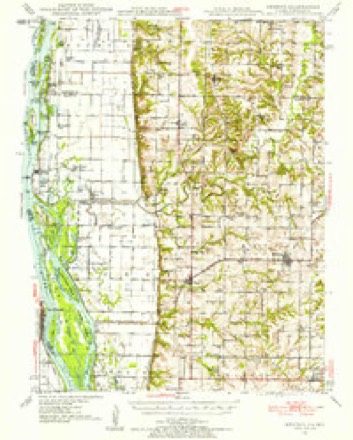
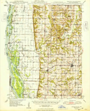
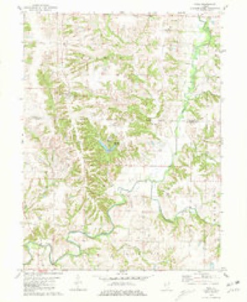
14 topographic sheets cover this place, the earliest surveyed in 1946 and the latest in 1990. It stands in Walker Township. It lies in ZIP code area 62351. The Survey maps it on the Tioga quadrangle. It stands 745 feet above sea level.
Topographic sheets covering this place
8 surveys from 14 printed sheetsMatched by testing this settlement's coordinate against the published boundary of every sheet in the United States Geological Survey's historical collection. Each opens the scanned sheet at the Survey.
- 1946 USGS Mendon quadrangle1:62500
- 1948 USGS Mendon quadrangle1:62500, 2 printings
- 1958 USGS Burlington quadrangle1:250000, 4 printings
- 1961 USGS Burlington quadrangle1:250000
- 1963 USGS Burlington quadrangle1:250000
- 1981 USGS Tioga quadrangle1:24000
- 1986 USGS Keokuk quadrangle1:100000, 2 printings
- 1990 USGS Burlington quadrangle1:250000, 2 printings




In the county-history sources
9,970 words on this townshipHistory of Hancock County, Illinois, Together with an Outline History of the State, and a Digest of State Laws, published 1880 names this settlement in its chapter on Walker Township. These are the passages that mention it, exactly as the scans read.
Tioga, laid out by George Ensminger, in March, 1855, near the south line of the township. This latter occupies the site of what was Yelrome, or Morley Town, in the Mormon days, and which was so ruthlessly burnt out in the fall of ISio, and its inhabitants driven away. [See Chapter YL]
Passage source: History of Hancock County, Illinois, Together with an Outline History of the State, and a Digest of State Laws, published 1880.
Dr. Yirgil Kingsley, physician and surgeon, Tioga, 111. The Doctor is a native of Hancock county. 111., and was born April 7, 1852, in the old Montebello House, near Hamilton. His parents -were A. S. and Cynthia Kingsley, who came to Illinois about 1845. The former was a prominent farmer of this county, and was sadly missed after his death, whicli occurred Feb. 3. 1878, at the age of 70 years, 9 months and 17 days. Our subject is related to the well known Piggotts, who were among the first settlers of St. Louis. The Doctor graduated at the Keoknk College of Physicians, June 14, 1877, with high honors. He also attended lectures in the St. Louis Medical College during tlie session of lS75-'6. He began practice July 25, 1877, in Tioga, this county, where he now has a good patronage. He was married Sept. 15, 1874, to Miss Pearle O. Howes, daughter of F. M. Howes, of Montebello tp., an early settler of this county. Mr. and Mrs. Kingsley have 2 children, - Chester H. and Cleo M. The Doctor has also made a very fine collection of geological specimens, and is still pursuing this study with energy. During the winter of 1878-'9, he delivered a course of lectures to the citizens of Tioga, on the subject of human anatomy, the laws of health, and hygiene.
Passage source: History of Hancock County, Illinois, Together with an Outline History of the State, and a Digest of State Laws, published 1880.
Machine-read from a century-old scan, so expect the errors a machine makes: misspelled names, dropped words, stray characters.
Mines and quarries near this place
2 within 5 milesRegional context, not property-specific evidence. The federal mineral resources record lists 2 workings within 5 miles of Tioga: 1 past producer, 1 producer. 1 still produces. What was taken out: Stone, Crushed/Broken, Sand and Gravel, Construction. Distance is straight-line from the map coordinates, so a quarry counted here may appear on a neighbouring settlement's page as well.
| Where | Site | Commodity | Status | Recorded |
|---|---|---|---|---|
| Quincy Sand Co. Dredge | Sand and Gravel, Construction | Producer | ||
| Vinson Quarry | Stone, Crushed/Broken | Past Producer |
Storms near this place
8 since 2003Regional context, not property-specific evidence. The National Weather Service names Tioga in 8 storm reports between 2003 and 2022: 2 funnel cloud, 2 hail, 2 thunderstorm wind, 1 tornado. No death or injury is recorded in these reports. Each account below is quoted exactly as the forecast office filed it, from the NOAA Storm Events Database, and each date opens the federal record of that event.
| When | Event | Place named | Harm | What the report says |
|---|---|---|---|---|
| May 2003 | Tornado (F2) | Tioga | $400,000 | no account filed |
| September 2022 | Funnel Cloud | Tioga | - | Funnel cloud, with possible tornado. No damage reported that would be associated with a tornado through. |
| September 2022 | Thunderstorm Wind | Tioga | - | Tree uprooted by the wind. |
| July 2015 | Thunderstorm Wind | Tioga | - | A few moderate sized tree branches were blown down. The strong winds were estimated to last about 10 minutes. |
| June 2012 | Hail | Tioga | - | Penny sized hail shredded leaves off of trees about 2 miles east of Tioga, IL at 1025 am CDT June 24. The hail covered about 50 to 70 percent of the ground. |
| May 2008 | Flood | Tioga | - | The Mississippi River at Keokuk was over its major flood stage level from 7:00 pm May 1 to 7:00 pm May 6. |
| June 2010 | Hail | Tioga | - | no account filed |
| July 2003 | Funnel Cloud | Tioga | - | no account filed |
Nearest settlements
The eight closest, with where each one stands in the county. Distances are straight-line, computed from the Geographic Names Information System coordinates.
| Map | Place | Distance | Sheets |
|---|---|---|---|
| Breckenridge | 3.9 miles | 14 | |
| Mallard | 4.6 miles | 17 | |
| Sutter | 4.7 miles | 16 | |
| Elderville | 8.7 miles | 16 | |
| Stillwell | 8.7 miles | 14 | |
| West Point | 9.2 miles | 14 | |
| Chili | 10.9 miles | 14 | |
| Basco | 11.2 miles | 14 |
Elsewhere
Matched on this settlement's Geographic Names Information System number rather than its name, so it cannot be a different place of the same name in another state.
| Wikipedia article on Tioga | An encyclopaedic summary. Its text is share-alike, so it is linked here rather than copied. |
| Wikidata item Q7808692 | The structured record the population and elevation above come from. Public domain (CC0). |
Provenance
This settlement is recorded in the Geographic Names Information System as feature 419740. The sheet list is computed by point-in-boundary test against the United States Geological Survey's historical topographic inventory. Both are works of the United States government and carry no copyright under 17 U.S.C. 105.
Mines and quarries. USGS Mineral Resources Data System (MRDS) https://mrdata.usgs.gov/mrds/ A work of the United States government, no copyright under 17 U.S.C. 105.
Storms. NOAA National Centers for Environmental Information, Storm Events Database https://www.ncei.noaa.gov/stormevents/ A work of the United States government, no copyright under 17 U.S.C. 105. Narratives are quoted verbatim from the National Weather Service report and are not edited or summarised.