 Block
From the record
One of 86 National Register listings published here for Kane County · listed in 2022 · category: District.
Sources: the National Register database, National Park Service
Listed on the National Register of Historic Places in 2022.
One of 86 National Register listings published here for Kane County · listed in 2022 · category: District.
Sources: the National Register database, National Park Service
The chapter on Blackberry Township in History of Kane County, Ill., published 1908 names Sugar Grove. This is what it says, exactly as the scans read.
The first road was laid out by W. A. Tanner, later of Aurora, from Sugar Grove to Chicken Grove, through the township in 1837. A Union church was built in 1853, among the early preachers who served them being Rev. Springer and Rev. \'an Deusen. In 1879 a cheese factory was built.
Passage source: History of Kane County, Ill., published 1908.
Machine-read from a century-old scan, so expect the errors a machine makes: misspelled names, dropped words, stray characters.
Read the whole chapter on Blackberry Township - 1,749 words on its settlement, mills, schools and churches.
Regional context, not property-specific evidence. The federal mineral resources record lists 12 workings within 5 miles of George M. Crego Farm: 6 past producers, 4 producers, 2 plants. 6 still produce. What was taken out: Sand and Gravel, Construction. Distance is straight-line from the map coordinates, so a quarry counted here may appear on a neighbouring settlement's page as well.
| Where | Site | Commodity | Status | Recorded |
|---|---|---|---|---|
| Bald Mound Pit, Site #5 | Sand and Gravel, Construction | Producer | ||
| Elburn Pit & Mill | Sand and Gravel, Construction | Plant | ||
| Elburn Plant | Sand and Gravel, Construction | Producer | ||
| Feltes Plant No. 7 & Pit | Sand and Gravel, Construction | Past Producer | ||
| Harker Pit | Sand and Gravel, Construction | Past Producer | ||
| Kane County Hwy. Dept. Pit | Sand and Gravel, Construction | Past Producer | ||
| Kane County Pit | Sand and Gravel, Construction | Producer | ||
| Kane Sand & Gravel | Sand and Gravel, Construction | Producer | ||
| Kaneville Plant & Pit | Sand and Gravel, Construction | Plant | ||
| Kuglee Pit | Sand and Gravel, Construction | Past Producer |
Regional context, not property-specific evidence. The National Weather Service names Sugar Grove, the town this property stands in, in 35 storm reports between 1999 and 2025: 20 thunderstorm wind, 10 hail, 1 tornado, 1 funnel cloud. No death or injury is recorded in these reports. Each account below is quoted exactly as the forecast office filed it, from the NOAA Storm Events Database, and each date opens the federal record of that event.
| When | Event | Place named | Harm | What the report says |
|---|---|---|---|---|
| June 2011 | Lightning | Sugar Grove | $95,000 | A house was struck by lightning on Carol Street causing extensive structural damage. |
| January 2005 | Thunderstorm Wind | Sugar Grove | $10,000 | A farm house was damaged at Rt. 47 and Kadeka Rd. 400 feet of cedar fence was torn down. 3 foot diameter trees were snapped off and a 20 foot tall tree was uprooted. |
| August 2009 | Thunderstorm Wind | Sugar Grove | $1,000 | Large tree limbs and signs were blown down along Route 30 between Route 47 and Route 25. |
| August 2025 | Heavy Rain | Sugar Grove | - | A private weather station in southwest Aurora recorded 5.66 of 24-hour rainfall, 4.88 of which fell between 2 and 6 AM CST. |
| May 2014 | Hail | Sugar Grove | - | Multiple reports of hail between 1.00 inches and 1.50 inches came in from around Sugar Grove. |
| June 2014 | Flood | Sugar Grove | - | Approximately eight inches of standing water was reported over the intersection of Galena Boulevard and Municipal Drive. |
| June 2011 | Thunderstorm Wind | Sugar Grove | - | Multiple large trees were downed near the intersection of Route 47 and Baseline Road. |
| August 2011 | Thunderstorm Wind | Sugar Grove | - | Numerous six to twelve inch diameter tree limbs were blown down. |
| June 2010 | Thunderstorm Wind | Sugar Grove | - | A gust to 78 mph was measured at the Aurora Municipal Airport. |
| June 2007 | Thunderstorm Wind | Sugar Grove | - | Trees were blown down. |
| January 2005 | Thunderstorm Wind | Sugar Grove | - | Report measured at Aurora Municipal Airport in Sugar Grove. |
| May 2003 | Tornado (F0) | Sugar Grove | - | A weak tornado touched down 2 miles west of Route 47 off Interstate 88 in rural Kane county. The tornado was on the ground for 2 minutes. No Damage was reported. |
| July 1999 | Thunderstorm Wind | Sugar Grove | - | Thunderstorm winds tore the roof off of a building. |
| April 2023 | Hail | Sugar Grove | - | no account filed |
| August 2018 | Hail | Sugar Grove | - | no account filed |
| June 2015 | Hail | Sugar Grove | - | no account filed |
| May 2014 | Thunderstorm Wind | Sugar Grove | - | no account filed |
| June 2014 | Thunderstorm Wind | Sugar Grove | - | no account filed |
| June 2013 | Hail | Sugar Grove | - | no account filed |
| June 2013 | Hail | Sugar Grove | - | no account filed |
| July 2013 | Thunderstorm Wind | Sugar Grove | - | no account filed |
| May 2011 | Hail | Sugar Grove | - | no account filed |
| June 2011 | Hail | Sugar Grove | - | no account filed |
| August 2011 | Thunderstorm Wind | Sugar Grove | - | no account filed |
| July 2011 | Thunderstorm Wind | Sugar Grove | - | no account filed |
| August 2011 | Hail | Sugar Grove | - | no account filed |
| July 2011 | Thunderstorm Wind | Sugar Grove | - | no account filed |
| June 2010 | Thunderstorm Wind | Sugar Grove | - | no account filed |
| July 2007 | Thunderstorm Wind | Sugar Grove | - | no account filed |
| March 2007 | Thunderstorm Wind | Sugar Grove | - | no account filed |
| September 2006 | Funnel Cloud | Sugar Grove | - | no account filed |
| May 2003 | Thunderstorm Wind | Sugar Grove | - | no account filed |
| May 2003 | Hail | Sugar Grove | - | no account filed |
| July 2003 | Thunderstorm Wind | Sugar Grove | - | no account filed |
| June 2002 | Thunderstorm Wind | Sugar Grove | - | no account filed |
No historic map-sheet match is published for this property yet. That does not mean no map exists. This record needs a coordinate-quality review before it can be joined to a sheet boundary. Browse the county's mapped places while that work is pending.
Other National Register properties close enough to walk or drive between, ordered by distance from this one. Both positions come from the same geocoding pass that matched these properties to their map sheets.
| Photograph | Property | Distance | Listed |
|---|---|---|---|
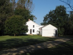 | Ephraim Smith House | 3.8 miles | 1980 |
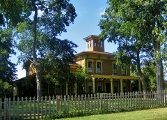 | Stearns-Wadsworth House | 4.2 miles | 1982 |
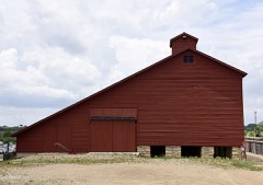 | Potter and Barker Grain Elevator | 6.1 miles | 2016 |
 | Gray-Watkins Mill | 6.2 miles | 1979 |
 | Sam and Ruth Van Sickle Ford House | 7.4 miles | |
 | Aurora College Complex | 7.8 miles | 1984 |
| National Archives record | The nomination case file for reference 100007994 in Record Group 79. |
| Kane County | All 86 listed properties in this county. |