 Block
Dover, Indiana
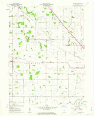
9 topographic sheets cover this place, the earliest surveyed in 1953 and the latest in 1984. It stands in Jefferson Township. It lies in ZIP code area 46071. The Survey maps it on the Hazelrigg quadrangle. It stands 899 feet above sea level.
Topographic sheets covering this place
5 surveys from 9 printed sheetsMatched by testing this settlement's coordinate against the published boundary of every sheet in the United States Geological Survey's historical collection. Each opens the scanned sheet at the Survey.
- 1953 USGS Danville quadrangle1:250000, 3 printings
- 1955 USGS Danville quadrangle1:250000
- 1956 USGS Danville quadrangle1:250000
- 1961 USGS Hazelrigg quadrangle1:24000, 2 printings
- 1984 USGS Lafayette quadrangle1:100000, 2 printings




In the county-history sources
6,889 words on this townshipEarly Life and Times in Boone County Indiana, published 1861 names this settlement in its chapter on Jefferson Township. These are the passages that mention it, exactly as the scans read.
This township occupies a place in the west tier of townships. It is bounded on the south by Jackson, on the west by Montgomery County, on the north by Sugar Creek and Washington Townships, and on the west by Center. A part of it was originally embraced in the Indianreserve. Jefferson contains about forty-six sections, two sections and a half out of the northeast corner makes that much less than forty-eight square sections. The township is drained by Wolf Creek and Walnut fork of Sugar Creek. The former flows ia a northwestern direction entering Sugar Oreek Township. The latter flows west, leaving the township at section thirty, entering Montgomery County near the town of Shannondale. Dover, near the center, is now and has been for years the voting place and trading point in Jefferson, The trade is, however, divided between Lebanon, Thorntown and Shannondale. To say the township as a rule is well cultivated would not be saying too much. Naturally of good soil, assisted by good husbandry, good crops are annually gathered, unless drouth or wet weather preventing.
Passage source: Early Life and Times in Boone County Indiana, published 1861.
Sampson Bowen, one of the pioneers of Jefferson, you will find one mile southeast of Dover, pleasantly located ; is a good talker, well posted on early life in Boone County. Mrs. B. is a sister of Dr. Burk, of Jamestown, and daughter of the late Samuel Burk, of this township. I was kindly cared for at their hospitable home.
Passage source: Early Life and Times in Boone County Indiana, published 1861.
Wash Irwin. just west, is living on the old homestead where his father lived many years, but now lives in Dover. The two old men, Mr. Farlow and Mr. Irwin, are highly respected in and about Dover.
Passage source: Early Life and Times in Boone County Indiana, published 1861.
Machine-read from a century-old scan, so expect the errors a machine makes: misspelled names, dropped words, stray characters.
Read the whole chapter on Jefferson Township - it names this place 2 more 2 times.
Storms near this place
4 since 2010Regional context, not property-specific evidence. The National Weather Service names Dover in 4 storm reports between 2010 and 2011: 2 thunderstorm wind, 1 heavy rain, 1 hail. No death or injury is recorded in these reports. Each account below is quoted exactly as the forecast office filed it, from the NOAA Storm Events Database, and each date opens the federal record of that event.
| When | Event | Place named | Harm | What the report says |
|---|---|---|---|---|
| October 2010 | Thunderstorm Wind | Dover | $15,000 | A grain bin was reported damaged at County Road 650 West and State Route 32 due to damaging thunderstorm wind gusts. |
| October 2010 | Thunderstorm Wind | Dover | $15,000 | State Route 32 was reported closed due to damaging thunderstorm wind gusts causing power lines to come down, debris in the road, and an overturned semi. Highway 52 is also blocked by a downed tree. |
| March 2011 | Hail | Dover | - | One inch hail was reported near County Roads 600 West and 200 North. |
| July 2010 | Heavy Rain | Dover | - | The observer measured 1.30 inches of rain that fell in approximately 30 minutes. |
Nearest settlements
The eight closest, with where each one stands in the county. Distances are straight-line, computed from the Geographic Names Information System coordinates.
| Map | Place | Distance | Sheets |
|---|---|---|---|
| Hazelrigg | 3.6 miles | 9 | |
| Max | 3.7 miles | 9 | |
| Advance | 4.0 miles | 13 | |
| Thorntown | 5.2 miles | 10 | |
| Hazel College | 5.8 miles | 9 | |
| Northfield Village | 7.6 miles | 11 | |
| Stringtown | 7.8 miles | 11 | |
| Lebanon | 8.0 miles | 11 |
Elsewhere
Matched on this settlement's Geographic Names Information System number rather than its name, so it cannot be a different place of the same name in another state.
| Wikipedia article on Dover | An encyclopaedic summary. Its text is share-alike, so it is linked here rather than copied. |
| Wikidata item Q54888716 | The structured record the population and elevation above come from. Public domain (CC0). |
Provenance
This settlement is recorded in the Geographic Names Information System as feature 433658. The sheet list is computed by point-in-boundary test against the United States Geological Survey's historical topographic inventory. Both are works of the United States government and carry no copyright under 17 U.S.C. 105.
Storms. NOAA National Centers for Environmental Information, Storm Events Database https://www.ncei.noaa.gov/stormevents/ A work of the United States government, no copyright under 17 U.S.C. 105. Narratives are quoted verbatim from the National Weather Service report and are not edited or summarised.