 Block
Argos, Indiana
11 topographic sheets cover this place, the earliest surveyed in 1953 and the latest in 1984. It stands in Walnut Township. It lies in ZIP code area 46501. It stands on Deep Creek. The Survey maps it on the Argos quadrangle. 1,777 people lived here at the 2020 count. It stands 728 feet above sea level.
On record in Argos
Buildings and businesses the archive holds for this place. Each opens its own page, with the source record it came from.
On the National Register 4 records
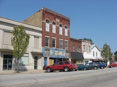 Argos Downtown Historic Districtlisted 2001
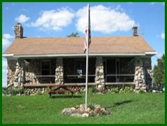 Argos Izaak Walton League Historic Districtlisted 2011
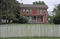 Lewis and Sarah Boggs Houselisted 2012
- Argos Northside Historic District,listed 2017
Population over time
2 figuresArgos grew from 1,691 to 1,777 between 2010 and 2020. These are the recorded population figures Wikidata holds for this place, reached through the Geographic Names Information System number this page is keyed on rather than by name, so they belong to this place and not to another of the same name. Most are census counts, but not all are: an early figure may be a founding or settlement estimate, and an estimate published within five years of a census is left out. The change column is computed, and is left blank where more than 20 years separate a figure from the one before it, because a gap that long is not a change between two counts.
| Year | People | Change |
|---|---|---|
| 2010 | 1,691 | |
| 2020 | 1,777 | +86 (+5%) |
Topographic sheets covering this place
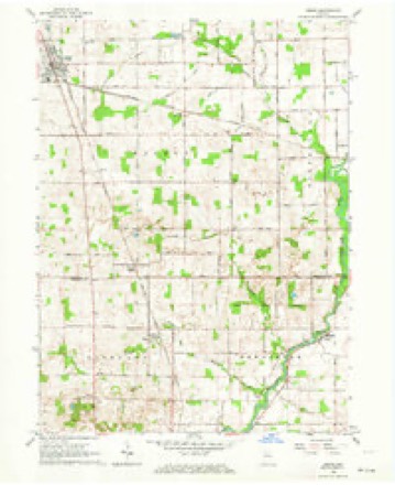
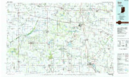
4 surveys from 11 printed sheetsMatched by testing this settlement's coordinate against the published boundary of every sheet in the United States Geological Survey's historical collection. Each opens the scanned sheet at the Survey.
- 1953 USGS Chicago quadrangle1:250000, 5 printings
- 1957 USGS Chicago quadrangle1:250000
- 1962 USGS Argos quadrangle1:24000, 3 printings
- 1984 USGS Knox quadrangle1:100000, 2 printings


Mines and quarries near this place
1 within 5 milesRegional context, not property-specific evidence. The federal mineral resources record lists 1 working within 5 miles of Argos: 1 producer. All of them still produce. What was taken out: Sand and Gravel, Construction. Distance is straight-line from the map coordinates, so a quarry counted here may appear on a neighbouring settlement's page as well.
| Where | Site | Commodity | Status | Recorded |
|---|---|---|---|---|
| White Pit | Sand and Gravel, Construction | Producer |
Storms near this place
18 since 1999Regional context, not property-specific evidence. The National Weather Service names Argos in 18 storm reports between 1999 and 2024: 13 thunderstorm wind, 4 hail, 1 tornado. No death or injury is recorded in these reports. Each account below is quoted exactly as the forecast office filed it, from the NOAA Storm Events Database, and each date opens the federal record of that event.
| When | Event | Place named | Harm | What the report says |
|---|---|---|---|---|
| August 2007 | Tornado (EF1) | Argos | $500,000 | The initial touchdown of the tornado was located a large grove of trees along Maple Rd. west of Argos and proceeded rapidly southeast to the southeast side of Argos. The tornado skipped along its track, snapping and uprooting numerous trees, downing power poles and lines and damaging some structures. Two businesses on the south side of Argos, near the intersection of US 31 and State Rd 10 suffered moderate damage. The roof of the Topp Industries plant suffered damage. A McDonalds/BP Station suffered metal siding and roofing damage along with the removal of a few gas pumps. A stationary police cruiser was spun by a combination of the strong winds and a sign post striking the car. Neither the officer, nor anyone else in the path of the tornado was injured. The tornado lifted southeast of this point. Exact damage figures were not available, but are estimated to be at least $500,000. |
| July 2007 | Thunderstorm Wind | Argos | $50,000 | A 150 year old barn was destroyed, as well as a 200 foot section of roof of adjacent work shop being ripped off. Trees were also reported down around Argos. Damage is estimated around $50,000. |
| August 2000 | Thunderstorm Wind | Argos | $10,000 | Large shed destroyed. |
| April 1999 | Thunderstorm Wind | Argos | $3,000 | Conservation officer reported to county sheriff that trees and power lines were down. |
| August 2022 | Thunderstorm Wind | Argos | $2,000 | A tree branch about 2 feet in diameter was snapped. |
| July 2024 | Thunderstorm Wind | Argos | $1,000 | Large limbs down on Kenilworth Rd in Argos. |
| June 2023 | Hail | Argos | $1,000 | no account filed |
| March 2022 | Thunderstorm Wind | Argos | - | A INDOT mesonet site northwest of Argos recorded a 62 mph wind gust. |
| June 2021 | Hail | Argos | - | Public report relayed by WNDU through Twitter. |
| May 2019 | Thunderstorm Wind | Argos | - | The public reported numerous trees down in the area. A large wooded playset was tossed several yards. |
| May 2019 | Thunderstorm Wind | Argos | - | The public reported a six to twelve inch diameter tree limb was blown down onto a home. |
| June 2017 | Thunderstorm Wind | Argos | - | Law enforcement officials reported a large tree was blown down. DOWN. |
| May 2015 | Thunderstorm Wind | Argos | - | The public reported a tree snapped at the base and fell onto a power line. |
| November 2013 | Thunderstorm Wind | Argos | - | Emergency management officials reported trees was blown down across Yearick and 1st Streets. |
| May 2007 | Thunderstorm Wind | Argos | - | Numerous trees, tree limbs, power lines and poles were reported down across the county, including Argos, Plymouth, and Bourbon. No reports of significant structure damage were received. |
| May 2005 | Thunderstorm Wind | Argos | - | Tree blown over. |
| June 2023 | Hail | Argos | - | no account filed |
| May 2000 | Hail | Argos | - | no account filed |
Nearest settlements
The eight closest, with where each one stands in the county. Distances are straight-line, computed from the Geographic Names Information System coordinates.
| Map | Place | Distance | Sheets |
|---|---|---|---|
| Walnut | 4.3 miles | 11 | |
| Old Tip Town | 5.4 miles | 11 | |
| Inwood | 5.5 miles | 11 | |
| Tippecanoe | 5.6 miles | 11 | |
| Bourbon | 6.6 miles | 12 | |
| Summit Chapel | 6.9 miles | 11 | |
| Rutland | 7.6 miles | 10 | |
| Twin Lakes | 8.8 miles | 11 |
Elsewhere
Matched on this settlement's Geographic Names Information System number rather than its name, so it cannot be a different place of the same name in another state.
| Wikipedia article on Argos | An encyclopaedic summary. Its text is share-alike, so it is linked here rather than copied. |
| Wikidata item Q649429 | The structured record the population and elevation above come from. Public domain (CC0). |
Provenance
This settlement is recorded in the Geographic Names Information System as feature 430243. The sheet list is computed by point-in-boundary test against the United States Geological Survey's historical topographic inventory. Both are works of the United States government and carry no copyright under 17 U.S.C. 105.
Mines and quarries. USGS Mineral Resources Data System (MRDS) https://mrdata.usgs.gov/mrds/ A work of the United States government, no copyright under 17 U.S.C. 105.
Storms. NOAA National Centers for Environmental Information, Storm Events Database https://www.ncei.noaa.gov/stormevents/ A work of the United States government, no copyright under 17 U.S.C. 105. Narratives are quoted verbatim from the National Weather Service report and are not edited or summarised.