 Block
Atwood, Indiana
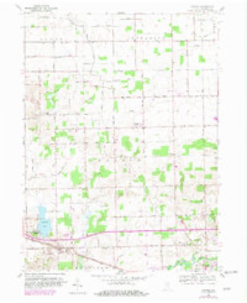
11 topographic sheets cover this place, the earliest surveyed in 1953 and the latest in 1994. It stands in Prairie Township. It lies in ZIP code area 46580. The Survey maps it on the Atwood quadrangle. It stands 823 feet above sea level.
Topographic sheets covering this place
5 surveys from 11 printed sheetsMatched by testing this settlement's coordinate against the published boundary of every sheet in the United States Geological Survey's historical collection. Each opens the scanned sheet at the Survey.
- 1953 USGS Fort Wayne quadrangle1:250000, 4 printings
- 1956 USGS Fort Wayne quadrangle1:250000, 2 printings
- 1959 USGS Atwood quadrangle1:24000, 3 printings
- 1984 USGS Fort Wayne quadrangle1:100000
- 1994 USGS Fort Wayne quadrangle1:100000




In the county-history sources
418 words on this townshipBiographical and Historical Reocrd of Kosciusko County, published 1887 names this settlement in its chapter on Prairie Township. These are the passages that mention it, exactly as the scans read.
1840, which was attached to the Leesburgh circuit. Tiiis denomination built tiie first liouse for public worship (a hewed log building), which was destroyed by tire a few months later. In 1843 a frame cluirch was erected on section 17. About the time the frame church was built, another eliurch of the Methodist faith was organized at the house of Elisha Dunnnck. They met for worship at his residence for a number of years, and in 1859 erected a frame church building on section 6, which was dedicated by Rev. J. Coldclazer the same year, and Rev. James Doiuihoe placed in charge of the congregation, which was then made a part of the Atwood charge. The church is known as Pleasant View Methodist Episcopal Church, and the Sunday-school that was organized with Elisha Dunnnck as superintendent, on the day the church was dedicated, has been uniformly prosperous to this date.
Passage source: Biographical and Historical Reocrd of Kosciusko County, published 1887.
Machine-read from a century-old scan, so expect the errors a machine makes: misspelled names, dropped words, stray characters.
Fires near this place
1 since 2003Regional context, not property-specific evidence. The federal wildfire occurrence database lists 1 fire within 5 miles of Atwood in 2003, burning about 1 acre in total. None started naturally. None was recorded as arson. Distance is straight-line from the map coordinates, so a fire counted here may appear on a neighbouring settlement's page as well.
| Reported cause | Fires |
|---|---|
| Equipment and vehicle use | 1 |
The most recent of them, most recent first, with the day each was reported and the service that recorded it.
| Date | Cause | Size | Reported by | Name on the report |
|---|---|---|---|---|
| 2 April 2003 | Equipment and vehicle use | 1.0 acres | Indiana State Fire Marshal's Office | not named |
Settlements close enough to share some of these fires:
Mines and quarries near this place
2 within 5 milesRegional context, not property-specific evidence. The federal mineral resources record lists 2 workings within 5 miles of Atwood: 1 producer, 1 past producer. 1 still produces. What was taken out: Sand and Gravel, Construction. Distance is straight-line from the map coordinates, so a quarry counted here may appear on a neighbouring settlement's page as well.
| Where | Site | Commodity | Status | Recorded |
|---|---|---|---|---|
| J & M Gravel Pit | Sand and Gravel, Construction | Producer | ||
| Pit | Sand and Gravel, Construction | Past Producer |
Storms near this place
14 since 1995Regional context, not property-specific evidence. The National Weather Service names Atwood in 14 storm reports between 1995 and 2025: 10 thunderstorm wind, 1 hail, 1 tornado, 1 lightning. No death or injury is recorded in these reports. Each account below is quoted exactly as the forecast office filed it, from the NOAA Storm Events Database, and each date opens the federal record of that event.
| When | Event | Place named | Harm | What the report says |
|---|---|---|---|---|
| July 2009 | Lightning | Atwood | $20,000 | Lightning struck a tree adjacent to a mobile home in the West Haven Estates, traveled along a tree root and blew a hole in the floor of the home. A woman in the trailer heard a loud band and then observed her couch on fire. She, another adult and 2 children were able to escape unharmed. Damage was estimated at around $20,000. |
| June 2025 | Thunderstorm Wind | Atwood | $10,000 | Multiple reports of trees down across Kosciusko County. Locations include Warsaw, Leesburg, Winona Lake and Atwood. |
| June 1995 | Thunderstorm Wind | Atwood | $5,000 | A chicken house in Atwood was destroyed. At Warsaw, winds of 60 to 70 mph forced a car off the road. |
| July 2022 | Thunderstorm Wind | Atwood | $1,000 | Tree branches of 1 to 3 inches in diameter were snapped along US 30. |
| August 2019 | Thunderstorm Wind | Atwood | - | Large tree limb from a pine tree was blown down. |
| July 2017 | Thunderstorm Wind | Atwood | - | The public reported a tree was blown down. |
| July 2017 | Thunderstorm Wind | Atwood | - | The public reported a six inch and eight inch diameter tree branch down onto a fence, breaking it. |
| July 2017 | Thunderstorm Wind | Atwood | - | The public reported three large, healthy trees, roughly two to three feet in diameter, uprooted at a residence. A few smaller trees and tree limbs were also blown down in the area. |
| September 2014 | Thunderstorm Wind | Atwood | - | Local officials reported trees were blown down onto Old U.S. 30 between County Roads 750 and 800 West. |
| June 2013 | Thunderstorm Wind | Atwood | - | The public reported two trees were blown down onto a road near the Atwood Fire Station. |
| August 2009 | Flash Flood | Atwood | - | Numerous roads were flooded for several hours as five to as much as ten inches of rain fell across the northern part of the county. The hardest hit areas were from Lake Tippecanoe west to Leesburg and then north into Milford, where reports of seven to ten inches of rain were received. Low spots in these areas had water several feet deep, with water reported to have been flowing over some roads, including portions of State Route 15, between Leesburg and Warsaw. Many of the roads in Leesburg were reported to have water with several vehicles being stranded for a short time. Vehicles were also stranded in portions of Warsaw. The highest rainfall amount was reported by a CoCoRaHS observer southeast of Milford, where 9.90 inches of rain was recorded. |
| July 2005 | Thunderstorm Wind | Atwood | - | While performing a survey on a possible tornado in the area, NWS personnel observed a few large trees damaged or uprooted as well as some corn stalks down on the south side of Hoffman Lake. Winds were estimated in the 60 to 65 mph range. |
| July 2005 | Tornado (F0) | Atwood | - | A trained spotter in the area observed several funnel clouds, one of which briefly touched down in an open field and dissipated. No damage could be found by the survey team associated with the touchdown. |
| May 2000 | Hail | Atwood | - | no account filed |
Nearest settlements
The eight closest, with where each one stands in the county. Distances are straight-line, computed from the Geographic Names Information System coordinates.
| Map | Place | Distance | Sheets |
|---|---|---|---|
| Hoffman Lake | 1.0 miles | 11 | |
| Etna Green | 4.0 miles | 12 | |
| Clunette | 4.9 miles | 11 | |
| Palestine | 5.9 miles | 11 | |
| Monoquet | 6.3 miles | 13 | |
| Warsaw | 6.7 miles | 12 | |
| Lakeside Park | 6.7 miles | 13 | |
| Mentone | 6.8 miles | 11 |
Elsewhere
Matched on this settlement's Geographic Names Information System number rather than its name, so it cannot be a different place of the same name in another state.
| Wikipedia article on Atwood | An encyclopaedic summary. Its text is share-alike, so it is linked here rather than copied. |
| Wikidata item Q4818861 | The structured record the population and elevation above come from. Public domain (CC0). |
Provenance
This settlement is recorded in the Geographic Names Information System as feature 430332. The sheet list is computed by point-in-boundary test against the United States Geological Survey's historical topographic inventory. Both are works of the United States government and carry no copyright under 17 U.S.C. 105.
Wildfire. Short, Karen C. 2022. Spatial wildfire occurrence data for the United States, 1992-2020 [FPA_FOD_20221014]. 6th Edition. Fort Collins, CO: Forest Service Research Data Archive. https://doi.org/10.2737/RDS-2013-0009.6 Collected with United States Government funding and usable without additional permissions or fees.
Mines and quarries. USGS Mineral Resources Data System (MRDS) https://mrdata.usgs.gov/mrds/ A work of the United States government, no copyright under 17 U.S.C. 105.
Storms. NOAA National Centers for Environmental Information, Storm Events Database https://www.ncei.noaa.gov/stormevents/ A work of the United States government, no copyright under 17 U.S.C. 105. Narratives are quoted verbatim from the National Weather Service report and are not edited or summarised.