 Block
Etna Green, Indiana
12 topographic sheets cover this place, the earliest surveyed in 1953 and the latest in 1984. It stands in Etna Township. It lies in ZIP code area 46524. The Survey maps it on the Bourbon quadrangle. 570 people lived here at the 2020 count. It stands 817 feet above sea level.
Population over time
2 figuresEtna Green fell from 586 to 570 between 2010 and 2020. These are the recorded population figures Wikidata holds for this place, reached through the Geographic Names Information System number this page is keyed on rather than by name, so they belong to this place and not to another of the same name. Most are census counts, but not all are: an early figure may be a founding or settlement estimate, and an estimate published within five years of a census is left out. The change column is computed, and is left blank where more than 20 years separate a figure from the one before it, because a gap that long is not a change between two counts.
| Year | People | Change |
|---|---|---|
| 2010 | 586 | |
| 2020 | 570 | -16 (-3%) |
Topographic sheets covering this place
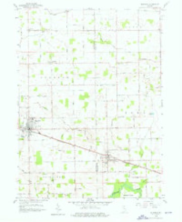
4 surveys from 12 printed sheetsMatched by testing this settlement's coordinate against the published boundary of every sheet in the United States Geological Survey's historical collection. Each opens the scanned sheet at the Survey.
- 1953 USGS Chicago quadrangle1:250000, 5 printings
- 1957 USGS Chicago quadrangle1:250000
- 1958 USGS Bourbon quadrangle1:24000, 4 printings
- 1984 USGS Knox quadrangle1:100000, 2 printings


In the county-history sources
523 words on this townshipBiographical and Historical Reocrd of Kosciusko County, published 1887 names this settlement in its chapter on Etna Township. These are the passages that mention it, exactly as the scans read.
Etna Township is bounded on the north by Scott, east by Prairie and Harrison townships, soutli by the Tippecanoe River, and west by Marsliall County. The settlement was not so early in this as in some other tow-nships, the first locations being made by Solomon Klingerman, Charles Rockbill and Itobei't Reed in 1843. The same year the Bowmans, Abraham and William, settled near the first, all near where the village of Etna Green is located. From 1850 until the war began Etna Township rapidly improved, and a large settlement was made. It is now a productive region, and the farmers are prosperous. The first tow'nship election was held in Etna Green in 1853; Joel Letfel was elected Justice of the Peace, and Samuel B. Gay, Constable.
Passage source: Biographical and Historical Reocrd of Kosciusko County, published 1887.
David Carr built a mill in 1852 at this place, the first in the township. A school was established in 1854, and Miss Stallaid was the teacher. Etna Green now has a good school building with 156 pupils in attendance. Professor Joseph M. Gaskill, Principal; Miss Kitt Ruscher, Intermediate, and Miss Blanch Lutes in charge of the Primary Department. J. F. Andrews, M. J. Hamlin and A. C. Jordan are school trustees.
Passage source: Biographical and Historical Reocrd of Kosciusko County, published 1887.
Machine-read from a century-old scan, so expect the errors a machine makes: misspelled names, dropped words, stray characters.
Read the whole chapter on Etna Township - it names this place 1 more 1 time.
Mines and quarries near this place
2 within 5 milesRegional context, not property-specific evidence. The federal mineral resources record lists 2 workings within 5 miles of Etna Green: 1 producer, 1 past producer. 1 still produces. What was taken out: Sand and Gravel, Construction. Distance is straight-line from the map coordinates, so a quarry counted here may appear on a neighbouring settlement's page as well.
| Where | Site | Commodity | Status | Recorded |
|---|---|---|---|---|
| J & M Gravel Pit | Sand and Gravel, Construction | Producer | ||
| Pit | Sand and Gravel, Construction | Past Producer |
Storms near this place
12 since 1998Regional context, not property-specific evidence. The National Weather Service names Etna Green in 12 storm reports between 1998 and 2025: 7 thunderstorm wind, 2 tornado, 2 hail, 1 flash flood. The reports record 5 injuries. Each account below is quoted exactly as the forecast office filed it, from the NOAA Storm Events Database, and each date opens the federal record of that event.
| When | Event | Place named | Harm | What the report says |
|---|---|---|---|---|
| June 1998 | Tornado (F1) | Etna Green | 4 hurt, $800,000 | THIS WAS ANOTHER TORNADO SPAWNED FROM THE SAME TORNADIC SUPERCELL THAT CAUSED DAMAGE IN PULASKI COUNTY EARLIER IN THE EVENING. 30 MOBILE HOMES AT THE MIKEL MOBILE ESTATES WERE DAMAGED, MANY SEVERELY. SOME WERE SIMPLY OVERTURNED WHILE OTHERS WERE COMPLETELY FLATTENED. 4 PEOPLE SUSTAINED MINOR INJURIES. |
| November 2016 | Thunderstorm Wind | Etna Green | 1 hurt | Emergency management officials reported a tree was blown down onto a vehicle. One occupant was injured. |
| July 1999 | Thunderstorm Wind | Etna Green | $25,000 | Power lines were downed from Etna Green to Atwood. |
| March 2025 | Thunderstorm Wind | Etna Green | $15,000 | Metal hog barn roof torn off and thrown throughout two fields. |
| April 2025 | Tornado (EF1) | Etna Green | $10,000 | A survey of damage revealed a tornado touched down southeast of Rutland on SR-10 and tracked quickly northeast. The tornado moved over numerous empty fields but also impacted several wooded areas as well as snapped or uprooted trees on private property. The tornado entered Bourbon and reached peak intensity on the northeast side of town in the area of Crocus Ct and Rose Lane where several homes suffered extensive roof damage. Debris was thrown into the field. Many homes showed garage doors being compromised, lowering potentially higher wind speeds. The tornado continued out of town, producing sporadic tree and power pole damage until reaching north of Etna Green in Kosciusko county where the damage ended. |
| April 1999 | Thunderstorm Wind | Etna Green | $5,000 | Sheiff and amateur radio operator reported several trees blown down and a roof blown off of a repair shop. |
| July 2018 | Thunderstorm Wind | Etna Green | - | Emergency management officials reported tree limbs were blown down along with damage to a grain bin and barn. Corn in a nearby field was also flattened. No indications of a circulation were noted, with damage most likely from an intense microburst around 70 mph. |
| July 2017 | Thunderstorm Wind | Etna Green | - | A trained spotter reported large tree limbs down, ranging from eight to twelve inches in diameter, near the intersection of Indiana 19 and County Road 800 North. |
| July 2017 | Flash Flood | Etna Green | - | Training thunderstorms over much of southwestern Kosciusko county dropped between 4 and 6 inches of rain in the span of a few hours, causing widespread flooding and areas of flash flooding. At least a dozen roads were closed at one point due to water flowing over them. South Bruner Street, just northeast of Palestine, was washed away over Magee Robbins Ditch when the water flow exceeded the drainage pipe limits. This resulted in residents on the other side being stranded for several hours until the water receded and temporary repairs could be made. |
| May 2000 | Thunderstorm Wind | Etna Green | - | Few trees down on power lines. |
| September 2014 | Hail | Etna Green | - | no account filed |
| September 2014 | Hail | Etna Green | - | no account filed |
Nearest settlements
The eight closest, with where each one stands in the county. Distances are straight-line, computed from the Geographic Names Information System coordinates.
Elsewhere
Matched on this settlement's Geographic Names Information System number rather than its name, so it cannot be a different place of the same name in another state.
| Wikipedia article on Etna Green | An encyclopaedic summary. Its text is share-alike, so it is linked here rather than copied. |
| Wikidata item Q2040945 | The structured record the population and elevation above come from. Public domain (CC0). |
Provenance
This settlement is recorded in the Geographic Names Information System as feature 452111. The sheet list is computed by point-in-boundary test against the United States Geological Survey's historical topographic inventory. Both are works of the United States government and carry no copyright under 17 U.S.C. 105.
Mines and quarries. USGS Mineral Resources Data System (MRDS) https://mrdata.usgs.gov/mrds/ A work of the United States government, no copyright under 17 U.S.C. 105.
Storms. NOAA National Centers for Environmental Information, Storm Events Database https://www.ncei.noaa.gov/stormevents/ A work of the United States government, no copyright under 17 U.S.C. 105. Narratives are quoted verbatim from the National Weather Service report and are not edited or summarised.