 Block
Becks Mill, Indiana
12 topographic sheets cover this place, the earliest surveyed in 1950 and the latest in 1990. It stands in Howard Township. It lies in ZIP code area 47167. It stands on Mill Creek. The Survey maps it on the Becks Mill quadrangle.
On record in Becks Mill
Buildings and businesses the archive holds for this place. Each opens its own page, with the source record it came from.
On the National Register within a mile 2 records
The National Register names another town for these. They stand within one mile of this settlement's coordinate.
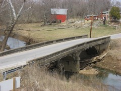 Beck's Mill Bridgelisted 2007 · 0.1 miles away
- Beck's Milllisted 1990 · 0.2 miles away
Topographic sheets covering this place
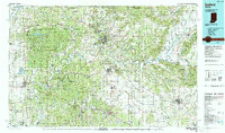
7 surveys from 12 printed sheetsMatched by testing this settlement's coordinate against the published boundary of every sheet in the United States Geological Survey's historical collection. Each opens the scanned sheet at the Survey.
- 1950 USGS Becks Mill quadrangle1:24000
- 1956 USGS Vincennes quadrangle1:250000, 4 printings
- 1957 USGS Vincennes quadrangle1:250000
- 1958 USGS Vincennes quadrangle1:250000, 2 printings
- 1966 USGS Becks Mill quadrangle1:24000, 2 printings
- 1986 USGS Bedford quadrangle1:100000
- 1990 USGS Bedford quadrangle1:100000



What happened here
An account from the chapter on Howard township. The inset identifies its exact source book and publication year.
Educational Report 69
"John Beck commanded a company of rangers at the battle of Tippecanoe, in November, 1811. Upon the return of the men a volley was fired at Beck's Hill. This volley was heard a long distance and gave rise to the report that the settlers there had been attacked by the Indians. About that time a fire, which had been started in the woods, threw up large volumes of smoke, and the report also went out that the Indians were burning the cabins and murdering the settlers.
In the county-history sources
9,695 words on this townshipFirst Educational Report, Washington County, Indiana : Containing Photographic Illustrations, Superintendents', Principals', Teachers', and Citizens' Reports of the Educational Work in the County, published 1915; Centennial History of Washington County, Indiana : Its People, Industies and Institutions : with Biographical Sketches of Representative Citizens and Genealogical Records of Many of the Old Families, published 1916 has no passage naming this settlement, which was common for smaller places. Its township is covered in full.
The chapter on Howard Township covers the township.
Read the chapter on Howard Township - 9,695 words.
Mines and quarries near this place
2 within 5 milesRegional context, not property-specific evidence. The federal mineral resources record lists 2 workings within 5 miles of Becks Mill: 2 producers. All of them still produce. What was taken out: Stone, Crushed/Broken. Distance is straight-line from the map coordinates, so a quarry counted here may appear on a neighbouring settlement's page as well.
| Where | Site | Commodity | Status | Recorded |
|---|---|---|---|---|
| Hoosier Stone Company Salem | Stone, Crushed/Broken | Producer | ||
| Owsley Quarry | Stone, Crushed/Broken | Producer |
Storms near this place
5 since 2003Regional context, not property-specific evidence. The National Weather Service names Becks Mill in 5 storm reports between 2003 and 2022: 2 thunderstorm wind, 2 tornado, 1 hail. No death or injury is recorded in these reports. Each account below is quoted exactly as the forecast office filed it, from the NOAA Storm Events Database, and each date opens the federal record of that event.
| When | Event | Place named | Harm | What the report says |
|---|---|---|---|---|
| January 2008 | Thunderstorm Wind | Becks Mill | $120,000 | A squall line produced a swath of wind damage as it crossed Washington County. Straight line winds destroyed a barn on South Church Road and another on Fairview Road. |
| January 2008 | Tornado (EF1) | Becks Mill | $60,000 | As a squall line crossed Washington County, a small tornado touched down intermittently within the down burst area. The most intense damage occurred near the intersection of Skylight and Cauble Roads, where several hardwood trees were snapped off, numerous trees were uprooted in different directions, a farm outbuilding was collapsed, and metal sheeting from a well-constructed barn was thrown 200 yards into the trees downwind.||On Cindy Lane near Springhouse Road, a large storage shed was shifted 40 degrees and a well-constructed home had significant loss of roofing. |
| March 2022 | Tornado (EF1) | Becks Mill | - | The tornado was observed touching down by two eyewitnesses near West Wilson Lane and Dog Trot Road at 8:06 PM EDT. Multiple hardwood trees were uprooted and a house suffered significant roof damage on West Wilson Lane. A barn suffered significant roof damage and two other outbuildings had minor damage. On the same property, a carport was lifted and thrown several hundred feet downstream. Debris from this property was also found on a farm approximately half a mile to the east.||The most intense damage occurred near the intersection of Mill Creek Road and Fort Hill Road. A well-constructed brick home had only minor damage to siding, shingles, and porch columns, but multiple trees were uprooted both northwest and northeast of the house. Just down the hill to the northeast, dozens of trees were uprooted or snapped, all laying nearly due north at an angle to the tornado`s northeastward motion. Maximum wind speeds at this point were estimated at 105 mph (EF-1), and the maximum path width at 200 yards.||The tornado continued northeast across open fields and then uprooted or snapped several trees, and caused minor shingle damage to two homes along Woodland Drive in the Naugle Addition subdivision. Two large hardwood trees were uprooted and other large branches were downed as the tornado continued northeast across Orchard Road.||As the tornado moved into the city of Salem a large tree was uprooted and another tree lost a large branch at Crown Hill Cemetery. The tornado continued into the Public Square, where it caused roof and exterior damage to two businesses located to the northwest of the Court House. The tornado lifted at 8:14 PM EDT just to the north of the square.||No fatalities or injuries were reported as a result of the tornado. All the residents our survey team spoke with had received the Tornado Warnings via some combination of Wireless Emergency Alerts, local TV broadcasts, or NOAA Weather Radio, and quickly sought shelter. Most of them took shelter in basements. Of those without a basement, one family took shelter in an interior bathroom, while another resident sought shelter with a neighbor whose house has a basement. |
| June 2019 | Thunderstorm Wind | Becks Mill | - | A tree blew down on Borden Road. |
| May 2003 | Hail | Becks Mill | - | no account filed |
Nearest settlements
The eight closest, with where each one stands in the county. Distances are straight-line, computed from the Geographic Names Information System coordinates.
| Map | Place | Distance | Sheets |
|---|---|---|---|
| Rosebud | 3.0 miles | 12 | |
| Shorts Corner | 3.8 miles | 14 | |
| Organ Springs | 4.1 miles | 14 | |
| McCol Place | 5.5 miles | 15 | |
| Salem | 5.6 miles | 15 | |
| Fair Acres | 5.9 miles | 15 | |
| Martin Heights | 5.9 miles | 15 | |
| Livonia | 6.6 miles | 11 |
Provenance
This settlement is recorded in the Geographic Names Information System as feature 449618. The sheet list is computed by point-in-boundary test against the United States Geological Survey's historical topographic inventory. Both are works of the United States government and carry no copyright under 17 U.S.C. 105.
Mines and quarries. USGS Mineral Resources Data System (MRDS) https://mrdata.usgs.gov/mrds/ A work of the United States government, no copyright under 17 U.S.C. 105.
Storms. NOAA National Centers for Environmental Information, Storm Events Database https://www.ncei.noaa.gov/stormevents/ A work of the United States government, no copyright under 17 U.S.C. 105. Narratives are quoted verbatim from the National Weather Service report and are not edited or summarised.