 Block
Livonia, Indiana
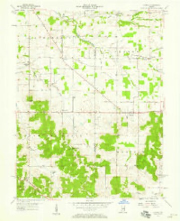
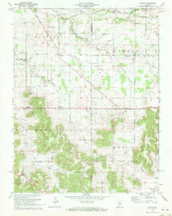
11 topographic sheets cover this place, the earliest surveyed in 1956 and the latest in 1990. It stands in Madison Township. It lies in ZIP code area 47108. It lies near Sand Bank Hill. The Survey maps it on the Livonia quadrangle.
Topographic sheets covering this place
7 surveys from 11 printed sheetsMatched by testing this settlement's coordinate against the published boundary of every sheet in the United States Geological Survey's historical collection. Each opens the scanned sheet at the Survey.
- 1956 USGS Vincennes quadrangle1:250000, 4 printings
- 1957 USGS Livonia quadrangle1:24000
- 1957 USGS Vincennes quadrangle1:250000
- 1958 USGS Vincennes quadrangle1:250000, 2 printings
- 1970 USGS Livonia quadrangle1:24000
- 1986 USGS Bedford quadrangle1:100000
- 1990 USGS Bedford quadrangle1:100000



In the county-history sources
2,761 words on this townshipCentennial History of Washington County, Indiana : Its People, Industies and Institutions : with Biographical Sketches of Representative Citizens and Genealogical Records of Many of the Old Families, published 1916 names this settlement in its chapter on Madison Township. These are the passages that mention it, exactly as the scans read.
Livonia is situated very near the Orange county boundary, twenty miles east of the famous French Lick and West Baden springs, the world-famous resort. It has many old buildings and these show a most wonderful building skill of the carpenters at the period they were erected. The farming land around this village is of the best and is noted all over southern Indiana. The principal field crops are corn, oats, wheat, barley, rye, cow peas, and alfalfa has been introduced with much success by quite a number of the farmers. Also gardening has Ijeen carried on successfully with a numljer who have a limited number of acres of land, and the only thing that prevents this occupation from becoming more extended is the great distance to the city market. As to fruits, many farmers are fast setting out a great variety of the best \arieties of trees and in a few years what is now the poorest land on the farm will l:>e a large-paying investment.
Passage source: Centennial History of Washington County, Indiana : Its People, Industies and Institutions : with Biographical Sketches of Representative Citizens and Genealogical Records of Many of the Old Families, published 1916.
In Madison township, in the long ago, Livonia was noted for its educational facilities. The early emigrants were mostly from the East where they had enjoyed the very best educational advantages. They realized what a good education meant and spared no available means to spread information among their children. Livonia possessed a classical school almost planted the seeds of one which brought forth fruit, and ni today a well-read people.
Passage source: Centennial History of Washington County, Indiana : Its People, Industies and Institutions : with Biographical Sketches of Representative Citizens and Genealogical Records of Many of the Old Families, published 1916.
In the year 1874 Geurge S. Trabue was in his eighty-first year and one of the few remaining old settlers in Madison township. His story of the early settlement of that part of the county was as follows: "I was born in Virginia in 1793. My father emigrated to Kentucky in 1804. Fortunately we always resitled in neighborhoods where there were schools and from the time I was seven years old until I was seventeen was sent to school every winter. I began teaching at seventeen in Kentucky and having laid by enough money to enter a little farm, came across to Indiana and entered a quarter section in 1816. I made up a school the same fall and taught where Livonia is now located. I boarded with Col. James McKinney, who kept a little store near 1)\-. The next summer I found em]>loyment in a store owned by .\. Rulston, a Scotchman, who owned what was afterwards known as ".Scotland Farm,"' the home of Gen. James A. Cravens. This was the east half of section 34. In the winter of 1818 I went back to Kentucky, returning the following spring. I built a primitive c;ibin on the land I had entered and continued for a few _\e,-irs tn teach school in winter and farm in ''Unmier.
Passage source: Centennial History of Washington County, Indiana : Its People, Industies and Institutions : with Biographical Sketches of Representative Citizens and Genealogical Records of Many of the Old Families, published 1916.
Machine-read from a century-old scan, so expect the errors a machine makes: misspelled names, dropped words, stray characters.
Read the whole chapter on Madison Township - it names this place 5 more 5 times.
Fires near this place
3 since 2004Regional context, not property-specific evidence. The federal wildfire occurrence database lists 3 fires within 5 miles of Livonia between 2004 and 2014, burning about 13 acres in total. None started naturally. None was recorded as arson. Distance is straight-line from the map coordinates, so a fire counted here may appear on a neighbouring settlement's page as well.
| Reported cause | Fires |
|---|---|
| Debris and open burning | 2 |
| Smoking | 1 |
The most recent of them, most recent first, with the day each was reported and the service that recorded it.
| Date | Cause | Size | Reported by | Name on the report |
|---|---|---|---|---|
| 21 March 2014 | Debris and open burning | 11 acres | Hoosier National Forest | STAMPER |
| 28 February 2004 | Debris and open burning | 1.5 acres | Hoosier National Forest | BROMMER |
| 12 November 2005 | Smoking | 1.0 acres | Hoosier National Forest | MILLERSBURG |
Settlements close enough to share some of these fires:
Mines and quarries near this place
1 within 5 milesRegional context, not property-specific evidence. The federal mineral resources record lists 1 working within 5 miles of Livonia: 1 producer. All of them still produce. What was taken out: Stone, Crushed/Broken. Distance is straight-line from the map coordinates, so a quarry counted here may appear on a neighbouring settlement's page as well.
| Where | Site | Commodity | Status | Recorded |
|---|---|---|---|---|
| Owsley Quarry | Stone, Crushed/Broken | Producer |
Storms near this place
7 since 2005Regional context, not property-specific evidence. The National Weather Service names Livonia in 7 storm reports between 2005 and 2024: 3 hail, 3 tornado, 1 thunderstorm wind. No death or injury is recorded in these reports. Each account below is quoted exactly as the forecast office filed it, from the NOAA Storm Events Database, and each date opens the federal record of that event.
| When | Event | Place named | Harm | What the report says |
|---|---|---|---|---|
| November 2017 | Tornado (EF0) | Livonia | $100,000 | The National Weather Service in conjunction with Washington County|Emergency Management Agency conducted a storm survey in central|Washington County and determined there were three distinct|touchdowns near and around the Salem, Indiana area Sunday evening|November 5. The first touchdown occurred approximately 5 miles west|of Salem on SW Washington School Rd. The touchdown occurred along a|forested area which threw branches and large portions of maple and|cedar trees over the road approximately 300 yards. The most|concentrated damage was at 1630 SW Washington School Rd. There was|an uprooted tree, along with shingle, gutter, roof and barn damage.|Several toys and pumpkins were turned and thrown cyclonically|towards the west. A trampoline was thrown approximately a mile from|the house along with lots of playground toys being thrown several|hundred yards. There were some trees down further along the|farmer's field, but the tornado lifted after traveling approximately|0.6 miles where a few trees were topped where it lifted. The peak|wind speed was estimated at 80 mph and most of the damage was at the tree top|level. |
| July 2024 | Hail | Livonia | - | Nickel sized hail reported near Livonia. |
| August 2023 | Thunderstorm Wind | Livonia | - | There was roof and tree damage in Livonia. |
| June 2019 | Hail | Livonia | - | One and three quarters inch hail fell. |
| April 2011 | Tornado (EF1) | Livonia | - | An NWS storm survey confirmed an EF-1 tornado with wind speeds up to 100 mph. The tornado touched down at the intersection of West Batts Rd. and John Batt Road, where a grain bin was destroyed and several trees were blown over. Just southwest of the Mount Tabor Road/West Washington Road intersection the twister destroyed two silos and a 20ft x 30ft outbuilding. A single story house also suffered severe damage at that location. At the end of the damage path a house had its roof partially torn off and gravel from the driveway was lifted and pelted into the side of the house. |
| April 2011 | Tornado (EF0) | Livonia | - | An NWS storm survey confirmed an EF-0 tornado with winds up to 75 mph. This tornado traveled from the intersection of West Washington Road and Batt Road to just north of Mount Tabor Road. Along its path a silo and two barns were damaged. Several trees were knocked down or snapped. |
| April 2005 | Hail | Livonia | - | no account filed |
Nearest settlements
The eight closest, with where each one stands in the county. Distances are straight-line, computed from the Geographic Names Information System coordinates.
| Map | Place | Distance | Sheets |
|---|---|---|---|
| Rosebud | 4.0 miles | 12 | |
| Claysville | 4.6 miles | 11 | |
| Smedley | 6.2 miles | 15 | |
| Campbellsburg | 6.6 miles | 13 | |
| Hardinsburg | 6.6 miles | 15 | |
| Becks Mill | 6.6 miles | 12 | |
| Fayetteville | 7.3 miles | 15 | |
| Saltillo | 7.5 miles | 13 |
Provenance
This settlement is recorded in the Geographic Names Information System as feature 451166. The sheet list is computed by point-in-boundary test against the United States Geological Survey's historical topographic inventory. Both are works of the United States government and carry no copyright under 17 U.S.C. 105.
Wildfire. Short, Karen C. 2022. Spatial wildfire occurrence data for the United States, 1992-2020 [FPA_FOD_20221014]. 6th Edition. Fort Collins, CO: Forest Service Research Data Archive. https://doi.org/10.2737/RDS-2013-0009.6 Collected with United States Government funding and usable without additional permissions or fees.
Mines and quarries. USGS Mineral Resources Data System (MRDS) https://mrdata.usgs.gov/mrds/ A work of the United States government, no copyright under 17 U.S.C. 105.
Storms. NOAA National Centers for Environmental Information, Storm Events Database https://www.ncei.noaa.gov/stormevents/ A work of the United States government, no copyright under 17 U.S.C. 105. Narratives are quoted verbatim from the National Weather Service report and are not edited or summarised.