 Block
Big Springs, Indiana
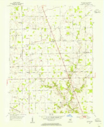
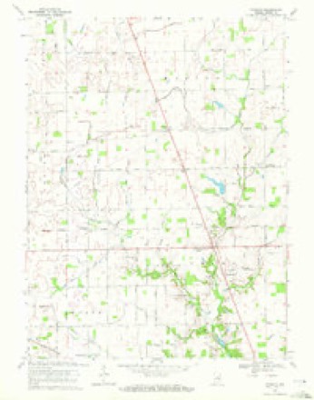
11 topographic sheets cover this place, the earliest surveyed in 1953 and the latest in 1984. It stands in Zionsville town. It lies in ZIP code area 46069. The Survey maps it on the Rosston quadrangle. It stands 922 feet above sea level.
Topographic sheets covering this place
6 surveys from 11 printed sheetsMatched by testing this settlement's coordinate against the published boundary of every sheet in the United States Geological Survey's historical collection. Each opens the scanned sheet at the Survey.
- 1953 USGS Danville quadrangle1:250000, 3 printings
- 1953 USGS Rosston quadrangle1:24000, 2 printings
- 1955 USGS Danville quadrangle1:250000
- 1956 USGS Danville quadrangle1:250000
- 1969 USGS Rosston quadrangle1:24000, 2 printings
- 1984 USGS Lafayette quadrangle1:100000, 2 printings




In the county-history sources
37,254 words on this townshipEarly Life and Times in Boone County Indiana, published 1861 names this settlement in its chapter on Zionsville Town. These are the passages that mention it, exactly as the scans read.
As carly as 1720 the French traders had established a trading post at Thorntown, being one of the system of posts extending from the valley of the St. Lawrence to that of the Lower Mississippi. In 1800, it is said, the town included thirty-six trading houses or stores, and was the home of a branch. of the Miami Indians. The white population up to this time seems to have included only males, and no attempt was made toestablish society or to found schools and churches.
Passage source: Early Life and Times in Boone County Indiana, published 1861.
Beclar, in Eagle Township, and about the same time a log school house was built in the new town of Thorntown, and Jefferson Hillis was engaged as teacher at the latter point. These two were the first houses erected, built especially for school purposes, within the county. The same year the first school in Washington Township was taught by Daniel Ellis, in a deserted settler's cabin, on the south bank of Sugar Creek just a few rods south of the subsequent site of the Chase or Ben Crose mill. In this same winter of 1832, the first school in Marion Township was taught in a eabin on the farm of John Pan, just north of Big Springs. It was not till 1836 that the first public schoo] house was built in Marion Township, being situated upon the farm of John Wright, not far from the present site of School No. 2. Within these years, from 1832 to 1837, private schools were carried on in all the new settlements. In Jefferson and Union townships as early as 1833, and in the southwest part of Jackson Township in 1835, schools had been established, and rudimentary instruction was given pupils who came through the tangled forests and swampy by-ways to gain what knowledge was then opened to them. Allof the schools in the county were at this time carried on by subscription on the settlers who, from their seanty means cheerfully gave, and, each in turn, boarded the teacher for the sake of giving their children a measure of preparation for the wider range of duties to devolve upon them with the development of the country. In 18385 the first school in Clinton Township had been established in a deserted cabin in the Mud Creek settlement, northwest of Elizaville, with J. H. Sample as teacher. The following year witnessed the first school in Perry Township, being in a cabin in the northwestern part of the township. In the year 1837 the first school in Worth Township, and probably the first free school in the county, was taught in a cabin on the farm of James McCord, the teacher being Henry Lucas, and the teacher being paid by the county. In the autumn of this same year a subscription school of two or three months' duration was taught by Pleasant Crawford in Harrison Town- ship. This was the first school taught in that township. From this time on the growth of the schools in the county kept pace with that of the population. In 1824 the legislature had enacted a law to establish school houses, of which two provisions were as follows:
Passage source: Early Life and Times in Boone County Indiana, published 1861.
Machine-read from a century-old scan, so expect the errors a machine makes: misspelled names, dropped words, stray characters.
Mines and quarries near this place
1 within 5 milesRegional context, not property-specific evidence. The federal mineral resources record lists 1 working within 5 miles of Big Springs: 1 past producer. None of them still produces. What was taken out: Sand and Gravel, Construction. Distance is straight-line from the map coordinates, so a quarry counted here may appear on a neighbouring settlement's page as well.
| Where | Site | Commodity | Status | Recorded |
|---|---|---|---|---|
| Routh Sand and Gravel Pit | Sand and Gravel, Construction | Past Producer |
Nearest settlements
The eight closest, with where each one stands in the county. Distances are straight-line, computed from the Geographic Names Information System coordinates.
| Map | Place | Distance | Sheets |
|---|---|---|---|
| Rosston | 2.1 miles | 11 | |
| Waugh | 2.6 miles | 11 | |
| Northfield | 2.9 miles | 11 | |
| Gadsden | 4.8 miles | 11 | |
| Allens Acres | 5.8 miles | 18 | |
| Hamilton (historical) | 6.6 miles | 18 | |
| Terhune | 6.6 miles | 9 | |
| Whitestown | 6.8 miles | 18 |
Elsewhere
Matched on this settlement's Geographic Names Information System number rather than its name, so it cannot be a different place of the same name in another state.
| Wikipedia article on Big Springs | An encyclopaedic summary. Its text is share-alike, so it is linked here rather than copied. |
| Wikidata item Q4906442 | The structured record the population and elevation above come from. Public domain (CC0). |
Provenance
This settlement is recorded in the Geographic Names Information System as feature 431066. The sheet list is computed by point-in-boundary test against the United States Geological Survey's historical topographic inventory. Both are works of the United States government and carry no copyright under 17 U.S.C. 105.
Mines and quarries. USGS Mineral Resources Data System (MRDS) https://mrdata.usgs.gov/mrds/ A work of the United States government, no copyright under 17 U.S.C. 105.