 Block
Terhune, Indiana
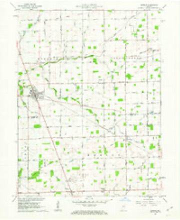
9 topographic sheets cover this place, the earliest surveyed in 1953 and the latest in 1984. It stands in Marion Township. It lies in ZIP code area 46069. The Survey maps it on the Kirklin quadrangle. It stands 932 feet above sea level.
Topographic sheets covering this place
5 surveys from 9 printed sheetsMatched by testing this settlement's coordinate against the published boundary of every sheet in the United States Geological Survey's historical collection. Each opens the scanned sheet at the Survey.
- 1953 USGS Danville quadrangle1:250000, 3 printings
- 1955 USGS Danville quadrangle1:250000
- 1956 USGS Danville quadrangle1:250000
- 1961 USGS Kirklin quadrangle1:24000, 2 printings
- 1984 USGS Lafayette quadrangle1:100000, 2 printings




In the county-history sources
1,059 words on this townshipEarly Life and Times in Boone County Indiana, published 1861 names this settlement in its chapter on Marion Township. These are the passages that mention it, exactly as the scans read.
Marion Township occupies the north corner of the County. It is bounded on the east by Hamilton County, on the south by Union, on the west by Clinton Township and on the north by Clinton County. It contains forty-six sections. It is drained by the headwaters of Big Eagle flowing south, leaving the township at section twenty-three, where it enters Union Township. The Michigan road passes through the entire township, bearing to the northwest, entering at the south side midway of the township, leaving at the northwest corner, where it enters Clinton County. The land is fully up to the average of other sister townships, and in fact in any other improvements, such as ditching, buildings, roads, school houses, etc. Big Springs, on the line between Marion and Union, is the principal trading place and postoffice, and has been for many years. The township originally was covered with the finest growth of timber, and that of the best and most valuable kinds, such as poplar, oak, walnut and ash. The Air Line Railroad cuts off a little corner at the extreme northeast, and where Terhune, a new town, is located. It is a trading place, also containing a postoffice and other mechanical shops, stores, etc. Kimberlain and Slab Town are both small villages. The latter on the Michigan Road, in the south part of the township. Among the first to move in this township were Edward Jackson and Caleb Richardson, who came in 1831, settled on Big Eagle, followed soon after by William and John Parr. Alfred Srite, William Lane and Lewis Harris settled in the south part of the township in 1833. In the spring of 1834 came Mr. Turpin, John Burns, Milton Hickson. Settled in 1835, Joseph McCoy, John Runo. A little later came the Stephensons. Jacob Johns, followed by Samuel Evans, Jesse Baker, Joseph Kimbal, Robert McNulty, John Wright, John Beard, John King, Samuel Moore, John Moore, John Wright, James Moore, Smith Castor, Robert Bell, Richard Cornell, Samuel Meyers.
Passage source: Early Life and Times in Boone County Indiana, published 1861.
Machine-read from a century-old scan, so expect the errors a machine makes: misspelled names, dropped words, stray characters.
Storms near this place
7 since 1996Regional context, not property-specific evidence. The National Weather Service names Terhune in 7 storm reports between 1996 and 2026: 4 hail, 3 thunderstorm wind. No death or injury is recorded in these reports. Each account below is quoted exactly as the forecast office filed it, from the NOAA Storm Events Database, and each date opens the federal record of that event.
| When | Event | Place named | Harm | What the report says |
|---|---|---|---|---|
| April 2011 | Thunderstorm Wind | Terhune | $45,000 | Damaging thunderstorm wind gusts caused roof damage to multiple structures in Terhune. |
| June 2023 | Thunderstorm Wind | Terhune | $10,000 | Thunderstorm winds caused minor roof damage and downed several smaller tree limbs in northeastern Boone County. |
| April 2026 | Thunderstorm Wind | Terhune | $2,000 | Tree downed on County Road 700 North by thunderstorm wind gusts. |
| June 2023 | Hail | Terhune | - | Thunderstorm hail continued into far northeastern Boone County, with hailstones as large as tennis balls. |
| May 2005 | Hail | Terhune | - | no account filed |
| May 2000 | Hail | Terhune | - | no account filed |
| June 1996 | Hail | Terhune | - | no account filed |
Nearest settlements
The eight closest, with where each one stands in the county. Distances are straight-line, computed from the Geographic Names Information System coordinates.
| Map | Place | Distance | Sheets |
|---|---|---|---|
| Elizaville | 5.7 miles | 9 | |
| Waugh | 5.8 miles | 11 | |
| Big Springs | 6.6 miles | 11 | |
| Rosston | 8.1 miles | 11 | |
| Gadsden | 8.9 miles | 11 | |
| Northfield | 9.3 miles | 11 | |
| Mechanicsburg | 10.7 miles | 9 | |
| Pike | 11.1 miles | 11 |
Elsewhere
Matched on this settlement's Geographic Names Information System number rather than its name, so it cannot be a different place of the same name in another state.
| Wikipedia article on Terhune | An encyclopaedic summary. Its text is share-alike, so it is linked here rather than copied. |
| Wikidata item Q7702362 | The structured record the population and elevation above come from. Public domain (CC0). |
Provenance
This settlement is recorded in the Geographic Names Information System as feature 444644. The sheet list is computed by point-in-boundary test against the United States Geological Survey's historical topographic inventory. Both are works of the United States government and carry no copyright under 17 U.S.C. 105.
Storms. NOAA National Centers for Environmental Information, Storm Events Database https://www.ncei.noaa.gov/stormevents/ A work of the United States government, no copyright under 17 U.S.C. 105. Narratives are quoted verbatim from the National Weather Service report and are not edited or summarised.