 Block
Boston, Indiana
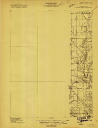
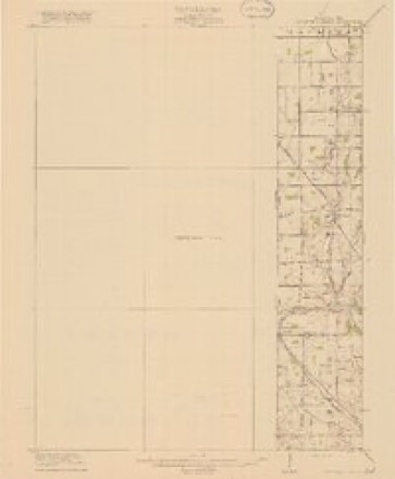
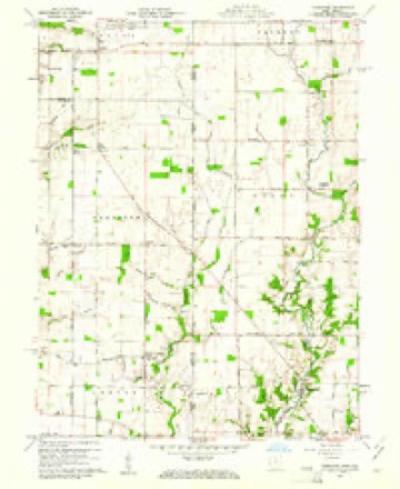
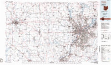
13 topographic sheets cover this place, the earliest surveyed in 1915 and the latest in 1986. It stands in Boston Township. It lies in ZIP code area 47374. The Survey maps it on the Fairhaven quadrangle. 150 people lived here at the 2020 count. It stands 1,132 feet above sea level.
Population over time
2 figuresBoston grew from 138 to 150 between 2010 and 2020. These are the recorded population figures Wikidata holds for this place, reached through the Geographic Names Information System number this page is keyed on rather than by name, so they belong to this place and not to another of the same name. Most are census counts, but not all are: an early figure may be a founding or settlement estimate, and an estimate published within five years of a census is left out. The change column is computed, and is left blank where more than 20 years separate a figure from the one before it, because a gap that long is not a change between two counts.
| Year | People | Change |
|---|---|---|
| 2010 | 138 | |
| 2020 | 150 | +12 (+9%) |
Topographic sheets covering this place
6 surveys from 13 printed sheetsMatched by testing this settlement's coordinate against the published boundary of every sheet in the United States Geological Survey's historical collection. Each opens the scanned sheet at the Survey.
- 1915 USGS College Corner quadrangle1:48000
- 1918 USGS College Corner quadrangle1:62500, 4 printings
- 1953 USGS Cincinnati quadrangle1:250000, 3 printings
- 1957 USGS Cincinnati quadrangle1:250000
- 1960 USGS Fairhaven quadrangle1:24000, 2 printings
- 1986 USGS Dayton quadrangle1:100000, 2 printings


In the county-history sources
41,763 words on this townshipHistory of Wayne County, Indiana, from Its First Settlement to the Present Time : with Numerous Biographical and Family Sketches, published 1872 names this settlement in its chapter on Boston Township. These are the passages that mention it, exactly as the scans read.
This township Avas formed from Wajne in February, 1835, and lies in the south-east corner of the county. Its length east and west is 6 miles ; its breadth north and south is 4 miles, making an area of 24 square miles. The principal stream in this township is the Elkhorn, which enters it about IJ miles west of Ohio line, and, running a south-westerly course, leaves the township IJ miles south of the north-west corner, about half a mile above the mouth of the stream. Some of the earlier settlements in the county were n ade within its limits. With the exception of Ilohnan, Rue, and a few others in that neighborhood, and John Cox, tlie Endsleys, aud perhaps a few others in what is now called Abington, there were probably no earlier settlers in Wayne county. Thomas Bulla, Jacob Fonts, and Jesse Davenport settled on the Elkhorn, 4 or 5 miles south-east of Kichmond ; Davenport and one or two of the Foutses, lower down, within the present townsliip of Boston - all tlie same year in which the Hoovers settled north of Richmond. The Hunts, the next year, settled on and near the Elkhorn, several miles below where Davenport settled.
Passage source: History of Wayne County, Indiana, from Its First Settlement to the Present Time : with Numerous Biographical and Family Sketches, published 1872.
In the north part of the township. Fielding Gaar settled on a part of section 21, lately occupied by R. Rue, now owned by Justice Kroskopf. Wm. Williams settled in 1814, where Isaac Bulla resides. He was a maker of spinning wheels, and removed to Richmond ; was also a minister in the society of Friends. Asa Jeffers settled on land now owned by Alonzo Osborn and Daniel W. Shatter. Adjoining this section on the south, James, William, and Robert Grimes owned the land now owned by John T. Williams. Daniel Hart, from N". C, settled, in 1814, on the land now owned by Francis Hendricks. Jesse Davenport, before mentioned, in 1806, settled on section 22, adjoining Wayne. A part of his laud is now owned by the heirs of George Grimes. Other parts of the section were owned or settled by Jeremiah Parker, Clark Williams, and Daniel Clark. Portions of the section are now owned by James McLain, Samuel S. Brown, Clayton Brown, Joseph Kokayne, Wm. Roberts, W. Elmer, and others. On the section adjoining, south, [27,] John McCombs, afterward John Ray, settled where now Wm. Ray resides. Jonathan Townsend, on the land now owned by Edward Timberlake.
Passage source: History of Wayne County, Indiana, from Its First Settlement to the Present Time : with Numerous Biographical and Family Sketches, published 1872.
The first Gi'ist-mill in the county was built by Charles Hunt, in 1807, on the Elkhorn, about a mile above its mouth, iu:>w near the west line of Boston township. It was a tub mill, and a cheap one, called in those days ''corn-cracker." lie afterward built anew mill, which, after four or five years, was destroyed by fire. A steam saw-mill on the same site, is now owned b}^ James and John Ensley. [Since the above was written, John Ensle}'' has died.] Jesse Davenport bnilt a grist-mill on the falls of Elkhorn creek, believed to have been the third one in the county. A few years later he built a saw-mill at the same place. These mills are but a few rods above the present mills, on the Richmond and Boston turnpike. There are at present a grist-mill and a saw-mill, called "Eelief Mills," owned by Samuel S. Brown, "Wm. A. Elmer, and John "Wolf. A steam saw-mill was built in 1837, by Eliphalet Stanley, at Boston, and sold soon after to Jacob W. Fisher and Wm. Fonts, who sold to Smith Rader, and he to Irvin and others. James L. Harris, half a mile north of town, built a steam saw-mill, which is now owned by Wm. T. McCoy. There was for a time attached to it a run of burr stones for grinding corn. A lath-machine is now attached.
Passage source: History of Wayne County, Indiana, from Its First Settlement to the Present Time : with Numerous Biographical and Family Sketches, published 1872.
Machine-read from a century-old scan, so expect the errors a machine makes: misspelled names, dropped words, stray characters.
Read the whole chapter on Boston Township - it names this place 54 more 54 times.
Storms near this place
2 since 2004Regional context, not property-specific evidence. The National Weather Service names Boston in 2 storm reports between 2004 and 2011: 1 tornado, 1 hail. No death or injury is recorded in these reports. Each account below is quoted exactly as the forecast office filed it, from the NOAA Storm Events Database, and each date opens the federal record of that event.
| When | Event | Place named | Harm | What the report says |
|---|---|---|---|---|
| November 2004 | Tornado (F0) | Boston | $5,000 | A tornado briefly touched down near Boston. Three power poles were knocked down and moved about a foot. |
| May 2011 | Hail | Boston | - | no account filed |
Nearest settlements
The eight closest, with where each one stands in the county. Distances are straight-line, computed from the Geographic Names Information System coordinates.
| Map | Place | Distance | Sheets |
|---|---|---|---|
| Locust Grove | 2.0 miles | 12 | |
| South Richmond | 4.5 miles | 10 | |
| Greenwood | 5.3 miles | 10 | |
| Abington | 5.9 miles | 14 | |
| Richmond | 6.4 miles | 10 | |
| Spring Grove Heights | 7.4 miles | 10 | |
| Spring Grove | 7.7 miles | 10 | |
| East Haven | 8.0 miles | 10 |
Elsewhere
Matched on this settlement's Geographic Names Information System number rather than its name, so it cannot be a different place of the same name in another state.
| Wikipedia article on Boston | An encyclopaedic summary. Its text is share-alike, so it is linked here rather than copied. |
| Wikidata item Q867496 | The structured record the population and elevation above come from. Public domain (CC0). |
Provenance
This settlement is recorded in the Geographic Names Information System as feature 431367. The sheet list is computed by point-in-boundary test against the United States Geological Survey's historical topographic inventory. Both are works of the United States government and carry no copyright under 17 U.S.C. 105.
Storms. NOAA National Centers for Environmental Information, Storm Events Database https://www.ncei.noaa.gov/stormevents/ A work of the United States government, no copyright under 17 U.S.C. 105. Narratives are quoted verbatim from the National Weather Service report and are not edited or summarised.