 Block
Richmond, Indiana
10 topographic sheets cover this place, the earliest surveyed in 1915 and the latest in 1986. It stands in Wayne Township. It lies in ZIP code area 47374. It stands on West Fork East Fork Whitewater River. The Survey maps it on the Richmond quadrangle. 35,720 people lived here at the 2020 count. It stands 981 feet above sea level.
Research this city
On record in Richmond
Buildings and businesses the archive holds for this place. Each opens its own page, with the source record it came from.
On the National Register 12 of 22 shown
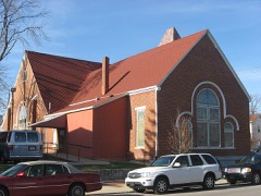 Bethel A.M.E. Churchlisted 1975
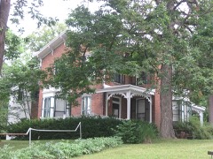 Mary Birdsall Houselisted 1999
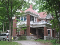 David Worth Dennis Houselisted 2001
 Earlham College Observatorylisted 1975
 East Main Street-Glen Miller Park Historic Districtlisted 1986
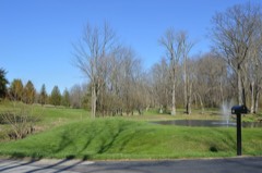 Forest Hills Country Clublisted 2015
 Abram Gaar House and Farmlisted 1975
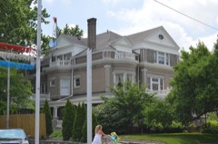 Oliver P. and Mary Alice Gaar Houselisted 2017
 Henry and Alice Gennett Houselisted 1983
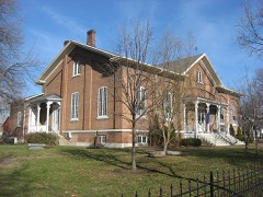 Hicksite Friends Meetinghouse (Wayne County Museum)listed 1975
 Leland Hotellisted 1985
 Murray Theaterlisted 1982
Population over time
2 figuresRichmond fell from 36,812 to 35,720 between 2010 and 2020. These are the recorded population figures Wikidata holds for this place, reached through the Geographic Names Information System number this page is keyed on rather than by name, so they belong to this place and not to another of the same name. Most are census counts, but not all are: an early figure may be a founding or settlement estimate, and an estimate published within five years of a census is left out. The change column is computed, and is left blank where more than 20 years separate a figure from the one before it, because a gap that long is not a change between two counts.
| Year | People | Change |
|---|---|---|
| 2010 | 36,812 | |
| 2020 | 35,720 | -1,092 (-3%) |
Topographic sheets covering this place
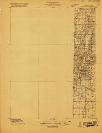
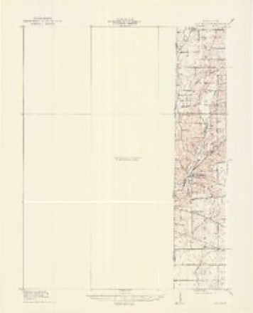
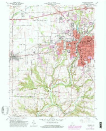
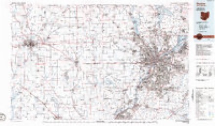
6 surveys from 10 printed sheetsMatched by testing this settlement's coordinate against the published boundary of every sheet in the United States Geological Survey's historical collection. Each opens the scanned sheet at the Survey.
- 1915 USGS New Paris quadrangle1:48000
- 1918 USGS New Paris quadrangle1:62500
- 1953 USGS Cincinnati quadrangle1:250000, 3 printings
- 1957 USGS Cincinnati quadrangle1:250000
- 1960 USGS Richmond quadrangle1:24000, 2 printings
- 1986 USGS Dayton quadrangle1:100000, 2 printings


In the county-history sources
58,967 words on this townshipHistory of Wayne County, Indiana, from Its First Settlement to the Present Time : with Numerous Biographical and Family Sketches, published 1872 names this settlement in its chapter on Wayne Township. These are the passages that mention it, exactly as the scans read.
Wayne was one of the six townships formed after the adoption of the first state constitution. It probably contained about one-sixth part of the territory of the county. In forming Union county, in 1819, the greater part of Harrison was taken into that county, and the remainder was afterward annexed to AVayne township. By the formation of Boston and Abington, Wayne was reduced to its present dimensions. It is 7 miles wide on its south line, and al)0ut 6| miles on its north line, and is 8 miles in length, north and south, making an area of a little less than 55 square miles. It is watered, mainly, by the Whitewater river and its three branches, or forks. East Fork enters it centrally on its east line ; Middle Fork near the north-east corner, and the two joining about half a mile above the city. The AVest Fork, I'rom Randolph county, enters the township directly north from Richmond, and unites with the AVhite water just above the railroad brido-e. The Elkhorn, from Ohio, crosses tlie south-cast corner of the township. Short creek, a snudl stream, running a south-westerly direction, enters the W hitewater near the south line of the township. Lick creek, run-
Passage source: History of Wayne County, Indiana, from Its First Settlement to the Present Time : with Numerous Biographical and Family Sketches, published 1872.
Most of the earlier inhabitants of this county settled within the present limits of Wayne township; and as the names of the greater portion of them have been given in our history of the early settlements, few of them will be repeated here.
Passage source: History of Wayne County, Indiana, from Its First Settlement to the Present Time : with Numerous Biographical and Family Sketches, published 1872.
Thomas Roberts, from North Carolina, settled on land now adjoining the city of Richmond, where he died, leaving the homestead in possession of his youngest son, Jonathan, who still resides on it. Walter, another son, in 1816, one mile west of Dover, where he now resides.
Passage source: History of Wayne County, Indiana, from Its First Settlement to the Present Time : with Numerous Biographical and Family Sketches, published 1872.
Machine-read from a century-old scan, so expect the errors a machine makes: misspelled names, dropped words, stray characters.
Read the whole chapter on Wayne Township - it names this place 182 more 182 times.
Mines and quarries near this place
4 within 5 milesRegional context, not property-specific evidence. The federal mineral resources record lists 4 workings within 5 miles of Richmond: 3 producers, 1 past producer. 3 still produce. What was taken out: Sand and Gravel, Construction. Distance is straight-line from the map coordinates, so a quarry counted here may appear on a neighbouring settlement's page as well.
| Where | Site | Commodity | Status | Recorded |
|---|---|---|---|---|
| A and D Excavation Company | Sand and Gravel, Construction | Producer | ||
| Cain's Lake Pit | Sand and Gravel, Construction | Producer | ||
| Middleboro Pit and Mill | Sand and Gravel, Construction | Producer | ||
| Richmond - #418 | Sand and Gravel, Construction | Past Producer |
Storms near this place
60 of 98 shownRegional context, not property-specific evidence. The National Weather Service names Richmond in 98 storm reports between 1994 and 2026: 53 thunderstorm wind, 22 hail, 12 flood, 8 flash flood. No death or injury is recorded in these reports. Each account below is quoted exactly as the forecast office filed it, from the NOAA Storm Events Database, and each date opens the federal record of that event.
| When | Event | Place named | Harm | What the report says |
|---|---|---|---|---|
| April 1999 | Thunderstorm Wind | Richmond | $200,000 | Six homes were damaged on the south side of Richmond. Also, a barn was reported blown over and several trees were knocked down. |
| June 2012 | Thunderstorm Wind | Richmond | $80,000 | There were two reports of roofs blown of buildings in Richmond due to thunderstorm winds. A school and a house also sustained roof damage. Numerous trees, tree limbs, and power lines were downed in the area. |
| July 2011 | Thunderstorm Wind | Richmond | $60,000 | Four trees fell on a house. Numerous other trees were reported down in the area. A house sustained roof damage. A trailer was pushed onto a porch. The roof was blown off of a press box and a dugout at a stadium. These occurrences were due to damaging thunderstorm winds. |
| June 2000 | Tornado (F1) | Richmond | $40,000 | Trees were knocked down throughout the city. A roof was blown off of a church on the 4700 block of National Road. Both a hotel and a restaurant sustained roof damage, and the hotel had a sign destroyed. |
| October 1998 | Lightning | Richmond | $25,000 | Lightning struck a home causing significant structural damage. |
| April 2011 | Heavy Rain | Richmond | $20,000 | Basements were flooded due to heavy rainfall. |
| March 2026 | Thunderstorm Wind | Richmond | $15,000 | A roof was blown off of a building on South 8th Street. |
| October 2013 | Thunderstorm Wind | Richmond | $15,000 | A large tree fell on two cars in Richmond due to thunderstorm winds. |
| July 2017 | Thunderstorm Wind | Richmond | $10,000 | Numerous trees were downed in and around Richmond. |
| July 2003 | Flash Flood | Richmond | $10,000 | Several homes sustained basement flooding. |
| July 1998 | Thunderstorm Wind | Richmond | $10,000 | Numerous trees downed. |
| June 2020 | Thunderstorm Wind | Richmond | $8,000 | A tree was knocked down onto a house in the 800 block of Elk Country Club Road. |
| May 2004 | Thunderstorm Wind | Richmond | $8,000 | A roof was peeled off of a house. Several trees were downed as well. |
| June 2008 | Hail | Richmond | $8,000 | no account filed |
| June 2015 | Thunderstorm Wind | Richmond | $7,000 | Numerous full sized trees and power lines were knocked down in and around Richmond. |
| May 2011 | Thunderstorm Wind | Richmond | $7,000 | Multiple trees were reported down due to damaging thunderstorm winds. One tree fell on a house due to the winds. |
| April 2024 | Flood | Richmond | $5,000 | High water was reported on several roads in the Richmond area. The high water damaged a culvert pipe west of Porterfield Road. |
| November 2017 | Flash Flood | Richmond | $5,000 | Rising water was rushing into a home on Liberty Avenue, leading to a water rescue. |
| June 2014 | Thunderstorm Wind | Richmond | $5,000 | Trees limbs were downed on power lines and a tree was downed due to thunderstorm winds. |
| March 2011 | Flood | Richmond | $5,000 | Numerous roads were flooded due to heavy rainfall. |
| February 2011 | Flood | Richmond | $5,000 | Numerous roads were closed due to high water. |
| April 2010 | Thunderstorm Wind | Richmond | $5,000 | Trees were reported down in multiple areas north of Richmond. |
| June 2008 | Thunderstorm Wind | Richmond | $5,000 | Several trees and power lines were downed, focused on the northwest and southeast areas of the county. |
| August 2005 | Thunderstorm Wind | Richmond | $5,000 | Several trees and power poles were downed. |
| September 2003 | Thunderstorm Wind | Richmond | $5,000 | Numerous trees were downed, including one on a home, causing minor damage. |
| May 2002 | Thunderstorm Wind | Richmond | $5,000 | Several large limbs were downed at the Richmond Mall. |
| May 2001 | Hail | Richmond | $5,000 | Three-quarter inch diameter hail fell 2 miles northwest of Richmond and trees and power lines were knocked down in Richmond. |
| May 2000 | Thunderstorm Wind | Richmond | $5,000 | Trees and power lines downed. |
| June 1999 | Flash Flood | Richmond | $5,000 | Standing water was reported in the city of Richmond. Flooded roads were also closed. |
| June 1998 | Thunderstorm Wind | Richmond | $5,000 | Numerous trees and power lines downed. |
| June 1998 | Thunderstorm Wind | Richmond | $5,000 | Numerous trees and power lines downed. |
| April 1994 | Thunderstorm Wind | Richmond | $5,000 | Numerous trees and power lines were downed by high winds in Richmond and Williamsburg. Historic Templeton Cabin and another home in Richmond sustained damage from fallen trees. Richmond Airport measured 91 mph winds. |
| August 2007 | Hail | Richmond | $5,000 | no account filed |
| November 2020 | Thunderstorm Wind | Richmond | $3,000 | A hollow, full-sized tree fell onto a roof. |
| July 2014 | Thunderstorm Wind | Richmond | $3,000 | Several trees downed due to thunderstorm winds from near Centerville to the south side of Richmond. |
| July 2013 | Thunderstorm Wind | Richmond | $3,000 | Large limbs and power lines were downed in south Richmond due to thunderstorm winds. |
| April 2011 | Thunderstorm Wind | Richmond | $3,000 | Damage occurred to road construction signs due to thunderstorm winds. |
| May 2008 | Thunderstorm Wind | Richmond | $3,000 | Large tree limbs were downed in town. |
| March 2007 | Flood | Richmond | $3,000 | Roads were flooded and closed across the county. |
| March 2007 | Flood | Richmond | $3,000 | Numerous roads were flooded and closed across the county due to the heavy rainfall. |
| May 2006 | Thunderstorm Wind | Richmond | $3,000 | Large tree limbs were downed. |
| June 2005 | Thunderstorm Wind | Richmond | $3,000 | A few trees were knocked down. |
| July 2003 | Thunderstorm Wind | Richmond | $3,000 | A few trees and power poles downed. |
| September 2002 | Thunderstorm Wind | Richmond | $3,000 | Trees were downed on the north side of town. |
| November 1998 | Thunderstorm Wind | Richmond | $3,000 | Numerous large limbs down. |
| October 1996 | Thunderstorm Wind | Richmond | $3,000 | no account filed |
| June 2015 | Thunderstorm Wind | Richmond | $2,500 | A tree was knocked over and a power pole was damaged. |
| April 2015 | Thunderstorm Wind | Richmond | $2,000 | Several trees were downed in the Richmond area. |
| July 2013 | Thunderstorm Wind | Richmond | $2,000 | Two trees were downed in the Richmond area due to thunderstorm winds. |
| October 2010 | Thunderstorm Wind | Richmond | $2,000 | In addition to the wind gust, many trees were also reported down around the area due to the damaging thunderstorm winds. |
| June 2008 | Flash Flood | Richmond | $2,000 | Old State Route 122 and US Route 27 were flooded between Boston and Richmond. |
| June 2008 | Thunderstorm Wind | Richmond | $2,000 | One tree and large limbs were downed. |
| August 2007 | Hail | Richmond | $2,000 | Two trees were also downed. |
| July 2003 | Thunderstorm Wind | Richmond | $2,000 | Large limbs and powerlines were knocked down. |
| August 2003 | Thunderstorm Wind | Richmond | $2,000 | Five trees were knocked down. |
| January 1996 | Thunderstorm Wind | Richmond | $2,000 | no account filed |
| June 2024 | Flash Flood | Richmond | $1,000 | A tree was downed over a road due to flood waters. |
| June 2023 | Thunderstorm Wind | Richmond | $1,000 | A tree was downed. |
| June 2020 | Thunderstorm Wind | Richmond | $1,000 | A tree was knocked down near the 700 block of 11th and 12th Streets. |
| May 2018 | Thunderstorm Wind | Richmond | $1,000 | A tree was uprooted at the corner of Richmond Avenue and Sedgwick Avenue. |
Nearest settlements
The eight closest, with where each one stands in the county. Distances are straight-line, computed from the Geographic Names Information System coordinates.
| Map | Place | Distance | Sheets |
|---|---|---|---|
| Spring Grove Heights | 1.0 miles | 10 | |
| Greenwood | 1.2 miles | 10 | |
| Spring Grove | 1.4 miles | 10 | |
| South Richmond | 2.0 miles | 10 | |
| East Haven | 2.3 miles | 10 | |
| Chester | 4.1 miles | 9 | |
| Wayne | 4.5 miles | 9 | |
| Locust Grove | 4.6 miles | 12 |
Elsewhere
Matched on this settlement's Geographic Names Information System number rather than its name, so it cannot be a different place of the same name in another state.
| Wikipedia article on Richmond | An encyclopaedic summary. Its text is share-alike, so it is linked here rather than copied. |
| Wikidata item Q548664 | The structured record the population and elevation above come from. Public domain (CC0). |
Provenance
This settlement is recorded in the Geographic Names Information System as feature 441976. The sheet list is computed by point-in-boundary test against the United States Geological Survey's historical topographic inventory. Both are works of the United States government and carry no copyright under 17 U.S.C. 105.
Mines and quarries. USGS Mineral Resources Data System (MRDS) https://mrdata.usgs.gov/mrds/ A work of the United States government, no copyright under 17 U.S.C. 105.
Storms. NOAA National Centers for Environmental Information, Storm Events Database https://www.ncei.noaa.gov/stormevents/ A work of the United States government, no copyright under 17 U.S.C. 105. Narratives are quoted verbatim from the National Weather Service report and are not edited or summarised.