 Block
Boxley, Indiana
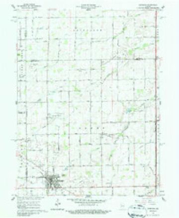
10 topographic sheets cover this place, the earliest surveyed in 1953 and the latest in 1984. It stands in Sheridan town. It lies in ZIP code area 46069. It stands on Teter Branch. The Survey maps it on the Sheridan quadrangle. It stands 919 feet above sea level.
Topographic sheets covering this place
5 surveys from 10 printed sheetsMatched by testing this settlement's coordinate against the published boundary of every sheet in the United States Geological Survey's historical collection. Each opens the scanned sheet at the Survey.
- 1953 USGS Danville quadrangle1:250000, 3 printings
- 1955 USGS Danville quadrangle1:250000
- 1956 USGS Danville quadrangle1:250000
- 1961 USGS Sheridan quadrangle1:24000, 3 printings
- 1984 USGS Lafayette quadrangle1:100000, 2 printings




What happened here
An account from the chapter on Sheridan town. The inset identifies its exact source book and publication year.
Condensed Milk Factory
The Indiana Condensed Milk Company's plant at Sheridan is among the largest of its kind in the country. It was established about the year 1900 by W. N. Wilson, succeeding the old butter works that had been there many years before this latter organization. Mr. Wilson was accidentally killed by the explosion of a sterilizing equipment.
In the county-history sources
18,460 words on this townshipHistory of Hamilton County Indiana, published 1915 names this settlement in its chapter on Sheridan Town. These are the passages that mention it, exactly as the scans read.
The Methodists organized the first church in Sheridan. This was in the winter of 1867-68, and Rev. R. A. Newton was the prime mover in the organ¬ ization. Meetings were held in the school house until 1870, when private houses were used for worship. In 1873 two lots were purchased of Caswell Boxley and in August work began on a new house of worship. Owing to the panic of 1873 work was suspended for a year. The church then was com¬ pleted at a, valuation of two thousand four hundred dollars. Rev. J. V. R. Miller preached the dedication sermon. During this service two hundred dollars was raised on the church debt.
Passage source: History of Hamilton County Indiana, published 1915.
The town of Sheridan is situated on section 31 and 32 of Adams civil township, in the northwestern part of the county. It was platted by Egbert Higbee in 1866, and is today the second largest place in the county. Its business interests are varied and rapidly increasing in magnitude. A recent history of the town, compiled by a resident connected with the high schools of that place, gives the following facts : "Sheridan has many progressive leaders to take care of her stores and shops. It would be interesting to know that Egbert Higbee, a resident of Elizaville, was the man who laid the plans for Sheridan and called it Millwood. Doctor Moore established the first store on what is now the comer of Second and Main streets. This was a general store, in which was kept for sale a little of everything. Just a. little later James Heatherington started a store where John Stahl's house now stands. Other stores were soon added, including one by P. Q. Pearson and John Wilson. C. Boxley started his store at the corner of Second and Main streets. These men soon sold to other parties. Hamilton Emmons started the first drug store in the town. John Francis was first to establish an exclusive grocery store. May Emmons was the first person to start in the millinery business. Uncle Tom and Aunt Kercheval kept the first boarding house and entertained travelers. Old Mr. Saxmon started the first undertaker's shop, on the corner of Georgia and Third streets.
Passage source: History of Hamilton County Indiana, published 1915.
The land forming the town site formerly belonged to Addison Boxley and the site was formed by dividing some of his land into lots and selling the same. The founders of the town, Addison and Thomas Boxley, were also the first store keepers. Dr. Thomas P. Boxley was the first postmaster, in which capacity he served for many years. One year after the founding ot the town it became a Democratic community. The first township election was held, and Reuben Tansey was elected justice of the peace. The first white child born in the township, Vinton Spencer, was born in the year 1830 within a few miles of Boxley. Also the first marriage in the township oc¬ curred at this place in 1833, the contracting parties being Stephen Blevens and Elsie McKinsey.
Passage source: History of Hamilton County Indiana, published 1915.
Machine-read from a century-old scan, so expect the errors a machine makes: misspelled names, dropped words, stray characters.
Read the whole chapter on Sheridan Town - it names this place 6 more 6 times.
Storms near this place
3 since 2004Regional context, not property-specific evidence. The National Weather Service names Boxley in 3 storm reports between 2004 and 2017: 2 thunderstorm wind, 1 tornado. No death or injury is recorded in these reports. Each account below is quoted exactly as the forecast office filed it, from the NOAA Storm Events Database, and each date opens the federal record of that event.
| When | Event | Place named | Harm | What the report says |
|---|---|---|---|---|
| November 2017 | Thunderstorm Wind | Boxley | $15,000 | Numerous large trees and branches were snapped. A roof of a barn and an old shed was destroyed. Also, the awning of a home was ripped off due to damaging thunderstorm wind gusts. |
| August 2016 | Tornado (EF1) | Boxley | $10,000 | An EF-1 tornado, with maximum winds estimated at 105 mph, snapped several tree trunks and flattened corn stalks along the path. |
| May 2004 | Thunderstorm Wind | Boxley | - | no account filed |
Nearest settlements
The eight closest, with where each one stands in the county. Distances are straight-line, computed from the Geographic Names Information System coordinates.
| Map | Place | Distance | Sheets |
|---|---|---|---|
| Bakers Corner | 3.2 miles | 10 | |
| Sheridan | 3.2 miles | 10 | |
| Deming | 5.4 miles | 15 | |
| Hortonville | 5.6 miles | 12 | |
| Lamong | 5.8 miles | 12 | |
| Arcadia | 8.2 miles | 11 | |
| Millersburg | 8.3 miles | 11 | |
| Eagletown | 8.6 miles | 12 |
Elsewhere
Matched on this settlement's Geographic Names Information System number rather than its name, so it cannot be a different place of the same name in another state.
| Wikipedia article on Boxley | An encyclopaedic summary. Its text is share-alike, so it is linked here rather than copied. |
| Wikidata item Q4951981 | The structured record the population and elevation above come from. Public domain (CC0). |
Provenance
This settlement is recorded in the Geographic Names Information System as feature 431418. The sheet list is computed by point-in-boundary test against the United States Geological Survey's historical topographic inventory. Both are works of the United States government and carry no copyright under 17 U.S.C. 105.
Storms. NOAA National Centers for Environmental Information, Storm Events Database https://www.ncei.noaa.gov/stormevents/ A work of the United States government, no copyright under 17 U.S.C. 105. Narratives are quoted verbatim from the National Weather Service report and are not edited or summarised.