 Block
Burney, Indiana
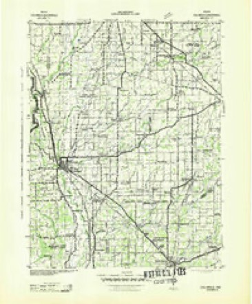
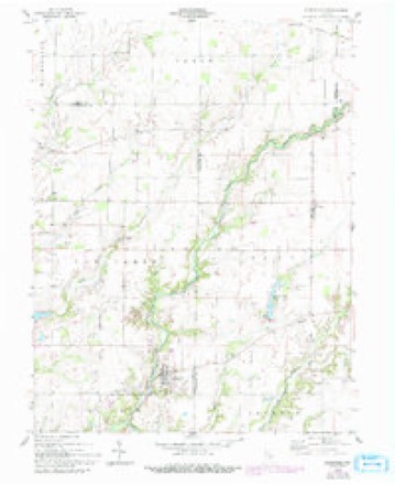
11 topographic sheets cover this place, the earliest surveyed in 1942 and the latest in 1986. It stands in Clay Township. It lies in ZIP code area 47240. The Survey maps it on the Hartsville quadrangle. It stands 830 feet above sea level.
On record in Burney
Buildings and businesses the archive holds for this place. Each opens its own page, with the source record it came from.
On the National Register 1 record
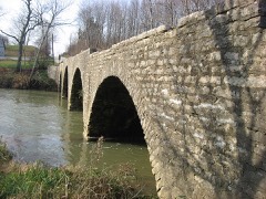 Champ's Ford Bridgelisted 2009
Topographic sheets covering this place
5 surveys from 11 printed sheetsMatched by testing this settlement's coordinate against the published boundary of every sheet in the United States Geological Survey's historical collection. Each opens the scanned sheet at the Survey.
- 1942 USGS Columbus quadrangle1:125000
- 1953 USGS Cincinnati quadrangle1:250000, 3 printings
- 1957 USGS Cincinnati quadrangle1:250000
- 1958 USGS Hartsville quadrangle1:24000, 4 printings
- 1986 USGS Greensburg quadrangle1:100000, 2 printings



In the county-history sources
2,772 words on this townshipHistory of Decatur County, Indiana : Its People, Industries and Institutions, published 1915 names this settlement in its chapter on Clay Township. These are the passages that mention it, exactly as the scans read.
The village of Burney, in Clay townhsip, on the Columbus, Hope & Greensburg railroad, was laid out on May 2, 1882, by James C. Pulse. It has enjoyed a steady growth from the beginning and is now a thriving town, with flourishing business enterprises and many attractive and comfortable homes. A fine, modern school building and two churches, Methodist and Baptist, take care of the educational and religious life of the community. The business and professional interests in 191 5 are as follows: Bank, Burney State Bank; barber, Thomas J. Henderson; blacksmith, J. E. Wasson, G. M. Miner & Son; carpenter and contractor, Edward Clapp; coal dealer, Sidner & Price; dentist, Frank Davis; elevator, Sidner & Price; express, American Express Company; garage. Smiley & Dean; general store, A. E. Howe, J. C. Hayes, H. C. Lawrence ; hardware, McCullough Hardware Co. ; hotel, Mrs. M. J. Luther, Mrs. Clay Alexander ; livery. Clay Alexander ; lumber, Padgett & Son ; meat market, W. S. Miner ; music teachers, Alice Arnold, Mrs. Elsie Gartin ; notary public, L. T. Howell, Fannie Johnson, W. W. Barnes ; photographer, F. W. Kean; physician, C. G. Harrod, Edward Porter; painter, Thomson & Luther; postoffice, W. S. Miner; paper hanger, Miers & Galbraith; restaurant, F. W. Kean, W. S. Miner; real estate and insurance, L. T. Powell; saw-mill. Otto Detrich; shoe cobbler, Frank Hiner; station agent, J. S. Miner; stock l^uyer, Pumphrey & Son, Davis & Davis, W. W. Lane.
Passage source: History of Decatur County, Indiana : Its People, Industries and Institutions, published 1915.
Burney is justly proud of its band, which was organized in the spring of 191 5. Although at this time it has been practicing but a few months, it has already given concerts which were well received. It is under the direction of George Dunn, of Adams. The members of the band are as follows : Cornets, Herbert Lawson, Lora Hayes, Walter Bailey, Ralph Howe, Roscoe Arnold, AValter Galitine, Robert Champ and Russell Emlay; baritone, John Christian ; alto, Jasper Spaugh and James Galbraith ; tenors, Harry Jackson and H. C. Miner; clarinets, Ernest Miner and L. D. Lambert; trombones, Fred Luther, T. J. Hendrickson, Edwin Gibson and Roy Emlay; melophone, Clarence Thomson; tuba, Burney Jackson; bass, Clifford Thurston; snare drum, Plenry Emlay; bass drum, Charles Gartin.
Passage source: History of Decatur County, Indiana : Its People, Industries and Institutions, published 1915.
Machine-read from a century-old scan, so expect the errors a machine makes: misspelled names, dropped words, stray characters.
Storms near this place
8 since 2006Regional context, not property-specific evidence. The National Weather Service names Burney in 8 storm reports between 2006 and 2025: 5 thunderstorm wind, 1 tornado, 1 hail, 1 flash flood. No death or injury is recorded in these reports. Each account below is quoted exactly as the forecast office filed it, from the NOAA Storm Events Database, and each date opens the federal record of that event.
| When | Event | Place named | Harm | What the report says |
|---|---|---|---|---|
| April 2006 | Thunderstorm Wind | Burney | $100,000 | Straight line winds damaged two trailers and an old store. |
| April 2006 | Tornado (F1) | Burney | $100,000 | A weak tornado briefly touched down near Burney in Decatur County. Among the damage was a destroyed garage, and several outbuildings. No injuries were reported. |
| April 2025 | Flash Flood | Burney | $25,000 | Several roads were closed across the county due to water flowing over them. 3 water rescues conducted. Total rainfall was around 1.5 inches. |
| July 2015 | Thunderstorm Wind | Burney | $5,000 | Trees or tree limbs were downed due to damaging thunderstorm wind gusts. |
| July 2012 | Thunderstorm Wind | Burney | $3,000 | Several trees were downed in the Burney area near the intersection of County Roads 100 South and 850 West due to damaging thunderstorm wind gusts. |
| July 2022 | Thunderstorm Wind | Burney | $2,000 | Thunderstorm wind gusts downed trees near the intersection of Indiana State Road 46 and County Road 700 West. |
| August 2011 | Thunderstorm Wind | Burney | - | An estimated 60 mph thunderstorm wind gust was observed near County Road 800 West and State Road 46. Quarter-sized hail was also observed. |
| May 2006 | Hail | Burney | - | No property damage was reported. |
Nearest settlements
The eight closest, with where each one stands in the county. Distances are straight-line, computed from the Geographic Names Information System coordinates.
| Map | Place | Distance | Sheets |
|---|---|---|---|
| Milford | 2.6 miles | 11 | |
| Ewington | 3.9 miles | 11 | |
| Forest Hill | 4.4 miles | 11 | |
| Horace | 5.5 miles | 11 | |
| Adams | 6.2 miles | 10 | |
| Harris City | 6.5 miles | 11 | |
| Craig | 6.5 miles | 11 | |
| Letts Corner | 6.7 miles | 11 |
Elsewhere
Matched on this settlement's Geographic Names Information System number rather than its name, so it cannot be a different place of the same name in another state.
| Wikipedia article on Burney | An encyclopaedic summary. Its text is share-alike, so it is linked here rather than copied. |
| Wikidata item Q4999701 | The structured record the population and elevation above come from. Public domain (CC0). |
Provenance
This settlement is recorded in the Geographic Names Information System as feature 431853. The sheet list is computed by point-in-boundary test against the United States Geological Survey's historical topographic inventory. Both are works of the United States government and carry no copyright under 17 U.S.C. 105.
Storms. NOAA National Centers for Environmental Information, Storm Events Database https://www.ncei.noaa.gov/stormevents/ A work of the United States government, no copyright under 17 U.S.C. 105. Narratives are quoted verbatim from the National Weather Service report and are not edited or summarised.