 Block
Cedar Lake, Indiana
12 topographic sheets cover this place, the earliest surveyed in 1953 and the latest in 1992. It stands in Hanover Township. It lies in ZIP code area 46303. The Survey maps it on the Lowell quadrangle. 14,106 people lived here at the 2020 count. It stands 709 feet above sea level.
On record in Cedar Lake
Buildings and businesses the archive holds for this place. Each opens its own page, with the source record it came from.
On the National Register 2 records
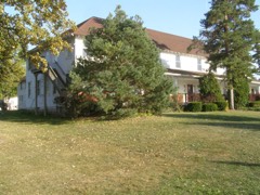 Lassen Hotellisted 1981
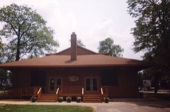 Monon Park Dancing Pavillionlisted 2001
Population over time
2 figuresCedar Lake grew from 11,560 to 14,106 between 2010 and 2020. These are the recorded population figures Wikidata holds for this place, reached through the Geographic Names Information System number this page is keyed on rather than by name, so they belong to this place and not to another of the same name. Most are census counts, but not all are: an early figure may be a founding or settlement estimate, and an estimate published within five years of a census is left out. The change column is computed, and is left blank where more than 20 years separate a figure from the one before it, because a gap that long is not a change between two counts.
| Year | People | Change |
|---|---|---|
| 2010 | 11,560 | |
| 2020 | 14,106 | +2,546 (+22%) |
Topographic sheets covering this place
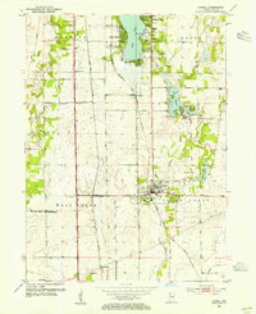
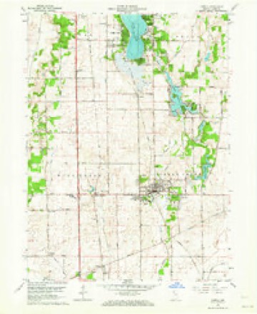
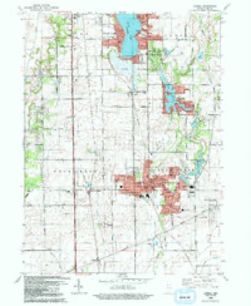
7 surveys from 12 printed sheetsMatched by testing this settlement's coordinate against the published boundary of every sheet in the United States Geological Survey's historical collection. Each opens the scanned sheet at the Survey.
- 1953 USGS Chicago quadrangle1:250000, 5 printings
- 1953 USGS Lowell quadrangle1:24000
- 1957 USGS Chicago quadrangle1:250000
- 1962 USGS Lowell quadrangle1:24000, 2 printings
- 1984 USGS Kankakee quadrangle1:100000
- 1991 USGS Kankakee quadrangle1:100000
- 1992 USGS Lowell quadrangle1:24000


In the county-history sources
1,796 words on this townshipA Standard History of Lake County, Indiana, and the Calumet Region, published 1915 names this settlement in its chapter on Hanover Township. These are the passages that mention it, exactly as the scans read.
Although the first settlers of what is now Hanover Township, on the west shores of Red Cedar Lake, were of New England origin, the second and the larger colony was composed of sturdy Germans who stamped their nationality on the township itself. The location of the stalwart Ball family on the Lake of the Red Cedars during "the year 1837, with the founding of the famous Cedar Lake Baptist Church, has been described at some length, and account has also been taken of the Sasse, Von Hollen and Herlitz families in the following year. As the advance of those fine German emigrants who formed the strongest element in the pioneer life of the western part of the county, and whose good influence is still potent in the lives and works of their descendants, it is no more than historic justice to pause at this point and give them their dues more in detail.
Passage source: A Standard History of Lake County, Indiana, and the Calumet Region, published 1915.
At that time he had been in America but four years, having emigrated from his native province of Hanover in 1834. The father of the little family bought the claims of Aaron Cox and Josiah Chase on the northwest of Cedar Lake. Mr. Sasse came with means and also accumulated property. He was a man of much native ability and strong influence, although never prone to assume public duties. Circumstances led him to visit his old home in the Fatherland three times after settling in Hanover Township ; so that he was well-traveled and well-informed.
Passage source: A Standard History of Lake County, Indiana, and the Calumet Region, published 1915.
The Meyers and the Beckmans came a little later than ]Mr. Klass. John H. Meyer was a native of Hanover, Germany, where he was married and where all his children were born. In 1851 he and his family sailed from Bremen and forty-two days later arrived in New York. The parents and one of their children went to Savannah, Georgia, for the winter, but the other three remained in New York. In the spring of 1852 the parents started for the ^Vest with the intention of locating at Fort Wayne, Indiana, ])ut on the death of a l)rother, wlio had taken up land near Cedar Lake, they came to Lake County and purchased 200 acres of land near the western extremity of that body of water. The father and nineteen-year-old son built a log cabin on a bank of the lake, high and dry, and commenced the hard, healthful life of the pioneer. The family was absorbed by the growing connnunity of German Lutherans, and in time both father and son (also John H. Meyer) became prosperous and prominent. The younger man, who married Miss Christena Doescher, became the father of twelve children, most of whom, as men and women, moved out of Hanover Township. His Avife was also
Passage source: A Standard History of Lake County, Indiana, and the Calumet Region, published 1915.
Machine-read from a century-old scan, so expect the errors a machine makes: misspelled names, dropped words, stray characters.
Read the whole chapter on Hanover Township - it names this place 2 more 2 times.
Storms near this place
34 since 1993Regional context, not property-specific evidence. The National Weather Service names Cedar Lake in 34 storm reports between 1993 and 2025: 20 thunderstorm wind, 9 hail, 2 tornado, 1 lightning. The reports record 1 death and 1 injury. Each account below is quoted exactly as the forecast office filed it, from the NOAA Storm Events Database, and each date opens the federal record of that event.
| When | Event | Place named | Harm | What the report says |
|---|---|---|---|---|
| July 2024 | Thunderstorm Wind | Cedar Lake | 1 killed | Numerous large tree limbs were blown down just west of Cedar Lake including a few that fell onto houses. One large tree limb, approximately 20 inches in diameter and 70 feet tall fell onto a one story house on 141st Court. The tree caused significant structural damage to the house and pinned a 44 year old woman in a bed. She died a short time later. Two other people in the house at the time were not injured. |
| May 1996 | Lightning | Cedar Lake | 1 hurt | no account filed |
| May 2007 | Thunderstorm Wind | Cedar Lake | $30,000 | A roof was partially torn off a building. Three utility poles were snapped near their base on Parish Avenue. Trees and power lines were also blown down. |
| May 2007 | Thunderstorm Wind | Cedar Lake | $10,000 | Tree limbs were blown down. A trailer was damaged near US 41. Four utility poles were blown down. |
| September 2014 | Thunderstorm Wind | Cedar Lake | $5,000 | Power poles were blown down. |
| June 1995 | Thunderstorm Wind | Cedar Lake | $1,000 | Trees were blown down. |
| March 2025 | Thunderstorm Wind | Cedar Lake | - | The trunk of a large tree was snapped at the base. |
| March 2025 | Thunderstorm Wind | Cedar Lake | - | Fascia was torn off of the canopy of a gas station on 133rd Ave in Cedar Lake. |
| May 2025 | Thunderstorm Wind | Cedar Lake | - | A private weather station measured a wind gust to 66 mph. |
| March 2025 | Tornado (EF1) | Cedar Lake | - | Damage surveys confirmed an EF-1 tornado in Cedar Lake. A brief tornado began near Wicker Avenue just south of 136th Place and moved rapidly northeast across Wicker Avenue and through a residential area of Cedar Lake. The tornado then continued north across West 133rd Avenue and along Lindberg Street before ending south of West 129th Avenue. Damage included several large uprooted or snapped trees, some of which fell onto and damaged homes. The most significant damage occurred east of Osborn Street between West 134th Place and West 133rd Lane, where a portion of a roof of a two story home landed in a neighboring yard, with peak winds estimated near 86 mph. In addition, a trampoline was found wrapped around a telephone pole along West 133rd Avenue. |
| March 2025 | Thunderstorm Wind | Cedar Lake | - | Roofing and siding damage occurred around the neighborhood north of Hanover Central High School. A downed fence and tossed lawn furniture were also found. |
| March 2025 | Thunderstorm Wind | Cedar Lake | - | Clay roofing tiles were ripped off of a church along 133rd Ave in Cedar Lake. A downed power line and a partially uprooted tree were also found in the area. |
| May 2024 | Hail | Cedar Lake | - | Nickel to quarter size hail was reported near Lake Shore Drive and Cline Avenue. |
| July 2024 | Thunderstorm Wind | Cedar Lake | - | A metal carport was bent and blown over. Tree limbs were blown down nearby. |
| July 2024 | Thunderstorm Wind | Cedar Lake | - | Trees were uprooted just north of Cedar Lake. Tree limbs were blown down nearby. |
| March 2023 | Thunderstorm Wind | Cedar Lake | - | A trained spotter estimated 60 mph winds as well as penny size hail. |
| June 2021 | Thunderstorm Wind | Cedar Lake | - | Two trees were blown down onto houses. |
| December 2021 | Tornado (EF0) | Cedar Lake | - | A tornado with peak winds of 85 mph touched down just south of 117th Avenue, west of Parrish Avenue where trees were uprooted. The tornado moved northeast and damaged a fence along Summerlin Street. The tornado crossed Cline Avenue producing minor tree damage and scattered light to moderate roof damage. A utility pole was snapped along Fathke Road, south of 109th Avenue. Tree damage continued north and south of 109th Avenue with the tornado crossing 109th Avenue near Hanley Street. The tornado continued producing minor tree damage as it crossed 105th Avenue. The tornado lifted near Maple Street, west of Main Street in Crown Point. |
| January 2020 | Heavy Rain | Cedar Lake | - | Rainfall of 3.15 inches was reported. |
| August 2020 | Thunderstorm Wind | Cedar Lake | - | A six inch diameter tree limb was blown down near 141st Avenue and Parrish Avenue in Cedar Lake. |
| June 2017 | Thunderstorm Wind | Cedar Lake | - | Wind gusts were estimated between 50 and 60 mph. |
| June 2015 | Flash Flood | Cedar Lake | - | Roads were flooded in Cedar Lake and at least one pickup truck was half submerged on the flooded roads. An observer reported 3.94 inches of rainfall in Cedar Lake. |
| July 2012 | Thunderstorm Wind | Cedar Lake | - | Two 10 inch diameter trees were blown down. |
| May 2007 | Thunderstorm Wind | Cedar Lake | - | Tree limbs down in Brunswick. |
| August 2003 | Thunderstorm Wind | Cedar Lake | - | Trees were blown down with estimated wind gusts to 70 mph. |
| October 2020 | Hail | Cedar Lake | - | no account filed |
| May 2018 | Hail | Cedar Lake | - | no account filed |
| May 2018 | Thunderstorm Wind | Cedar Lake | - | no account filed |
| July 2017 | Hail | Cedar Lake | - | no account filed |
| June 2012 | Hail | Cedar Lake | - | no account filed |
| July 2012 | Hail | Cedar Lake | - | no account filed |
| July 2003 | Hail | Cedar Lake | - | no account filed |
| August 2003 | Hail | Cedar Lake | - | no account filed |
| April 1993 | Hail | Cedar Lake | - | no account filed |
Nearest settlements
The eight closest, with where each one stands in the county. Distances are straight-line, computed from the Geographic Names Information System coordinates.
| Map | Place | Distance | Sheets |
|---|---|---|---|
| Cook | 1.7 miles | 12 | |
| Creston | 1.9 miles | 12 | |
| Lake Dalecarlia | 3.4 miles | 12 | |
| Brunswick | 3.7 miles | 16 | |
| Hawthorne Hills | 3.9 miles | 12 | |
| Klaasville | 4.1 miles | 13 | |
| Shady Lawn | 5.0 miles | 14 | |
| Lowell | 5.2 miles | 12 |
Elsewhere
Matched on this settlement's Geographic Names Information System number rather than its name, so it cannot be a different place of the same name in another state.
| Wikipedia article on Cedar Lake | An encyclopaedic summary. Its text is share-alike, so it is linked here rather than copied. |
| Wikidata item Q2252920 | The structured record the population and elevation above come from. Public domain (CC0). |
Provenance
This settlement is recorded in the Geographic Names Information System as feature 432282. The sheet list is computed by point-in-boundary test against the United States Geological Survey's historical topographic inventory. Both are works of the United States government and carry no copyright under 17 U.S.C. 105.
Storms. NOAA National Centers for Environmental Information, Storm Events Database https://www.ncei.noaa.gov/stormevents/ A work of the United States government, no copyright under 17 U.S.C. 105. Narratives are quoted verbatim from the National Weather Service report and are not edited or summarised.