 Block
Claypool, Indiana
11 topographic sheets cover this place, the earliest surveyed in 1953 and the latest in 1994. It stands in Clay Township. It lies in ZIP code area 46510. It stands on Trimble Creek. The Survey maps it on the Burket quadrangle. 396 people lived here at the 2020 count. It stands 889 feet above sea level.
Population over time
2 figuresClaypool fell from 431 to 396 between 2010 and 2020. These are the recorded population figures Wikidata holds for this place, reached through the Geographic Names Information System number this page is keyed on rather than by name, so they belong to this place and not to another of the same name. Most are census counts, but not all are: an early figure may be a founding or settlement estimate, and an estimate published within five years of a census is left out. The change column is computed, and is left blank where more than 20 years separate a figure from the one before it, because a gap that long is not a change between two counts.
| Year | People | Change |
|---|---|---|
| 2010 | 431 | |
| 2020 | 396 | -35 (-8%) |
Topographic sheets covering this place
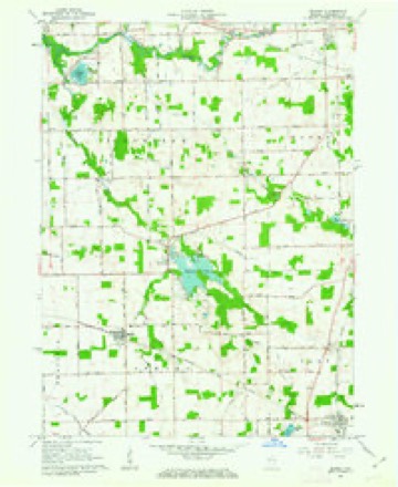
5 surveys from 11 printed sheetsMatched by testing this settlement's coordinate against the published boundary of every sheet in the United States Geological Survey's historical collection. Each opens the scanned sheet at the Survey.
- 1953 USGS Fort Wayne quadrangle1:250000, 4 printings
- 1956 USGS Fort Wayne quadrangle1:250000, 2 printings
- 1961 USGS Burket quadrangle1:24000, 3 printings
- 1984 USGS Fort Wayne quadrangle1:100000
- 1994 USGS Fort Wayne quadrangle1:100000




In the county-history sources
1,208 words on this townshipBiographical and Historical Reocrd of Kosciusko County, published 1887 names this settlement in its chapter on Clay Township. These are the passages that mention it, exactly as the scans read.
There are several important industries at Claypool, among which mwy be mentioned the fine saw-mill owned and operated liy J. AV. Shoemaker. There are two other mills owned by Jacob Ulrey and A. F. Chavey. A. J. Whittenberger is a large dealer in grain; Isaac Caldwell also owns a small elevator. There are two large stores that do a fine trade in general merchandise, Messrs. A. J. Whittenberger and AVilliam Sarber. The Grangers also have a store, but it has not been considered a paying investment, and the management frequently changes. The brick school-house was erected in 1878, and the United Brethren church in 1884. The medical profession is ably represented by Drs. George Ketchum, G. W. Brown and H. P. Hazel. The village has a population of 500 and is a very quiet and orderly place.
Passage source: Biographical and Historical Reocrd of Kosciusko County, published 1887.
Clay Grange, No. 729, was organized in 1869, at the Yager school -house. In 1879 it was moved to Claypool, and Harmony Grange united with it. Nelson Beigh is present master, and this grange has the largest membership of any in the county.
Passage source: Biographical and Historical Reocrd of Kosciusko County, published 1887.
Claypool Lodge, I. 0. 0. F., was organized December 17, 1875. The charter members and officers installed were : Noble Grand, A. J. Whittenberger; Vice Grand, John Boyce; Secretaj-y, Amos Pontius; Treasurer, George W. Harland; Warden, William Davis; Conductor, Thomas Decker; Inside Guard, Leander Penny; Outside Guard, James L. Deaton; Right Supporter to Noble Grand, John Haddix; Left Supporter to Noble Grand, Daniel Dick. The lodge has been in a prosperous condition since its organization, and the society have a room pleasantly fitted up over L. Peiui^-'s hardware store. The present officers are: Noble Grand, George Luke; Vice Grand, Thomas Dick; Secretary. John S. Deaton; Permanent Secretary, Amos Pontius; Treasurer, G. W. Ilrvin.
Passage source: Biographical and Historical Reocrd of Kosciusko County, published 1887.
Machine-read from a century-old scan, so expect the errors a machine makes: misspelled names, dropped words, stray characters.
Storms near this place
11 since 2000Regional context, not property-specific evidence. The National Weather Service names Claypool in 11 storm reports between 2000 and 2026: 7 thunderstorm wind, 4 hail. The reports record 2 injuries. Each account below is quoted exactly as the forecast office filed it, from the NOAA Storm Events Database, and each date opens the federal record of that event.
| When | Event | Place named | Harm | What the report says |
|---|---|---|---|---|
| August 2022 | Thunderstorm Wind | Claypool | 2 hurt, $20,000 | Dispatch indicates a tree is down on a vehicle with two people trapped. |
| April 2026 | Hail | Claypool | $1,000 | Broadcast media relayed a photo from the public of what is estimated to be between 2 and 2.25 inch hail in Claypool. |
| April 2026 | Hail | Claypool | $1,000 | Hail ranging from marble to half dollar size reported on the northeast side of Claypool. |
| May 2025 | Thunderstorm Wind | Claypool | $1,000 | Tree down on S Clay Street at Calhoun St. |
| June 2016 | Thunderstorm Wind | Claypool | - | Several trees and tree limbs were down in parts of Claypool. A large tree was uprooted, lifting the rear of a parked small RV several feet into the air. |
| July 2012 | Thunderstorm Wind | Claypool | - | A trained spotter reported a two and one half foot diameter tree was uprooted across County Farm Road, near County Road 450 South. |
| August 2011 | Thunderstorm Wind | Claypool | - | Law enforcement officials reported a tree limb down onto power lines on County Road 450 West just north of County Road 600. |
| May 2010 | Thunderstorm Wind | Claypool | - | Local media reported a tree was uprooted and fell onto a building. Numerous tree limbs were also blown down. No further information was available on the building damage. |
| May 2000 | Thunderstorm Wind | Claypool | - | Few trees down on power lines. |
| May 2015 | Hail | Claypool | - | no account filed |
| November 2011 | Hail | Claypool | - | no account filed |
Nearest settlements
The eight closest, with where each one stands in the county. Distances are straight-line, computed from the Geographic Names Information System coordinates.
| Map | Place | Distance | Sheets |
|---|---|---|---|
| Silver Lake | 4.0 miles | 10 | |
| Packerton | 4.5 miles | 10 | |
| Palestine | 5.0 miles | 11 | |
| Burket | 5.0 miles | 11 | |
| Sevastopol | 7.3 miles | 11 | |
| Sidney | 7.4 miles | 10 | |
| Winona Lake | 7.4 miles | 12 | |
| Beaver Dam | 7.6 miles | 11 |
Elsewhere
Matched on this settlement's Geographic Names Information System number rather than its name, so it cannot be a different place of the same name in another state.
| Wikipedia article on Claypool | An encyclopaedic summary. Its text is share-alike, so it is linked here rather than copied. |
| Wikidata item Q1913032 | The structured record the population and elevation above come from. Public domain (CC0). |
Provenance
This settlement is recorded in the Geographic Names Information System as feature 432596. The sheet list is computed by point-in-boundary test against the United States Geological Survey's historical topographic inventory. Both are works of the United States government and carry no copyright under 17 U.S.C. 105.
Storms. NOAA National Centers for Environmental Information, Storm Events Database https://www.ncei.noaa.gov/stormevents/ A work of the United States government, no copyright under 17 U.S.C. 105. Narratives are quoted verbatim from the National Weather Service report and are not edited or summarised.