 Block
Silver Lake, Indiana
10 topographic sheets cover this place, the earliest surveyed in 1953 and the latest in 1994. It stands in Lake Township. It lies in ZIP code area 46982. The Survey maps it on the Silver Lake quadrangle. 875 people lived here at the 2020 count. It stands 899 feet above sea level.
On record in Silver Lake
Buildings and businesses the archive holds for this place. Each opens its own page, with the source record it came from.
On the National Register 1 record
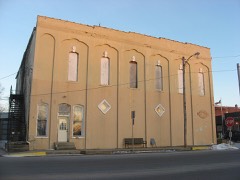 Silver Lake Historic Districtlisted 1992
Population over time
2 figuresSilver Lake fell from 915 to 875 between 2010 and 2020. These are the recorded population figures Wikidata holds for this place, reached through the Geographic Names Information System number this page is keyed on rather than by name, so they belong to this place and not to another of the same name. Most are census counts, but not all are: an early figure may be a founding or settlement estimate, and an estimate published within five years of a census is left out. The change column is computed, and is left blank where more than 20 years separate a figure from the one before it, because a gap that long is not a change between two counts.
| Year | People | Change |
|---|---|---|
| 2010 | 915 | |
| 2020 | 875 | -40 (-4%) |
Topographic sheets covering this place
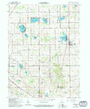
5 surveys from 10 printed sheetsMatched by testing this settlement's coordinate against the published boundary of every sheet in the United States Geological Survey's historical collection. Each opens the scanned sheet at the Survey.
- 1953 USGS Fort Wayne quadrangle1:250000, 4 printings
- 1956 USGS Fort Wayne quadrangle1:250000, 2 printings
- 1961 USGS Silver Lake quadrangle1:24000, 2 printings
- 1984 USGS Fort Wayne quadrangle1:100000
- 1994 USGS Fort Wayne quadrangle1:100000




In the county-history sources
1,488 words on this townshipBiographical and Historical Reocrd of Kosciusko County, published 1887 names this settlement in its chapter on Lake Township. These are the passages that mention it, exactly as the scans read.
Henry B. Funk built and operated by steam a saw-mill on section -34 in 1848. The only lake of any importance in the township is Silver Lake, a beautiful body of water. It abounds with fish, but the sportsmen of the neighborhood allow it to remain practically undisturbed.
Passage source: Biographical and Historical Reocrd of Kosciusko County, published 1887.
Dr. Daniel E. Terry was one of the fii'st to practice his profession in Silver Lake, to which village he came in 1862. For a score of years he was the leading physician and since his removal to Rochester, his son Percy E. Terry has ably succeeded him. J. M. Amiss, M. D., is the other resident physician and is likewise a talented gentleman.
Passage source: Biographical and Historical Reocrd of Kosciusko County, published 1887.
The Silver Lake House was the first hotel erected in the village and Orestes B. Turner was the first landlord. That hostelry is now t)wiied by John Lawrence, and is to be refitted during the present year. Dan D. Myers is proprietor of the American House and is one of the most popular hosts in the county. His wife ably manages the cuisine and commercial men make long trips in order to sit at the famous tables of that justly noted inn.
Passage source: Biographical and Historical Reocrd of Kosciusko County, published 1887.
Machine-read from a century-old scan, so expect the errors a machine makes: misspelled names, dropped words, stray characters.
Read the whole chapter on Lake Township - it names this place 10 more 10 times.
Storms near this place
11 since 2000Regional context, not property-specific evidence. The National Weather Service names Silver Lake in 11 storm reports between 2000 and 2017: 5 thunderstorm wind, 4 hail, 2 tornado. No death or injury is recorded in these reports. Each account below is quoted exactly as the forecast office filed it, from the NOAA Storm Events Database, and each date opens the federal record of that event.
| When | Event | Place named | Harm | What the report says |
|---|---|---|---|---|
| November 2005 | Thunderstorm Wind | Silver Lake | $1,000 | Trees were blown down across State Route 15. |
| May 2017 | Thunderstorm Wind | Silver Lake | - | Local fire officials reported several trees snapped or uprooted on properties along West County Road 950 South, between South 500 West and State Route 15. A few of these trees fell onto a residence, causing roof damage. Two barns suffered roof damage and a several spans of center pivot irrigation system were flipped. No injuries were reported. |
| July 2014 | Tornado (EF0) | Silver Lake | - | A NWS Storm survey confirmed a tornado touched down in Wabash County and crossed into Kosciusko County east of County Road 100 West. One farm just inside the Kosciusko county border had a hog barn destroyed with much of the debris being thrown to the southeast into a large grain silo facility. One large grain bin was completely flattened and severe damage occurred to a harvester silo. In addition, a corn crop field to the south of the county line road and east of the farm was flattened and shredded. Additional extensive crop and tree damage continued before the tornado dissipated in a grove of trees just west of County Road 400 East. The total track of the tornado across both counties was around 7 miles with maximum winds of around 100 mph. |
| August 2013 | Thunderstorm Wind | Silver Lake | - | Local law enforcement officials reported numerous trees and tree limbs down. |
| November 2013 | Tornado (EF2) | Silver Lake | - | A survey of damage in Wabash and Kosciusko counties by a NWS Survey team revealed that a tornado, which reached a maximum intensity of EF2, touched down just south of the Wabash/Kosciusko county line, west of State Route 15. The tornado crossed into Kosciusko county approximately 4 tenths of a mile east of State Route 15 and continued to the northeast over mainly open fields, occasionally causing tree damage until it hit a farm on CR 300 W approximately half a mile south of SR 14. At this location, there were 4 cattle barns completely destroyed with their contents thrown east-northeast into the field (DI:SBO DOD: 8). There were 600 cattle at the farm at the time the tornado hit and 10 of them were killed with another 10 injured. There was a two story home on this property that had part of the second story roof removed and the second story bedroom shifted as the east wall buckled outward. The debris field from this tornado continued to the NE and power poles were snapped at the base along SR 14. The tornado dissipated shortly after this as it crossed S County Farm Rd. The total path length across both counties was around 4.2 miles with a maximum estimated wind speed of 115 mph. |
| June 2009 | Hail | Silver Lake | - | An off duty NWS employee reported quarter size hail near Silver Lake. |
| May 2000 | Thunderstorm Wind | Silver Lake | - | Tree down. |
| May 2000 | Thunderstorm Wind | Silver Lake | - | Few trees down on power lines. |
| June 2008 | Hail | Silver Lake | - | no account filed |
| May 2004 | Hail | Silver Lake | - | no account filed |
| April 2000 | Hail | Silver Lake | - | no account filed |
Nearest settlements
The eight closest, with where each one stands in the county. Distances are straight-line, computed from the Geographic Names Information System coordinates.
| Map | Place | Distance | Sheets |
|---|---|---|---|
| Claypool | 4.0 miles | 11 | |
| Packerton | 5.8 miles | 10 | |
| Beaver Dam | 6.5 miles | 11 | |
| Lowman Corner | 6.7 miles | 11 | |
| Burket | 7.0 miles | 11 | |
| Sevastopol | 7.8 miles | 11 | |
| Palestine | 7.9 miles | 11 | |
| Sidney | 8.2 miles | 10 |
Elsewhere
Matched on this settlement's Geographic Names Information System number rather than its name, so it cannot be a different place of the same name in another state.
| Wikipedia article on Silver Lake | An encyclopaedic summary. Its text is share-alike, so it is linked here rather than copied. |
| Wikidata item Q2170370 | The structured record the population and elevation above come from. Public domain (CC0). |
Provenance
This settlement is recorded in the Geographic Names Information System as feature 443507. The sheet list is computed by point-in-boundary test against the United States Geological Survey's historical topographic inventory. Both are works of the United States government and carry no copyright under 17 U.S.C. 105.
Storms. NOAA National Centers for Environmental Information, Storm Events Database https://www.ncei.noaa.gov/stormevents/ A work of the United States government, no copyright under 17 U.S.C. 105. Narratives are quoted verbatim from the National Weather Service report and are not edited or summarised.