 Block
Cloverdale, Indiana
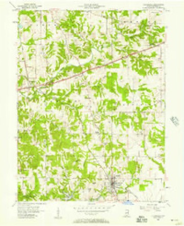
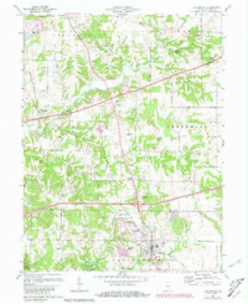
14 topographic sheets cover this place, the earliest surveyed in 1953 and the latest in 1986. It stands in Cloverdale Township. It lies in ZIP code area 46120. It lies near Sunset Hill (historical). The Survey maps it on the Cloverdale quadrangle. 2,060 people lived here at the 2020 count. It stands 814 feet above sea level.
On record in Cloverdale
Buildings and businesses the archive holds for this place. Each opens its own page, with the source record it came from.
On the National Register 2 records
- Cloverdale Historic Districtlisted 2018
- Dick Huffman Covered Bridgelisted 2024
Population over time
2 figuresCloverdale fell from 2,172 to 2,060 between 2010 and 2020. These are the recorded population figures Wikidata holds for this place, reached through the Geographic Names Information System number this page is keyed on rather than by name, so they belong to this place and not to another of the same name. Most are census counts, but not all are: an early figure may be a founding or settlement estimate, and an estimate published within five years of a census is left out. The change column is computed, and is left blank where more than 20 years separate a figure from the one before it, because a gap that long is not a change between two counts.
| Year | People | Change |
|---|---|---|
| 2010 | 2,172 | |
| 2020 | 2,060 | -112 (-5%) |
Topographic sheets covering this place
7 surveys from 14 printed sheetsMatched by testing this settlement's coordinate against the published boundary of every sheet in the United States Geological Survey's historical collection. Each opens the scanned sheet at the Survey.
- 1953 USGS Indianapolis quadrangle1:250000, 4 printings
- 1956 USGS Cloverdale quadrangle1:24000
- 1956 USGS Indianapolis quadrangle1:250000
- 1957 USGS Indianapolis quadrangle1:250000, 2 printings
- 1962 USGS Indianapolis quadrangle1:250000
- 1970 USGS Cloverdale quadrangle1:24000, 3 printings
- 1986 USGS Indianapolis quadrangle1:100000, 2 printings





In the county-history sources
3,608 words on this townshipBiographical and Historical Record of Putnam County, Indiana .., published 1887 names this settlement in its chapter on Cloverdale Township. These are the passages that mention it, exactly as the scans read.
The town of Cloverdale is situated on the L., N. A. & C. Uailroad, twelve miles south of Greencastle, and is the largest town in the county, exclusive of the county seat, having a population of 500. It was laid out by Andrew T. McCoy and Moses Nelson, in 183;J, and stands on section 1, township 12, range 4, and section 6, township 12, range 3.
Passage source: Biographical and Historical Record of Putnam County, Indiana .., published 1887.
Through the instrumentality of Dr. Dyer a seminary was erected in Cloverdale, in 1850, which was carried on for about three years. Professor William Bray was the first principal, and was followed by N. C. Woodward. The institution was chartered and was organized under promising circumstance.. Dr. Dyer, Andrew T. McCoy and John Sandy were the largest stockholders. The school finally failed, because a majority of the stockholders refused to be taxed for its support.
Passage source: Biographical and Historical Record of Putnam County, Indiana .., published 1887.
The schools of the township are good, and their wants are well attended to by the efficiei.t trustee, William Vestal. Cloverdale Seminary and Graded School is under the general management of a board of town trustees. The special object of the seminary is to train teachers for the common school. The course of study and work doue are thorough, and the facilities for gaining an education are good.
Passage source: Biographical and Historical Record of Putnam County, Indiana .., published 1887.
Machine-read from a century-old scan, so expect the errors a machine makes: misspelled names, dropped words, stray characters.
Read the whole chapter on Cloverdale Township - it names this place 13 more 13 times.
Mines and quarries near this place
3 within 5 milesRegional context, not property-specific evidence. The federal mineral resources record lists 3 workings within 5 miles of Cloverdale: 3 producers. All of them still produce. What was taken out: Stone, Crushed/Broken, Limestone, Dimension. Distance is straight-line from the map coordinates, so a quarry counted here may appear on a neighbouring settlement's page as well.
| Where | Site | Commodity | Status | Recorded |
|---|---|---|---|---|
| Rock Hill Quarry | Limestone, Dimension | Producer | ||
| Cloverdale Stone Quarry | Stone, Crushed/Broken | Producer | ||
| Putman County Stone Pit | Stone, Crushed/Broken | Producer |
Storms near this place
40 since 1993Regional context, not property-specific evidence. The National Weather Service names Cloverdale in 40 storm reports between 1993 and 2026: 21 hail, 14 thunderstorm wind, 3 flash flood, 2 tornado. The reports record 1 injury. Each account below is quoted exactly as the forecast office filed it, from the NOAA Storm Events Database, and each date opens the federal record of that event.
| When | Event | Place named | Harm | What the report says |
|---|---|---|---|---|
| December 2015 | Thunderstorm Wind | Cloverdale | 1 hurt, $10,000 | A semi trailer was blown off US Highway 231 at Interstate 70 due to damaging thunderstorm wind gusts. One injury was reported. |
| July 2001 | Thunderstorm Wind | Cloverdale | $20,000 | no account filed |
| April 2017 | Thunderstorm Wind | Cloverdale | $15,000 | Three or four tree were blown down on Down Boy Way in Cloverdale. One of the trees is dead and fell into a mobile home, coming to rest halfway to the floor. |
| December 2015 | Thunderstorm Wind | Cloverdale | $15,000 | A box trailer was reported to be overturned due to damaging thunderstorm wind gusts. Trees and tree limbs were down too, along with some power outages. |
| August 2001 | Thunderstorm Wind | Cloverdale | $10,000 | no account filed |
| July 2023 | Thunderstorm Wind | Cloverdale | $5,000 | Thunderstorm winds downed trees in Putnam County. |
| May 2003 | Tornado (F0) | Cloverdale | $5,000 | no account filed |
| August 1993 | Thunderstorm Wind | Cloverdale | $5,000 | no account filed |
| March 2026 | Thunderstorm Wind | Cloverdale | $4,000 | Thunderstorm wind gusts downed multiple trees. |
| January 2012 | Thunderstorm Wind | Cloverdale | $3,000 | Trees were blown down at this loaction due to damaging thunderstorm wind gusts. |
| October 2014 | Tornado (EF0) | Cloverdale | $2,000 | A damage survey revealed a brief EF0 tornado causing damage to a couple trees approximately 2 miles southeast of Cloverdale. The tornado was sighted by the Emergency Manager, who observed swirling corn stalks in the air. |
| November 1994 | Thunderstorm Wind | Cloverdale | $2,000 | Thunderstorm winds blew down large tree limbs. |
| July 2008 | Thunderstorm Wind | Cloverdale | $800 | Thunderstorm winds blew down a tree onto State Route 42. |
| June 2014 | Flash Flood | Cloverdale | $500 | Two to four inches of water was running over Indiana 42 near East County Road 1200 South. Water was still rising. |
| June 2025 | Thunderstorm Wind | Cloverdale | - | Trained Spotter measured a 63 mph thunderstorm wind gust. |
| March 2017 | Thunderstorm Wind | Cloverdale | - | A measured 63 mph thunderstorm wind gust was observed in this location. |
| August 2009 | Hail | Cloverdale | - | A thunderstorm produced golf ball sized hail on the north side of Cloverdale. Power flashes were also observed and power was out in the town. |
| July 2008 | Flash Flood | Cloverdale | - | Flooding from heavy thunderstorm rains was reported on US Highway 231. |
| June 2007 | Hail | Cloverdale | - | Nickel hail was reported by law enforcement at the highway 231 interchange on interstate 70. |
| June 2001 | Hail | Cloverdale | - | 1 inch hail reported near Interstate 70. |
| June 2021 | Hail | Cloverdale | - | no account filed |
| June 2021 | Hail | Cloverdale | - | no account filed |
| March 2016 | Hail | Cloverdale | - | no account filed |
| March 2012 | Hail | Cloverdale | - | no account filed |
| April 2007 | Hail | Cloverdale | - | no account filed |
| March 2006 | Hail | Cloverdale | - | no account filed |
| March 2006 | Hail | Cloverdale | - | no account filed |
| June 2006 | Hail | Cloverdale | - | no account filed |
| May 2004 | Thunderstorm Wind | Cloverdale | - | no account filed |
| May 2004 | Hail | Cloverdale | - | no account filed |
| May 2003 | Flash Flood | Cloverdale | - | no account filed |
| May 2003 | Hail | Cloverdale | - | no account filed |
| April 2003 | Hail | Cloverdale | - | no account filed |
| August 2001 | Hail | Cloverdale | - | no account filed |
| April 1998 | Hail | Cloverdale | - | no account filed |
| April 1998 | Hail | Cloverdale | - | no account filed |
| April 1998 | Hail | Cloverdale | - | no account filed |
| May 1996 | Hail | Cloverdale | - | no account filed |
| April 1996 | Hail | Cloverdale | - | no account filed |
| April 1996 | Hail | Cloverdale | - | no account filed |
Nearest settlements
The eight closest, with where each one stands in the county. Distances are straight-line, computed from the Geographic Names Information System coordinates.
| Map | Place | Distance | Sheets |
|---|---|---|---|
| Cradick Corner | 2.1 miles | 14 | |
| Jenkinsville | 4.5 miles | 16 | |
| Westland | 5.5 miles | 14 | |
| Putnamville | 5.6 miles | 14 | |
| Belle Union | 6.2 miles | 13 | |
| Mount Meridian | 6.3 miles | 14 | |
| Manhattan | 7.6 miles | 16 | |
| Cagle Mill | 8.0 miles | 15 |
Elsewhere
Matched on this settlement's Geographic Names Information System number rather than its name, so it cannot be a different place of the same name in another state.
| Wikipedia article on Cloverdale | An encyclopaedic summary. Its text is share-alike, so it is linked here rather than copied. |
| Wikidata item Q1966807 | The structured record the population and elevation above come from. Public domain (CC0). |
Provenance
This settlement is recorded in the Geographic Names Information System as feature 432688. The sheet list is computed by point-in-boundary test against the United States Geological Survey's historical topographic inventory. Both are works of the United States government and carry no copyright under 17 U.S.C. 105.
Mines and quarries. USGS Mineral Resources Data System (MRDS) https://mrdata.usgs.gov/mrds/ A work of the United States government, no copyright under 17 U.S.C. 105.
Storms. NOAA National Centers for Environmental Information, Storm Events Database https://www.ncei.noaa.gov/stormevents/ A work of the United States government, no copyright under 17 U.S.C. 105. Narratives are quoted verbatim from the National Weather Service report and are not edited or summarised.