 Block
Columbus, Indiana
14 topographic sheets cover this place, the earliest surveyed in 1942 and the latest in 1986. It stands in Columbus Township. It lies in ZIP code area 47201. It stands on Flatrock River. The Survey maps it on the Columbus quadrangle. 50,474 people lived here at the 2020 count. It stands 630 feet above sea level.
Research this city
On record in Columbus
Buildings and businesses the archive holds for this place. Each opens its own page, with the source record it came from.
On the National Register 12 of 21 shown
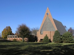 First Baptist ChurchNational Historic Landmark · listed 2000
 First Christian ChurchNational Historic Landmark · listed 2001
 Irwin Union Bank and TrustNational Historic Landmark · listed 2000
 Mabel McDowell Elementary SchoolNational Historic Landmark · listed 2001
 North Christian ChurchNational Historic Landmark · listed 2000
 David Aikens Houselisted 2001
 Bartholomew County Courthouselisted 1979
 Columbus City Halllisted 1979
 Elnora Daugherty Farmlisted 1992
 William R. Gant Farmlisted 2000
 Haw Creek Leather Companylisted 1998
 D.W. Heagy Farmlisted 1998
Population over time
2 figuresColumbus grew from 44,061 to 50,474 between 2010 and 2020. These are the recorded population figures Wikidata holds for this place, reached through the Geographic Names Information System number this page is keyed on rather than by name, so they belong to this place and not to another of the same name. Most are census counts, but not all are: an early figure may be a founding or settlement estimate, and an estimate published within five years of a census is left out. The change column is computed, and is left blank where more than 20 years separate a figure from the one before it, because a gap that long is not a change between two counts.
| Year | People | Change |
|---|---|---|
| 2010 | 44,061 | |
| 2020 | 50,474 | +6,413 (+15%) |
Topographic sheets covering this place
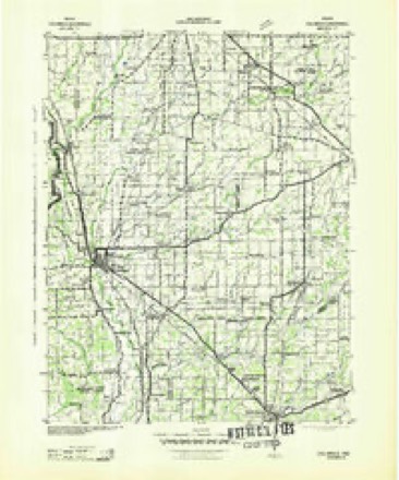
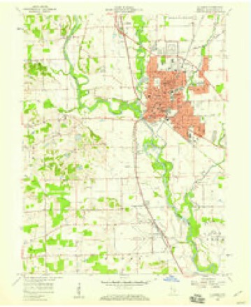
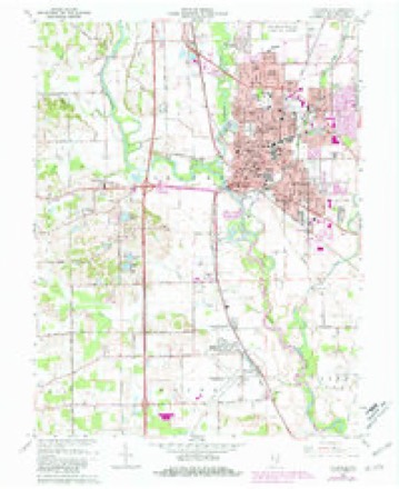
6 surveys from 14 printed sheetsMatched by testing this settlement's coordinate against the published boundary of every sheet in the United States Geological Survey's historical collection. Each opens the scanned sheet at the Survey.
- 1942 USGS Columbus quadrangle1:125000
- 1953 USGS Cincinnati quadrangle1:250000, 3 printings
- 1957 USGS Cincinnati quadrangle1:250000
- 1958 USGS Columbus quadrangle1:24000
- 1962 USGS Columbus quadrangle1:24000, 6 printings
- 1986 USGS Greensburg quadrangle1:100000, 2 printings



Mines and quarries near this place
5 within 5 milesRegional context, not property-specific evidence. The federal mineral resources record lists 5 workings within 5 miles of Columbus: 3 producers, 1 past producer, 1 unknown. 3 still produce. What was taken out: Sand and Gravel, Construction. Distance is straight-line from the map coordinates, so a quarry counted here may appear on a neighbouring settlement's page as well.
| Where | Site | Commodity | Status | Recorded |
|---|---|---|---|---|
| B.D.W. Pit | Sand and Gravel, Construction | Past Producer | ||
| Carter Gravel Company | Sand and Gravel, Construction | Producer | ||
| Columbus Gravel & Concr. Prod.,Inc. | Sand and Gravel, Construction | Producer | ||
| Rees Pit | Sand and Gravel, Construction | Unknown | ||
| Spray Sand and Gravel Dredge | Sand and Gravel, Construction | Producer |
Storms near this place
60 of 81 shownRegional context, not property-specific evidence. The National Weather Service names Columbus in 81 storm reports between 1994 and 2026: 48 thunderstorm wind, 18 hail, 6 flash flood, 4 lightning. The reports record 1 injury. Each account below is quoted exactly as the forecast office filed it, from the NOAA Storm Events Database, and each date opens the federal record of that event.
| When | Event | Place named | Harm | What the report says |
|---|---|---|---|---|
| August 1996 | Lightning | Columbus | 1 hurt | no account filed |
| June 2008 | Flash Flood | East Columbus | $100,000,000 | State Road 46 and State Road 11 are closed due to flash flooding from heavy rainfall. The hospital in Columbus was evacuated and water entered the building due to the flooding of Haw Creek. Houses were flooded with residents stranded. Several bridges collapsed and were washed away. |
| July 2020 | Lightning | East Columbus | $150,000 | Twelve apartments were damaged due to a fire that was caused by a lightning strike. Heavy fire damage caused portions of the roof to collapse onto the ceiling above the second floor apartment units. A number of off-duty firefighters were called in to assist to put out the fire. |
| March 2006 | Flood | Columbus | $100,000 | no account filed |
| June 2025 | Thunderstorm Wind | East Columbus | $75,000 | Thunderstorm wind gusts downed multiple trees and wires across the county with a few roads blocked. Report of one tree on the roof of a house in Columbus. Another report of a tree on top of four to six unoccupied vehicles. No injuries occurred. |
| March 1997 | Thunderstorm Wind | Columbus | $50,000 | no account filed |
| June 2019 | Flash Flood | East Columbus | $45,000 | Dispatch reported standing water on many roads across Columbus with storm drains unable to keep up due to heavy thunderstorm rainfall. Several cars were standing in several feet of water. |
| June 2019 | Flash Flood | East Columbus | $40,000 | Significant flooding was reported in and around Columbus with numerous streets closed and cars stranded in flood water due to heavy thunderstorm rainfall. |
| June 2008 | Thunderstorm Wind | East Columbus | $40,000 | Damage was reported south of the airport near Rocky Ford Road. Powerlines were blown down and parts of roofs were off buildings due to damaging thunderstorm winds. |
| June 2018 | Flood | East Columbus | $30,000 | Water was reported to be up to the door handles of one or more vehicles in Columbus due to heavy rainfall. |
| June 2008 | Flash Flood | East Columbus | $20,000 | Flash flooding was reported including in areas that rarely flood due to heavy rainfall. |
| May 2009 | Lightning | Columbus | $10,000 | Lightning is suspected to be the cause of a house fire, which held ten occupants, occurring at approximately 4 AM EST. The fire was quickly extinguished by firefighters. This minimized structural damage but contents were a total loss in one room and the rest of the house sustained extensive heat damage, melting all plastic items. Property damage cost has been greatly estimated. |
| January 2007 | Flood | Columbus | $10,000 | The East Fork White at Columbus flooded. At one point, four teenagers had to be rescued by the Bartholomew County Swift Water Rescue Team after driving into flood waters. The vehicle had stalled in high water and was beginning to be swept away. No one was injured. |
| May 2004 | Thunderstorm Wind | Columbus | $10,000 | A tree fell on a van busting out its windows and flattening its suspension. Several other trees were also downed in the vicinity. |
| July 2015 | Thunderstorm Wind | East Columbus | $8,000 | Broadcast media reported that a tree was down on a house and there were power outages in parts of town due to damaging thunderstorm wind gusts. |
| June 2019 | Thunderstorm Wind | East Columbus | $7,000 | An estimated thunderstorm wind gust of 60 mph downed numerous trees, ranging from 18 to 30 inches in diameter, due to damaging thunderstorm wind gusts. The spotter saw the trees fall due to straight line wind gusts. |
| June 2010 | Thunderstorm Wind | Columbus | $7,000 | Trees were reported down on many county roads across Bartholomew County. The time this event occurred is estimated. |
| May 2020 | Thunderstorm Wind | East Columbus | $6,000 | Several trees uprooted at this location due to thunderstorm wind gusts. |
| May 2020 | Thunderstorm Wind | East Columbus | $6,000 | Several trees uprooted due to thunderstorm wind gusts near Columbus East High School. |
| July 2008 | Thunderstorm Wind | East Columbus | $6,000 | Trees and utility lines were found down throughout the city due to thunderstorm winds. |
| March 2026 | Flood | East Columbus | $5,000 | Clifty Creek, rose through minor flood stage late on the 4th in Columbus, which was amplified by additional isolated downpours during the afternoon that totaled mainly 0.10-0.50 inches. Twelve homeless individuals and three dogs had to be water rescued from their encampment under the US Highway 31 bridge over Clifty Creek. |
| July 2020 | Thunderstorm Wind | Columbus | $5,000 | Several tree branches of unknown size downed due to thunderstorm wind gusts. One fell and damaged a car. |
| April 2017 | Thunderstorm Wind | East Columbus | $5,000 | Estimated 50 to 60 mph thunderstorm wind gusts downed trees near this location. Pea sized hail was also observed. |
| May 2002 | Thunderstorm Wind | Columbus | $5,000 | Trees down on a trailer |
| June 1994 | Thunderstorm Wind | Columbus | $5,000 | A utility pole was downed on the north side of Columbus. |
| August 1996 | Thunderstorm Wind | Columbus | $5,000 | no account filed |
| June 2025 | Thunderstorm Wind | East Columbus | $4,000 | Thunderstorm wind gusts blew down a large tree and fence. |
| May 1995 | Thunderstorm Wind | Columbus | $3,000 | Trees and power lines were downed on the west side of Columbus. |
| May 2013 | Thunderstorm Wind | East Columbus | $2,000 | A tree was reported down on Smith Street in Columbus due to damaging thunderstorm wind gusts. Tree limbs were elsewhere in the county. |
| May 2011 | Thunderstorm Wind | East Columbus | $1,500 | Tree limbs were reported down on power lines due to damaging thunderstorm wind gusts. |
| June 2025 | Thunderstorm Wind | East Columbus | $1,000 | Thunderstorm wind gusts split a twelve-inch diameter pine tree in half. |
| February 2019 | Flash Flood | Columbus | $1,000 | Water was running across Rockyford Road between Talley Road and Bonnell Road due to flash flooding from heavy rainfall. |
| May 2018 | Thunderstorm Wind | East Columbus | $1,000 | A two foot diameter tree was blown down into the street near the intersection of 16th and Chestnut Streets due to damaging thunderstorm wind gusts. This tree missed hitting a vehicle by about one foot. The report was relayed through amateur radio. |
| July 2013 | Thunderstorm Wind | Columbus | $1,000 | Several tree limbs and power lines were downed in and near this location due to strong thunderstorm wind gusts. |
| April 2007 | Thunderstorm Wind | Columbus | $1,000 | Power lines were down on US-31 between 800 N and 900 N due to damaging thunderstorm winds. |
| May 1996 | Thunderstorm Wind | Columbus | $1,000 | no account filed |
| May 2011 | Thunderstorm Wind | East Columbus | $800 | Eight inch tree limbs were reported down, due to damaging thunderstorm wind gust, approximately one half mile south of the 25th Street and Taylor Road intersection. |
| May 1996 | Thunderstorm Wind | Columbus | $500 | no account filed |
| May 2018 | Thunderstorm Wind | East Columbus | - | A thunderstorm wind gust estimated at 60 mph was observed in this location. |
| July 2015 | Thunderstorm Wind | East Columbus | - | An estimated 60 mph thunderstorm wind gust was observed on Central Avenue. |
| June 2008 | Thunderstorm Wind | East Columbus | - | Several large tree limbs were down due to damaging thunderstorm winds. |
| April 2007 | Thunderstorm Wind | Columbus | - | Two trees were reported down near county roads 650 E and 250 N due to damaging thunderstorm winds. |
| January 2006 | Heavy Rain | Columbus | - | 1.3 inches of rain fell in 30 minutes. |
| June 2006 | Thunderstorm Wind | Columbus | - | Trees were downed. |
| May 2005 | Thunderstorm Wind | Columbus | - | Several trees were blown down throughout Columbus. One fell on a parked car, and another fell on a church. No damage estimates were available. |
| May 2005 | Thunderstorm Wind | Columbus | - | A 12-inch diameter tree was blown down. |
| May 2005 | Thunderstorm Wind | Columbus | - | An estimated wind gust of 60 mph occurred in Columbus. |
| July 2005 | Thunderstorm Wind | Columbus | - | A church roof, under repair at the time of the storm, was partially damaged by the wind. No damage estimates were available. |
| July 2004 | Thunderstorm Wind | Columbus | - | Power lines were downed. |
| July 2003 | Thunderstorm Wind | Columbus | - | Large trees down |
| September 2002 | Thunderstorm Wind | Columbus | - | Trees and Power lines down |
| July 1995 | Thunderstorm Wind | Columbus | - | Trees were downed. |
| May 2025 | Hail | East Columbus | - | no account filed |
| May 2020 | Hail | East Columbus | - | no account filed |
| March 2012 | Hail | East Columbus | - | no account filed |
| May 2011 | Hail | East Columbus | - | no account filed |
| January 2006 | Hail | Columbus | - | no account filed |
| January 2006 | Hail | Columbus | - | no account filed |
| March 2006 | Hail | Columbus | - | no account filed |
| April 2006 | Hail | Columbus | - | no account filed |
Nearest settlements
The eight closest, with where each one stands in the county. Distances are straight-line, computed from the Geographic Names Information System coordinates.
| Map | Place | Distance | Sheets |
|---|---|---|---|
| East Columbus | 1.0 miles | 14 | |
| Garden City | 1.4 miles | 14 | |
| North Columbus | 2.3 miles | 14 | |
| Forest Park | 2.4 miles | 14 | |
| Everroad Park | 2.6 miles | 14 | |
| Parkside | 2.6 miles | 14 | |
| Riverview Acres | 2.8 miles | 14 | |
| Corn Brook | 3.1 miles | 14 |
Elsewhere
Matched on this settlement's Geographic Names Information System number rather than its name, so it cannot be a different place of the same name in another state.
| Wikipedia article on Columbus | An encyclopaedic summary. Its text is share-alike, so it is linked here rather than copied. |
| Wikidata item Q941870 | The structured record the population and elevation above come from. Public domain (CC0). |
Provenance
This settlement is recorded in the Geographic Names Information System as feature 432826. The sheet list is computed by point-in-boundary test against the United States Geological Survey's historical topographic inventory. Both are works of the United States government and carry no copyright under 17 U.S.C. 105.
Mines and quarries. USGS Mineral Resources Data System (MRDS) https://mrdata.usgs.gov/mrds/ A work of the United States government, no copyright under 17 U.S.C. 105.
Storms. NOAA National Centers for Environmental Information, Storm Events Database https://www.ncei.noaa.gov/stormevents/ A work of the United States government, no copyright under 17 U.S.C. 105. Narratives are quoted verbatim from the National Weather Service report and are not edited or summarised.