Block
From the record
23 National Register listings published here, 5 of them National Historic Landmarks.
Sources: the county history on the Internet Archive · the National Register database, National Park Service
87 topographic sheets cover 47 settlements here, and 23 properties are on the National Register of Historic Places.
23 National Register listings published here, 5 of them National Historic Landmarks.
Sources: the county history on the Internet Archive · the National Register database, National Park Service
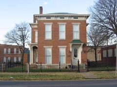
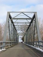
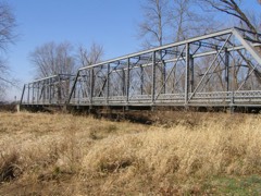
Every property in this county listed on the National Register of Historic Places, with the year it was listed and the federal nomination document.
Every wildfire the federal occurrence database records inside this county: 11 of them, burning about 1,890 acres. None started naturally and none was recorded as arson. Each settlement page carries the fires within five miles of it.
| Reported cause | Fires |
|---|---|
| Missing data/not specified/undetermined | 8 |
| Debris and open burning | 3 |
The five largest, by the area the report gives. None of them was recorded as arson.
| Date | Cause | Size | Reported by | Name on the report |
|---|---|---|---|---|
| 9 March 2007 | Missing data/not specified/undetermined | 1,549 acres | Indiana Division of Forestry | COYOTE FIRE |
| 22 April 2007 | Missing data/not specified/undetermined | 165 acres | Indiana Division of Forestry | INCOMING FIRE |
| 22 April 2007 | Missing data/not specified/undetermined | 156 acres | Indiana Division of Forestry | TOO LATE FIRE |
| 3 November 2005 | Missing data/not specified/undetermined | 10 acres | Indiana State Fire Marshal's Office | not named |
| 16 November 2016 | Debris and open burning | 6.5 acres | Hoosier National Forest | WEST BAKER HOLLOW |
| 25 October 1999 | Debris and open burning | 1.0 acres | Hoosier National Forest | PONDEROSA |
| 15 October 2005 | Missing data/not specified/undetermined | 1.0 acres | Indiana State Fire Marshal's Office | not named |
| 16 June 2003 | Missing data/not specified/undetermined | 1.0 acres | Indiana State Fire Marshal's Office | not named |
Every settlement page carries the fires within five miles of it - see the settlement index below.
The NOAA Storm Events Database holds 316 reports for this county, causing 4 deaths, 8 injuries and about $284,097,550 in recorded property damage. Each settlement page carries the reports that name it.
| Kind of event | Reports |
|---|---|
| Thunderstorm Wind | 188 |
| Hail | 66 |
| Tornado | 19 |
| Flash Flood | 19 |
| Flood | 17 |
| Lightning | 6 |
| Heavy Rain | 1 |
The most serious of them, by death, then injury, then recorded damage. The accounts are quoted exactly as the forecast office filed them.
| When | Event | Place named | Harm | What the report says |
|---|---|---|---|---|
| June 2008 | Flash Flood | Nortonsburg | 1 killed, $10,000 | A man was driving home from work on Saturday June 7th on County Road 550 North near County Road 475 East when the flooded Haw Creek pushed his vehicle about 300 yards off the road. He was advised to stay in his vehicle, however he tried to walk away. He drowned around 1230 EST on June 7th after he tried to walk back to dry land. The flood waters swept the man downstream. His body was found on Monday June 9th at around 1615 EST in a creek bank near County Road 450 North. |
| June 2008 | Flash Flood | Old St Louis | 1 killed, $10,000 | A man drowned the afternoon of Saturday June 7th after his car was swept off the road near the flooded Haw Creek. He got out of his car and tried to walk back to his house. He then drowned in the flood waters. |
| April 2025 | Flood | Garden City | 1 killed | The exact time is unknown, but the victim chose to stay in his home near the river when moderate to major flooding was ongoing. He was found 5 days later having drowned. |
| April 2018 | Flood | Riverview Acres | 1 killed | Fox 59 reported that a missing kayaker was found dead Friday, April 6th not far from where his kayak was found earlier in the day. The DNR said his body was found about 100 yards away from his kayak, located between Tannehill Bridge and Lowell Bridge on the Driftwood River.||It is believed the 26-year-old man drowned while kayaking on suspected flood waters of the Driftwood River near Columbus on the morning of April 5th. Moderate flooding was occurring on the East Fork White River at Columbus which is slightly downstream from the incident. The time and location of the report is estimated. |
| July 1978 | Tornado (F1) | not stated | 6 hurt, $25,000 | no account filed |
| July 2023 | Thunderstorm Wind | Taylorsville | 1 hurt, $100,000 | Trees downed by thunderstorm wind gusts damaged five cars and an RV with an injury in the RV. |
| August 1996 | Lightning | Columbus | 1 hurt | no account filed |
| June 2008 | Flood | Garden | $150,000,000 | Flooding occurred along the East Fork White River in Bartholomew County, including in Columbus, due to heavy rain. |
| June 2008 | Flash Flood | East Columbus | $100,000,000 | State Road 46 and State Road 11 are closed due to flash flooding from heavy rainfall. The hospital in Columbus was evacuated and water entered the building due to the flooding of Haw Creek. Houses were flooded with residents stranded. Several bridges collapsed and were washed away. |
| April 1974 | Tornado (F4) | not stated | $25,000,000 | no account filed |
| May 1971 | Tornado (F2) | not stated | $2,500,000 | no account filed |
| March 2025 | Tornado (EF2) | Columbus Arpt | $1,600,000 | The tornado produced nearly continuous, yet mainly EF1-intensity damage across its relatively long track from about one mile west-southwest of the Rosstown community to about one mile south-southeast of Newbern. Beginning just east of Interstate 65, damage occurred on the northwest side of both the Rosstown and Waynesville communities, and then about 2-3 miles west and north of the Elizabethtown area, which included two areas of more intense damage consistent with low end EF2 winds: walls and roofs collapsed on well built metal farm buildings, with debris lofted and thrown a quarter to one half mile to the north and northeast at both locations. Elsewhere, most county roads within the circulation's path had several utility poles broken, as well as small metal high transmission towers (not heavier steel structures) twisted and bent down. This damage was EF1-rated given adjacent wooden double poles (H-frame) that had no damage. Maximum winds were estimated at 112 mph. |
| April 2025 | Flash Flood | Taylorsville | $500,000 | Numerous roads closed across the county due to flash flooding. 2 dams went into elevated risk for failure. Total rainfall was between 1.7 and 2.5 inches. |
| April 1994 | Thunderstorm Wind | Waymansville | $500,000 | Four miles north of Columbus a highway sign was blown down. At Waymansville several trailers were damaged, and 9 homes sustained roof damage. Also at Waymansville a carport was destroyed at a business, one barn was heavily damaged, and 3 other barns sustained minor damage. |
| June 2023 | Thunderstorm Wind | Garden City | $350,000 | A trained spotter measured a 60 mph thunderstorm wind gust at this location. Numerous trees and power lines also downed with over 9000 power outages caused by the storm. |
| July 2008 | Lightning | Elizabethtown | $350,000 | Lightning was blamed as the cause of a fire that destroyed an Elizabethtown house. The fire was discovered by a passer-by at about 4:39 AM EST, according to the fire department. The department estimated the fire caused at least $350,000 in damage to the house and contents. The fire was believed to have been burning for some time before it was discovered as evidenced by the entire front of the house, and halfway inside, being engulfed in flames. The owners were at work at the time of occurrence. |
| April 1996 | Tornado (F1) | Burnsville | $250,000 | no account filed |
| November 1992 | Tornado (F2) | not stated | $250,000 | no account filed |
| September 1976 | Tornado (F1) | not stated | $250,000 | no account filed |
| June 1973 | Tornado (F1) | not stated | $250,000 | no account filed |
| May 1969 | Tornado (F2) | not stated | $250,000 | no account filed |
| April 1968 | Tornado (F3) | not stated | $250,000 | no account filed |
| July 2020 | Lightning | East Columbus | $150,000 | Twelve apartments were damaged due to a fire that was caused by a lightning strike. Heavy fire damage caused portions of the roof to collapse onto the ceiling above the second floor apartment units. A number of off-duty firefighters were called in to assist to put out the fire. |
| June 2021 | Flash Flood | Prentis Corners | $100,000 | County Road 410 North between County Road 1000 East and State Road 46 was washed out by rapidly flowing water destroying a pipe. Water was noted to be flowing over the road over the time. |
| November 2005 | Tornado (F1) | Hope | $100,000 | A strong F3 tornado touched down in northern Bartholomew county on 15 November 2005, continuing into southeast Shelby county, where it would do the majority of its damage. No one was killed by this powerful tornado, despite areas of severe damage, and only one minor injury was reported. A resident sustained an ankle injury when moving quickly down into his basement with his family to take cover. The worst damage along the tornado's path took place along and near Vandalia Road just east of the town of Geneva, where a large hog farm was severely damaged, and an old farm house was blown off its foundation. The structural integrity of the destroyed home was insufficient to justify a violent rating. Around 25 properties were damaged in this largely rural area, with six declared total losses. |
| March 2006 | Flood | Columbus | $100,000 | no account filed |
| June 2019 | Thunderstorm Wind | Garden City | $85,000 | Storm survey found 10-15 homes sustained damage to siding, roofs, and gutters in the Shadow Creek Farms neighborhood just south of County Road 200 South and west of State Route 11. Multiple hardwood trees were snapped and dropped to the northeast. Tree and limb damage were isolated to the northeast of the neighborhood across another neighborhood and into the Bartholomew County Fairgrounds. Additional structural damage occurred to a barn across State Route 11. An irrigation device was flipped over in an adjacent field. |
| June 2025 | Thunderstorm Wind | East Columbus | $75,000 | Thunderstorm wind gusts downed multiple trees and wires across the county with a few roads blocked. Report of one tree on the roof of a house in Columbus. Another report of a tree on top of four to six unoccupied vehicles. No injuries occurred. |
| March 2006 | Lightning | Hope | $60,000 | The home of Pauly Quillen Yeadon, 72, was struck by lightning and severely damaged by the ensuing fire early on the morning of 12 March 2006. Three separate fire departments responded to the call, and managed to extinguish the fire, but not before it damaged the entire second floor. The first floor suffered significant water damage. |
| September 2024 | Thunderstorm Wind | Azalia | $50,000 | Thunderstorm winds consistent with a brief microburst downed oak and hickory trees into a metal pole barn at 5850 West County Road 100 South. Damage continued for about 0.5 miles east laying down crops. |
| June 2008 | Thunderstorm Wind | Columbus Arpt | $50,000 | Utility poles were snapped and an empty warehouse was blown apart due to damaging thunderstorm winds. |
| May 2002 | Flash Flood | Countywide | $50,000 | no account filed |
| March 1997 | Thunderstorm Wind | Columbus | $50,000 | no account filed |
| June 2019 | Flash Flood | East Columbus | $45,000 | Dispatch reported standing water on many roads across Columbus with storm drains unable to keep up due to heavy thunderstorm rainfall. Several cars were standing in several feet of water. |
| June 2019 | Flash Flood | East Columbus | $40,000 | Significant flooding was reported in and around Columbus with numerous streets closed and cars stranded in flood water due to heavy thunderstorm rainfall. |
| June 2008 | Thunderstorm Wind | East Columbus | $40,000 | Damage was reported south of the airport near Rocky Ford Road. Powerlines were blown down and parts of roofs were off buildings due to damaging thunderstorm winds. |
| June 2018 | Flood | East Columbus | $30,000 | Water was reported to be up to the door handles of one or more vehicles in Columbus due to heavy rainfall. |
| March 2008 | Flood | Garden City | $30,000 | Flooding occurred along the East Fork White River in Bartholomew County, including near Columbus, due to heavy rain. Multiple roads were flooded due to heavy rain. A school bus had to be rescued from flood waters on March 27th west of Columbus. No injuries were reported. |
| August 2012 | Thunderstorm Wind | Hope | $25,000 | Trees were down on houses in the Hope area due to damaging thunderstorm wind gusts. The power was reported out as well. |
| September 1988 | Tornado (F0) | not stated | $25,000 | no account filed |
| June 1973 | Tornado (F2) | not stated | $25,000 | no account filed |
| July 1959 | Tornado (F1) | not stated | $25,000 | no account filed |
| April 2026 | Thunderstorm Wind | Ogilville | $20,000 | Thunderstorm wind gusts downed a tree onto a camper. Additional sporadic damage reported in the western and southern portions of the county. |
| July 2021 | Flash Flood | Old St Louis | $20,000 | Indiana State Route 9 is impassable or washed out from the Shelby County line to Hope town square. At least one water rescue was performed. |
| May 2015 | Thunderstorm Wind | Clifford | $20,000 | Large trees were downed and a semi-truck was blown over due to damaging thunderstorm wind gusts. |
| June 2008 | Flash Flood | East Columbus | $20,000 | Flash flooding was reported including in areas that rarely flood due to heavy rainfall. |
| March 2025 | Thunderstorm Wind | Taylorsville | $15,000 | Thunderstorm winds snapped two wooden power poles and a center-pivot sprinkler was overturned in the field north of County Road 800 North. |
| July 2015 | Thunderstorm Wind | Elizabethtown | $15,000 | Numerous trees were downed, one on a garage, due to damaging thunderstorm wind gusts. |
| July 2015 | Thunderstorm Wind | Azalia | $15,000 | Numerous trees were downed along Route 31 between Columbus and Seymour due to damaging thunderstorm wind gusts. Route 31 was reported to be impassible in a few spots. |
| March 2008 | Flood | Garden City | $15,000 | Flooding occurred along the East Fork White River in Bartholomew County, including near Columbus, due to heavy rain and snow melt. |
| March 2025 | Thunderstorm Wind | Ogilville | $10,000 | A barn roof was blown off and a trailer was blown over by thunderstorm wind gusts along with several nearby reports of tree and tree limb damage. |
| June 2025 | Thunderstorm Wind | Taylorsville | $10,000 | Large billboard blown over by thunderstorm wind gusts. Measured 60 mph thunderstorm wind gust by a trained spotter. |
| May 2022 | Thunderstorm Wind | Taylorsville | $10,000 | Thunderstorm winds downed numerous tree limbs in the area and folded over a highway sign. Received via Twitter. |
| June 2019 | Thunderstorm Wind | Garden | $10,000 | Damage to trees and power lines were reported from southeast of Columbus due to damaging thunderstorm wind gusts. |
| April 2017 | Thunderstorm Wind | Burnsville | $10,000 | Damaging thunderstorm wind gusts took out a barn and downed trees near this location. |
| May 2011 | Thunderstorm Wind | Bethel Vlg | $10,000 | Large trees were reported down and a barn sustained roof damage due to damaging thunderstorm wind gusts. |
| May 2009 | Lightning | Columbus | $10,000 | Lightning is suspected to be the cause of a house fire, which held ten occupants, occurring at approximately 4 AM EST. The fire was quickly extinguished by firefighters. This minimized structural damage but contents were a total loss in one room and the rest of the house sustained extensive heat damage, melting all plastic items. Property damage cost has been greatly estimated. |
| March 2008 | Flood | Riverview Acres | $10,000 | Flooding occurred along the Flatrock River in Bartholomew County, including near Columbus, due to heavy rain. Multiple roads were flooded due to the heavy rain. |
| June 2008 | Thunderstorm Wind | Garden City | $10,000 | A tree crashed onto a cabin along the Driftwood River and trapped the resident inside for two hours. The smashed porch closed off the cabin's only outside door. |
| January 2007 | Flood | Columbus | $10,000 | The East Fork White at Columbus flooded. At one point, four teenagers had to be rescued by the Bartholomew County Swift Water Rescue Team after driving into flood waters. The vehicle had stalled in high water and was beginning to be swept away. No one was injured. |
The Survey's mineral resources record lists 6 workings inside this county. 4 still produce and 2 are closed or unrecorded. Each settlement page carries the workings within five miles of it.
| Commodity | Workings |
|---|---|
| Sand and Gravel, Construction | 5 |
| Stone, Crushed/Broken | 1 |
The least common of them first, because a county's hundredth gravel pit says nothing its first ten did not.
| Where | Site | Commodity | Status | Recorded |
|---|---|---|---|---|
| Meshberger Quarry and Mill | Stone, Crushed/Broken | Producer | ||
| B.D.W. Pit | Sand and Gravel, Construction | Past Producer | ||
| Carter Gravel Company | Sand and Gravel, Construction | Producer | ||
| Columbus Gravel & Concr. Prod.,Inc. | Sand and Gravel, Construction | Producer | ||
| Rees Pit | Sand and Gravel, Construction | Unknown | ||
| Spray Sand and Gravel Dredge | Sand and Gravel, Construction | Producer |
One book written about this county, cut here where the book itself is cut, at its printed chapters: 8 chapters in all. Every chapter is public domain, machine-read from the scan and reproduced complete. A chapter already given under one of the county's towns is not repeated in this list.
| Chapter | Length |
|---|---|
| Chapter 9 | 93,968 words in 6 parts |
| Chapter with an unread heading (no. 2 of those read) | 29,316 words in 2 parts |
| Chapter 3 | 13,472 words |
| Chapter 4 | 2,098 words |
| Chapter 5: I'.y Col. S. Stansnxr | 6,078 words |
| Chapter 6 | 33,298 words in 3 parts |
| Chapter 8 | 14,043 words |
| Chapter 9: 1!y C. Rickktts | 21,167 words in 2 parts |
Named settlements recorded in the Geographic Names Information System, each with the topographic sheets covering it. Villages, hamlets and abandoned places alike. Each is shown with the nearest named watercourse or landform and the survey quadrangle it falls on.
Sand Creek township · 47232 · On Little Sand Creek · Azalia quadrangle
11 sheets, 1942 to 1986
Harrison township · 47201 · Near Patterson Hill · New Bellsville quadrangle
18 sheets, 1942 to 1986
Wayne township · 47201 · On Opossum Creek · Columbus quadrangle
14 sheets, 1942 to 1986
Flat Rock township · 47226 · On Slash-Loesch Ditch · Hope quadrangle
15 sheets, 1942 to 1986
Columbus township · 47201 · On Flatrock River · Columbus quadrangle
14 sheets, 1942 to 1986
Sand Creek township · 47232 · On Cooks Creek · Elizabethtown quadrangle
11 sheets, 1942 to 1986
Columbus township · 47201 · On Flatrock River · Columbus quadrangle
14 sheets, 1942 to 1986
Ohio township · 47201 · Near Patterson Hill · New Bellsville quadrangle
18 sheets, 1942 to 1986
Harrison township · 47201 · Near Taylor Hill · New Bellsville quadrangle
18 sheets, 1942 to 1986
Clay township · 47203 · On Sloan Branch · Elizabethtown quadrangle
11 sheets, 1942 to 1986
Camp Atterbury unorganized territory · 46124 · On Mud Creek · Nineveh quadrangle
23 sheets, 1942 to 1998
Sand Creek township · 47201 · On Brush Creek · Elizabethtown quadrangle
11 sheets, 1942 to 1986
Clay township · 47203 · On Otter Creek · Elizabethtown quadrangle
11 sheets, 1942 to 1986
Flat Rock township · 47246 · On Trimnell Branch · Hope quadrangle
15 sheets, 1942 to 1986
Harrison township · 47201 · Near Dowell Hill · New Bellsville quadrangle
18 sheets, 1942 to 1986
Wayne township · 47201 · On Little Sand Creek · Jonesville quadrangle
13 sheets, 1942 to 1986