 Block
Garden City, Indiana
14 topographic sheets cover this place, the earliest surveyed in 1942 and the latest in 1986. It stands in Columbus Township. It lies in ZIP code area 47201. It stands on Flatrock River. The Survey maps it on the Columbus quadrangle. It stands 610 feet above sea level.
On record in Garden City
Buildings and businesses the archive holds for this place. Each opens its own page, with the source record it came from.
On the National Register within a mile 1 record
The National Register names another town for these. They stand within one mile of this settlement's coordinate.
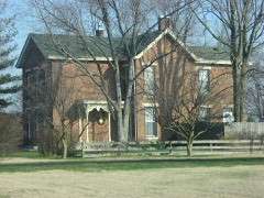 David Aikens Houselisted 2001 · 0.7 miles away
Topographic sheets covering this place
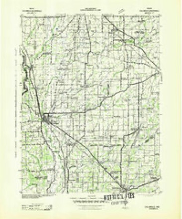
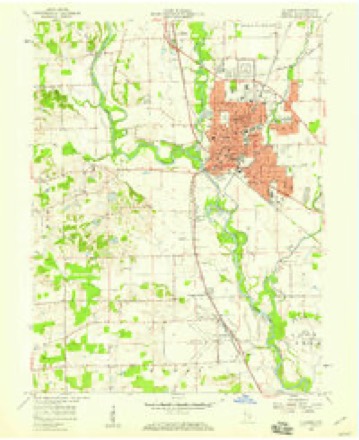
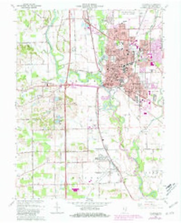
6 surveys from 14 printed sheetsMatched by testing this settlement's coordinate against the published boundary of every sheet in the United States Geological Survey's historical collection. Each opens the scanned sheet at the Survey.
- 1942 USGS Columbus quadrangle1:125000
- 1953 USGS Cincinnati quadrangle1:250000, 3 printings
- 1957 USGS Cincinnati quadrangle1:250000
- 1958 USGS Columbus quadrangle1:24000
- 1962 USGS Columbus quadrangle1:24000, 6 printings
- 1986 USGS Greensburg quadrangle1:100000, 2 printings



Mines and quarries near this place
5 within 5 milesRegional context, not property-specific evidence. The federal mineral resources record lists 5 workings within 5 miles of Garden City: 3 producers, 1 past producer, 1 unknown. 3 still produce. What was taken out: Sand and Gravel, Construction. Distance is straight-line from the map coordinates, so a quarry counted here may appear on a neighbouring settlement's page as well.
| Where | Site | Commodity | Status | Recorded |
|---|---|---|---|---|
| B.D.W. Pit | Sand and Gravel, Construction | Past Producer | ||
| Carter Gravel Company | Sand and Gravel, Construction | Producer | ||
| Columbus Gravel & Concr. Prod.,Inc. | Sand and Gravel, Construction | Producer | ||
| Rees Pit | Sand and Gravel, Construction | Unknown | ||
| Spray Sand and Gravel Dredge | Sand and Gravel, Construction | Producer |
Storms near this place
12 since 2008Regional context, not property-specific evidence. The National Weather Service names Garden City in 12 storm reports between 2008 and 2025: 5 thunderstorm wind, 4 flood, 2 hail, 1 flash flood. The reports record 1 death. Each account below is quoted exactly as the forecast office filed it, from the NOAA Storm Events Database, and each date opens the federal record of that event.
| When | Event | Place named | Harm | What the report says |
|---|---|---|---|---|
| April 2025 | Flood | Garden City | 1 killed | The exact time is unknown, but the victim chose to stay in his home near the river when moderate to major flooding was ongoing. He was found 5 days later having drowned. |
| June 2023 | Thunderstorm Wind | Garden City | $350,000 | A trained spotter measured a 60 mph thunderstorm wind gust at this location. Numerous trees and power lines also downed with over 9000 power outages caused by the storm. |
| June 2019 | Thunderstorm Wind | Garden City | $85,000 | Storm survey found 10-15 homes sustained damage to siding, roofs, and gutters in the Shadow Creek Farms neighborhood just south of County Road 200 South and west of State Route 11. Multiple hardwood trees were snapped and dropped to the northeast. Tree and limb damage were isolated to the northeast of the neighborhood across another neighborhood and into the Bartholomew County Fairgrounds. Additional structural damage occurred to a barn across State Route 11. An irrigation device was flipped over in an adjacent field. |
| March 2008 | Flood | Garden City | $30,000 | Flooding occurred along the East Fork White River in Bartholomew County, including near Columbus, due to heavy rain. Multiple roads were flooded due to heavy rain. A school bus had to be rescued from flood waters on March 27th west of Columbus. No injuries were reported. |
| March 2008 | Flood | Garden City | $15,000 | Flooding occurred along the East Fork White River in Bartholomew County, including near Columbus, due to heavy rain and snow melt. |
| June 2008 | Thunderstorm Wind | Garden City | $10,000 | A tree crashed onto a cabin along the Driftwood River and trapped the resident inside for two hours. The smashed porch closed off the cabin's only outside door. |
| May 2018 | Thunderstorm Wind | Garden City | $2,500 | A thunderstorm wind gust of 47 mph was measured in this location where 8-inch tree limbs were broken off trees near the 4H Fairgrounds. |
| June 2018 | Flood | Garden City | $1,000 | Some street flooding, perhaps a few inches deep, was observed on Washington Street near 16th Street in Columbus due to heavy rainfall. This report was received via Facebook. |
| May 2010 | Flash Flood | Garden City | $1,000 | Flash flooding was reported at the intersection of 13th Street and Washington Street. |
| May 2018 | Thunderstorm Wind | Garden City | $200 | A six inch tree limb was broken a tree due to strong thunderstorm wind gusts. |
| May 2017 | Hail | Garden City | - | no account filed |
| May 2011 | Hail | Garden City | - | no account filed |
Nearest settlements
The eight closest, with where each one stands in the county. Distances are straight-line, computed from the Geographic Names Information System coordinates.
| Map | Place | Distance | Sheets |
|---|---|---|---|
| Columbus | 1.4 miles | 14 | |
| East Columbus | 2.1 miles | 14 | |
| Bethel Village | 2.2 miles | 14 | |
| Walesboro | 2.8 miles | 14 | |
| North Columbus | 3.7 miles | 14 | |
| Forest Park | 3.8 miles | 14 | |
| Everroad Park | 3.9 miles | 14 | |
| Parkside | 4.0 miles | 14 |
Elsewhere
Matched on this settlement's Geographic Names Information System number rather than its name, so it cannot be a different place of the same name in another state.
| Wikipedia article on Garden City | An encyclopaedic summary. Its text is share-alike, so it is linked here rather than copied. |
| Wikidata item Q5522192 | The structured record the population and elevation above come from. Public domain (CC0). |
Provenance
This settlement is recorded in the Geographic Names Information System as feature 434943. The sheet list is computed by point-in-boundary test against the United States Geological Survey's historical topographic inventory. Both are works of the United States government and carry no copyright under 17 U.S.C. 105.
Mines and quarries. USGS Mineral Resources Data System (MRDS) https://mrdata.usgs.gov/mrds/ A work of the United States government, no copyright under 17 U.S.C. 105.
Storms. NOAA National Centers for Environmental Information, Storm Events Database https://www.ncei.noaa.gov/stormevents/ A work of the United States government, no copyright under 17 U.S.C. 105. Narratives are quoted verbatim from the National Weather Service report and are not edited or summarised.