 Block
East Columbus, Indiana
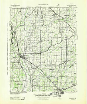
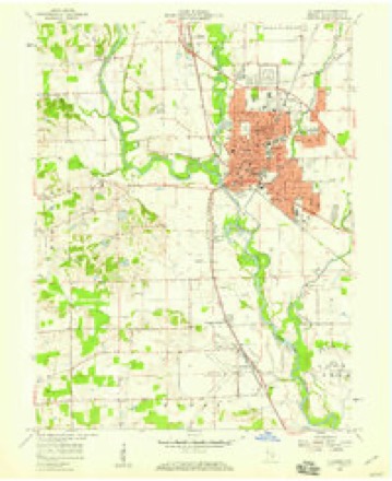
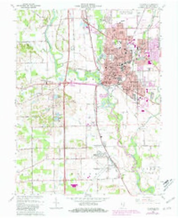
14 topographic sheets cover this place, the earliest surveyed in 1942 and the latest in 1986. It stands in Columbus Township. It lies in ZIP code area 47201. The Survey maps it on the Columbus quadrangle.
On record in East Columbus
Buildings and businesses the archive holds for this place. Each opens its own page, with the source record it came from.
On the National Register within a mile 5 records
The National Register names another town for these. They stand within one mile of this settlement's coordinate.
 Mabel McDowell Elementary SchoolNational Historic Landmark · listed 2001 · 0.5 miles away
 First Christian ChurchNational Historic Landmark · listed 2001 · 0.9 miles away
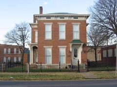 McEwen-Samuels-Marr Houselisted 1978 · 0.9 miles away
 Columbus City Halllisted 1979 · 1.0 miles away
- Columbus Historic Districtlisted 1982 · 0.9 miles away
Topographic sheets covering this place
6 surveys from 14 printed sheetsMatched by testing this settlement's coordinate against the published boundary of every sheet in the United States Geological Survey's historical collection. Each opens the scanned sheet at the Survey.
- 1942 USGS Columbus quadrangle1:125000
- 1953 USGS Cincinnati quadrangle1:250000, 3 printings
- 1957 USGS Cincinnati quadrangle1:250000
- 1958 USGS Columbus quadrangle1:24000
- 1962 USGS Columbus quadrangle1:24000, 6 printings
- 1986 USGS Greensburg quadrangle1:100000, 2 printings



Mines and quarries near this place
5 within 5 milesRegional context, not property-specific evidence. The federal mineral resources record lists 5 workings within 5 miles of East Columbus: 3 producers, 1 past producer, 1 unknown. 3 still produce. What was taken out: Sand and Gravel, Construction. Distance is straight-line from the map coordinates, so a quarry counted here may appear on a neighbouring settlement's page as well.
| Where | Site | Commodity | Status | Recorded |
|---|---|---|---|---|
| B.D.W. Pit | Sand and Gravel, Construction | Past Producer | ||
| Carter Gravel Company | Sand and Gravel, Construction | Producer | ||
| Columbus Gravel & Concr. Prod.,Inc. | Sand and Gravel, Construction | Producer | ||
| Rees Pit | Sand and Gravel, Construction | Unknown | ||
| Spray Sand and Gravel Dredge | Sand and Gravel, Construction | Producer |
Storms near this place
28 since 2008Regional context, not property-specific evidence. The National Weather Service names East Columbus in 28 storm reports between 2008 and 2026: 17 thunderstorm wind, 4 flash flood, 4 hail, 2 flood. No death or injury is recorded in these reports. Each account below is quoted exactly as the forecast office filed it, from the NOAA Storm Events Database, and each date opens the federal record of that event.
| When | Event | Place named | Harm | What the report says |
|---|---|---|---|---|
| June 2008 | Flash Flood | East Columbus | $100,000,000 | State Road 46 and State Road 11 are closed due to flash flooding from heavy rainfall. The hospital in Columbus was evacuated and water entered the building due to the flooding of Haw Creek. Houses were flooded with residents stranded. Several bridges collapsed and were washed away. |
| July 2020 | Lightning | East Columbus | $150,000 | Twelve apartments were damaged due to a fire that was caused by a lightning strike. Heavy fire damage caused portions of the roof to collapse onto the ceiling above the second floor apartment units. A number of off-duty firefighters were called in to assist to put out the fire. |
| June 2025 | Thunderstorm Wind | East Columbus | $75,000 | Thunderstorm wind gusts downed multiple trees and wires across the county with a few roads blocked. Report of one tree on the roof of a house in Columbus. Another report of a tree on top of four to six unoccupied vehicles. No injuries occurred. |
| June 2019 | Flash Flood | East Columbus | $45,000 | Dispatch reported standing water on many roads across Columbus with storm drains unable to keep up due to heavy thunderstorm rainfall. Several cars were standing in several feet of water. |
| June 2019 | Flash Flood | East Columbus | $40,000 | Significant flooding was reported in and around Columbus with numerous streets closed and cars stranded in flood water due to heavy thunderstorm rainfall. |
| June 2008 | Thunderstorm Wind | East Columbus | $40,000 | Damage was reported south of the airport near Rocky Ford Road. Powerlines were blown down and parts of roofs were off buildings due to damaging thunderstorm winds. |
| June 2018 | Flood | East Columbus | $30,000 | Water was reported to be up to the door handles of one or more vehicles in Columbus due to heavy rainfall. |
| June 2008 | Flash Flood | East Columbus | $20,000 | Flash flooding was reported including in areas that rarely flood due to heavy rainfall. |
| July 2015 | Thunderstorm Wind | East Columbus | $8,000 | Broadcast media reported that a tree was down on a house and there were power outages in parts of town due to damaging thunderstorm wind gusts. |
| June 2019 | Thunderstorm Wind | East Columbus | $7,000 | An estimated thunderstorm wind gust of 60 mph downed numerous trees, ranging from 18 to 30 inches in diameter, due to damaging thunderstorm wind gusts. The spotter saw the trees fall due to straight line wind gusts. |
| May 2020 | Thunderstorm Wind | East Columbus | $6,000 | Several trees uprooted at this location due to thunderstorm wind gusts. |
| May 2020 | Thunderstorm Wind | East Columbus | $6,000 | Several trees uprooted due to thunderstorm wind gusts near Columbus East High School. |
| July 2008 | Thunderstorm Wind | East Columbus | $6,000 | Trees and utility lines were found down throughout the city due to thunderstorm winds. |
| March 2026 | Flood | East Columbus | $5,000 | Clifty Creek, rose through minor flood stage late on the 4th in Columbus, which was amplified by additional isolated downpours during the afternoon that totaled mainly 0.10-0.50 inches. Twelve homeless individuals and three dogs had to be water rescued from their encampment under the US Highway 31 bridge over Clifty Creek. |
| April 2017 | Thunderstorm Wind | East Columbus | $5,000 | Estimated 50 to 60 mph thunderstorm wind gusts downed trees near this location. Pea sized hail was also observed. |
| June 2025 | Thunderstorm Wind | East Columbus | $4,000 | Thunderstorm wind gusts blew down a large tree and fence. |
| May 2013 | Thunderstorm Wind | East Columbus | $2,000 | A tree was reported down on Smith Street in Columbus due to damaging thunderstorm wind gusts. Tree limbs were elsewhere in the county. |
| May 2011 | Thunderstorm Wind | East Columbus | $1,500 | Tree limbs were reported down on power lines due to damaging thunderstorm wind gusts. |
| June 2025 | Thunderstorm Wind | East Columbus | $1,000 | Thunderstorm wind gusts split a twelve-inch diameter pine tree in half. |
| May 2018 | Thunderstorm Wind | East Columbus | $1,000 | A two foot diameter tree was blown down into the street near the intersection of 16th and Chestnut Streets due to damaging thunderstorm wind gusts. This tree missed hitting a vehicle by about one foot. The report was relayed through amateur radio. |
| May 2011 | Thunderstorm Wind | East Columbus | $800 | Eight inch tree limbs were reported down, due to damaging thunderstorm wind gust, approximately one half mile south of the 25th Street and Taylor Road intersection. |
| May 2018 | Thunderstorm Wind | East Columbus | - | A thunderstorm wind gust estimated at 60 mph was observed in this location. |
| July 2015 | Thunderstorm Wind | East Columbus | - | An estimated 60 mph thunderstorm wind gust was observed on Central Avenue. |
| June 2008 | Thunderstorm Wind | East Columbus | - | Several large tree limbs were down due to damaging thunderstorm winds. |
| May 2025 | Hail | East Columbus | - | no account filed |
| May 2020 | Hail | East Columbus | - | no account filed |
| March 2012 | Hail | East Columbus | - | no account filed |
| May 2011 | Hail | East Columbus | - | no account filed |
Nearest settlements
The eight closest, with where each one stands in the county. Distances are straight-line, computed from the Geographic Names Information System coordinates.
| Map | Place | Distance | Sheets |
|---|---|---|---|
| Columbus | 1.0 miles | 14 | |
| Everroad Park | 2.0 miles | 14 | |
| Garden City | 2.1 miles | 14 | |
| North Columbus | 2.2 miles | 14 | |
| Forest Park | 2.5 miles | 14 | |
| Parkside | 2.6 miles | 14 | |
| Jewell Village | 2.8 miles | 11 | |
| Riverview Acres | 3.0 miles | 14 |
Provenance
This settlement is recorded in the Geographic Names Information System as feature 433876. The sheet list is computed by point-in-boundary test against the United States Geological Survey's historical topographic inventory. Both are works of the United States government and carry no copyright under 17 U.S.C. 105.
Mines and quarries. USGS Mineral Resources Data System (MRDS) https://mrdata.usgs.gov/mrds/ A work of the United States government, no copyright under 17 U.S.C. 105.
Storms. NOAA National Centers for Environmental Information, Storm Events Database https://www.ncei.noaa.gov/stormevents/ A work of the United States government, no copyright under 17 U.S.C. 105. Narratives are quoted verbatim from the National Weather Service report and are not edited or summarised.