 Block
DeMotte, Indiana
12 topographic sheets cover this place, the earliest surveyed in 1953 and the latest in 1992. It stands in Keener Township. It lies in ZIP code area 46310. The Survey maps it on the DeMotte quadrangle. 4,168 people lived here at the 2020 count. It stands 669 feet above sea level.
Population over time
2 figuresDeMotte grew from 3,814 to 4,168 between 2010 and 2020. These are the recorded population figures Wikidata holds for this place, reached through the Geographic Names Information System number this page is keyed on rather than by name, so they belong to this place and not to another of the same name. Most are census counts, but not all are: an early figure may be a founding or settlement estimate, and an estimate published within five years of a census is left out. The change column is computed, and is left blank where more than 20 years separate a figure from the one before it, because a gap that long is not a change between two counts.
| Year | People | Change |
|---|---|---|
| 2010 | 3,814 | |
| 2020 | 4,168 | +354 (+9%) |
Topographic sheets covering this place
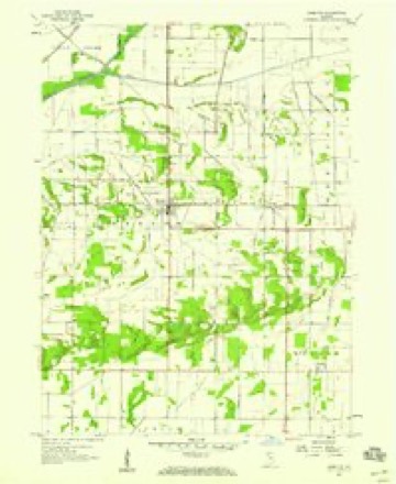
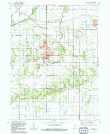
6 surveys from 12 printed sheetsMatched by testing this settlement's coordinate against the published boundary of every sheet in the United States Geological Survey's historical collection. Each opens the scanned sheet at the Survey.
- 1953 USGS Chicago quadrangle1:250000, 5 printings
- 1957 USGS Chicago quadrangle1:250000
- 1957 USGS DeMotte quadrangle1:24000, 3 printings
- 1984 USGS Kankakee quadrangle1:100000
- 1991 USGS Kankakee quadrangle1:100000
- 1992 USGS De Motte quadrangle1:24000



Storms near this place
29 since 2003Regional context, not property-specific evidence. The National Weather Service names DeMotte in 29 storm reports between 2003 and 2026: 18 thunderstorm wind, 5 hail, 2 flash flood, 2 heavy rain. No death or injury is recorded in these reports. Each account below is quoted exactly as the forecast office filed it, from the NOAA Storm Events Database, and each date opens the federal record of that event.
| When | Event | Place named | Harm | What the report says |
|---|---|---|---|---|
| June 2011 | Thunderstorm Wind | Demotte | $10,000 | Grain bins and an outbuilding were destroyed northwest of De Motte. |
| March 2025 | Thunderstorm Wind | Demotte | - | Video from local broadcast media shows that at least a few large trees were uprooted around a DeMotte neighborhood, including two that fell onto houses. Location could not be determined by the video and is very approximate, likely on the north or west side of town based on radar velocity imagery. |
| July 2025 | Heavy Rain | Demotte | - | Storm total rainfall of 4.46 inches was measured by a private weather station with 2.80 inches falling between 11:59 CST and 12:59 CST. |
| May 2024 | Thunderstorm Wind | Demotte | - | A wind gust to 71 mph was measured by a private weather station. Tree limbs 3 to 4 inches in diameter were blown down near County Roads 1200 N and 950 W. |
| May 2024 | Thunderstorm Wind | Demotte | - | A tree was blown down blocking a road near 8th Avenue NW and Juniper Street SW. |
| May 2024 | Thunderstorm Wind | Demotte | - | A tree was blown down across a road near 3rd Avenue NW and Dogwood Street NW. |
| May 2024 | Thunderstorm Wind | Demotte | - | Power lines were blown down on 15th Avenue NW. |
| May 2024 | Flood | Demotte | - | Flowing water was reported on Cedar Street NW near 3rd Ave NW. |
| July 2024 | Tornado (EF0) | Demotte | - | A tornado with estimated peak winds of 75 mph touched down in Lake County and crossed the Kankakee River and into Jasper County just west of Route 231. The tornado produced tree and crop damage as it moved across northern Jasper County. High resolution satellite imagery showed concentrated damage to crops just before the tornado crossed the Kankakee River and moved into Porter County, just east of County Road N 125 W. |
| March 2023 | Thunderstorm Wind | Demotte | - | A trained spotter measured a 78 mph gust and reported power poles down in the De Motte area. |
| July 2023 | Thunderstorm Wind | Demotte | - | Large tree branches were downed in DeMotte. |
| August 2022 | Thunderstorm Wind | Demotte | - | Extensive damage was reported along State Road 10 and surrounding areas from Demotte to Wheatfield. Healthy trees were snapped at their base and at least 7 free standing utility poles were snapped in an open field. A metal roof was torn off a farm building and spread across a field. Numerous tree limbs were blown down in Wheatfield and shingles were blown off roofs. A 35 to 40 foot tall tree was uprooted near Route 10 and Route 49. A spotter measured a wind gust to 78 mph before their equipment failed. |
| June 2021 | Thunderstorm Wind | Demotte | - | Tree limbs were blown down. |
| December 2021 | Thunderstorm Wind | Demotte | - | A trained spotter reported a measured gust to 72 mph. |
| August 2019 | Thunderstorm Wind | Demotte | - | Tree limbs were blown down with wind gusts estimated to 60 mph. |
| April 2011 | Thunderstorm Wind | Demotte | - | Tree limbs were blown down. |
| June 2010 | Thunderstorm Wind | Demotte | - | One tree was blown down. |
| August 2009 | Heavy Rain | Demotte | - | Rainfall of 2.75 inches was reported in the past 24 hours. |
| May 2004 | Flash Flood | Demotte | - | Creek and stream flooding occurred. A total of 1.36 inches of rain fell in 28 minutes. |
| July 2004 | Thunderstorm Wind | Demotte | - | Numerous large tree limbs down on County Rd. 1000N and in the Tanglewood subdivision. |
| June 2004 | Flash Flood | Demotte | - | Widespread flooding was reported. Three inches of rain fell in half an hour. |
| March 2026 | Hail | Demotte | - | no account filed |
| June 2019 | Hail | Demotte | - | no account filed |
| September 2014 | Thunderstorm Wind | Demotte | - | no account filed |
| August 2011 | Hail | Demotte | - | no account filed |
| June 2008 | Hail | Demotte | - | no account filed |
| June 2008 | Hail | Demotte | - | no account filed |
| July 2003 | Thunderstorm Wind | Demotte | - | no account filed |
| July 2003 | Thunderstorm Wind | Demotte | - | no account filed |
Nearest settlements
The eight closest, with where each one stands in the county. Distances are straight-line, computed from the Geographic Names Information System coordinates.
| Map | Place | Distance | Sheets |
|---|---|---|---|
| Kersey | 2.2 miles | 12 | |
| Deer Park | 2.5 miles | 12 | |
| Forest City | 3.6 miles | 11 | |
| Stoutsburg | 4.5 miles | 11 | |
| Kniman | 4.8 miles | 12 | |
| Virgie | 5.6 miles | 10 | |
| Moffitt | 6.5 miles | 10 | |
| Wheatfield | 7.6 miles | 11 |
Elsewhere
Matched on this settlement's Geographic Names Information System number rather than its name, so it cannot be a different place of the same name in another state.
| Wikipedia article on DeMotte | An encyclopaedic summary. Its text is share-alike, so it is linked here rather than copied. |
| Wikidata item Q2348578 | The structured record the population and elevation above come from. Public domain (CC0). |
Provenance
This settlement is recorded in the Geographic Names Information System as feature 450503. The sheet list is computed by point-in-boundary test against the United States Geological Survey's historical topographic inventory. Both are works of the United States government and carry no copyright under 17 U.S.C. 105.
Storms. NOAA National Centers for Environmental Information, Storm Events Database https://www.ncei.noaa.gov/stormevents/ A work of the United States government, no copyright under 17 U.S.C. 105. Narratives are quoted verbatim from the National Weather Service report and are not edited or summarised.