 Block
From the record
12 National Register listings published here.
Sources: the National Register database, National Park Service
45 topographic sheets cover 33 settlements here, and 12 properties are on the National Register of Historic Places.
12 National Register listings published here.
Sources: the National Register database, National Park Service
Every property in this county listed on the National Register of Historic Places, with the year it was listed and the federal nomination document.
| Photograph | Property | Type | Listed | Reference |
|---|---|---|---|---|
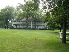 | Fountain Park Chautauqua | district | 2001 | 01001351 |
 | Charles Halleck Student Center | building | 2016 | 16000331 |
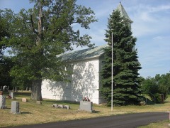 | Independence Methodist Church | building | 1982 | 82000042 |
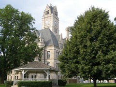 | Jasper County Courthouse | building | 1983 | 83000126 |
| David & Sarah Nowels House | building | 2023 | 100008660 | |
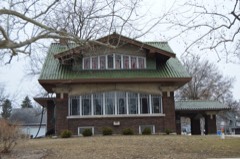 | Oren F. and Adelia Parker House | building | 2014 | 14000804 |
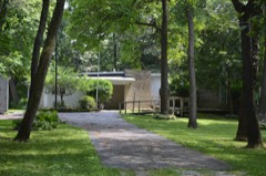 | Hugh and Leona Rank House | building | 2016 | 16000332 |
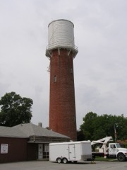 | Remington Water Tower and Town Hall | structure | 2003 | 03001314 |
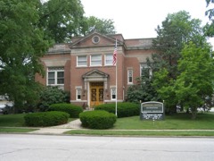 | Rensselaer Carnegie Library | building | 1994 | 94000233 |
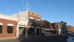 | Rensselaer Courthouse Square Historic District | district | 2012 | 12000185 |
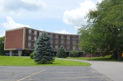 | Schwietermann Hall | building | 2016 | 16000333 |
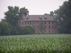 | St. Joseph Indian Normal School | building | 1973 | 73000018 |
The NOAA Storm Events Database holds 263 reports for this county, causing 2 deaths, 32 injuries and about $7,710,750 in recorded property damage. Each settlement page carries the reports that name it.
| Kind of event | Reports |
|---|---|
| Thunderstorm Wind | 148 |
| Hail | 47 |
| Tornado | 33 |
| Flash Flood | 13 |
| Flood | 11 |
| Heavy Rain | 8 |
| Funnel Cloud | 2 |
| Lightning | 1 |
The most serious of them, by death, then injury, then recorded damage. The accounts are quoted exactly as the forecast office filed them.
| When | Event | Place named | Harm | What the report says |
|---|---|---|---|---|
| March 1976 | Tornado (F3) | not stated | 1 killed, 8 hurt, $250,000 | no account filed |
| January 2008 | Flash Flood | North Newton | 1 killed, $1,000,000 | Lake Arthur Estates in Remington was evacuted after four to five feet of water flooded the trailer park. Interstate 65 was closed near mile marker 210 after Carpenter Creek overflowed its banks and flooded all lanes of traffic. One man drowned after he was swept away by flood waters while trying to evacuate in Remington. Numerous roads and low lying areas were flooded. Storm total rainfall was 5.15 inches in Remington and 3.53 inches in Rensselaer. |
| April 1963 | Tornado (F4) | not stated | 16 hurt, $2,500,000 | no account filed |
| March 2026 | Tornado (EF1) | Kniman | 3 hurt | An EF-1 tornado with estimated peak winds of 110 mph tracked across northern Jasper County south of Stoutsburg, Wheatfield, and Dunns Bridge. This tornado began about 2 miles south of Stoutsburg along CR W 1000 N, where there was damage noted to a solar panel field and power poles. The tornado moved east-northeast, causing damage to a farmstead on CR N 200 W. The most significant damage from this tornado was noted just south of Wheatfield on the 0-100 block of CR W 1100 N and on the 1100 block of State Route 49, where numerous homes sustained considerable damage and numerous trees and power poles were downed. The tornado continued to damage solar panel fields, trees, power poles, and farmsteads as it moved toward the Starke County line, passing through the unincorporated community of Tefft. The tornado dissipated before reaching Starke County on the 500 block of CR E 1350 N. Three minor injuries were reported with the tornado. |
| April 1997 | Thunderstorm Wind | Rensselaer | 2 hurt | no account filed |
| September 1967 | Tornado (F2) | not stated | 1 hurt, $25,000 | no account filed |
| December 1966 | Tornado (F2) | not stated | 1 hurt, $25,000 | no account filed |
| July 2022 | Lightning | (Rzl) Jasper County Airport | 1 hurt | A 10 year old girl was touching a metal fence that was in contact with a barn, when the barn was struck by lightning. The current traveled through the fence and into her right arm. She complained of pain and numbness in her right arm and was taken to a hospital and released later that afternoon. |
| February 2008 | Flood | Remington | $2,000,000 | After heavy rain and flash flooding on February 4th and 5th, flood waters slowly subsided by February 9th due to saturated and frozen ground and already high river levels. Significant flooding was reported in Rensselaer with damage to many homes. |
| February 2018 | Flood | Remington | $288,000 | Many areas of Jasper County were flooded with some roads flooded and closed. Storm total rainfall amounts included 6.50 inches two miles south southeast of Wheatfield; 6.41 inches one mile north northwest of De Motte and 4.70 inches one mile north of Rensselaer. |
| September 2008 | Flash Flood | Remington | $250,000 | Flash flooding or significant flooding was reported across parts of Jasper County, including street closures due to flooding, basement flooding and creek, stream and river flooding. Columbia Park was flooded in Rensselaer. Flood waters surrounded homes and bussinesses in DeMotte. |
| June 1981 | Tornado (F1) | not stated | $250,000 | no account filed |
| June 1975 | Tornado (F1) | not stated | $250,000 | no account filed |
| April 1962 | Tornado (F2) | not stated | $250,000 | no account filed |
| November 2013 | Tornado (EF1) | Rensselaer | $150,000 | Multiple empty grain bins and outbuildings were destroyed across four farmsteads with large paths of debris thrown two miles downstream. Utility poles were blown down along with dozens of trees that were snapped. Maximum winds were estimated to 100 mph. |
| November 2013 | Tornado (EF1) | Remington | $75,000 | This is a continuation of a tornado that touched down in Newton County at 1:27 PM CST. The tornado mainly passed over open fields; however, near the end of the path an outbuilding was destroyed and small farm equipment moved, including one piece that was rolled into a grain storage bin. Debris was noted as far as a mile downstream. The highest winds were estimated to around 100 mph. |
| June 2014 | Tornado (EF1) | Forest City | $60,000 | A tornado started near Colfax St. and tracked through the south side of Shelby, through DeMotte, and ended slightly east of N. 600W Rd. A large barn was completely destroyed, and damage was done to houses in both Shelby and DeMotte. In addition, numerous hardwood trees were snapped and uprooted. Maximum winds were estimated to 110 mph. |
| November 2013 | Thunderstorm Wind | Rensselaer | $50,000 | Several grain bins were knocked down. Trees and power lines were blown down on the east side of Rensselaer. Roof damage occurred to several businesses and outbuildings. |
| May 2011 | Tornado (EF1) | Rensselaer | $50,000 | A tornado touched down along Sparling Road halfway between Schuster and Mt. Calvary Roads. The tornado moved northeast across southeastern portions of Rensselaer. A truck was overturned near Route 231 and and Drexel. Power lines, tree limbs and shingles were blown down. The tornado lifted near Highway 114, just east of the high school. |
| September 2008 | Tornado (EF1) | Kersey | $30,000 | A tornado touched down approximately 5 miles northwest of Wheatfield near the Oak Heritage Estates. This tornado caused structual damage to one mobile home, damage to multiple trees and corn fields. Damage began southwest of the intersection of North 450 West and Hawthorn Road, where a 10 yard wide path of corn stalks was completely flattened in a convergent manner. Damage continued where a roof was lifted off a mobile home and thrown into the yard. Also at this location, two trees were completely uprooted. Along the path of this tornado, the tops of many trees had sheared limbs along with scattered debris ranging from toys to trash bins. |
| May 2011 | Tornado (EF1) | Rensselaer Jasper Ar | $25,000 | A tornado touched down just north of Wood Road and south of West Amsler Road, and crossed U.S. Highway 231 (north McKinley Ave). The tornado was rated EF1 with roof damage to the Farm Bureau Insurance building at 2570 North McKinley Avenue as well as soffit, fascia and window damage to the Purdue Agricultural Extension office just to the west. The EF1 damage was confined to a path length of approximately 100 yards with weaker EF0 damage over the remainder of the track. The tornado lifted as it moved across highway 231. |
| May 1977 | Tornado (F1) | not stated | $25,000 | no account filed |
| March 1976 | Tornado (F1) | not stated | $25,000 | no account filed |
| June 1958 | Tornado (F1) | not stated | $25,000 | no account filed |
| June 1958 | Tornado (F2) | not stated | $25,000 | no account filed |
| August 2011 | Thunderstorm Wind | Rensselaer Jasper Ar | $20,000 | The emergency manager reported numerous trees blown down across Rensselaer. Five trees were damaged in the Weston Cemetery. A large tree limb caved in the roof of a car and damaged the roof of a house near Brookside Park. |
| June 2014 | Tornado (EF1) | Kersey | $10,000 | This tornado occurred northwest of Wheatfield tracking near W. 1450N Rd. Damage was done to a large pole barn with the roof blown off and multiple walls collapsed. There were also numerous trees snapped and uprooted. Maximum winds were estimated to 105 mph. |
| June 2011 | Thunderstorm Wind | Demotte | $10,000 | Grain bins and an outbuilding were destroyed northwest of De Motte. |
| July 2010 | Thunderstorm Wind | Gifford | $10,000 | Six to eight inch diameter tree limbs and small trees were blown down near 500N and Route 49. Minor damage was reported to some houses. |
| July 2001 | Tornado (F0) | Rensselaer | $10,000 | A tornado touched down near County Road 400E and 200S destroying a garage and damaging the corner of a roof of a barn. The tornado continued through corn and bean fields and exited Jasper County 12 miles east of Rensselaer and moved into Pulaski County. (See Storm Data for Indiana, Northeast) |
| May 2013 | Thunderstorm Wind | Rensselaer | $5,000 | Widespread trees and power lines were blown down. |
| May 2008 | Thunderstorm Wind | Fair Oaks | $5,000 | A bill board sign was completely demolished with wooden posts snapped on Interstate 65 near Fair Oaks. There was also damage to trees as well as debris evident in the trees. |
| July 2007 | Thunderstorm Wind | Wheatfield | $5,000 | Two trees and powerlines blown down. |
| April 1957 | Tornado (F1) | not stated | $2,500 | no account filed |
| May 1956 | Tornado (F1) | not stated | $2,500 | no account filed |
| April 2011 | Thunderstorm Wind | Wheatfield | $1,000 | A power pole and its wires were reported down in the town of Wheatfield. |
| October 2010 | Thunderstorm Wind | Remington | $1,000 | A telephone pole was snapped. |
| May 2011 | Tornado (EF1) | Rensselaer Jasper Ar | $500 | Tree damage consisting of uprooted softwood and hardwood trees, hardwood trees twisted and snapped and numerous large hardwood and softwood tree limbs blown down was observed along the path of this tornado. A wooden light pole was also snapped. |
| June 1954 | Tornado | not stated | $250 | no account filed |
| March 2026 | Tornado (EF1) | Forest City | - | A destructive EF-3 tornado was nearing the end of its lifecycle upon briefly moving into northwest Jasper County and dissipated shortly thereafter. After forming in Kankakee County and causing EF-3 caliber damage in Kankakee and Newton counties, this tornado crossed into far northwestern Jasper County between W 1100 N Road and W 1200 N Road. Along N 1200 W Road just east of I-65, a continuous corridor of trees was entirely uprooted, a few outbuildings were damaged, and the roof was removed from a house. In the community of Forest City, a continuous corridor of trees was uprooted, and a few residences had shingles removed. The tornado diminished in intensity as it moved northeast toward N 1100 W Road, and then dissipated just south of the intersection of N 1100 W Road and W 1300 N Road. The tornado resulted in three fatalities and around a dozen injuries, though none reported in Jasper County. The damage sustained in Jasper County was found to be on the order of EF-1 strength. |
| April 2026 | Hail | (Rzl) Jasper County Airport | - | A photo showed hail slightly larger than quarter size east of the Jasper County Fairgrounds. |
| April 2026 | Thunderstorm Wind | Stoutsburg | - | Power poles were damaged in a number of spots near and north of Stoutsburg. |
| April 2026 | Thunderstorm Wind | Wheatfield | - | A fence was damaged and a large playground set rolled out of a yard in Wheatfield. |
| June 2025 | Thunderstorm Wind | Kniman | - | A photo was shared showing a tree or large branch downed along CR 500W near CR 1050 N. |
| March 2025 | Thunderstorm Wind | Demotte | - | Video from local broadcast media shows that at least a few large trees were uprooted around a DeMotte neighborhood, including two that fell onto houses. Location could not be determined by the video and is very approximate, likely on the north or west side of town based on radar velocity imagery. |
| June 2025 | Thunderstorm Wind | Wheatfield | - | Numerous tree and power lines were reported down along a corridor from CR 100E to CR 400 N east of Wheatfield between CR 1300N and IN-10. |
| July 2025 | Heavy Rain | Demotte | - | Storm total rainfall of 4.46 inches was measured by a private weather station with 2.80 inches falling between 11:59 CST and 12:59 CST. |
| August 2025 | Thunderstorm Wind | (Rzl) Jasper County Airport | - | A photo shared via social media showed tree damage along CR1000 south of IN-114. |
| August 2025 | Thunderstorm Wind | (Rzl) Jasper County Airport | - | Multiple trees were damaged at the Curtis Creek Golf Club west of Rensselaer. Some trees were snapped or uprooted while many others lost limbs and large branches. |
| August 2025 | Thunderstorm Wind | (Rzl) Jasper County Airport | - | A photo shared via social media showed multiple broken power poles and a rolled camper. |
| August 2024 | Thunderstorm Wind | Cheever Airport | - | Photos shared via social media showed a large tree branch down onto a car near DeMotte. A canopy and trampoline were also lofted by the winds and impaled by a horse fence at the same residence. |
| August 2024 | Thunderstorm Wind | Fountain Park | - | A tree was reported down and blocking Hwy 231 near W County Rd 1200 S. |
| May 2024 | Thunderstorm Wind | Demotte | - | A wind gust to 71 mph was measured by a private weather station. Tree limbs 3 to 4 inches in diameter were blown down near County Roads 1200 N and 950 W. |
| May 2024 | Thunderstorm Wind | Demotte | - | A tree was blown down blocking a road near 8th Avenue NW and Juniper Street SW. |
| May 2024 | Thunderstorm Wind | Demotte | - | A tree was blown down across a road near 3rd Avenue NW and Dogwood Street NW. |
| May 2024 | Thunderstorm Wind | Demotte | - | Power lines were blown down on 15th Avenue NW. |
| May 2024 | Flood | Demotte | - | Flowing water was reported on Cedar Street NW near 3rd Ave NW. |
| May 2024 | Flood | Stoutsburg | - | High standing water was reported at State Road 10 and County Road 200 W. |
| July 2024 | Thunderstorm Wind | Fountain Park | - | A large tree was blown down blocking Route 231. |
| July 2024 | Tornado (EF0) | Demotte | - | A tornado with estimated peak winds of 75 mph touched down in Lake County and crossed the Kankakee River and into Jasper County just west of Route 231. The tornado produced tree and crop damage as it moved across northern Jasper County. High resolution satellite imagery showed concentrated damage to crops just before the tornado crossed the Kankakee River and moved into Porter County, just east of County Road N 125 W. |
The Survey's mineral resources record lists 8 workings inside this county. 5 still produce and 3 are closed or unrecorded. Each settlement page carries the workings within five miles of it.
| Commodity | Workings |
|---|---|
| Sand and Gravel, Construction | 3 |
| Stone, Crushed/Broken | 2 |
| Lead, Zinc | 1 |
| Sulfur | 1 |
| Aluminum | 1 |
| Stone | 1 |
The least common of them first, because a county's hundredth gravel pit says nothing its first ten did not.
| Where | Site | Commodity | Status | Recorded |
|---|---|---|---|---|
| Apex Intrnat Alloys/ Bicknell, Ind | Aluminum | Unknown | ||
| Jasper Co. Hwy. Dept. | Stone | Producer | ||
| Sphalerite and Galena Occurrence | Lead, Zinc, Sulfur | Occurrence | Galena, Sphalerite | |
| A. Metz, Inc. | Stone, Crushed/Broken | Producer | ||
| Babcock Quarry | Stone, Crushed/Broken | Producer | ||
| Continental Sand and Gravel | Sand and Gravel, Construction | Producer | ||
| Morocco Sand and Gravel Co. | Sand and Gravel, Construction | Producer | ||
| Rensselaer Sand and Gravel Pit | Sand and Gravel, Construction | Past Producer |
Named settlements recorded in the Geographic Names Information System, each with the topographic sheets covering it. Villages, hamlets and abandoned places alike. Each is shown with the nearest named watercourse or landform and the survey quadrangle it falls on.