 Block
Dillsboro, Indiana
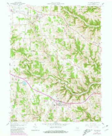
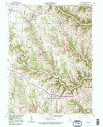
10 topographic sheets cover this place, the earliest surveyed in 1953 and the latest in 1992. It stands in Clay Township. It lies in ZIP code area 47018. It lies near Station Hollow. The Survey maps it on the Dillsboro quadrangle. 1,360 people lived here at the 2020 count. It stands 869 feet above sea level.
On record in Dillsboro
Buildings and businesses the archive holds for this place. Each opens its own page, with the source record it came from.
On the National Register 1 record
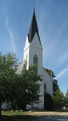 St. John's Lutheran Church and Schoollisted 1996
Population over time
2 figuresDillsboro grew from 1,327 to 1,360 between 2010 and 2020. These are the recorded population figures Wikidata holds for this place, reached through the Geographic Names Information System number this page is keyed on rather than by name, so they belong to this place and not to another of the same name. Most are census counts, but not all are: an early figure may be a founding or settlement estimate, and an estimate published within five years of a census is left out. The change column is computed, and is left blank where more than 20 years separate a figure from the one before it, because a gap that long is not a change between two counts.
| Year | People | Change |
|---|---|---|
| 2010 | 1,327 | |
| 2020 | 1,360 | +33 (+2%) |
Topographic sheets covering this place
5 surveys from 10 printed sheetsMatched by testing this settlement's coordinate against the published boundary of every sheet in the United States Geological Survey's historical collection. Each opens the scanned sheet at the Survey.
- 1953 USGS Cincinnati quadrangle1:250000, 3 printings
- 1957 USGS Cincinnati quadrangle1:250000
- 1958 USGS Dillsboro quadrangle1:24000, 3 printings
- 1986 USGS Greensburg quadrangle1:100000, 2 printings
- 1992 USGS Dillsboro quadrangle1:24000



In the county-history sources
3,278 words on this townshipHistory of Dearborn County Indiana, published 1915 names this settlement in its chapter on Clay Township. These are the passages that mention it, exactly as the scans read.
Clay township lies mostly on a ridge, between the deep valleys of South Hogan, Laughery and Hayes branch. In the center of the township it is high above the valleys. Dillsboro, which lies nearly in the center of the township, is seven hundred and eighty-five feet above the sea level and commands a fine view of the country about.
Passage source: History of Dearborn County Indiana, published 1915.
Dillsboro is a very pretty village with neat front yards and cozy, home¬ like cottages. Its population in 1910 is given at four hundred and twenty-five, which is probably less than it is at this time. The town has recently taken on a greater degree of prosperity on account of the good pikes leading to it and the growth of the sanitarium which has been established here. Some years ago the citizens of the town, desiring to find if there was natural gas in the ground beneath their place, organized a company and sunk wells, but instead of finding gas they unexpectedly discovered water with medicinal virtues which they were quick to take advantage of and give the public the benefit. They have organized a company, erected a building that they expected would ac¬ commodate the public for the present but have found it all too small and larger buildings will be necessary at once.
Passage source: History of Dearborn County Indiana, published 1915.
Besides the sanitarium the town has a number of stores that transact business with a large scope of country to the west and south. It is claimed for the town that the Dillsboro station does in the way of country produce the second best business of any on the line of the Baltimore & Ohio railway between Cincinnati and St. Louis. The town has concrete pavements on all its streets, electric lights and graded high school with a two-years course. The postoffice has three rural routes going out from it to the country around about The town permits no saloons and its citizens are of a high order of intelligence.
Passage source: History of Dearborn County Indiana, published 1915.
Machine-read from a century-old scan, so expect the errors a machine makes: misspelled names, dropped words, stray characters.
Read the whole chapter on Clay Township - it names this place 3 more 3 times.
Fires near this place
3 since 2004Regional context, not property-specific evidence. The federal wildfire occurrence database lists 3 fires within 5 miles of Dillsboro between 2004 and 2005, burning about 9 acres in total. None started naturally. None was recorded as arson. Distance is straight-line from the map coordinates, so a fire counted here may appear on a neighbouring settlement's page as well.
| Reported cause | Fires |
|---|---|
| Recreation and ceremony | 3 |
The most recent of them, most recent first, with the day each was reported and the service that recorded it.
| Date | Cause | Size | Reported by | Name on the report |
|---|---|---|---|---|
| 10 April 2004 | Recreation and ceremony | 1.0 acres | Indiana State Fire Marshal's Office | not named |
| 18 March 2005 | Recreation and ceremony | 3.0 acres | Indiana State Fire Marshal's Office | not named |
| 28 February 2004 | Recreation and ceremony | 5.0 acres | Indiana State Fire Marshal's Office | not named |
Settlements close enough to share some of these fires:
Storms near this place
15 since 1995Regional context, not property-specific evidence. The National Weather Service names Dillsboro in 15 storm reports between 1995 and 2020: 7 thunderstorm wind, 4 hail, 2 flash flood, 1 flood. No death or injury is recorded in these reports. Each account below is quoted exactly as the forecast office filed it, from the NOAA Storm Events Database, and each date opens the federal record of that event.
| When | Event | Place named | Harm | What the report says |
|---|---|---|---|---|
| April 2020 | Tornado (EF0) | Dillsboro | $40,000 | The tornado touched down in the 8800 block of Davies Road. The tornado continued to travel southeast, destroying barns and damaging roofs and trees for about 1 mile. ||Based on the degree of damage, the tornado produced winds of around 75 mph. |
| June 2005 | Thunderstorm Wind | Dillsboro | $3,000 | Two trees were downed. |
| June 1999 | Thunderstorm Wind | Dillsboro | $3,000 | A severe thunderstorm produced winds that knocked down several trees. |
| May 1996 | Thunderstorm Wind | Dillsboro | $3,000 | no account filed |
| October 2016 | Thunderstorm Wind | Dillsboro | $2,000 | A few trees were reported knocked down. |
| August 2018 | Thunderstorm Wind | Dillsboro | $1,000 | A tree was knocked down. |
| July 2007 | Hail | Dillsboro | $1,000 | no account filed |
| June 2016 | Flash Flood | Dillsboro | - | Elder Lane was impassable due to high water. |
| April 2014 | Flood | Dillsboro | - | Three roads were closed due to standing water caused by heavy rainfall. These roads included State Route 262 in Dillsboro, Huesman Road, and Laughery Creek Road. |
| May 2002 | Flash Flood | Dillsboro | - | High water covered Spangler Road. |
| March 1995 | Hail | Dillsboro | - | An isolated severe thunderstorm quickly developed over Dearborn County during the very early morning hours of the 23rd. The storm produced dime size hail in Dillsboro. |
| October 2016 | Hail | Dillsboro | - | no account filed |
| April 2003 | Thunderstorm Wind | Dillsboro | - | no account filed |
| April 1998 | Hail | Dillsboro | - | no account filed |
| November 1996 | Thunderstorm Wind | Dillsboro | - | no account filed |
Nearest settlements
The eight closest, with where each one stands in the county. Distances are straight-line, computed from the Geographic Names Information System coordinates.
| Map | Place | Distance | Sheets |
|---|---|---|---|
| Dillsboro Station | 1.4 miles | 10 | |
| Chesterville | 3.5 miles | 10 | |
| Farmers Retreat | 3.7 miles | 8 | |
| Cold Springs | 3.8 miles | 10 | |
| Mount Sinai | 5.4 miles | 19 | |
| Sparta | 6.1 miles | 10 | |
| Wilmington | 6.7 miles | 19 | |
| Moores Hill | 6.8 miles | 10 |
Elsewhere
Matched on this settlement's Geographic Names Information System number rather than its name, so it cannot be a different place of the same name in another state.
| Wikipedia article on Dillsboro | An encyclopaedic summary. Its text is share-alike, so it is linked here rather than copied. |
| Wikidata item Q1026784 | The structured record the population and elevation above come from. Public domain (CC0). |
Provenance
This settlement is recorded in the Geographic Names Information System as feature 433558. The sheet list is computed by point-in-boundary test against the United States Geological Survey's historical topographic inventory. Both are works of the United States government and carry no copyright under 17 U.S.C. 105.
Wildfire. Short, Karen C. 2022. Spatial wildfire occurrence data for the United States, 1992-2020 [FPA_FOD_20221014]. 6th Edition. Fort Collins, CO: Forest Service Research Data Archive. https://doi.org/10.2737/RDS-2013-0009.6 Collected with United States Government funding and usable without additional permissions or fees.
Storms. NOAA National Centers for Environmental Information, Storm Events Database https://www.ncei.noaa.gov/stormevents/ A work of the United States government, no copyright under 17 U.S.C. 105. Narratives are quoted verbatim from the National Weather Service report and are not edited or summarised.