 Block
Farmers Retreat, Indiana
8 topographic sheets cover this place, the earliest surveyed in 1956 and the latest in 1990. It stands in Caesar Creek Township. It lies in ZIP code area 47018. The Survey maps it on the Bear Branch quadrangle. It stands 879 feet above sea level.
On record in Farmers Retreat
Buildings and businesses the archive holds for this place. Each opens its own page, with the source record it came from.
On the National Register within a mile 1 record
The National Register names another town for these. They stand within one mile of this settlement's coordinate.
 St. John's Lutheran Church and Schoollisted 1996 · 0.1 miles away
Topographic sheets covering this place
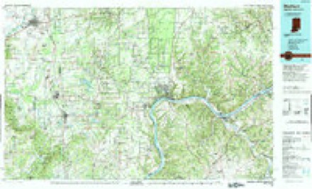
5 surveys from 8 printed sheetsMatched by testing this settlement's coordinate against the published boundary of every sheet in the United States Geological Survey's historical collection. Each opens the scanned sheet at the Survey.
- 1956 USGS Louisville quadrangle1:250000, 2 printings
- 1959 USGS Bear Branch quadrangle1:24000, 3 printings
- 1964 USGS Louisville quadrangle1:250000
- 1986 USGS Madison quadrangle1:100000
- 1990 USGS Madison quadrangle1:100000
In the county-history sources
2,990 words on this townshipHistory of Dearborn County Indiana, published 1915 names this settlement in its chapter on Caesar Creek Township. These are the passages that mention it, exactly as the scans read.
Farmers Retreat is the central place of the township of Caesar Creek, and considerable business is transacted there. The houses are extended along the highway for some distance. There are several stores and a blacksmith shop. The physician resident at the place is Dr. C. C. Housmeyer. A good macad¬ amized highway extends through the township, leading from Dillsboro to Friendship and Versailles, in Ripley county. The township, while the small¬ est of any in the county, is at the same time one of the most thrifty, and the people of the township are strictly law abiding and abreast of the times in everything that goes to make up good citizenship.
Passage source: History of Dearborn County Indiana, published 1915.
Machine-read from a century-old scan, so expect the errors a machine makes: misspelled names, dropped words, stray characters.
Fires near this place
3 since 2004Regional context, not property-specific evidence. The federal wildfire occurrence database lists 3 fires within 5 miles of Farmers Retreat between 2004 and 2005, burning about 9 acres in total. None started naturally. None was recorded as arson. Distance is straight-line from the map coordinates, so a fire counted here may appear on a neighbouring settlement's page as well.
| Reported cause | Fires |
|---|---|
| Recreation and ceremony | 3 |
The most recent of them, most recent first, with the day each was reported and the service that recorded it.
| Date | Cause | Size | Reported by | Name on the report |
|---|---|---|---|---|
| 10 April 2004 | Recreation and ceremony | 1.0 acres | Indiana State Fire Marshal's Office | not named |
| 18 March 2005 | Recreation and ceremony | 3.0 acres | Indiana State Fire Marshal's Office | not named |
| 28 February 2004 | Recreation and ceremony | 5.0 acres | Indiana State Fire Marshal's Office | not named |
Settlements close enough to share some of these fires:
Storms near this place
8 since 2008Regional context, not property-specific evidence. The National Weather Service names Farmers Retreat in 8 storm reports between 2008 and 2024: 4 thunderstorm wind, 2 flash flood, 2 hail. No death or injury is recorded in these reports. Each account below is quoted exactly as the forecast office filed it, from the NOAA Storm Events Database, and each date opens the federal record of that event.
| When | Event | Place named | Harm | What the report says |
|---|---|---|---|---|
| March 2017 | Thunderstorm Wind | Farmers Retreat | $50,000 | The westernmost extent of damage was found near Davies Road and US Route 62 south-southwest of Dillsboro. More significant damage occurred south of Dillsboro on Arlington Road, Martin Road, and Kachina Trail. Tree damage was more extensive through this area, with roof damage to several residences, and a few barns and outbuildings destroyed. Significant tree damage was also observed to the east on Bocock Road and Indiana State Road 262, again with many trees snapped or uprooted and a few instances of minor structural damage. Some tree damage was also observed on Hueseman Road. This was part of about a 13 mile swath of damage that continued into Ohio County. The damage was consistent with winds in the 70 to 80 mph range. |
| April 2020 | Thunderstorm Wind | Farmers Retreat | $25,000 | A barn was severely damaged in the 4600 block of S. Farmers Retreat Road. Debris was scattered in nearby fields. Also, minor structural damage occurred to nearby structures. |
| April 2020 | Thunderstorm Wind | Farmers Retreat | $15,000 | A barn was flattened along the 4200 block of S. Farmers Retreat Rd. |
| April 2008 | Flash Flood | Farmers Retreat | $3,000 | Several roads were flooded including State Route 156 outside of Vevay. |
| June 2008 | Thunderstorm Wind | Farmers Retreat | $3,000 | Numerous large trees were blown down. |
| June 2018 | Flash Flood | Farmers Retreat | - | High rushing water was reported along State Route 62 and Davies Road. |
| April 2024 | Hail | Farmers Retreat | - | no account filed |
| October 2016 | Hail | Farmers Retreat | - | no account filed |
Nearest settlements
The eight closest, with where each one stands in the county. Distances are straight-line, computed from the Geographic Names Information System coordinates.
| Map | Place | Distance | Sheets |
|---|---|---|---|
| Dillsboro | 3.7 miles | 10 | |
| Dillsboro Station | 5.0 miles | 10 | |
| Cold Springs | 6.7 miles | 10 | |
| Chesterville | 6.8 miles | 10 | |
| Mount Sinai | 9.0 miles | 19 | |
| Sparta | 9.4 miles | 10 | |
| Moores Hill | 9.5 miles | 10 | |
| Wilmington | 10.2 miles | 19 |
Elsewhere
Matched on this settlement's Geographic Names Information System number rather than its name, so it cannot be a different place of the same name in another state.
| Wikipedia article on Farmers Retreat | An encyclopaedic summary. Its text is share-alike, so it is linked here rather than copied. |
| Wikidata item Q5435801 | The structured record the population and elevation above come from. Public domain (CC0). |
Provenance
This settlement is recorded in the Geographic Names Information System as feature 434404. The sheet list is computed by point-in-boundary test against the United States Geological Survey's historical topographic inventory. Both are works of the United States government and carry no copyright under 17 U.S.C. 105.
Wildfire. Short, Karen C. 2022. Spatial wildfire occurrence data for the United States, 1992-2020 [FPA_FOD_20221014]. 6th Edition. Fort Collins, CO: Forest Service Research Data Archive. https://doi.org/10.2737/RDS-2013-0009.6 Collected with United States Government funding and usable without additional permissions or fees.
Storms. NOAA National Centers for Environmental Information, Storm Events Database https://www.ncei.noaa.gov/stormevents/ A work of the United States government, no copyright under 17 U.S.C. 105. Narratives are quoted verbatim from the National Weather Service report and are not edited or summarised.