 Block
East Germantown, Indiana
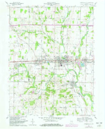
8 topographic sheets cover this place, the earliest surveyed in 1953 and the latest in 1986. It stands in Jackson Township. It lies in ZIP code area 47370. It stands on Dry Branch. The Survey maps it on the Cambridge City quadrangle. 261 people lived here at the 2020 count. It stands 951 feet above sea level.
Population over time
2 figuresEast Germantown fell from 410 to 261 between 2010 and 2020. These are the recorded population figures Wikidata holds for this place, reached through the Geographic Names Information System number this page is keyed on rather than by name, so they belong to this place and not to another of the same name. Most are census counts, but not all are: an early figure may be a founding or settlement estimate, and an estimate published within five years of a census is left out. The change column is computed, and is left blank where more than 20 years separate a figure from the one before it, because a gap that long is not a change between two counts.
| Year | People | Change |
|---|---|---|
| 2010 | 410 | |
| 2020 | 261 | -149 (-36%) |
Topographic sheets covering this place
4 surveys from 8 printed sheetsMatched by testing this settlement's coordinate against the published boundary of every sheet in the United States Geological Survey's historical collection. Each opens the scanned sheet at the Survey.
- 1953 USGS Cincinnati quadrangle1:250000, 3 printings
- 1957 USGS Cincinnati quadrangle1:250000
- 1960 USGS Cambridge City quadrangle1:24000, 2 printings
- 1986 USGS New Castle quadrangle1:100000, 2 printings



In the county-history sources
10,460 words on this townshipHistory of Wayne County, Indiana, from Its First Settlement to the Present Time : with Numerous Biographical and Family Sketches, published 1872 names this settlement in its chapter on Jackson Township. These are the passages that mention it, exactly as the scans read.
The Lutheran Church and congregation at East Germantown, composed mainly of Germans from Pennsylvania, was formed about the year 1824. Among their early members were the Waltzes, Condos, Keplers, and others. Meetings were for several years held in the log school-house. Their minister, Rev. Gruber, lived in Ohio, but came over at stated times to preach and perform other pastoral services. Two acres of ground, a short distance north of town, were purchased at $11 an acre, comprising the sites of the present house of worehip, parsonage, and cemetery. The meeting-house was built in 1833. There being among these Pennsylvania immigrants members of the German Peformed Church, they joined with the Lutherans in building the house, and called a pastor of their own, S. Zumpey. The ministers preached alternately to the united congregation. This union continued but a few years, since which time the congregation has been solely under a Lutheran pastorate. After Mr. Gruber, they were served for a time by missionaries, Henkel, Heinaka, and perhaps others; and since by regular pastors, beginning with Schultz, who was succeeded by Eisency. They preached only in the German language. Next, Julius Stirewalt and Isaac Hursh, who preached in German and English alternately. M. J. Stirewalt, the present minister, preaches exclusively in English. About ten years ago, the church edifice was thoroughly repaired, and a gallery at one end, a steeple, and bell were added.
Passage source: History of Wayne County, Indiana, from Its First Settlement to the Present Time : with Numerous Biographical and Family Sketches, published 1872.
William Hawkins, son of John Hawkins, a native of South Carolina, was one of the earliest settlers at Cambridge City, and original owner of most of the land on which the town has been built. It had been entered in 1813, by his father, who did not live to occupy it. ISTor did William, his son, to whom the land descended, make any material improvement on it until peace had, been made with the Indians, in 1814. In 1817, he married Isabel Powell, by whom he had ten children: 1. Jane, who married Allen Williams, and died here. He resides at Xenia, 0. 2. John S. N., a physician at Cheyenne, Wyoming Territory. 3. 3Iar}/, wife of Pyrrhus Woodward, of N"ewcastle. 4. Simon P., who died at 7. 5. Nathan S., who married Huldah C. Marsh, of Vt., and resides near Cambridge. 6. Tamar J.., wife of David Binford ; they live at Thornton. 7. William, who married Amelia Marshall, and lives at Leavenworth, Kansas. 8, 9. Amos, who died at 11 ; and Isabel, in infancy. 10. Lemuel, who married Caroline Brown.
Passage source: History of Wayne County, Indiana, from Its First Settlement to the Present Time : with Numerous Biographical and Family Sketches, published 1872.
Dr. John W. Smith, son of Benjamin Smith, was born in Wayne township, and removed with his father, in 1824, to Jackson, ^ mile north of Dublin. He commenced practice as a physician, at Dalton, in 1836; practiced at Dublin from 1849 till 1855 ; since in Wabash county, and in Peru, Miami Co. ; and returned in 1868 to Dublin. He was married to Abigail Misner, by whom he had three sons; all of whom. and himself served in the late war. Dr. Smith was a surgeon of the 155th liegiment. Amos C, his eldest son, served 4 years and 4 months; James D., to the end of the war; both wounded. Oliver C, the youngest, served 4 months.
Passage source: History of Wayne County, Indiana, from Its First Settlement to the Present Time : with Numerous Biographical and Family Sketches, published 1872.
Machine-read from a century-old scan, so expect the errors a machine makes: misspelled names, dropped words, stray characters.
Read the whole chapter on Jackson Township - it names this place 2 more 2 times.
Mines and quarries near this place
1 within 5 milesRegional context, not property-specific evidence. The federal mineral resources record lists 1 working within 5 miles of East Germantown: 1 producer. All of them still produce. What was taken out: Sand and Gravel, Construction. Distance is straight-line from the map coordinates, so a quarry counted here may appear on a neighbouring settlement's page as well.
| Where | Site | Commodity | Status | Recorded |
|---|---|---|---|---|
| Cambridge City Pit | Sand and Gravel, Construction | Producer |
Storms near this place
6 since 2008Regional context, not property-specific evidence. The National Weather Service names East Germantown in 6 storm reports between 2008 and 2024: 3 thunderstorm wind, 2 flood, 1 flash flood. No death or injury is recorded in these reports. Each account below is quoted exactly as the forecast office filed it, from the NOAA Storm Events Database, and each date opens the federal record of that event.
| When | Event | Place named | Harm | What the report says |
|---|---|---|---|---|
| March 2008 | Flood | East Germantown | $2,000 | Frank Meyers Road was flooded and closed south of Hagerstown. |
| December 2015 | Thunderstorm Wind | East Germantown | $1,500 | One healthy tree was uprooted. |
| July 2024 | Thunderstorm Wind | East Germantown | $1,000 | A large tree was downed near the intersection of Pearl Street and Main Street. |
| June 2014 | Thunderstorm Wind | East Germantown | $1,000 | A large limb was downed due to thunderstorm winds. |
| June 2024 | Flash Flood | East Germantown | - | Water was reported to be flowing over US-40 near Elm Street. |
| September 2021 | Flood | East Germantown | - | High water was reported on U.S. 40 in Pershing. |
Nearest settlements
The eight closest, with where each one stands in the county. Distances are straight-line, computed from the Geographic Names Information System coordinates.
| Map | Place | Distance | Sheets |
|---|---|---|---|
| Pennville | 1.4 miles | 9 | |
| Cambridge City | 1.8 miles | 8 | |
| Milton | 1.9 miles | 8 | |
| Mount Auburn | 2.8 miles | 8 | |
| Hiser | 3.2 miles | 9 | |
| Jacksonburg | 3.3 miles | 9 | |
| Dublin | 3.8 miles | 8 | |
| College Corner | 4.0 miles | 9 |
Elsewhere
Matched on this settlement's Geographic Names Information System number rather than its name, so it cannot be a different place of the same name in another state.
| Wikipedia article on East Germantown | An encyclopaedic summary. Its text is share-alike, so it is linked here rather than copied. |
| Wikidata item Q384182 | The structured record the population and elevation above come from. Public domain (CC0). |
Provenance
This settlement is recorded in the Geographic Names Information System as feature 433906. The sheet list is computed by point-in-boundary test against the United States Geological Survey's historical topographic inventory. Both are works of the United States government and carry no copyright under 17 U.S.C. 105.
Mines and quarries. USGS Mineral Resources Data System (MRDS) https://mrdata.usgs.gov/mrds/ A work of the United States government, no copyright under 17 U.S.C. 105.
Storms. NOAA National Centers for Environmental Information, Storm Events Database https://www.ncei.noaa.gov/stormevents/ A work of the United States government, no copyright under 17 U.S.C. 105. Narratives are quoted verbatim from the National Weather Service report and are not edited or summarised.