 Block
Jacksonburg, Indiana
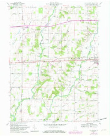
9 topographic sheets cover this place, the earliest surveyed in 1953 and the latest in 1986. It stands in Harrison Township. It lies in ZIP code area 47327. The Survey maps it on the Jacksonburg quadrangle. It stands 991 feet above sea level.
Topographic sheets covering this place
4 surveys from 9 printed sheetsMatched by testing this settlement's coordinate against the published boundary of every sheet in the United States Geological Survey's historical collection. Each opens the scanned sheet at the Survey.
- 1953 USGS Cincinnati quadrangle1:250000, 3 printings
- 1957 USGS Cincinnati quadrangle1:250000
- 1960 USGS Jacksonburg quadrangle1:24000, 3 printings
- 1986 USGS New Castle quadrangle1:100000, 2 printings



In the county-history sources
8,432 words on this townshipHistory of Wayne County, Indiana : Together with Sketches of Its Cities, Villages and Towns, published 1884 names this settlement in its chapter on Harrison Township. These are the passages that mention it, exactly as the scans read.
This township is bonndeJ on the north by Jeiferson and Clay Townships, on the east by Clay and Centre, south by Centre and Jackson, and West by Jackson and Jefferson. It is of irregular form, like half the townships in this county, dividing on section and quarter section lines, being five miles east and west in its widest part, and four and one-half miles north and south in its extreinest length. It has on the assessment roll 10,650.27 acres of land. The land is of a fair quality and the township has a solid foundation, financially speaking. Its farmers are in good circnmstances, intelligent and prudent. The eastern part of the township is watered by Green's Fork and its branches, and on the west by Martindale's Creek. It is an agricultural and stock township, having but one postoffice and small village called Jacksonburg. The assessed value of its real estate in 1882 was $398,115; assessed value of personal property, $136,295; total value, $531,4:10. The population of the township steadily decreased for thirty years, and in the last decade only gained eiglit. The population in 1850 was 766; in 1860, 6U', in 1870, 580; in 1880, 588. The town or village of Jacksonburg had a population of 109 in 1870, and in 1880, 112. This gave the township a gain of five and the village a gain of three in ten years, which may be considered rather slow work.
Passage source: History of Wayne County, Indiana : Together with Sketches of Its Cities, Villages and Towns, published 1884.
The village of Jacksonburg was platted by Robert Leavell, on the northwest quarter of the southwest quarter of section 8, in the year 1814. In the following spring a survey was made by Henry Bryan, which is of record and was dated March 23, 1815. It is, with the exception of Centreville, the oldest town, or village, in the county. When Jackson Township was formed, Feb. 10, 1817, the voting precinct was at Jacksonburg until 1836. In 1843, when Harrison was formed, it again became the voting precinct of the township, which it still retains. The first election, however, in Harrison Township after it was organized was held at the house of John Williams. In early days it was a central point for military parades, and of all the amusement of the day. Horse-racing, shooting at a mark, jumping, wrestling and sometimes fighting were characteristic of the place. It attained its greatest population in the decade between 1830 and 1840, but the advent of Cambridge City put a stop to its growth. It had a population at one time of probabl}' 250 if not 300, but in 1850 had dropped to less than 200, and in
Passage source: History of Wayne County, Indiana : Together with Sketches of Its Cities, Villages and Towns, published 1884.
The first physician in Jacksonburg was Loring A. Waldo, in 1817, who about fifteen years afterward moved to Delaware County. The next was L. P. Puinphrey, who after a few years removed to Henry County. Among his successors were Dr. Leggett, Dr. Taylor; in 1849 Dr. Samuel S. Boyd, later of Dublin, and John R. Mauk.
Passage source: History of Wayne County, Indiana : Together with Sketches of Its Cities, Villages and Towns, published 1884.
Machine-read from a century-old scan, so expect the errors a machine makes: misspelled names, dropped words, stray characters.
Read the whole chapter on Harrison Township - it names this place 15 more 15 times.
Mines and quarries near this place
1 within 5 milesRegional context, not property-specific evidence. The federal mineral resources record lists 1 working within 5 miles of Jacksonburg: 1 producer. All of them still produce. What was taken out: Sand and Gravel, Construction. Distance is straight-line from the map coordinates, so a quarry counted here may appear on a neighbouring settlement's page as well.
| Where | Site | Commodity | Status | Recorded |
|---|---|---|---|---|
| Cambridge City Pit | Sand and Gravel, Construction | Producer |
Storms near this place
5 since 1997Regional context, not property-specific evidence. The National Weather Service names Jacksonburg in 5 storm reports between 1997 and 2024: 3 thunderstorm wind, 1 hail, 1 flash flood. No death or injury is recorded in these reports. Each account below is quoted exactly as the forecast office filed it, from the NOAA Storm Events Database, and each date opens the federal record of that event.
| When | Event | Place named | Harm | What the report says |
|---|---|---|---|---|
| June 2009 | Hail | Jacksonburg | $100,000 | An expansive thunderstorm produced hail along a long swath across Wayne County, with the majority of reports coming from the more populated areas of Centerville and Richmond. Hail report sizes ranged from 0.75 inch to 1.75 inch along the swath. |
| June 2024 | Flash Flood | Jacksonburg | $8,000 | A culvert was washed out on Jacksonburg Road. |
| May 2015 | Thunderstorm Wind | Jacksonburg | $4,000 | Two semi trailers were blown into the median of I-70 near the State Route 1 interchange. |
| October 2013 | Thunderstorm Wind | Jacksonburg | $2,000 | One tree was downed and several other trees were blown partially down southeast of Hagerstown due to thunderstorm winds. |
| July 1997 | Thunderstorm Wind | Jacksonburg | - | An observer reported a 60 mph wind gust. |
Nearest settlements
The eight closest, with where each one stands in the county. Distances are straight-line, computed from the Geographic Names Information System coordinates.
| Map | Place | Distance | Sheets |
|---|---|---|---|
| College Corner | 2.1 miles | 9 | |
| Hoover Mill | 2.3 miles | 9 | |
| Pennville | 2.7 miles | 9 | |
| Hiser | 3.0 miles | 9 | |
| East Germantown | 3.3 miles | 8 | |
| Pinhook | 3.7 miles | 9 | |
| Greens Fork | 4.4 miles | 8 | |
| Cambridge City | 4.5 miles | 8 |
Elsewhere
Matched on this settlement's Geographic Names Information System number rather than its name, so it cannot be a different place of the same name in another state.
| Wikipedia article on Jacksonburg | An encyclopaedic summary. Its text is share-alike, so it is linked here rather than copied. |
| Wikidata item Q6117855 | The structured record the population and elevation above come from. Public domain (CC0). |
Provenance
This settlement is recorded in the Geographic Names Information System as feature 436904. The sheet list is computed by point-in-boundary test against the United States Geological Survey's historical topographic inventory. Both are works of the United States government and carry no copyright under 17 U.S.C. 105.
Mines and quarries. USGS Mineral Resources Data System (MRDS) https://mrdata.usgs.gov/mrds/ A work of the United States government, no copyright under 17 U.S.C. 105.
Storms. NOAA National Centers for Environmental Information, Storm Events Database https://www.ncei.noaa.gov/stormevents/ A work of the United States government, no copyright under 17 U.S.C. 105. Narratives are quoted verbatim from the National Weather Service report and are not edited or summarised.