 Block
Cambridge City, Indiana
8 topographic sheets cover this place, the earliest surveyed in 1953 and the latest in 1986. It stands in Jackson Township. It lies in ZIP code area 47327. It stands on Crietz Creek. The Survey maps it on the Cambridge City quadrangle. 1,751 people lived here at the 2020 count. It stands 935 feet above sea level.
On record in Cambridge City
Buildings and businesses the archive holds for this place. Each opens its own page, with the source record it came from.
On the National Register 3 records
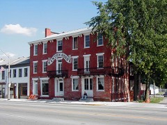 Cambridge City Historic Districtlisted 1991
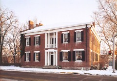 Conklin-Montgomery Houselisted 1975
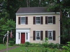 Lackey-Overbeck Houselisted 1976
Population over time
2 figuresCambridge City fell from 1,870 to 1,751 between 2010 and 2020. These are the recorded population figures Wikidata holds for this place, reached through the Geographic Names Information System number this page is keyed on rather than by name, so they belong to this place and not to another of the same name. Most are census counts, but not all are: an early figure may be a founding or settlement estimate, and an estimate published within five years of a census is left out. The change column is computed, and is left blank where more than 20 years separate a figure from the one before it, because a gap that long is not a change between two counts.
| Year | People | Change |
|---|---|---|
| 2010 | 1,870 | |
| 2020 | 1,751 | -119 (-6%) |
Topographic sheets covering this place
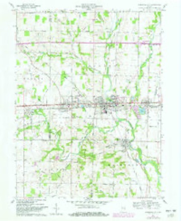
4 surveys from 8 printed sheetsMatched by testing this settlement's coordinate against the published boundary of every sheet in the United States Geological Survey's historical collection. Each opens the scanned sheet at the Survey.
- 1953 USGS Cincinnati quadrangle1:250000, 3 printings
- 1957 USGS Cincinnati quadrangle1:250000
- 1960 USGS Cambridge City quadrangle1:24000, 2 printings
- 1986 USGS New Castle quadrangle1:100000, 2 printings



In the county-history sources
10,460 words on this townshipHistory of Wayne County, Indiana, from Its First Settlement to the Present Time : with Numerous Biographical and Family Sketches, published 1872 names this settlement in its chapter on Jackson Township. These are the passages that mention it, exactly as the scans read.
Jackson township was formed in Februar}', 1817, by the first board of county commissioners under the first state constitution. It then probably contained about one-sixth of the area of the county, or upward of 60 square miles. By the several alterations of its bounds, in the formation of new townships and of adjoining counties, it has been reduced to about 28J square miles, and to a shape not easily described. It is 6 miles wide on its west line, and 3 miles of its east end is but 1| miles wide - its entire length 8 miles. The National road and the Indiana Central Railroad run on nearly parallel lines, about GO rods apart, east and west, nearly through the whole length of the township.
Passage source: History of Wayne County, Indiana, from Its First Settlement to the Present Time : with Numerous Biographical and Family Sketches, published 1872.
Dr. Trout, from Ohio about 1834, was tbe first Physician in town. lie remained but a few years. The second is supposed to have been Dr. E. Licket; the third, Dr. Hittel, from Ohio. Present physicians are Joseph Weeks and Daniel Carpenter.
Passage source: History of Wayne County, Indiana, from Its First Settlement to the Present Time : with Numerous Biographical and Family Sketches, published 1872.
The lands at and in the vicinity of the site of Cambridge City were settled early. John Hawkins, from Kentucky, a native of South Carolina, entered, in 1813, the north-east quarter of section 27, which included the site of the old town of Vandalia; but he did not live to occupy it. The laud descended to his son, William Hawkins, who took up the fractional quarter west of it ; the two quarters embracing nearl}' all of the site of Cambridge. Simon Powell, from Kentucky, also a native of South Carolina, entered the quarter north of the present farm of General Meredith, extending to the old State road. He, too, died without settling on his purchase. His family settled on it in 1813 or 1814, the eldest son having nearly attained to manhood. Their cabin stood on the east bank of the river, south of East Cambridge. Jesse Symonds, iS'orth Carolina, bought north side of the State road, adjoining Hawkins's, but, without settling on it, sold to Josiah Draper. JSTathan Symonds, from jN". C, settled north of and adjoining Jesse's, and afterward sold to Wm. Conw^ell. These lands are now owned by John Callaway. Henry Crull settled early on the north part, and George Ish on the south part of the present farm of Gen. Solomon Meredith. They sold to Ira Lackey, who, in or about the year 1836, built the house (since enlarged) wliere Meredith now" resides. Wm. Hawkins bought, besides the lands already mentioned, the land w^here his son I^athan S. resides, near and north-west of the town. Samuel Charles, from N". C, on land east side of Hawkins's, forming a part of the tract north side of town, owned by John Callaway. A'anbuskirk, on the land now owned by Alfred B. Williams, and perhaps the lands of Henry and John Ingerman and otliers. Henry Palen, from IS". C., on land now^ owned by John
Passage source: History of Wayne County, Indiana, from Its First Settlement to the Present Time : with Numerous Biographical and Family Sketches, published 1872.
Machine-read from a century-old scan, so expect the errors a machine makes: misspelled names, dropped words, stray characters.
Read the whole chapter on Jackson Township - it names this place 41 more 41 times.
Mines and quarries near this place
1 within 5 milesRegional context, not property-specific evidence. The federal mineral resources record lists 1 working within 5 miles of Cambridge City: 1 producer. All of them still produce. What was taken out: Sand and Gravel, Construction. Distance is straight-line from the map coordinates, so a quarry counted here may appear on a neighbouring settlement's page as well.
| Where | Site | Commodity | Status | Recorded |
|---|---|---|---|---|
| Cambridge City Pit | Sand and Gravel, Construction | Producer |
Storms near this place
23 since 1996Regional context, not property-specific evidence. The National Weather Service names Cambridge City in 23 storm reports between 1996 and 2025: 14 thunderstorm wind, 6 hail, 2 flood, 1 flash flood. No death or injury is recorded in these reports. Each account below is quoted exactly as the forecast office filed it, from the NOAA Storm Events Database, and each date opens the federal record of that event.
| When | Event | Place named | Harm | What the report says |
|---|---|---|---|---|
| July 2024 | Thunderstorm Wind | Cambridge City | $40,000 | Numerous trees were downed in the Cambridge City area, affecting 30 to 40 properties. |
| April 2020 | Thunderstorm Wind | Cambridge City | $15,000 | Numerous power lines were knocked down along with a few smaller trees near Cambridge City and west of Milton. |
| May 2011 | Flash Flood | Cambridge City | $10,000 | Motorists were stranded in high water due to flash flooding caused by heavy rainfall. A road was closed due to a culvert washout. |
| September 2002 | Thunderstorm Wind | Cambridge City | $8,000 | A roof was blown off a building in town. Several trees were knocked down as well. |
| June 2008 | Hail | Cambridge City | $8,000 | no account filed |
| March 2025 | Thunderstorm Wind | Cambridge City | $5,000 | Multiple trees were downed in downtown Cambridge City. |
| November 2005 | Thunderstorm Wind | Cambridge City | $5,000 | Large limbs were knocked down. |
| August 1998 | Thunderstorm Wind | Cambridge City | $5,000 | Trees downed. |
| November 2005 | Thunderstorm Wind | Cambridge City | $3,000 | A few trees were knocked down. |
| May 2003 | Thunderstorm Wind | Cambridge City | $3,000 | Trees were knocked down. |
| May 2011 | Thunderstorm Wind | Cambridge City | $2,000 | Trees were reported down due to damaging thunderstorm winds. |
| August 2006 | Flood | Cambridge City | $2,000 | Up to 1.5 feet of water over several roads, including US Route 40. |
| November 2014 | Thunderstorm Wind | Cambridge City | $1,000 | A few trees were downed in Cambridge City. |
| June 2010 | Thunderstorm Wind | Cambridge City | $1,000 | Trees were reported down due to damaging thunderstorm winds. |
| June 2010 | Thunderstorm Wind | Cambridge City | $1,000 | Trees were reported down due to damaging thunderstorm winds. |
| June 2000 | Thunderstorm Wind | Cambridge City | $1,000 | Trees were blown down. |
| July 2016 | Thunderstorm Wind | Cambridge City | $500 | A tree was blown down. |
| August 2021 | Flood | Cambridge City | - | High water was reported on a few roads in the Cambridge City area. |
| June 2014 | Hail | Cambridge City | - | no account filed |
| June 2012 | Hail | Cambridge City | - | no account filed |
| September 2012 | Hail | Cambridge City | - | no account filed |
| June 2005 | Hail | Cambridge City | - | no account filed |
| June 1996 | Hail | Cambridge City | - | no account filed |
Nearest settlements
The eight closest, with where each one stands in the county. Distances are straight-line, computed from the Geographic Names Information System coordinates.
| Map | Place | Distance | Sheets |
|---|---|---|---|
| Mount Auburn | 1.0 miles | 8 | |
| East Germantown | 1.8 miles | 8 | |
| Milton | 1.9 miles | 8 | |
| Dublin | 2.0 miles | 8 | |
| Pennville | 3.2 miles | 9 | |
| Jacksonburg | 4.5 miles | 9 | |
| Hiser | 5.0 miles | 9 | |
| College Corner | 5.6 miles | 9 |
Elsewhere
Matched on this settlement's Geographic Names Information System number rather than its name, so it cannot be a different place of the same name in another state.
| Wikipedia article on Cambridge City | An encyclopaedic summary. Its text is share-alike, so it is linked here rather than copied. |
| Wikidata item Q1882756 | The structured record the population and elevation above come from. Public domain (CC0). |
Provenance
This settlement is recorded in the Geographic Names Information System as feature 431999. The sheet list is computed by point-in-boundary test against the United States Geological Survey's historical topographic inventory. Both are works of the United States government and carry no copyright under 17 U.S.C. 105.
Mines and quarries. USGS Mineral Resources Data System (MRDS) https://mrdata.usgs.gov/mrds/ A work of the United States government, no copyright under 17 U.S.C. 105.
Storms. NOAA National Centers for Environmental Information, Storm Events Database https://www.ncei.noaa.gov/stormevents/ A work of the United States government, no copyright under 17 U.S.C. 105. Narratives are quoted verbatim from the National Weather Service report and are not edited or summarised.