 Block
Ellettsville, Indiana
30 topographic sheets cover this place, the earliest surveyed in 1908 and the latest in 1998. It stands in Richland Township. It lies in ZIP code area 47429. The Survey maps it on the Whitehall quadrangle. 6,655 people lived here at the 2020 count. It stands 696 feet above sea level.
On record in Ellettsville
Buildings and businesses the archive holds for this place. Each opens its own page, with the source record it came from.
On the National Register 2 records
 Ellettsville Downtown Historic Districtlisted 2006
 Matthews Stone Company Historic Districtlisted 2013
Population over time
2 figuresEllettsville grew from 6,378 to 6,655 between 2010 and 2020. These are the recorded population figures Wikidata holds for this place, reached through the Geographic Names Information System number this page is keyed on rather than by name, so they belong to this place and not to another of the same name. Most are census counts, but not all are: an early figure may be a founding or settlement estimate, and an estimate published within five years of a census is left out. The change column is computed, and is left blank where more than 20 years separate a figure from the one before it, because a gap that long is not a change between two counts.
| Year | People | Change |
|---|---|---|
| 2010 | 6,378 | |
| 2020 | 6,655 | +277 (+4%) |
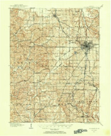
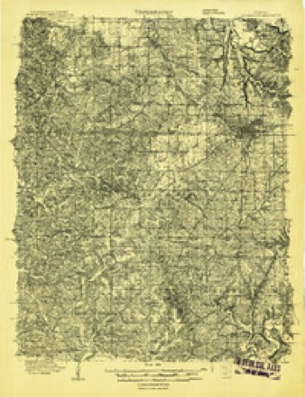
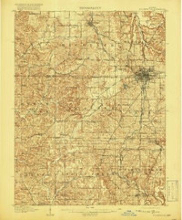
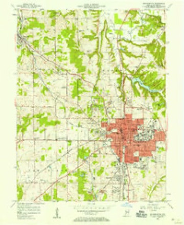
Topographic sheets covering this place
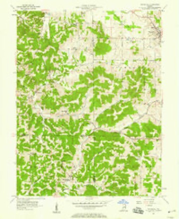
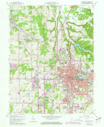
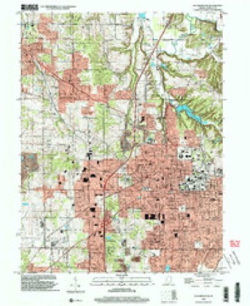
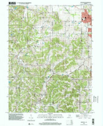
13 surveys from 30 printed sheetsMatched by testing this settlement's coordinate against the published boundary of every sheet in the United States Geological Survey's historical collection. Each opens the scanned sheet at the Survey.
- 1908 USGS Bloomington quadrangle1:62500
- 1908 USGS Bloomington quadrangle1:48000
- 1910 USGS Bloomington quadrangle1:62500, 6 printings
- 1953 USGS Indianapolis quadrangle1:250000, 4 printings
- 1956 USGS Bloomington quadrangle1:24000
- 1956 USGS Indianapolis quadrangle1:250000
- 1957 USGS Indianapolis quadrangle1:250000, 2 printings
- 1957 USGS Whitehall quadrangle1:24000, 4 printings
- 1962 USGS Indianapolis quadrangle1:250000
- 1966 USGS Bloomington quadrangle1:24000, 4 printings
- 1986 USGS Bloomington quadrangle1:100000, 3 printings
- 1998 USGS Bloomington quadrangle1:24000
- 1998 USGS Whitehall quadrangle1:24000





In the county-history sources
18,040 words on this township1884 History of Monroe County Indiana, published 1884 names this settlement in its chapter on Richland Township. These are the passages that mention it, exactly as the scans read.
I hesa section of the county possesses many interesting features, not only from its natural attractions, but from the fact that it was settled at a very early day and grew to worth and prominence while other portions were yet comparatively uninhabited. Of course the township has the usual characteristics of exterior and interior that belong to Monroe County as a whole. 'There are the argillaceous bluffs, with their soil of semi- sterility; there are the lower lands, where the agriculturist usually reaps his best, if not only, valuable return; there are the timber tracts, which have been largely denuded of their best woods; and there is that broken, cut-up appearance so common to the southern part of the Hoosier State. The lower lands are usually of a rich combined soil of sand, lime, clay and alluvium, the latter often predominating and affording a mellow, fertile tract of the greatest value, and one greatly sought after by those who understand the requirements of good crops. An abundance of excellent limestone is found near the surface, and is being worked by numerous companies. The section at the quarry, one and a half miles north of Ellettsville, is as follows:
Passage source: 1884 History of Monroe County Indiana, published 1884.
It is difficult to state who was the first permanent settler in this township. Several tracts were purchased in 1816, as will be seen from the above, but so far as can be learned only one family came out that fall to reside in the township during the winter. In about October, 1816, William Edmundson, without owning the land, located within a short distance of Ellettsville, erecting there a small, round-log cabin, in which he domiciled his family. He did not enter his land - the northwest quarter of
Passage source: 1884 History of Monroe County Indiana, published 1884.
George Sharp, the father of Jonathan Sharp, was probably the most experienced bear hunter ever a resident of Monroe County. He had lived before coming to the county in a wild section of the South, and during a surveying expedition of considerable magnitude, had been one of four or five scouts and hunters who supplied all the wild meat required by the members of the expedition. He averaged a bear a day for months, besides scores of buffaloes, deer, turkeys, etc. He killed hundreds of bears' in his time, and had many narrow escapes from death, but his incredible strength, coolness, skill, and knowledge of the animals, always brought him through without serious injury. He went armed with a huge butcher knife, the blade of which was one foot in length, and carried a rifle, with ball heavy enough to bring down the largest game. His son, Johnston Sharp, yet has his knife, which is truly a formidable weapon, and is greatly prized as a keepsake. It was used in killing one of the few bears taken in Richland Township. In about 1819, during the early winter, and just after a light fall of snow, some man in the settlement, in going through the woods, saw a large and curiously shaped track, and could not account for the same. Old man Sharp was called on to decide, and pronounced it the track of a large bear. The trail was immediately followed and led to a large hollow sycamore which stood a short distance north of Ellettsville. All the men of the settlement gathered around to participate in the killing, but were prohibited from using guns for fear, in the excitement, of shooting some person. The tree was cut down. While this was heing done, Mr. Sharp, the only one experienced in the habits of bears, was plied with all manner of questions, such as " Which way will it run?'' ** Where shall I stand?" etc., and answered all in a manner to keep his neighbors on the " ragged edge," and make them feel their decided inferiority on questions of bear-hunting. The huge tree came down with a crash, split open, and, to the astonishment of all, revealed three bears - one large one and two cubs three-fourths grown. The dogs to the number of about a dozen immediately set upon the bears, which, severely stunned by the fall, could at first offer only partial resistance, and were readily dispatched with clubs and cautious rifle shots before they had recovered their usual strength. One of the cubs caught a dog owned by Mr. Sharp, and was crushing the life out of it, when the irate owner, armed with the big butcher knife above mentioned, ran up and reaching over the bear, struck it to the heart from the opposite side. The yelping canine was instantly released and in a few moments the bear was dead. Several present could not understand.why Mr. Sharp had reached over the bear and struck it from the opposite side from which he was standing. He explained that bears when struck with a knife always snapped at and struck with their paws at the immediate object hurting - in this case the knife - regardless of who or what was on the other side, and he cited them to the fact that the bear when struck had bitten savagely at the knife, striking also with its paws, and had he been on that side would, no doubt, have suffered injury. He had 'been in too many hand-to-hand (so to speak) conflicts with these animals not to know how to use the knife. The three bears were taken and dressed, and parceled out among the settlers, all of whom enjoyed eating a large piece of juicy bearsteak, which, it is said, tastes much like pork, and can be fried in its own fat. Several other bears were killed in the township very early, an account of which cannot be given. Wolves were very troublesome, and were caught with steel traps. Panthers were occasionally found. A small dog, belonging to Mr. Milligan, treed a large one early one evening and kept it there all night, strange as it may seem. arly the next morning, Mr. Milligan, who had heard the continued barking, went out with his rifle and shot the panther dead from its perch in the tree. It was a very large specimen of its species, measuring, it is said, nearly twelve feet 'from tip to tip.
Passage source: 1884 History of Monroe County Indiana, published 1884.
Machine-read from a century-old scan, so expect the errors a machine makes: misspelled names, dropped words, stray characters.
Read the whole chapter on Richland Township - it names this place 24 more 24 times.
Fires near this place
127 since 2003Regional context, not property-specific evidence. The federal wildfire occurrence database lists 127 fires within 5 miles of Ellettsville between 2003 and 2008, burning about 58 acres in total. 3 started naturally. 19 were recorded as arson. Distance is straight-line from the map coordinates, so a fire counted here may appear on a neighbouring settlement's page as well.
| Reported cause | Fires |
|---|---|
| Debris and open burning | 36 |
| Recreation and ceremony | 35 |
| Missing data/not specified/undetermined | 30 |
| Arson/incendiarism | 19 |
| Natural | 3 |
| Equipment and vehicle use | 2 |
| Smoking | 1 |
| Other causes | 1 |
The most recent of them, most recent first, with the day each was reported and the service that recorded it.
| Date | Cause | Size | Reported by | Name on the report |
|---|---|---|---|---|
| 8 September 2004 | Debris and open burning | under an acre | Indiana State Fire Marshal's Office | not named |
| 7 September 2005 | Arson/incendiarism | under an acre | Indiana State Fire Marshal's Office | not named |
| 6 September 2005 | Arson/incendiarism | under an acre | Indiana State Fire Marshal's Office | not named |
| 3 September 2007 | Recreation and ceremony | 1.0 acres | Indiana State Fire Marshal's Office | not named |
| 23 September 2004 | Debris and open burning | under an acre | Indiana State Fire Marshal's Office | not named |
| 17 September 2004 | Debris and open burning | under an acre | Indiana State Fire Marshal's Office | not named |
| 14 September 2004 | Equipment and vehicle use | under an acre | Indiana State Fire Marshal's Office | not named |
| 7 August 2006 | Debris and open burning | under an acre | Indiana State Fire Marshal's Office | not named |
Settlements close enough to share some of these fires:
Mines and quarries near this place
10 of 11 shownRegional context, not property-specific evidence. The federal mineral resources record lists 11 workings within 5 miles of Ellettsville: 5 producers, 5 past producers, 1 plant. 6 still produce. What was taken out: Limestone, Dimension, Stone, Crushed/Broken, Fire Clay (Refractory), Limestone, General. Distance is straight-line from the map coordinates, so a quarry counted here may appear on a neighbouring settlement's page as well.
| Where | Site | Commodity | Status | Recorded |
|---|---|---|---|---|
| Indiana Ceramic Plant | Fire Clay (Refractory) | Plant | ||
| Indiana Limestone Quarry | Limestone, General | Past Producer | ||
| Bloomington Quarry | Stone, Crushed/Broken | Producer | ||
| Indiana Cal-Pro. Inc | Stone, Crushed/Broken | Producer | ||
| Arlington Mill | Limestone, Dimension | Past Producer | ||
| Arlington Quarry | Limestone, Dimension | Past Producer | ||
| Bennett Mill | Limestone, Dimension | Past Producer | ||
| Ed Bennett Quarry | Limestone, Dimension | Past Producer | ||
| Hunter Valley Quarry | Limestone, Dimension | Producer | ||
| Smith's Quarry | Limestone, Dimension | Producer |
Storms near this place
48 since 1997Regional context, not property-specific evidence. The National Weather Service names Ellettsville in 48 storm reports between 1997 and 2025: 21 thunderstorm wind, 15 hail, 4 flash flood, 3 tornado. No death or injury is recorded in these reports. Each account below is quoted exactly as the forecast office filed it, from the NOAA Storm Events Database, and each date opens the federal record of that event.
| When | Event | Place named | Harm | What the report says |
|---|---|---|---|---|
| September 2002 | Tornado (F3) | Ellettsville | $10,000,000 | no account filed |
| May 2004 | Tornado (F1) | Ellettsville | $250,000 | An F1 tornado caused significant damage to a cabin northeast of Ellettsville. Most of the path was along a wooded area with numerous trees felled. |
| June 2019 | Tornado (EF2) | Ellettsville | $110,000 | The EF-2 rated tornado, with max wind speeds of 130 mph, began in rural countryside northeast of Ellettsville doing some tree damage before crossing State Road 46 and doing significant tree damage along Chafin Chapel Road. A 400 yard wide path of trees was completely shredded in spots. Additional widespread tree damage was found on Mount Tabor Road and West Cowden Road. Along West Cowden Road, several barns and outbuildings were destroyed as well as a loosely anchored garage completely swept off of its foundation. The tornado continued into rural forest before dissipating. |
| December 2013 | Flash Flood | Ellettsville | $50,000 | Water rescues were ongoing in town. People were trapped in multiple residences and vehicles due to high water in the vicinity of Vine and Temperance Streets. |
| February 2019 | Flash Flood | Ellettsville | $30,000 | All downtown streets of Ellettsville are impassable due to flash flooding from heavy rainfall. State Road 46 Westbound is underwater. The Eastbound lane is still passable. |
| June 2023 | Thunderstorm Wind | Ellettsville | $25,000 | Tree downed on a house by thunderstorm wind gusts. |
| May 2022 | Thunderstorm Wind | Ellettsville | $20,000 | Large trees and power line downed by thunderstorm wind gusts. |
| August 2009 | Thunderstorm Wind | Ellettsville | $15,000 | Many trees were downed, uprooted, or split due to thunderstorm wind gusts within Ellettsville. No information on whether any homes were damaged by these trees. |
| May 2017 | Thunderstorm Wind | Ellettsville | $10,000 | Multiple social media reports of trees downed on roads in and around the Ellettsville area due to damaging thunderstorm wind gusts. |
| September 2000 | Thunderstorm Wind | Ellettsville | $10,000 | no account filed |
| September 2016 | Flash Flood | Ellettsville | $7,000 | A water rescue from a vehicle occurred at this location due to flash flooding from heavy thunderstorm rainfall. |
| June 2010 | Thunderstorm Wind | Ellettsville | $5,000 | Trees, up to 10 inches in diameter, were reported down due to damaging thunderstorm wind gusts in this location. |
| June 2008 | Flash Flood | Ellettsville | $5,000 | Law enforcement informed the NWS that numerous roads were flooded in the Bloomington area. A landslide occurred on Harmony Road just off of Kirksville Road, located near SR 45 in southwest Bloomington. |
| April 2025 | Thunderstorm Wind | Ellettsville | $4,000 | Multiple trees of unknown size downed by thunderstorm wind gusts. |
| May 2012 | Thunderstorm Wind | Ellettsville | $4,000 | Isolated reports of trees being down in the Ellettsville area were due to damaging thunderstorm wind gusts. |
| May 2017 | Thunderstorm Wind | Ellettsville | $3,500 | A large tree limb split and was blown onto a house due to damaging thunderstorm wind gusts. |
| April 2024 | Thunderstorm Wind | Ellettsville | $3,000 | Thunderstorm winds downed a large tree at West Lost Mans Lane and North Union Valley Road. |
| July 2008 | Thunderstorm Wind | Ellettsville | $3,000 | Trees and utility lines were blown down by thunderstorm winds. |
| March 2024 | Thunderstorm Wind | Ellettsville | $2,000 | Several large tree limbs snapped by thunderstorm wind gusts. |
| May 2012 | Flood | Ellettsville | $1,000 | A few roads were closed in Ellettsville due to high water from thunderstorm heavy rainfall. |
| May 2012 | Flood | Ellettsville | $1,000 | A few homes were evacuated as a precaution due to high water near where Jacks Defeat Creek crosses State Route 46. |
| July 2012 | Thunderstorm Wind | Ellettsville | $1,000 | A twelve inch diameter tree was snapped off at the base near the intersection of North Hartstrait and Ratliff Roads due to damaging thunderstorm wind gusts. |
| June 1998 | Thunderstorm Wind | Ellettsville | $500 | Few trees down. |
| June 2023 | Hail | Ellettsville | - | Thunderstorm hail continued into northwestern Monroe County, with hail as large as tennis balls to the south of Ellettsville. |
| December 2021 | Thunderstorm Wind | Ellettsville | - | Trees down by thunderstorm wind gusts across Monroe County. |
| May 2009 | Thunderstorm Wind | Ellettsville | - | A tree was blown down by thunderstorm winds on Red Hill Road, Ellettsville, Indiana. |
| June 2008 | Heavy Rain | Ellettsville | - | Measured rainfall of 6.00 inches was reported. |
| April 2006 | Hail | Ellettsville | - | No property damage estimates were available. |
| May 2005 | Heavy Rain | Ellettsville | - | Nearly an inch of rain fell in 30 minutes in Ellettsville. |
| November 2005 | Thunderstorm Wind | Ellettsville | - | Trees were downed. |
| August 2004 | Thunderstorm Wind | Ellettsville | - | Several trees were downed by wind gusts. |
| March 2025 | Hail | Ellettsville | - | no account filed |
| May 2025 | Hail | Ellettsville | - | no account filed |
| May 2024 | Hail | Ellettsville | - | no account filed |
| May 2017 | Hail | Ellettsville | - | no account filed |
| May 2012 | Hail | Ellettsville | - | no account filed |
| May 2011 | Hail | Ellettsville | - | no account filed |
| June 2010 | Funnel Cloud | Ellettsville | - | no account filed |
| April 2006 | Hail | Ellettsville | - | no account filed |
| June 2006 | Hail | Ellettsville | - | no account filed |
| June 2005 | Hail | Ellettsville | - | no account filed |
| July 2004 | Thunderstorm Wind | Ellettsville | - | no account filed |
| April 2002 | Hail | Ellettsville | - | no account filed |
| September 2001 | Hail | Ellettsville | - | no account filed |
| May 2000 | Thunderstorm Wind | Ellettsville | - | no account filed |
| May 1999 | Hail | Ellettsville | - | no account filed |
| May 1998 | Hail | Ellettsville | - | no account filed |
| April 1997 | Thunderstorm Wind | Ellettsville | - | no account filed |
Nearest settlements
The eight closest, with where each one stands in the county. Distances are straight-line, computed from the Geographic Names Information System coordinates.
| Map | Place | Distance | Sheets |
|---|---|---|---|
| West Brook Downs | 1.8 miles | 25 | |
| Forest Park Heights | 2.6 miles | 25 | |
| Lancaster Park | 3.8 miles | 25 | |
| Stinesville | 4.7 miles | 18 | |
| Modesto | 4.8 miles | 17 | |
| Hunter Switch | 5.0 miles | 25 | |
| Arlington | 5.3 miles | 25 | |
| Mount Tabor | 5.4 miles | 18 |
Elsewhere
Matched on this settlement's Geographic Names Information System number rather than its name, so it cannot be a different place of the same name in another state.
| Wikipedia article on Ellettsville | An encyclopaedic summary. Its text is share-alike, so it is linked here rather than copied. |
| Wikidata item Q2419893 | The structured record the population and elevation above come from. Public domain (CC0). |
Provenance
This settlement is recorded in the Geographic Names Information System as feature 434095. The sheet list is computed by point-in-boundary test against the United States Geological Survey's historical topographic inventory. Both are works of the United States government and carry no copyright under 17 U.S.C. 105.
Wildfire. Short, Karen C. 2022. Spatial wildfire occurrence data for the United States, 1992-2020 [FPA_FOD_20221014]. 6th Edition. Fort Collins, CO: Forest Service Research Data Archive. https://doi.org/10.2737/RDS-2013-0009.6 Collected with United States Government funding and usable without additional permissions or fees.
Mines and quarries. USGS Mineral Resources Data System (MRDS) https://mrdata.usgs.gov/mrds/ A work of the United States government, no copyright under 17 U.S.C. 105.
Storms. NOAA National Centers for Environmental Information, Storm Events Database https://www.ncei.noaa.gov/stormevents/ A work of the United States government, no copyright under 17 U.S.C. 105. Narratives are quoted verbatim from the National Weather Service report and are not edited or summarised.