 Block
Fremont, Indiana
15 topographic sheets cover this place, the earliest surveyed in 1939 and the latest in 1993. It stands in Fremont Township. It lies in ZIP code area 46737. The Survey maps it on the Angola East quadrangle. 2,034 people lived here at the 2020 count. It stands 1,056 feet above sea level.
On record in Fremont
Buildings and businesses the archive holds for this place. Each opens its own page, with the source record it came from.
On the National Register 4 records
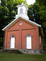 Collins Schoollisted 2002
 William L. Lords Houselisted 1983
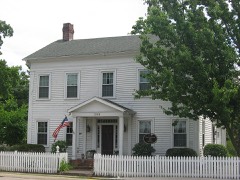 Enos Michael Houselisted 1982
- Erastus and Louise Farnham House and Barnlisted 2022
Population over time
2 figuresFremont fell from 2,138 to 2,034 between 2010 and 2020. These are the recorded population figures Wikidata holds for this place, reached through the Geographic Names Information System number this page is keyed on rather than by name, so they belong to this place and not to another of the same name. Most are census counts, but not all are: an early figure may be a founding or settlement estimate, and an estimate published within five years of a census is left out. The change column is computed, and is left blank where more than 20 years separate a figure from the one before it, because a gap that long is not a change between two counts.
| Year | People | Change |
|---|---|---|
| 2010 | 2,138 | |
| 2020 | 2,034 | -104 (-5%) |
Topographic sheets covering this place
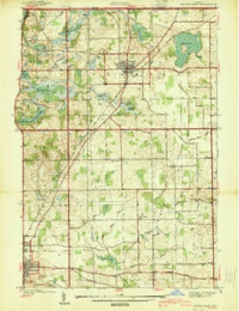
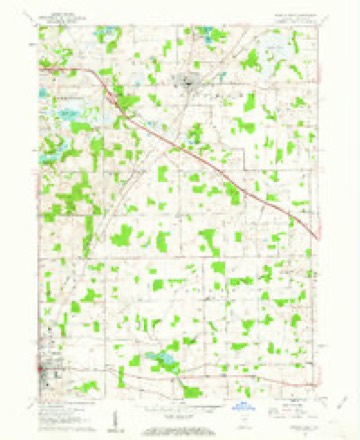
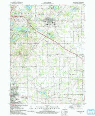
8 surveys from 15 printed sheetsMatched by testing this settlement's coordinate against the published boundary of every sheet in the United States Geological Survey's historical collection. Each opens the scanned sheet at the Survey.
- 1939 USGS Angola East quadrangle1:24000
- 1947 USGS Angola East quadrangle1:24000, 2 printings
- 1953 USGS Fort Wayne quadrangle1:250000, 4 printings
- 1956 USGS Fort Wayne quadrangle1:250000, 2 printings
- 1960 USGS Angola East quadrangle1:24000, 3 printings
- 1985 USGS Adrian quadrangle1:100000
- 1990 USGS Adrian quadrangle1:100000
- 1993 USGS Angola East quadrangle1:24000


In the county-history sources
17,226 words on this townshipHistory of Steuben County, Indiana, Together with... Biographies of Representative Citizens, published 1885 names this settlement in its chapter on Fremont Township. These are the passages that mention it, exactly as the scans read.
The township first known as Brockville, but afterward named in honor of the famous " pathfinder," JohnC. Fremont, is bounded on the north by Branch County, in the State of Michigan; on the east by Clear Lake Township; on the south by York and Scott, and on the west by Jamestown. It is four miles north and south, and five and three-quarters east and west. Its area is accordingly about twenty-three square miles, or 15,000 acres, of which 600 are covered by water. The largest lakes are Cedar, on sections 14, 15, 22, 27, 26 and 23; Walter's Lake, on 18, and Fish Lake, on 16 and 21. The Fort Wayne & Jackson branch of the Lake Sliore & Michigan Southern Railroad crosses the township from southwest to northeast, over sections 32, 29, 28, 21, 22, 15, 14 and 13. It has two stations, Fremont and Ray, the latter being partly in Branch County, Mich.
Passage source: History of Steuben County, Indiana, Together with... Biographies of Representative Citizens, published 1885.
One day in the latter part of August, 1835, John McMahan unhitched his horses about a mile from the present village of Fremont, and to him belongs the honor of being the first white settler in the township. Uncle Demary Tillitson passed Mr. Mc- Mahan about two hours after the latter had stopped, and he is thus entitled to the second place on the roll of old settlers. Mr. Tillitson "took up" eighty acres of land where the commodious residence of Erastus Farnhara (now of Chicago) was afterward erected, and Mr. McMahan settled a mile further north. He died in 1878, being survived by Demary Tillitson for a short time. That same fall several more settlers came into the township, among them being Jeremiah Tillitson, an uncle of Demary's, Jacob Roop, Fred Bowers and Peter Cluck. Jeremiah Tillitson died about 1874, in his eightieth year.
Passage source: History of Steuben County, Indiana, Together with... Biographies of Representative Citizens, published 1885.
Jacob Roop was killed about 1865 by the carelessness of a drug clerk. He had been troubled for some time with the rheumatism, and called on a physician for something to relieve him. The doctor told him to take a spoonful of tincture of colchicum every three or four hours. Mr. Roop took the prescription to a drug store. The clerk didn't know what tincture meant, and so gave him colchicum seed. He took one spoonful of them and in about three hours was in great agony, but thinking that it might be necessary to cure him took another spoonful. He grew rapidly worse. Medical aid was summoned from Fremont and other places, but notwithstanding every effort was made to save him he died in a few hours, having suffered terribly. Fred Bowers died of old age about 1869, being at the time of his death nearly ninety years of age. Peter Cluck was a blacksmith, and was noted as a very powerful man. One of his sons, Peter, succeeded him in that occupation at Fremont. Another sou was killed in the late civil war. The old gentleman died about 1870.
Passage source: History of Steuben County, Indiana, Together with... Biographies of Representative Citizens, published 1885.
Machine-read from a century-old scan, so expect the errors a machine makes: misspelled names, dropped words, stray characters.
Read the whole chapter on Fremont Township - it names this place 51 more 51 times.
Fires near this place
3 since 2002Regional context, not property-specific evidence. The federal wildfire occurrence database lists 3 fires within 5 miles of Fremont between 2002 and 2019, burning about 1 acre in total. 1 started naturally. None was recorded as arson. Distance is straight-line from the map coordinates, so a fire counted here may appear on a neighbouring settlement's page as well.
| Reported cause | Fires |
|---|---|
| Missing data/not specified/undetermined | 1 |
| Equipment and vehicle use | 1 |
| Natural | 1 |
The most recent of them, most recent first, with the day each was reported and the service that recorded it.
| Date | Cause | Size | Reported by | Name on the report |
|---|---|---|---|---|
| 8 August 2013 | Missing data/not specified/undetermined | under an acre | Michigan Department of Natural Resources | BRANCH 01 - MUCK LAKE FIRE |
| 26 March 2019 | Equipment and vehicle use | 1.0 acres | Michigan Department of Natural Resources | LAKELAND VFD 0019033 - 2019 |
| 15 November 2002 | Natural | under an acre | Michigan Department of Natural Resources | not named |
Settlements close enough to share some of these fires:
Mines and quarries near this place
1 within 5 milesRegional context, not property-specific evidence. The federal mineral resources record lists 1 working within 5 miles of Fremont: 1 past producer. None of them still produces. What was taken out: Sand and Gravel, Construction. Distance is straight-line from the map coordinates, so a quarry counted here may appear on a neighbouring settlement's page as well.
| Where | Site | Commodity | Status | Recorded |
|---|---|---|---|---|
| Angola Sand and Gravel Pit | Sand and Gravel, Construction | Past Producer |
Storms near this place
34 since 1998Regional context, not property-specific evidence. The National Weather Service names Fremont in 34 storm reports between 1998 and 2022: 19 thunderstorm wind, 13 hail, 1 lightning, 1 flood. No death or injury is recorded in these reports. Each account below is quoted exactly as the forecast office filed it, from the NOAA Storm Events Database, and each date opens the federal record of that event.
| When | Event | Place named | Harm | What the report says |
|---|---|---|---|---|
| July 1998 | Lightning | Fremont | $312,000 | LIGHTNING INDUCED FIRES DESTROYED A BARN AND KENNEL AT 3580 S CR RD 800 E. ANOTHER LIGHTNING INDUCED FIRE DESTROYED ANOTHER BARN AND FARM TRACTORS AT 3285 N CR RD 650 E WHICH TOOK FIRE FIGHTERS 40 MINUTES TO GET UNDER CONTROL. |
| July 2007 | Thunderstorm Wind | Fremont | $100,000 | Local emergency management performed a storm survey of damage west of Fremont. A strip mall suffered significant damage to the roof and soffits as well as broken windows. Numerous trees were reported down in the area with one onto a car. Some trees were uprooted, as large as 20 inches in diameter. Trees and a light pole were blown down at a Holiday Inn Express. The damage appeared to be consistent with straight line winds of around 70 mph. Damage is estimated at around $100,000. |
| September 2005 | Hail | Fremont | $50,000 | 30 to 35 homes were reported to have siding damage and a few vehicles also suffered some damage. Hail up to golf ball size was reported. |
| September 2005 | Thunderstorm Wind | Fremont | $40,000 | Several trees were blown down, one reported to be 24 inches in diameter. A 12 inch diameter tree fell onto a parked police car, which was totaled as a result. A large cottonwood tree was blown down near Snow Lake, with debris from the tree knocking over a fence and utility shed. |
| August 2007 | Thunderstorm Wind | Fremont | $20,000 | Numerous power lines and trees were blown down. |
| July 2001 | Flood | Fremont | $9,000 | Store located in "a small gully" as described by owner experienced water up to the owners knee after rainfall of around 2 inches in 3 hours. No injuries. |
| August 2022 | Thunderstorm Wind | Fremont | $2,000 | Tree branches one foot in diameter were down south of Fremont. |
| July 2002 | Thunderstorm Wind | Fremont | $1,000 | Trained spotter reported large trees down west of Fremont near Pleasant Lake. One of the trees was blown down on a home with minor damage. |
| April 1998 | Thunderstorm Wind | Fremont | $1,000 | Power lines and trees down in northern Steuben County south of Fremont and north of Snow Lake. |
| May 2022 | Thunderstorm Wind | Fremont | - | The public reported several large tree limbs down along as well as a flipped trampoline. |
| June 2020 | Thunderstorm Wind | Fremont | - | EM reports numerous trees down. |
| July 2019 | Thunderstorm Wind | Fremont | - | Emergency management officials reported multiple trees and power lines blown down along SR 120, west of Fremont. |
| June 2013 | Thunderstorm Wind | Fremont | - | Emergency management officials reported tree limbs blown down onto power lines. |
| July 2012 | Thunderstorm Wind | Fremont | - | A trained spotter reported numerous three to six inch diameter tree limbs down. |
| July 2011 | Thunderstorm Wind | Fremont | - | Amateur radio operators reported the top half of a five inch diameter tree down blocking the road near State Route 827 and County Road 300 East. |
| May 2011 | Thunderstorm Wind | Fremont | - | Amateur radio operators reported several power lines and trees down in and around Fremont. |
| June 2010 | Thunderstorm Wind | Fremont | - | Emergency management officials reported trees down in the Fremont area, one of which fell onto a house. No further damage details were provided. |
| March 2005 | Thunderstorm Wind | Fremont | - | A measured 62 mph wind gust was reported by a spotter in Fremont. |
| July 2005 | Thunderstorm Wind | Fremont | - | Several tree limbs were blown down. |
| July 2005 | Thunderstorm Wind | Fremont | - | Tree down onto power line. |
| September 2005 | Thunderstorm Wind | Fremont | - | Numerous limbs were blown down. |
| September 2005 | Hail | Fremont | - | Hail up to the size of nickels was reported. |
| July 2005 | Thunderstorm Wind | Fremont | - | Tree blown down onto power line. |
| February 2017 | Hail | Fremont | - | no account filed |
| May 2007 | Hail | Fremont | - | no account filed |
| May 2007 | Hail | Fremont | - | no account filed |
| July 2007 | Hail | Fremont | - | no account filed |
| July 2007 | Hail | Fremont | - | no account filed |
| July 2007 | Hail | Fremont | - | no account filed |
| March 2003 | Hail | Fremont | - | no account filed |
| August 2000 | Hail | Fremont | - | no account filed |
| May 1999 | Hail | Fremont | - | no account filed |
| May 1999 | Hail | Fremont | - | no account filed |
| August 1998 | Hail | Fremont | - | no account filed |
Nearest settlements
The eight closest, with where each one stands in the county. Distances are straight-line, computed from the Geographic Names Information System coordinates.
| Map | Place | Distance | Sheets |
|---|---|---|---|
| Valley Outlet Center | 3.7 miles | 16 | |
| Jamestown | 4.6 miles | 16 | |
| Page | 4.9 miles | 16 | |
| Potawatomi Inn | 5.1 miles | 16 | |
| Glen Eden | 5.2 miles | 16 | |
| Clear Lake | 5.3 miles | 16 | |
| Eastpoint Terminal | 6.2 miles | 16 | |
| Lake James | 6.4 miles | 16 |
Elsewhere
Matched on this settlement's Geographic Names Information System number rather than its name, so it cannot be a different place of the same name in another state.
| Wikipedia article on Fremont | An encyclopaedic summary. Its text is share-alike, so it is linked here rather than copied. |
| Wikidata item Q2308230 | The structured record the population and elevation above come from. Public domain (CC0). |
Provenance
This settlement is recorded in the Geographic Names Information System as feature 434824. The sheet list is computed by point-in-boundary test against the United States Geological Survey's historical topographic inventory. Both are works of the United States government and carry no copyright under 17 U.S.C. 105.
Wildfire. Short, Karen C. 2022. Spatial wildfire occurrence data for the United States, 1992-2020 [FPA_FOD_20221014]. 6th Edition. Fort Collins, CO: Forest Service Research Data Archive. https://doi.org/10.2737/RDS-2013-0009.6 Collected with United States Government funding and usable without additional permissions or fees.
Mines and quarries. USGS Mineral Resources Data System (MRDS) https://mrdata.usgs.gov/mrds/ A work of the United States government, no copyright under 17 U.S.C. 105.
Storms. NOAA National Centers for Environmental Information, Storm Events Database https://www.ncei.noaa.gov/stormevents/ A work of the United States government, no copyright under 17 U.S.C. 105. Narratives are quoted verbatim from the National Weather Service report and are not edited or summarised.