 Block
Greenwood, Indiana
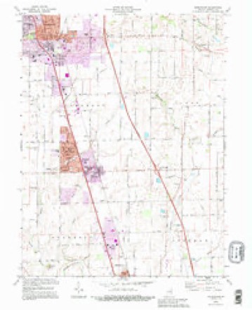
16 topographic sheets cover this place, the earliest surveyed in 1953 and the latest in 1992. It stands in Pleasant Township. It lies in ZIP code area 46142. It lies near Polk Hill. The Survey maps it on the Greenwood quadrangle. 63,830 people lived here at the 2020 count. It stands 804 feet above sea level.
Research this city
On record in Greenwood
Buildings and businesses the archive holds for this place. Each opens its own page, with the source record it came from.
On the National Register 3 records
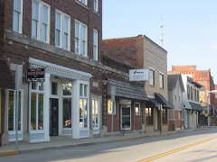 Greenwood Commercial Historic Districtlisted 1991
- Bagby-Doub Farmsteadlisted 2021
- Greenwood Residential Historic Districtlisted 2017
Population over time
2 figuresGreenwood grew from 49,791 to 63,830 between 2010 and 2020. These are the recorded population figures Wikidata holds for this place, reached through the Geographic Names Information System number this page is keyed on rather than by name, so they belong to this place and not to another of the same name. Most are census counts, but not all are: an early figure may be a founding or settlement estimate, and an estimate published within five years of a census is left out. The change column is computed, and is left blank where more than 20 years separate a figure from the one before it, because a gap that long is not a change between two counts.
| Year | People | Change |
|---|---|---|
| 2010 | 49,791 | |
| 2020 | 63,830 | +14,039 (+28%) |
Topographic sheets covering this place
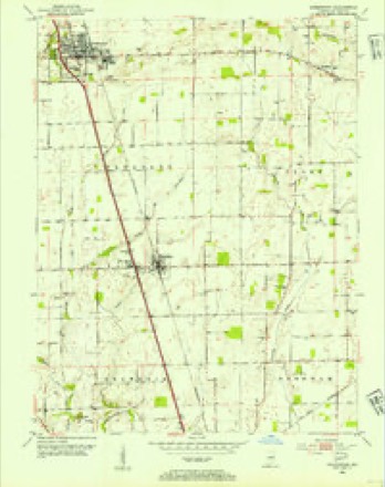
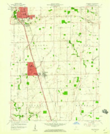
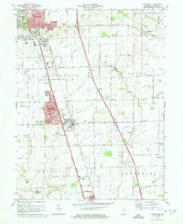
9 surveys from 16 printed sheetsMatched by testing this settlement's coordinate against the published boundary of every sheet in the United States Geological Survey's historical collection. Each opens the scanned sheet at the Survey.
- 1953 USGS Greenwood quadrangle1:24000
- 1953 USGS Indianapolis quadrangle1:250000, 4 printings
- 1956 USGS Indianapolis quadrangle1:250000
- 1957 USGS Indianapolis quadrangle1:250000, 2 printings
- 1959 USGS Greenwood quadrangle1:24000
- 1962 USGS Indianapolis quadrangle1:250000
- 1973 USGS Greenwood quadrangle1:24000, 3 printings
- 1986 USGS Indianapolis quadrangle1:100000, 2 printings
- 1992 USGS Greenwood quadrangle1:24000





In the county-history sources
22,145 words on this townshipHistory of Johnson County, Indiana : from the Earliest Time to the Present, with Biographical Sketches, Notes, Etc. Together with a Short History of the Northwest, the Indiana Territory, and the State of Indiana, published 1888 names this settlement in its chapter on Pleasant Township. These are the passages that mention it, exactly as the scans read.
Samuel V. Alexander, a prominent farmer and well-to-do citizen of Pleasant Township, was born on a farm in that township, October 3, 1842, and was the son of Joseph S. and Matilda (Jones) Alexander, the former of whom was the son of John and Elizabeth Alexander, and the latter was the daughter of Jubal and Jane (Suiter) Jones. His father was born about the 17th day of March, 1819. He was drowned while fording White River, on horseback, September 15, 1855. He was a farmer by occupation, and was a member of the Methodist Episcopal Church. The mother of our subject was born in Pleasant Township, this county, about the 27th day of November, 1824. She was married to Joseph S. Alexander, in 1840, and about four years after his death, she was married to David' Scott. She died in Pleasant Township, November 8, 1868. John Alexander was born March 24, 1780, and died in Pleasant Township, April 5, 1855. His wife, Elizabeth Alexander, was born December 3, 1780, and died in Pleasant Township, December 13, 1872. The first wife of Joseph S. Alexander was Elizabeth Lyons. When the subject of this sketch was yet a little child his parents located in the northeast part of Clark Township, but when he was eleven years old they returned" Jo Pleasant Township, where the rest of his youth was spent. He took up the vocation of a farmer for himself at about sixteen years of age. Mr. Alexander served his country in the Union army three years, having been enrolled as a private in Company D, Twenty-sixth Indiana Infantry, July 28, 1861. He received an honorable discharge at Indianapolis, September 21, 1864. He was in the battle of Prairie Grove, Ark., the siege of Vicksburg, and many other skirmishes. When Mr. Alexander returned from the war he resumed farming in Pleasant Township, which he has since continued. He has occupied his present home since the latter part of December, 1866. On the 29th of March, 1866, he was married to Mary J. Cox. She was born in Pleasant Township, July 6, 1846, and was the daughter of Irvin and Matilda A. (Davis) Cox, the former of whom was the son of Jonathan and Susannah Cox, and the latter was the daughter of Reuben and Mary (Brown) Davis. Her father was born in Hamilton County, Ohio, October n, 1825, and died at Xenia, Ind., January 23, 1884. He was a minister of the United Brethren Church. The mother of Mrs. Alexander was born July 27, 1830, in Pleasant Township, and now resides in Indianapolis. Our subject and wife have had six children: William J., born May 13, 1867; Elizabeth A., July 18, 1868; Martha N., September 18, 187 1, deceased; the next was a boy that was born April 3, 1873, and died unnamed; Mirpie B., October 16, 1875; Rssa P., October 17, 1881, deceased. Mr. and Mrs. Alexander are members of the United Brethren Church. The former is a member of the G. A. R., and he is a republican in politics. He owns 104 acres of land, about eighty of which are in cultivation. It contains a handsome slate-roofed frame residence, and is otherwise well-improved. The wife of Mr. Alexander owns a farm of forty acres, which is in Pleasant Township.
Passage source: History of Johnson County, Indiana : from the Earliest Time to the Present, with Biographical Sketches, Notes, Etc. Together with a Short History of the Northwest, the Indiana Territory, and the State of Indiana, published 1888.
Abram Brewer, of Pleasant Township, was born on the farm where he now lives, May 25, 1830, and was the son of Garrett C. and Mary (Van Birke) Brewer. His life occupation "has beenfarming. He was married December 6, 187 1, to Martha E. Purcell. She was born in Hancock County, Ind., October 1, 1843, and was the daughter of John and Sarah (Skinner) Purcell. Mr. and Mrs. Brewer have four children: Maggie F., born October 26, 1872; Jessie, November 19, 1876; Charles, July 29, 1879, and Hattie, September 19, 1882, all of whom are living. Mr. Brewer and wife are members of the Presbyterian Church. In politics, the the former is a republican. He owns 100 acres of land, about half of which is in cultivation.
Passage source: History of Johnson County, Indiana : from the Earliest Time to the Present, with Biographical Sketches, Notes, Etc. Together with a Short History of the Northwest, the Indiana Territory, and the State of Indiana, published 1888.
Edgar D. Brewer, a prominent farmer of Pleasant Township, was born on the old Brewer homestead, three and one-half miles northwest of Franklin, March 25, 1850, and was the son of Daniel and Magdalene (Ditmars) Brewer. His father was born in Mercer County, Ky., June 18, 1814, and was the son of Daniel and Theodocia (Derland) Brewer, with whom he came to Johnson County in 1833. The family settled in the southern part of Pleasant Township, where Daniel Brewer, Sr., and Theodocia, his wife, spent the rest of their lives. Daniel Brewer, Jr., the father of our subject, was married four times, his second wife being our subject's mother. She was born in about 1826, and was the daughter of Garrett Ditmars. The father and mother of our subject were married some time during the year 1849, the mother dying April 2, 1862, and the father March 31, 1887. Edgar D. Brewer was reared on the old homestead in Franklin Township, and in addition to a good common school education, he was a student in Hopewell Academy three years. At the age of nineteen, he became a partner in a general store in Franklin, and gave his attention to this three years. In 1872, he turned his attention to saw-milling, and for three years he was connected with a saw-mill in Pleasant Township. He was married October 21, 1873, to Sallie Ann Beazley. She was born in Henry County, Ky., March 23, 1851, and was the daughter of Augustine and Sallie Ann (Webb) Beazley, the former of whom was born in Hensley County, Ky., September 1, 1805, and the latter was born in Henry County, Ky., August 20, 181 2. Her parents were married in Henry County, Ky., August 15, 1833. They both spent their entire lives in their native county, the former dying July 3, 1863, and the latter September 21, 1865. Augustine Beazley was the owner of a vast estate, and was also an extensive slave-holder. In August, 1874, Mr. a"d Mrs. Brewer located on the old Brewer homestead, where the former was born, and resided there until August, 1 88 1, when they removed to their present home in Pleasant Township. They now reside on a beautiful farm, one-half a mile west of Whiteland. It contains 104 acres, and is well improved and situated. Besides this, Mr. Brewer is now the owner of the old home farm, in Franklin Township. It contains 205 acres, and is also well improved. Our subject and wife have three children: Norma, born September 1, 1874; Jonn D., January 19, 1878, and Neva, March 24, 18S0; all of whom are living. Mr. and Mrs. Brewer are members of the Presbyterian Church. In politics, Mr. Brewer is a democrat. He is one of the leading farmers of the county, and he and wife are among its best citizens.
Passage source: History of Johnson County, Indiana : from the Earliest Time to the Present, with Biographical Sketches, Notes, Etc. Together with a Short History of the Northwest, the Indiana Territory, and the State of Indiana, published 1888.
Machine-read from a century-old scan, so expect the errors a machine makes: misspelled names, dropped words, stray characters.
Read the whole chapter on Pleasant Township - it names this place 21 more 21 times.
Mines and quarries near this place
1 within 5 milesRegional context, not property-specific evidence. The federal mineral resources record lists 1 working within 5 miles of Greenwood: 1 unknown. None of them still produces. What was taken out: Sand and Gravel, Construction. Distance is straight-line from the map coordinates, so a quarry counted here may appear on a neighbouring settlement's page as well.
| Where | Site | Commodity | Status | Recorded |
|---|---|---|---|---|
| Kelsay & York Gravel Pit | Sand and Gravel, Construction | Unknown |
Storms near this place
60 of 80 shownRegional context, not property-specific evidence. The National Weather Service names Greenwood in 80 storm reports between 1994 and 2025: 39 hail, 31 thunderstorm wind, 7 lightning, 2 tornado. The reports record 3 deaths and 2 injuries. Each account below is quoted exactly as the forecast office filed it, from the NOAA Storm Events Database, and each date opens the federal record of that event.
| When | Event | Place named | Harm | What the report says |
|---|---|---|---|---|
| June 2008 | Thunderstorm Wind | Greenwood | 3 killed, 2 hurt, $10,000 | Thunderstorm winds contributed to the collapse of a wall and scaffolding at a construction site in the Precedent South Business Center south of Main Street near I-65. The incident killed 3 and injured 2. All were male workers. |
| September 2002 | Tornado (F3) | Greenwood | $25,000,000 | no account filed |
| March 2006 | Tornado (F2) | Greenwood | $3,000,000 | A tornado touched down just west of Interstate 65 and Main Street in Greenwood on the evening of 31 March 2006. This tornado was on the ground for 25 minutes, covered an area 17 miles long, and caused significant damage to several homes and businesses along its path, which continued into neighboring Shelby County. At its peak, near the small town of London in Shelby County, the tornado was a strong F2, with a width of four tenths of a mile. The tornado lifted near US 52 and State Road 9 in north central Shelby County. According to the American Red Cross of Greater Indianapolis, more than 140 homes were damaged, some of them severely. Fortunately, no fatalities or life-threatening injuries were reported, although at least one driver, Megan Mahoney of Chesterfield, MO, sustained a concussion when her car was rolled or tossed off of Interstate 74 in Shelby County and into the yard of a home over 150 feet away. This was the third significant tornado in just over three and a half years to affect the southern suburbs of the Indianapolis metropolitan area. |
| June 2005 | Lightning | Greenwood | $200,000 | Lightning sparked a fire that heavily damaged the third floor of the Polo Run Apartments in Greenwood. |
| August 2000 | Thunderstorm Wind | Greenwood | $200,000 | no account filed |
| June 1999 | Thunderstorm Wind | Greenwood | $200,000 | no account filed |
| April 2006 | Lightning | Greenwood | $100,000 | A lightning strike set fire to a home in Greenwood. The fire spread quickly up a chimney space and destroyed an upstairs bedroom and the roof, and collapsed some of the second floor. |
| August 2000 | Lightning | Greenwood | $100,000 | no account filed |
| January 1999 | Lightning | Greenwood | $75,000 | Lightning struck a church a caused a fire which inflicted heavy damage on it. |
| August 2000 | Lightning | Greenwood | $60,000 | no account filed |
| May 2003 | Lightning | Greenwood | $15,000 | no account filed |
| May 2002 | Thunderstorm Wind | Greenwood | $10,000 | Part of a roof blown off a house that was under contstruction |
| May 1996 | Lightning | Greenwood | $10,000 | no account filed |
| June 1998 | Thunderstorm Wind | Greenwood | $8,000 | no account filed |
| July 2009 | Thunderstorm Wind | Greenwood | $7,000 | Thunderstorm wind gusts downed trees near Greenwood. |
| July 2014 | Thunderstorm Wind | Greenwood | $5,000 | Plate glass windows were blown out on the southeast corner of Value City Furniture due to damaging thunderstorm wind gusts. Additionally, the awning on the Vitamin Shoppe, in front of Value City Furniture, was ripped off of the building. |
| June 1994 | Thunderstorm Wind | Greenwood | $5,000 | Power lines were downed. |
| July 2013 | Thunderstorm Wind | Greenwood | $4,000 | Trees were reported down in this location due to damaging thunderstorm wind gusts. This report was received via Twitter. |
| June 2008 | Thunderstorm Wind | Greenwood | $4,000 | Thunderstorm winds uprooted a tree, blew down a tree limb approximately 9 inches in diameter, and blew down a 5-foot by 7-foot church sign. A number of small limbs were found down along Main Street in downtown Greenwood. |
| April 2025 | Thunderstorm Wind | Greenwood | $2,000 | Trees of unknown size downed by thunderstorm wind gusts. |
| July 2006 | Thunderstorm Wind | Greenwood | $2,000 | Trees, power lines, and at least one power pole were damaged. |
| April 1997 | Thunderstorm Wind | Greenwood | $2,000 | no account filed |
| July 2015 | Thunderstorm Wind | Greenwood | $1,000 | A tree was downed near the intersection of Highway 31 and Smith Valley Road due to damaging thunderstorm wind gusts. |
| July 2014 | Thunderstorm Wind | Greenwood | $1,000 | A two to three foot diameter tree was snapped at its base in front of the Greenwood Park Mall due to damaging thunderstorm wind gusts. |
| October 2010 | Thunderstorm Wind | Greenwood | $1,000 | Power lines were reported down at Stop 18 and Highway 31 due to damaging thunderstorm wind gusts. |
| January 2013 | Thunderstorm Wind | Greenwood | $750 | A power pole was leaning on Fry Road, near the intersection with US Route 31 just south of the Greenwood Park Mall, due to damaging thunderstorm wind gusts. |
| June 2010 | Thunderstorm Wind | Greenwood | $500 | Tree damage was reported one quarter mile north of West Smith Valley Road. A 6 to 8 inch split in the tree trunk was observed. |
| August 2012 | Hail | Greenwood | - | Nickel to quarter sized hail was reported one mile west of the Greenwood airport. |
| August 2012 | Hail | Greenwood | - | Quarter sized hail was reported at Greenwood Mall. |
| April 2010 | Hail | Greenwood | - | Event occurred 1 mile west of the Greenwood airport. |
| October 2010 | Hail | Greenwood | - | Dime to pea sized hail was reported at the intersection of County Line Road and Madison Avenue. |
| April 2005 | Thunderstorm Wind | Greenwood | - | Trees were blown down. |
| June 2005 | Thunderstorm Wind | Greenwood | - | The roof was blown off of a trailer and several trees and power lines were downed. |
| June 2005 | Thunderstorm Wind | Greenwood | - | Trees were blown down. |
| July 2005 | Thunderstorm Wind | Greenwood | - | Numerous trees were blown down. |
| June 2002 | Thunderstorm Wind | Greenwood | - | Trees down. |
| August 2002 | Thunderstorm Wind | Greenwood | - | Trees down |
| June 1995 | Thunderstorm Wind | Greenwood | - | Numerous large tree limbs blown down. |
| July 2023 | Hail | Greenwood | - | no account filed |
| April 2015 | Hail | Greenwood | - | no account filed |
| April 2015 | Hail | Greenwood | - | no account filed |
| April 2015 | Hail | Greenwood | - | no account filed |
| April 2015 | Hail | Greenwood | - | no account filed |
| April 2015 | Hail | Greenwood | - | no account filed |
| April 2015 | Hail | Greenwood | - | no account filed |
| June 2015 | Hail | Greenwood | - | no account filed |
| March 2012 | Hail | Greenwood | - | no account filed |
| March 2012 | Hail | Greenwood | - | no account filed |
| August 2012 | Hail | Greenwood | - | no account filed |
| August 2012 | Hail | Greenwood | - | no account filed |
| June 2011 | Hail | Greenwood | - | no account filed |
| June 2011 | Hail | Greenwood | - | no account filed |
| May 2011 | Hail | Greenwood | - | no account filed |
| May 2011 | Hail | Greenwood | - | no account filed |
| May 2011 | Hail | Greenwood | - | no account filed |
| May 2011 | Hail | Greenwood | - | no account filed |
| April 2006 | Hail | Greenwood | - | no account filed |
| April 2006 | Hail | Greenwood | - | no account filed |
| June 2006 | Hail | Greenwood | - | no account filed |
| April 2005 | Hail | Greenwood | - | no account filed |
Nearest settlements
The eight closest, with where each one stands in the county. Distances are straight-line, computed from the Geographic Names Information System coordinates.
| Map | Place | Distance | Sheets |
|---|---|---|---|
| Spring Hill | 0.8 miles | 16 | |
| McCarty | 1.3 miles | 16 | |
| Green Valley | 1.8 miles | 16 | |
| Imperial Hills | 2.2 miles | 17 | |
| Hendricks | 2.2 miles | 16 | |
| Critchfield | 3.1 miles | 16 | |
| Frances | 3.3 miles | 16 | |
| El Dorado | 3.3 miles | 16 |
Elsewhere
Matched on this settlement's Geographic Names Information System number rather than its name, so it cannot be a different place of the same name in another state.
| Wikipedia article on Greenwood | An encyclopaedic summary. Its text is share-alike, so it is linked here rather than copied. |
| Wikidata item Q1778780 | The structured record the population and elevation above come from. Public domain (CC0). |
Provenance
This settlement is recorded in the Geographic Names Information System as feature 435464. The sheet list is computed by point-in-boundary test against the United States Geological Survey's historical topographic inventory. Both are works of the United States government and carry no copyright under 17 U.S.C. 105.
Mines and quarries. USGS Mineral Resources Data System (MRDS) https://mrdata.usgs.gov/mrds/ A work of the United States government, no copyright under 17 U.S.C. 105.
Storms. NOAA National Centers for Environmental Information, Storm Events Database https://www.ncei.noaa.gov/stormevents/ A work of the United States government, no copyright under 17 U.S.C. 105. Narratives are quoted verbatim from the National Weather Service report and are not edited or summarised.