 Block
Huntsville, Indiana
14 topographic sheets cover this place, the earliest surveyed in 1952 and the latest in 1986. It stands in Fall Creek Township. It lies in ZIP code area 46064. It stands on Spring Branch. The Survey maps it on the Anderson South quadrangle. It stands 869 feet above sea level.
On record in Huntsville
Buildings and businesses the archive holds for this place. Each opens its own page, with the source record it came from.
On the National Register within a mile 2 records
The National Register names another town for these. They stand within one mile of this settlement's coordinate.
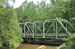 Madison County Bridge No. 149listed 2008 · 0.3 miles away
 Pendleton Historic Districtlisted 1991 · 1.0 miles away
Topographic sheets covering this place
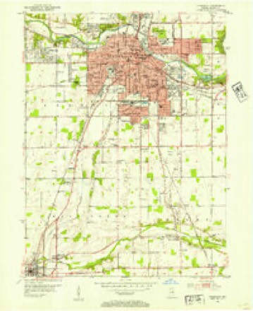
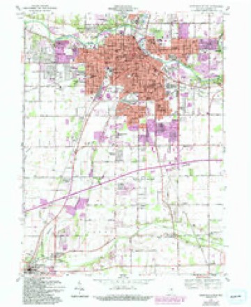
5 surveys from 14 printed sheetsMatched by testing this settlement's coordinate against the published boundary of every sheet in the United States Geological Survey's historical collection. Each opens the scanned sheet at the Survey.
- 1952 USGS Anderson quadrangle1:24000
- 1953 USGS Muncie quadrangle1:250000, 5 printings
- 1956 USGS Muncie quadrangle1:250000
- 1961 USGS Anderson South quadrangle1:24000, 4 printings
- 1986 USGS Muncie quadrangle1:100000, 3 printings



In the county-history sources
3,943 words on this townshipHistory of Madison County, Indiana, from 1820 to 1874 : Giving a General Review of Principal Events, Statistical and Historical Items, Derived from Official Sources, published 1874 names this settlement in its chapter on Fall Creek Township. These are the passages that mention it, exactly as the scans read.
Mr. H. was born in Wayne county, Indiana, January 20th, 1817; moved with his father to near Huntsville in April, 1831, and commenced the practice of medicine, in April, 1839, in connection with Dr. Wyman. He was. elected to the State Senate in 1850, from the counties of Madison and Hancock ; he was elected to the House of Representatives from Madison county in 1853, and was elected county treasurer in 1860. He was elected State Senator from the counties of Madison and Grant, receiving fifty three majority over his opponent, M. S. Robinson. By some irregularity his seat was contested in the Senate, and it was. awarded to Mr. Robinson, since which time he has retired from the political field with honor. As a physician, Mr. Hunt has had no superior in the county, having been in every nook and comer of the same, administering to the sick and the afflicted. In 1872 he became a citizen of Spiceland, Henry county. In 1855 he buried his first wife at Huntsville; his second wife is the daughter of John McCallister, sen. Mr. H. carried with him the well wishes of the people he had represented and administered to. In person he was of medium size, fair complexion, with light hair and good features.
Passage source: History of Madison County, Indiana, from 1820 to 1874 : Giving a General Review of Principal Events, Statistical and Historical Items, Derived from Official Sources, published 1874.
Machine-read from a century-old scan, so expect the errors a machine makes: misspelled names, dropped words, stray characters.
Fires near this place
7 since 2004Regional context, not property-specific evidence. The federal wildfire occurrence database lists 7 fires within 5 miles of Huntsville in 2004, burning about 3 acres in total. None started naturally. 1 was recorded as arson. Distance is straight-line from the map coordinates, so a fire counted here may appear on a neighbouring settlement's page as well.
| Reported cause | Fires |
|---|---|
| Missing data/not specified/undetermined | 2 |
| Recreation and ceremony | 2 |
| Equipment and vehicle use | 1 |
| Arson/incendiarism | 1 |
| Debris and open burning | 1 |
The most recent of them, most recent first, with the day each was reported and the service that recorded it.
| Date | Cause | Size | Reported by | Name on the report |
|---|---|---|---|---|
| 3 April 2004 | Arson/incendiarism | under an acre | Indiana State Fire Marshal's Office | not named |
| 29 April 2004 | Equipment and vehicle use | under an acre | Indiana State Fire Marshal's Office | not named |
| 18 April 2004 | Recreation and ceremony | 1.0 acres | Indiana State Fire Marshal's Office | not named |
| 16 April 2004 | Missing data/not specified/undetermined | under an acre | Indiana State Fire Marshal's Office | not named |
| 7 March 2004 | Missing data/not specified/undetermined | under an acre | Indiana State Fire Marshal's Office | not named |
| 12 March 2004 | Debris and open burning | under an acre | Indiana State Fire Marshal's Office | not named |
| 10 March 2004 | Recreation and ceremony | 1.0 acres | Indiana State Fire Marshal's Office | not named |
Settlements close enough to share some of these fires:
Mines and quarries near this place
2 within 5 milesRegional context, not property-specific evidence. The federal mineral resources record lists 2 workings within 5 miles of Huntsville: 1 occurrence, 1 producer. 1 still produces. What was taken out: Zinc, Sulfur, Stone, Crushed/Broken. Distance is straight-line from the map coordinates, so a quarry counted here may appear on a neighbouring settlement's page as well.
| Where | Site | Commodity | Status | Recorded |
|---|---|---|---|---|
| Pendleton Quarry | Stone, Crushed/Broken | Producer | ||
| Sphalerite Occurrence Z73 | Zinc, Sulfur | Occurrence | Sphalerite |
Storms near this place
9 since 2008Regional context, not property-specific evidence. The National Weather Service names Huntsville in 9 storm reports between 2008 and 2025: 7 thunderstorm wind, 2 hail. No death or injury is recorded in these reports. Each account below is quoted exactly as the forecast office filed it, from the NOAA Storm Events Database, and each date opens the federal record of that event.
| When | Event | Place named | Harm | What the report says |
|---|---|---|---|---|
| April 2025 | Thunderstorm Wind | Huntsville | $15,000 | Multiple trees and power lines downed by thunderstorm wind gusts. Interstate 69 was briefly closed near mile marker 222 due to downed lines. |
| February 2023 | Thunderstorm Wind | Huntsville | $10,000 | Thunderstorm winds snapped a power pole at its base. |
| May 2022 | Thunderstorm Wind | Huntsville | $10,000 | Thunderstorm winds downed multiple large trees. |
| June 2009 | Thunderstorm Wind | Huntsville | $5,000 | Two ten inch diameter trees were downed in the town of Pendleton. It was noted that the trees were not in the best health. Some other tree limbs were also downed in the area, as well as some accumulation of pea sized hail. Also, one mile east of Pendleton on State Route 36, severe thunderstorm winds removed metal storage building doors from a shed. |
| July 2023 | Thunderstorm Wind | Huntsville | $2,000 | Thunderstorm winds downed a tree onto Indiana Route 38 at 2277 west. |
| March 2020 | Thunderstorm Wind | Huntsville | $2,000 | Several 4 to 6 tree limbs snapped with numerous smaller limbs broken due to thunderstorm wind gusts. |
| May 2019 | Thunderstorm Wind | Huntsville | - | An estimated 60 mph thunderstorm wind gust was observed in this location. |
| August 2011 | Hail | Huntsville | - | A funnel cloud was observed with the hail. |
| June 2008 | Hail | Huntsville | - | no account filed |
Nearest settlements
The eight closest, with where each one stands in the county. Distances are straight-line, computed from the Geographic Names Information System coordinates.
| Map | Place | Distance | Sheets |
|---|---|---|---|
| Pendleton | 1.2 miles | 9 | |
| Idlewold | 2.0 miles | 10 | |
| Harmeson Heights | 4.0 miles | 14 | |
| New Columbus | 4.0 miles | 14 | |
| Alliance | 4.6 miles | 14 | |
| Emporia | 5.1 miles | 14 | |
| Crestlawn | 5.3 miles | 14 | |
| Ingalls | 5.3 miles | 10 |
Elsewhere
Matched on this settlement's Geographic Names Information System number rather than its name, so it cannot be a different place of the same name in another state.
| Wikipedia article on Huntsville | An encyclopaedic summary. Its text is share-alike, so it is linked here rather than copied. |
| Wikidata item Q5945830 | The structured record the population and elevation above come from. Public domain (CC0). |
Provenance
This settlement is recorded in the Geographic Names Information System as feature 436638. The sheet list is computed by point-in-boundary test against the United States Geological Survey's historical topographic inventory. Both are works of the United States government and carry no copyright under 17 U.S.C. 105.
Wildfire. Short, Karen C. 2022. Spatial wildfire occurrence data for the United States, 1992-2020 [FPA_FOD_20221014]. 6th Edition. Fort Collins, CO: Forest Service Research Data Archive. https://doi.org/10.2737/RDS-2013-0009.6 Collected with United States Government funding and usable without additional permissions or fees.
Mines and quarries. USGS Mineral Resources Data System (MRDS) https://mrdata.usgs.gov/mrds/ A work of the United States government, no copyright under 17 U.S.C. 105.
Storms. NOAA National Centers for Environmental Information, Storm Events Database https://www.ncei.noaa.gov/stormevents/ A work of the United States government, no copyright under 17 U.S.C. 105. Narratives are quoted verbatim from the National Weather Service report and are not edited or summarised.