 Block
Pendleton, Indiana
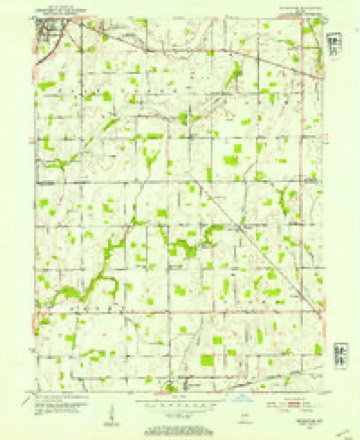
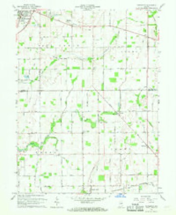
9 topographic sheets cover this place, the earliest surveyed in 1953 and the latest in 1986. It stands in Fall Creek Township. It lies in ZIP code area 46064. It stands on Prairie Creek. The Survey maps it on the Pendleton quadrangle.
On record in Pendleton
Buildings and businesses the archive holds for this place. Each opens its own page, with the source record it came from.
On the National Register 3 records
 Fall Creek Meeting Houselisted 1997
 Madison County Bridge No. 149listed 2008
 Pendleton Historic Districtlisted 1991
Topographic sheets covering this place
5 surveys from 9 printed sheetsMatched by testing this settlement's coordinate against the published boundary of every sheet in the United States Geological Survey's historical collection. Each opens the scanned sheet at the Survey.
- 1953 USGS Cincinnati quadrangle1:250000, 3 printings
- 1953 USGS Pendleton quadrangle1:24000, 2 printings
- 1957 USGS Cincinnati quadrangle1:250000
- 1966 USGS Pendleton quadrangle1:24000
- 1986 USGS New Castle quadrangle1:100000, 2 printings



In the county-history sources
3,943 words on this townshipHistory of Madison County, Indiana, from 1820 to 1874 : Giving a General Review of Principal Events, Statistical and Historical Items, Derived from Official Sources, published 1874 names this settlement in its chapter on Fall Creek Township. These are the passages that mention it, exactly as the scans read.
Pendleton and Huntsvillc are both in this township. Among the first settlers of this township, commencing in 1820, were James Pendleton, Judge Winchell, Thomas Bell, Thomas and James Scott, Dr. Bordwell, Elias Hollingsworth, the Richmond family and Israel T. Cox. CJoming soon after were George Nicholson, Adam Dobson, Martin Chapman, William Williams, Enos Adamson, William and Thomas Silver, Isaac and John Busby, Palmer Patrick, J. T. Swain, B. F. Gregory, Judge AValker, William and James Brown, John H. and Ward Cook, A. M. Ulin, John J. Lewis and Neal Hardy.
Passage source: History of Madison County, Indiana, from 1820 to 1874 : Giving a General Review of Principal Events, Statistical and Historical Items, Derived from Official Sources, published 1874.
Mr. H. was born in Philadelphia in the year 1803 ; came first to Indiana in 1832 ; returned, and came again in 1833. He came the first time all the way on foot ; on his arrival the second time he settled on his farm two and a half miles east of Pendleton, where he continued to live up to the time of his death, which occurred November the 16th, 1869. He was engaged for several years in the mercantile business in Pendleton, beginning in 1851. In 1861 he was elected to the oflSce of township trustee, in which capacity he served for a period of eight years, to the entire satisfaction of all. He was the first President, as well as a large stockholder in the Newcastle turnpike, in which enterprise he took a lively interest. In early life he was a Free Soiler, but in later life he acted with the Republican party. He was at Pendleton at the mobbing of Fred. Douglas, and took him under his roof for protection, afterward receiving a letter from Mr. D. thanking him for his unlimited kindness on that occasion. This letter will be published if it can be obtained. Mr. H. was a member of the Odd Fellows' lodge at Pendleton. He was the father of T. F. Hardy, of Markleville, and Morris Hardy, of Fall Creek, and Mrs. Lewis and Mrs. Boston, of Markleville. In person Mr. H. was of medium hight, was square and heavy made, goqd features, high forehead and dark eyes. He is buried at the Friends' graveyard, two and one-miles east of Pendleton.
Passage source: History of Madison County, Indiana, from 1820 to 1874 : Giving a General Review of Principal Events, Statistical and Historical Items, Derived from Official Sources, published 1874.
Mr. H. was born in Ohio in 1815 ; came with his parents to this county in 1820, locating on Fall creek, two miles- below Pendleton; remained there until 1828 when he removed to Anderson, thence to Richland township remaining there seven years; returned again to Lafayette township, where he now lives. He at one time owned the Moss Island mill where by flood in 1857 he lost considerable of property. He also, while living in Richland township, met with the loss of having his house burned. He aided in organizing Lafayette township, where he served several years as justice of the peace and ten years as township trustee. Mr. H. is a Methodist ; has always been a zealous worker, serving as class leader and a strong friend to the Sabbath school in 'hich cause he takes especial delight. Mr. H. has been a long time in the county, has seen Fall creek, Richland and Lafayette, in fact all the county, in a state of nature; is one of the few men who were here as early as 1820. In short, Mr. H. has seen -considerable of real life - losing by flood and fire his hard earned recourses. What hardships he has endured ; what changes have taken place within his recollection! He has seen those who were strong and healthful like himself suddenly stricken down by the hand of death, and from the handful of pioneers with scanty means has seen comparatively a dense population spring up with abundance upon every hand. He can also appreciate the contrast between the well furnished churches of to-day with their large and well dressed audiences, with the few homely dressed personages who were wont to meet at his father's humble cabin.
Passage source: History of Madison County, Indiana, from 1820 to 1874 : Giving a General Review of Principal Events, Statistical and Historical Items, Derived from Official Sources, published 1874.
Machine-read from a century-old scan, so expect the errors a machine makes: misspelled names, dropped words, stray characters.
Read the whole chapter on Fall Creek Township - it names this place 5 more 5 times.
Fires near this place
7 since 2004Regional context, not property-specific evidence. The federal wildfire occurrence database lists 7 fires within 5 miles of Pendleton in 2004, burning about 3 acres in total. None started naturally. 1 was recorded as arson. Distance is straight-line from the map coordinates, so a fire counted here may appear on a neighbouring settlement's page as well.
| Reported cause | Fires |
|---|---|
| Missing data/not specified/undetermined | 2 |
| Recreation and ceremony | 2 |
| Equipment and vehicle use | 1 |
| Arson/incendiarism | 1 |
| Debris and open burning | 1 |
The most recent of them, most recent first, with the day each was reported and the service that recorded it.
| Date | Cause | Size | Reported by | Name on the report |
|---|---|---|---|---|
| 3 April 2004 | Arson/incendiarism | under an acre | Indiana State Fire Marshal's Office | not named |
| 29 April 2004 | Equipment and vehicle use | under an acre | Indiana State Fire Marshal's Office | not named |
| 18 April 2004 | Recreation and ceremony | 1.0 acres | Indiana State Fire Marshal's Office | not named |
| 16 April 2004 | Missing data/not specified/undetermined | under an acre | Indiana State Fire Marshal's Office | not named |
| 7 March 2004 | Missing data/not specified/undetermined | under an acre | Indiana State Fire Marshal's Office | not named |
| 12 March 2004 | Debris and open burning | under an acre | Indiana State Fire Marshal's Office | not named |
| 10 March 2004 | Recreation and ceremony | 1.0 acres | Indiana State Fire Marshal's Office | not named |
Settlements close enough to share some of these fires:
Mines and quarries near this place
2 within 5 milesRegional context, not property-specific evidence. The federal mineral resources record lists 2 workings within 5 miles of Pendleton: 1 occurrence, 1 producer. 1 still produces. What was taken out: Zinc, Sulfur, Stone, Crushed/Broken. Distance is straight-line from the map coordinates, so a quarry counted here may appear on a neighbouring settlement's page as well.
| Where | Site | Commodity | Status | Recorded |
|---|---|---|---|---|
| Pendleton Quarry | Stone, Crushed/Broken | Producer | ||
| Sphalerite Occurrence Z73 | Zinc, Sulfur | Occurrence | Sphalerite |
Storms near this place
24 since 1994Regional context, not property-specific evidence. The National Weather Service names Pendleton in 24 storm reports between 1994 and 2026: 15 thunderstorm wind, 6 hail, 2 tornado, 1 lightning. The reports record 5 injuries. Each account below is quoted exactly as the forecast office filed it, from the NOAA Storm Events Database, and each date opens the federal record of that event.
| When | Event | Place named | Harm | What the report says |
|---|---|---|---|---|
| September 2002 | Tornado (F2) | Pendleton | 2 hurt, $8,000,000 | no account filed |
| May 2017 | Thunderstorm Wind | Pendleton | 2 hurt, $25,000 | This damaging thunderstorm wind gust was estimated at 65 mph. Two 53-foot trailers were on their side. The driver and passenger of one semi truck with an attached 53-foot trailer on the side sustained minor injuries. Two port-o-lets were blown over. One fiberglass light pole was blown over as well.This occurred near 73rd Street and Layton Avenue. |
| May 2019 | Tornado (EF2) | Pendleton | 1 hurt, $150,000 | NWS Indianapolis found tornado damage started west of Pendleton. The tornado moved through the north side of Pendleton toward Huntsville. In this area, mainly EF-1 damage was found, consisting of many trees blown down and minor roof damage.||Damage to structures in this part of the tornado path was caused primarily from trees falling onto homes and buildings. Saturated ground due to recent rains contributed to the numerous trees blown down.||The EF-2 tornado damage was found northeast of Huntsville. Three homes here suffered EF-2 damage which included roofs blown off two homes. A third home suffered damage when a part of an exterior brick wall collapsed inward to the home. The max wind speed was estimated at 130 mph. ||Thereafter, the tornado continued northeast, crossing Interstate 69 before lifting near 57th street and Main Street in Anderson. |
| March 2026 | Thunderstorm Wind | Pendleton | $120,000 | Thunderstorm wind gusts downed several trees and poles which were blocking roads. Structural damage to roofs of houses was also reported. |
| August 2007 | Thunderstorm Wind | Pendleton | $45,000 | A tree that was three feet in diameter fell onto four cars parked at the correctional facility. All four cars were totaled. |
| April 1999 | Thunderstorm Wind | Pendleton | $20,000 | Thunderstorm winds blew a trailer over, damaged a barn and a few roofs. |
| May 2022 | Thunderstorm Wind | Pendleton | $15,000 | Thunderstorm winds downed a 6 inch healthy tree limb onto the roof of a Jeep. |
| June 2009 | Lightning | Pendleton | $15,000 | A house was struck by lightning two miles northeast of Pendleton. No further information on property damage was given. The time and property damage of this event has been estimated. |
| August 2007 | Thunderstorm Wind | Pendleton | $10,000 | Thunderstorm winds caused damage to the wood baffling of the Indiana State Police firearms range. The sound system was also destroyed. |
| August 2019 | Thunderstorm Wind | Pendleton | $5,000 | Trees and power lines downed at the intersection of County Road 525 West and State Road 132 due to thunderstorm wind gusts. |
| June 2008 | Thunderstorm Wind | Pendleton | $2,000 | Power lines were reported down due to damaging thunderstorm winds. |
| August 2007 | Thunderstorm Wind | Pendleton | $1,000 | Trees and power lines were reported down due to damaging thunderstorm winds. |
| July 2015 | Thunderstorm Wind | Pendleton | $200 | Tree limbs were downed on Garden Drive due to strong thunderstorm wind gusts. |
| June 2008 | Thunderstorm Wind | Pendleton | - | A 10-inch diameter tree was blown down due to damaging thunderstorm winds. |
| September 2007 | Thunderstorm Wind | Pendleton | - | Trees were reported down due to damaging thunderstorm winds. |
| April 1994 | Thunderstorm Wind | Pendleton | - | Several trees and power lines were blown down. |
| April 2006 | Hail | Pendleton | - | no account filed |
| April 2006 | Hail | Pendleton | - | no account filed |
| August 2001 | Hail | Pendleton | - | no account filed |
| April 2000 | Hail | Pendleton | - | no account filed |
| May 2000 | Thunderstorm Wind | Pendleton | - | no account filed |
| August 2000 | Thunderstorm Wind | Pendleton | - | no account filed |
| June 1996 | Hail | Pendleton | - | no account filed |
| July 1994 | Hail | Pendleton | - | no account filed |
Nearest settlements
The eight closest, with where each one stands in the county. Distances are straight-line, computed from the Geographic Names Information System coordinates.
| Map | Place | Distance | Sheets |
|---|---|---|---|
| Idlewold | 0.9 miles | 10 | |
| Huntsville | 1.2 miles | 14 | |
| Ingalls | 4.2 miles | 10 | |
| Alfont | 4.8 miles | 10 | |
| New Columbus | 5.0 miles | 14 | |
| Harmeson Heights | 5.1 miles | 14 | |
| Hardscrabble | 5.3 miles | 13 | |
| Alliance | 5.7 miles | 14 |
Provenance
This settlement is recorded in the Geographic Names Information System as feature 440989. The sheet list is computed by point-in-boundary test against the United States Geological Survey's historical topographic inventory. Both are works of the United States government and carry no copyright under 17 U.S.C. 105.
Wildfire. Short, Karen C. 2022. Spatial wildfire occurrence data for the United States, 1992-2020 [FPA_FOD_20221014]. 6th Edition. Fort Collins, CO: Forest Service Research Data Archive. https://doi.org/10.2737/RDS-2013-0009.6 Collected with United States Government funding and usable without additional permissions or fees.
Mines and quarries. USGS Mineral Resources Data System (MRDS) https://mrdata.usgs.gov/mrds/ A work of the United States government, no copyright under 17 U.S.C. 105.
Storms. NOAA National Centers for Environmental Information, Storm Events Database https://www.ncei.noaa.gov/stormevents/ A work of the United States government, no copyright under 17 U.S.C. 105. Narratives are quoted verbatim from the National Weather Service report and are not edited or summarised.