 Block
Jamestown, Indiana
13 topographic sheets cover this place, the earliest surveyed in 1953 and the latest in 1983. It stands in Baugo Township. It lies in ZIP code area 46517. The Survey maps it on the Osceola quadrangle. It stands 778 feet above sea level.
On record in Jamestown
Buildings and businesses the archive holds for this place. Each opens its own page, with the source record it came from.
On the National Register within a mile 1 record
The National Register names another town for these. They stand within one mile of this settlement's coordinate.
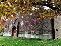 Baugo Township Gymnasiumlisted 2016 · 0.1 miles away
Topographic sheets covering this place
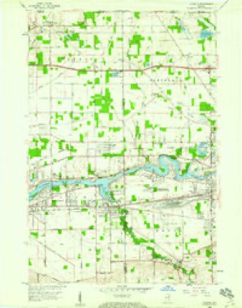
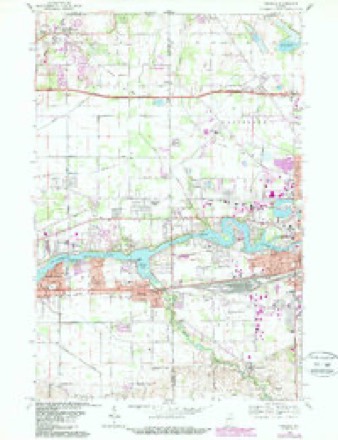
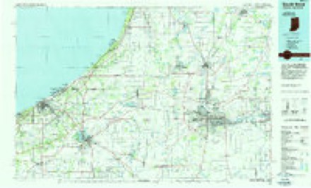
5 surveys from 13 printed sheetsMatched by testing this settlement's coordinate against the published boundary of every sheet in the United States Geological Survey's historical collection. Each opens the scanned sheet at the Survey.
- 1953 USGS Chicago quadrangle1:250000, 5 printings
- 1957 USGS Chicago quadrangle1:250000
- 1958 USGS Osceola quadrangle1:24000
- 1969 USGS Osceola quadrangle1:24000, 4 printings
- 1983 USGS South Bend quadrangle1:100000, 2 printings


In the county-history sources
3,191 words on this townshipHistory of Elkhart County, Indiana : Together with Sketches of Its Cities ... and Biographies of Representative Citizens : History of Indiana, Embracing Accounts of the Pre-historic Races .., published 1881 names this settlement in its chapter on Baugo Township. These are the passages that mention it, exactly as the scans read.
The dates of the ;irrival of the early settlers, and of the organization of the township, and other items of history are almost buried in obscurity. The old pioneers that effected the first settlements in the midst of hundreds of wild savages of this township have long since passed off the " stage of action," and been lain beneatli the sod. According to the evidence of Mr. Daniel Richason, who is the most authentic source we have, Mr. Wm. Mote was the first, lie having settled here in 1S30. Tlie next was John McNey, who was followed by Messrs. James Davis, John Barnes, Mr. Kellog, Jacob Kupel and Wm. Hichason. Later came Azel and Horace Meads, Jacob Kupel (again), Isaac Morris and some others. The last named person remained in the township for only one year, then Vv'ent to Olive township. Messrs. Wm. Richason and James Davis erected a sav/-mill on the Baugo at Jamestown (now called Jimtown'i. This town is situated on the bank of the Baugo, on section 26; it v.-as laid out about the year 1835, by James Davis.
Passage source: History of Elkhart County, Indiana : Together with Sketches of Its Cities ... and Biographies of Representative Citizens : History of Indiana, Embracing Accounts of the Pre-historic Races .., published 1881.
Opened the first store in the place. The town was almost abandoned. A brick school-house is all the building in the place that is worth mentioning. The iirst election was held in the school-house at this place in 1S36; the township was organized some time pi-evions to this. The first school-liouse in the township was bnilt of logs in Jamestown. The county chapel is the M. E. denomination, and was bnilt in ISSi by Zenas Bsldeu. It is SOx-iO feet in size, and is a very elegant and commodious structure. In 1S74 a Baptist society erected a church on section 27, at a cost of §1.700. It is surrounded with a cemetery beautifully laid off in wards.
Passage source: History of Elkhart County, Indiana : Together with Sketches of Its Cities ... and Biographies of Representative Citizens : History of Indiana, Embracing Accounts of the Pre-historic Races .., published 1881.
Machine-read from a century-old scan, so expect the errors a machine makes: misspelled names, dropped words, stray characters.
Mines and quarries near this place
3 within 5 milesRegional context, not property-specific evidence. The federal mineral resources record lists 3 workings within 5 miles of Jamestown: 2 unknowns, 1 producer. 1 still produces. What was taken out: Sand and Gravel, Construction. Distance is straight-line from the map coordinates, so a quarry counted here may appear on a neighbouring settlement's page as well.
| Where | Site | Commodity | Status | Recorded |
|---|---|---|---|---|
| Hunterlake Pit | Sand and Gravel, Construction | Unknown | ||
| Pit No. 3 | Sand and Gravel, Construction | Producer | ||
| Riegsecker Pit | Sand and Gravel, Construction | Unknown |
Storms near this place
12 since 2009Regional context, not property-specific evidence. The National Weather Service names Jamestown in 12 storm reports between 2009 and 2023: 7 thunderstorm wind, 4 hail, 1 flood. No death or injury is recorded in these reports. Each account below is quoted exactly as the forecast office filed it, from the NOAA Storm Events Database, and each date opens the federal record of that event.
| When | Event | Place named | Harm | What the report says |
|---|---|---|---|---|
| July 2022 | Thunderstorm Wind | Jamestown | $15,000 | Tree down on house. Reported via Facebook. |
| July 2023 | Hail | Jamestown | $5,000 | no account filed |
| June 2023 | Hail | Jamestown | $2,000 | A photos shows quarter size hail mixed with pea to penny size hail. |
| June 2023 | Thunderstorm Wind | Jamestown | $1,000 | Large trees limbs down at a residence. |
| June 2021 | Thunderstorm Wind | Jamestown | - | Sustained winds up to 60 mph with multiple trees and power lines down. |
| June 2021 | Thunderstorm Wind | Jamestown | - | Several small tree limbs broken. |
| June 2021 | Flood | Jamestown | - | MPing report of flooding. |
| August 2018 | Thunderstorm Wind | Jamestown | - | The public reported a tree was blown down, blocking the road on County Roads 24 and 3. |
| July 2015 | Thunderstorm Wind | Jamestown | - | Tree damage reported with power outage. |
| June 2009 | Thunderstorm Wind | Jamestown | - | Trained spotters reported numerous tree limbs, as well as one tree, being blown down near Jamestown. |
| June 2022 | Hail | Jamestown | - | no account filed |
| June 2017 | Hail | Jamestown | - | no account filed |
Nearest settlements
The eight closest, with where each one stands in the county. Distances are straight-line, computed from the Geographic Names Information System coordinates.
| Map | Place | Distance | Sheets |
|---|---|---|---|
| Elkhart | 4.0 miles | 13 | |
| Dunlap | 5.4 miles | 13 | |
| De Camp Gardens | 5.8 miles | 13 | |
| Greenleaf Manor | 6.3 miles | 13 | |
| East Lake Estates | 6.5 miles | 13 | |
| Wakarusa | 6.9 miles | 11 | |
| Garden Village | 7.1 miles | 13 | |
| Midway | 7.1 miles | 12 |
Elsewhere
Matched on this settlement's Geographic Names Information System number rather than its name, so it cannot be a different place of the same name in another state.
| Wikipedia article on Jamestown | An encyclopaedic summary. Its text is share-alike, so it is linked here rather than copied. |
| Wikidata item Q6146154 | The structured record the population and elevation above come from. Public domain (CC0). |
Provenance
This settlement is recorded in the Geographic Names Information System as feature 436932. The sheet list is computed by point-in-boundary test against the United States Geological Survey's historical topographic inventory. Both are works of the United States government and carry no copyright under 17 U.S.C. 105.
Mines and quarries. USGS Mineral Resources Data System (MRDS) https://mrdata.usgs.gov/mrds/ A work of the United States government, no copyright under 17 U.S.C. 105.
Storms. NOAA National Centers for Environmental Information, Storm Events Database https://www.ncei.noaa.gov/stormevents/ A work of the United States government, no copyright under 17 U.S.C. 105. Narratives are quoted verbatim from the National Weather Service report and are not edited or summarised.