 Block
Wakarusa, Indiana
11 topographic sheets cover this place, the earliest surveyed in 1953 and the latest in 1983. It stands in Olive Township. It lies in ZIP code area 46573. The Survey maps it on the Wakarusa quadrangle. 1,998 people lived here at the 2020 count. It stands 840 feet above sea level.
Population over time
2 figuresWakarusa grew from 1,758 to 1,998 between 2010 and 2020. These are the recorded population figures Wikidata holds for this place, reached through the Geographic Names Information System number this page is keyed on rather than by name, so they belong to this place and not to another of the same name. Most are census counts, but not all are: an early figure may be a founding or settlement estimate, and an estimate published within five years of a census is left out. The change column is computed, and is left blank where more than 20 years separate a figure from the one before it, because a gap that long is not a change between two counts.
| Year | People | Change |
|---|---|---|
| 2010 | 1,758 | |
| 2020 | 1,998 | +240 (+14%) |
Topographic sheets covering this place
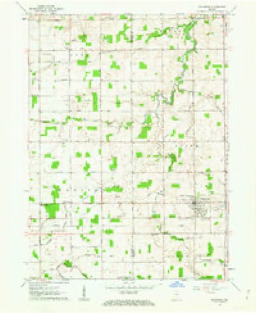
4 surveys from 11 printed sheetsMatched by testing this settlement's coordinate against the published boundary of every sheet in the United States Geological Survey's historical collection. Each opens the scanned sheet at the Survey.
- 1953 USGS Chicago quadrangle1:250000, 5 printings
- 1957 USGS Chicago quadrangle1:250000
- 1961 USGS Wakarusa quadrangle1:24000, 3 printings
- 1983 USGS South Bend quadrangle1:100000, 2 printings


In the county-history sources
13,383 words on this townshipHistory of Elkhart County, Indiana : Together with Sketches of Its Cities ... and Biographies of Representative Citizens : History of Indiana, Embracing Accounts of the Pre-historic Races .., published 1881 names this settlement in its chapter on Olive Township. These are the passages that mention it, exactly as the scans read.
In order to meet the requirements of educating the younger generation, which now were moving out on the threshold of life, the old pioneers en masse took from the primeval forest rough, nnhewn logs and erected a cabin on sec. 11. This structure was furnished with slab seats, split-log floor, greased-paper windowlights, and a huge fire-place that would easily receive a log ten feet in length. On a bitter cold winter morning the shivering, halffrozen children would be seated compactly around the "great furnace," thus forming a semi-circle and utterly crowding the "Hoosier schoolmaster" back in the relentless cold. It was only on such occasions that the pupils had the " upper hand " of their teacher. Log school-houses were " all the go " and " style " till about 1848, when they were replaced by frame and brick structures. Religious meetings were held in school and private houses till the year 1866, when the Lutherans erected a church edifice atWakarusa. Messrs. Jesse Flickinger and William Lutz were the principal contributors in this enterprise. The next church house was erected by the Baptist society the following year. The founders of this Church were Mr. Stevens, deceased, and Joseph and Benj. Hughes. In 1874 a church of the M. E. denomination was built by Josiah N. Kronk, Joseph Seaman, Christian S. Farber, David Iker, Geo. Berkey and Geo. H. Gore. The Christians built a house of worship in Wakarusa in 1870, and the principals of this organization were Drs. Shaifer and Knepple and I. C. Bennett, since deceased. In 1861 a Mennonite church was established on sec. 2 by Jacob Wisler, John Weaver, Martin Hoover and Christian Bair. The cemetery near this church was laid out in 1855. It is handsomely divided in wards, and is situated on such a beautiful eminence the passer-by is impressed that that spot was intended by
Passage source: History of Elkhart County, Indiana : Together with Sketches of Its Cities ... and Biographies of Representative Citizens : History of Indiana, Embracing Accounts of the Pre-historic Races .., published 1881.
In 1849 a postofiice. designated as Mt. Olive," was established three and a half miles north of Wakarusa. Harvey Bly was postmaster. In 1852, shortly after the location and the laying out of Wakarusa, then '' Salem," the postofiice was removed and established at that point. This town is situated in the southern part of Olive township, and was laid off by Messrs. Holdeman, Smeltzer and Fletcher. In 1859 the name was changed from Salem to Wakarusa, there being another Salem in Indiana.
Passage source: History of Elkhart County, Indiana : Together with Sketches of Its Cities ... and Biographies of Representative Citizens : History of Indiana, Embracing Accounts of the Pre-historic Races .., published 1881.
Among the rare personages that are found in the human family, Wakarusa furnishes one which is very remarkable. The person is Stephen E. Lammond. He was born March IS, 1864, in Ohio. His parents are Cortland and Nancy Lammond. He is now in his 16th year, is three feet and nine inches in height, and weighs 60 lbs. He is a very brilliant little man, and reads in the fourth reader, besides other advanced studies which he pursues.
Passage source: History of Elkhart County, Indiana : Together with Sketches of Its Cities ... and Biographies of Representative Citizens : History of Indiana, Embracing Accounts of the Pre-historic Races .., published 1881.
Machine-read from a century-old scan, so expect the errors a machine makes: misspelled names, dropped words, stray characters.
Read the whole chapter on Olive Township - it names this place 14 more 14 times.
Mines and quarries near this place
1 within 5 milesRegional context, not property-specific evidence. The federal mineral resources record lists 1 working within 5 miles of Wakarusa: 1 producer. All of them still produce. What was taken out: Sand and Gravel, Construction. Distance is straight-line from the map coordinates, so a quarry counted here may appear on a neighbouring settlement's page as well.
| Where | Site | Commodity | Status | Recorded |
|---|---|---|---|---|
| Christner Gravel Pit | Sand and Gravel, Construction | Producer |
Storms near this place
29 since 1994Regional context, not property-specific evidence. The National Weather Service names Wakarusa in 29 storm reports between 1994 and 2025: 20 thunderstorm wind, 7 hail, 1 lightning, 1 tornado. No death or injury is recorded in these reports. Each account below is quoted exactly as the forecast office filed it, from the NOAA Storm Events Database, and each date opens the federal record of that event.
| When | Event | Place named | Harm | What the report says |
|---|---|---|---|---|
| June 2010 | Tornado (EF1) | Wakarusa | $300,000 | A survey of damage indicated a circulation touched down northwest of Wakarusa and worked east southeast, passing north of the town. The circulation skipped along its nearly 12 mile track, producing varying degrees of tree damage, including tree topping, uproots and snapping large limbs. The greatest damage occurred at the Ultimaster plant on State Route 19, where a portion of a second story wall and roof was ripped away. Tree and corn damage continued as the circulation approached New Paris, where it finally dissipated. Despite its track, the maximum width was only around 50 yards with maximum estimated winds of around 100 mph. Damage is estimated at $300,000. |
| May 2002 | Lightning | Wakarusa | $100,000 | Lightning struck a dairy barn in Wakarusa causing a fire that destroyed it. Seven horses and 13 cows were killed. |
| May 2011 | Thunderstorm Wind | Wakarusa | $25,000 | A trained spotter reported several trees down near Wakarusa. In addition, a barn suffered extensive roof damage near the intersection of County Roads 42 and 103. |
| July 2024 | Thunderstorm Wind | Wakarusa | $5,000 | Large tree down at a residence. |
| June 1994 | Thunderstorm Wind | Wakarusa | $5,000 | Power lines were downed. |
| May 1999 | Thunderstorm Wind | Wakarusa | $3,000 | Trees and power lines down. |
| June 2025 | Thunderstorm Wind | Wakarusa | $1,000 | Broadcast Media reported a few trees and limbs down on Country Road 3 on the northside of Wakarusa, IN. |
| June 2024 | Hail | Wakarusa | $500 | Picture of nickel size hail. |
| April 1998 | Thunderstorm Wind | Wakarusa | $500 | Power lines down near Wakarusa. Trees down 4 miles WSW of Goshen and 3-8 miles NE of Goshen. |
| May 2019 | Thunderstorm Wind | Wakarusa | - | A trained spotter reported a very large tree was blown down. |
| June 2016 | Thunderstorm Wind | Wakarusa | - | County dispatch reported trees and power lines down in the Wakarusa area. |
| July 2014 | Thunderstorm Wind | Wakarusa | - | Wind gusts to 73 mph were recorded in the Nappanee and Wakarusa area, west of State Route 19. Six to eight inch diameter limbs and utility lines were down in the area with some corn fields laid over. |
| June 2013 | Thunderstorm Wind | Wakarusa | - | The public estimated a 60 mph wind gust. Large tree limbs were blown down in the area. |
| November 2013 | Thunderstorm Wind | Wakarusa | - | The public reported trees down, as well as silo and outbuilding damage on County Road 1 near Wakarusa. |
| November 2013 | Thunderstorm Wind | Wakarusa | - | The public reported a shed was thrown into a tree with a swing-set being blown over. |
| July 2009 | Hail | Wakarusa | - | A CoCoRaHS observer reported penny size hail, as well as 1.50 inches of rain in a half hour. |
| July 2009 | Thunderstorm Wind | Wakarusa | - | Law enforcement officials reported a few trees down in the Wakarusa area. |
| July 2003 | Thunderstorm Wind | Wakarusa | - | Law enforcement reported trees and power lines down in Wakarusa. |
| August 2001 | Thunderstorm Wind | Wakarusa | - | Large tree limbs down. |
| May 2000 | Thunderstorm Wind | Wakarusa | - | 80-foot pine downed. Numerous power lines and trees downed. |
| June 2000 | Thunderstorm Wind | Wakarusa | - | Tree down. |
| June 1994 | Thunderstorm Wind | Wakarusa | - | Large limbs were blown down. |
| June 2019 | Hail | Wakarusa | - | no account filed |
| May 2019 | Hail | Wakarusa | - | no account filed |
| August 2003 | Thunderstorm Wind | Wakarusa | - | no account filed |
| October 1999 | Hail | Wakarusa | - | no account filed |
| April 1999 | Hail | Wakarusa | - | no account filed |
| June 1998 | Thunderstorm Wind | Wakarusa | - | no account filed |
| February 1996 | Hail | Wakarusa | - | no account filed |
Nearest settlements
The eight closest, with where each one stands in the county. Distances are straight-line, computed from the Geographic Names Information System coordinates.
Elsewhere
Matched on this settlement's Geographic Names Information System number rather than its name, so it cannot be a different place of the same name in another state.
| Wikipedia article on Wakarusa | An encyclopaedic summary. Its text is share-alike, so it is linked here rather than copied. |
| Wikidata item Q1824175 | The structured record the population and elevation above come from. Public domain (CC0). |
Provenance
This settlement is recorded in the Geographic Names Information System as feature 452499. The sheet list is computed by point-in-boundary test against the United States Geological Survey's historical topographic inventory. Both are works of the United States government and carry no copyright under 17 U.S.C. 105.
Mines and quarries. USGS Mineral Resources Data System (MRDS) https://mrdata.usgs.gov/mrds/ A work of the United States government, no copyright under 17 U.S.C. 105.
Storms. NOAA National Centers for Environmental Information, Storm Events Database https://www.ncei.noaa.gov/stormevents/ A work of the United States government, no copyright under 17 U.S.C. 105. Narratives are quoted verbatim from the National Weather Service report and are not edited or summarised.